|
|
|
| Tales from the Woods |
|
|
| 21-06-2009 |
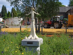
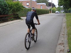
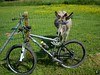
 Meerdael Summer Solstice ride Meerdael Summer Solstice ride |
Just when I was getting ready to ride out, a bit before noon, some kind of thunderstorm passed by with a lot of rain and even some hail. OK, no ride now, maybe later.
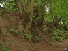
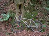
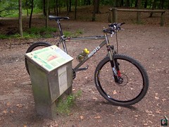
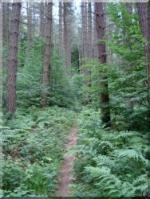
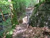
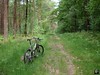
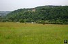
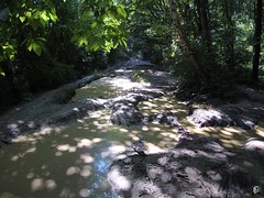
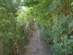
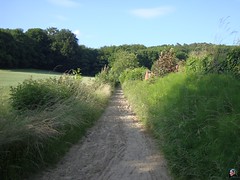
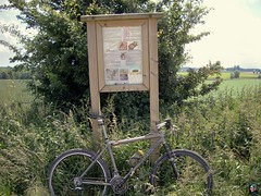
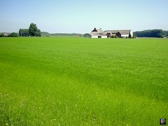
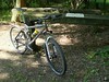
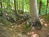
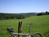
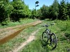
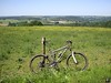
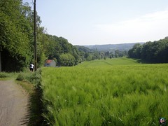
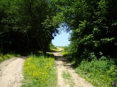
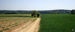
Around 6pm I went out into the forest for the complete BLOSO trails of Meerdael. In the beginning I had a bit of wet roads but when I rode further away from the Naamsesteenweg things got dryer. Then riding towards the Naamsesteenweg again - in Heverleebos that was - things got wetter again. Once I passed over towards Korbeek Dyle on the green trail the trails became dry. Great, and I made good speed. Upon crossing over towards the Red I neared the Naamsesteenweg again and indeed, things got wet again. Seems like there was a band some 500-750 metres east and west of the North-South axis the Naamsesteenweg forms though Meerdael Forest, where it had rained considerably more than in the rest of the forest. When I rode along the Hamme Mille plains all of a sudden the road was blocked by a broad puddle. Damn. Entering the forest again, the trails were wet and my bike got dirty. Oh well, I just put the hammer down and before long I was again on some dryer trails riding into Bierbeek and back into Mollendaal forest . But nearing the Naamsesteenweg again, on the last part of the red loop, things gor messy again. A bit further, after changing from red to blue, I was on dry trails again. The last bit in Heverlee forest upon reaching the green trail again, was a little wetter once more. But obviously the sun was out and even though it was quite chilly - with an average temperature throughout the ride of a mere 16 degrees C, I wasn't feeling cold, thanks to my Odlo windstopper underwear, very handy in these situations. I had an average of almost 21kph which - in view of the circumstances and the ride I did yesterday - was pretty good.
Ride Stats : 55K and 480/551 (Polar/Garmin) in 2h39mins
4436/42635
21-06-2009, 22:32 geschreven door Big Bad Wolf
|
|
|
|
|
| 17-06-2009 |
| Overijse Bloso's with Guna |
Today the weather was nice and warm, ideal for a ride in the late afternoon. After last saturdays' ride I felt like I suffered from a heatstroke. The whole Sunday I had a headache and by Monday morning it was bad enough to keep me in bed. I had forgotten to apply sunscreen and even though the sun was veiled, the UV rays must have reached my skin because I saw red on my arms and legs. Stupid mistake.
So today, even though it was 5.30pm when I rode out, I did apply my usual factor 20 sunscreen. I rode through Meerdael forest and clambered up the Smeysberg with the Moots before dropping down into Huldenberg and riding up to Overijse where I had a meeting with Guna. She was fresh out of the Raid des Hautes Fagnes, where she completed the 90K. It was her toughest ride ever and I can understand that. I never rode the RDHF but I warned her it was a toughie. But she went on a rode it. Amazing, and my helmet goes off to her. Well done !
But today we were doing the Overijse BLOSO's and the pace was gentle but firm. I have done them azillion times but each time I am enjoying the succession of short climbs and descents, a great was to train some interval. Some of the climbs are quite tricky and one should never take the downhills for granted. They surprise you every time. After heavy rains gulleys are formed , branches are dropped on the trail and here and there a bit of mud spiced things up a bit more. But we managed all of them very well, and I was once more surprised by the progress Guna had made in both uphill speed and downhill prowess. And then she didn't even have her full suspension bike with her, but even with the hardtail with v-brakes she is fast . The trails were great, dry for the most part except for the downhill in the Bois de Laurensart which had a bit of mud in some of the hollow road sections.
When we split up I returned towards Huldenberg and did the offroad climb starting at the mill at Neerijse. A quick dash into Meerdael forest with the offroad climb out of Sint Joris Weert in the opposite direction of the BLOSO route, where I passed a couple of bikers. In all a good quality midweek ride.
Ride Stats : 61K and 701 heightmeters (Garmin) in 3h25mins
4326/41600
17-06-2009, 22:07 geschreven door Big Bad Wolf
|
|
|
|
|
| 13-06-2009 |
| Otto's Mount |

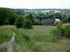
A beautiful sunny morning, so out I went. I had the plan to ride out towards the Ravel in Hoegaarden, follow that until my odometer showed 50K, return and ride back over Meldert towards home.
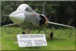
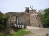
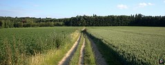
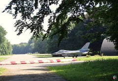
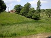
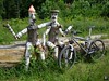
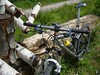
When I passed near the 1st Wing in La Bruyere I noticed a special version of an F16 standing behind the gates. So I stopped to make a picture before riding on along the very beautiful village of Sart Melin and St Remy Geest. A bit further I was on the Ravel and things went easy towards Vedrin. I hit the 250m mark and a bit later in the descent towards Namur I hit the 50K mark. So I turned my bike around and rode back towards Eghezee. On the way I noticed the tumulus in Hottomont and decided to make a little detour to look at it a bit closer and take some pics. The tumulus has been built by the Romans and is suspected to be the last resting place of a Roman General called Otto. Hence the name of the little town - Hottomont , Otto's Mount - it is said. Could be, or maybe not.. the dim and distant past is sometimes filled with a lot of hearsay and twisted stories. What is certain is that there is a tumulus and that I made some pictures of it.
After that I rode on towards Eghezee and later Jodoigne. I followed the ravel until it reached Hoegaarden. Here I had to turn towards Meldert and La Bruyere. The sun was out from time to time, but there were also periods of cloud cover. But I noticed when I got home that my skin had turned red. A good solid ride, but on a low scale of intensity, because I had an average heartrate of 121bpm. I was using the latest Assos trousers and I must say, they kept my bum free of pain and hardship throughout the entire ride. With the price these things are selling for, it better be good.
Ride Stats : 114,5K and 555/559 heightmeters (Polar/Garmin) in 4h54mins
4265/40895
13-06-2009, 00:00 geschreven door Big Bad Wolf
|
|
|
|
|
| 11-06-2009 |
| Back on the road again |
|
Today the sun was back, at last. After 3 days of rain - sometimes heavy - I was keen to ride out again. I didn't want to go out too long though, just a quick dash to feel the legs. The wind was blowing fiercely from the west , so I chose my loop carefully to avoid it as much as possible. As was to be expected, my legs felt good after 3 days of rest. Good thing because last week was a big one with over 300K and 3650 heightmeters.
On the PC front I could at last begin to work with my new desktop PC, a Quad Core speed monster with 4Gigs of RAM and running XP Pro. I still need to get my Polar interface to work though. Since the new PC doesn't have any COM ports, only USB connections, I got a RS232-USB converter but the thing doesn't seem to work. Or at least my Polar software doesn't use it. A mans' work is never done it seems, and nothing in IT is easy.
Ride Stats : 21K and 120/139 heightmeters (Polar/Garmin) in 51mins
4151/40340
11-06-2009, 19:52 geschreven door Big Bad Wolf
|
|
|
|
|
| 02-06-2009 |
| Recovery |
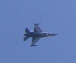
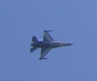
It took the sun a little while before she broke through the clouds but around noon I took off for an easy recovery ride. My legs didn't feel too bad after last weekend but I chose not to overdo it, and enjoy the beautiful Brabant Walloon landscapes. An F16 from nearby 1St Wing Airbase was doing all kinds of movements in the sky - probably training for the upcoming show of the 21st of July, Belgian National Independence Day - and I stopped a while to look in awe to the grace and power of the aircraft. The sound was deafening at times .
When the show was over I rode on . The wind was still blowing noticeably out of Northerly corners but it seemed to have turned more towards the West. Anyway, I looped back towards the language border, enjoying my day off from work to the fullest.
Ride Stats : 45K and 300/310 heightmeters (Polar/Garmin) in 2h08mins
3973/38040
02-06-2009, 22:10 geschreven door Big Bad Wolf
|
|
|
|
|
| 01-06-2009 |
| Hallerbos Roadbook |
I wanted to do a long ride today, so I chose to ride the Merlin to 7 Fontaines in Dworp, where I could start a roadbook I found on utagawa.com. This roadbook looked promising with 36K and 749 heightmeters in the Hallerbos and Braine-Le-Chateau area. From past experiences I knew the Hallerbos could provide a lot of heightmeters on a short distance but I was a bit sceptical on the total. Well, lets find out shall we?
Riding towards the Hallerbos from Meerdael can roughly be divided into 3 sections, the first being the ride towards Duisburg and the entry of the Sonian Forest, the second being the ride through the Sonian forest and the third part the ride through Sint Genesius Rode and Dworp towards the lakes of the 7 Fontaines area. When I arrived I switched my Edge 705 to course mode and set out along the roadbook. The first couple of K's were very familiar of earlier rides I've done here. Riding around the lake and then entering a small singletrack which leads along the edge of a field towards a long climb into the Hallerbos. Reaching the Hallerbos I had a bit of difficulty with the GPS not being able to follow the course anymore. The track passes twice at this area, perhaps that was the reason. Oh well, I could still see the track on my map so I continued following that. A nice ondulating passage in the forest and some steep descents and ascents before leaving the forest to cross the R0 highway. The track than follows a bit of tarmac before turning into a nice singletrack zooming down into the outskirts of Braine Le Chateau.
Some more tarmac here but every now and again also some narrow trails which are hard to spot. Descending towards the N28 and after crossing that the track goes up again, sometimes very steep, making its way towards the Lembeekbos. This is a great section of trails, I have to constantly watch the map on my GPS because the track keeps turning left and right, going up and down all the time. Here the heightmeters are won very easily and the hot sun when leaving the forest makes me drink more than I had anticipated. I narrowly escape landing into a rivulet which crosses the trail unexpectedly. The landscapes are beautiful here but it is also important to keep an eye on the trail. A very long descent on a straight track in the forest, great. What goes down must come up again, and indeed, the following climb add another 50 heightmeters to the counter. The trail is turning towards the north again and I stop for a snack upon exiting the Lembeekbos. A bit later I cross the N28 again and enter Hallerbos once more. A bit further I undercross the R0 again and another section in the Hallerbos - which curiously enough smells of onions this time of year - has me enjoy this beautiful forest to the fullest. If I didn't know better I could imagine myself being in the Ardennes . The pine trees, the narrow tracks, the constant climbing and descending. Great ! But this trail comes to an end, not before a last succession of backroads and narrow trails in downdown Halle. I arrive at the 7 Fontaines again with 36K and 660 heightmeters for this lap. Not bad. When I upload the track to Motionbased another 70 heightmeters are added bringing the total to 730. This indeed corresponds with the figures of the roadbook.
I have a bite to eat before starting the return loop towards Meerdael. The wind, which had been favorable this morning, was now blowing against me. This, coupled to the fatigue of the already more than 75K in my legs, made this a difficult ending of a great ride. My drinking bottle was empty and I was glad to be able to refill it at the well near the Zoete Waters. I need to bring along a second bottle on trips like these, or stop along the way to refill my bottle. The bike performed flawlessly, todays trails offering only a fraction of the technicality and difficulty it has to endure when riding in the Ardennes. Still, the sections of singletrail where beautiful and I had to put the chain on the small ring a lot, some very steep ascents. Kudos to whomever made this GPS track, not a single forbidden trail was used in the Hallerbos. Also, the extra section towards Braine Le Chateau and the Lembeekbos was a fine addition.
Ride Stats : 109.5K and 1170/1173 heightmeters (Polar/Garmin) in 5h35mins
Hallerbos Roadbook : 35.5K and 660/730 heightmeters (Garmin/Motionbased) in 2h18
Hill Factor : 18.6/20.5
GPS track on Motionbased : CLICK
3928/37740
01-06-2009, 20:54 geschreven door Big Bad Wolf
|
|
|
|
|
| 30-05-2009 |
| O2 Bikers Roadbook Harzé |
When rising I found the sun out, and a beautiful day was announcing itself. Temperatures in the low 20-ies and a stiff breeze to keep things from getting too hot. Great day for a ride.
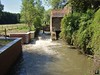
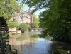
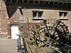
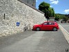
So I rode the red Mazda to Harzé, a little town not far from Aywaille, in the province of Liege in our Belgian Ardennes. An hour later I was setting up the Merlin for the start of the roadbook I was going to ride. I got it from the O2 Bikers website. Upon checking the trace and given the beautiful area, I didn't hesitate to select this ride for a closer inspection. Directly from the beginning, the tone was set. A steep singletrack leading away from Harze. I had to select the small ring in front, it wouldn't be the last time today, to cope with the hill. My heartrate went up in the 140-ies , the bike's suspension was moving gently beneath me, life was good. A short rest on some flatter terrain upon reaching the top of the ascent, and then the trail disappeared into a dark forest. Upon reaching the Bois du Pouhon the drop downhill in the dense forest was a technical one, to the point of being unrideable at certain stages. Too many rocks, mud and some water flowing on the track forced me to walk for a couple of times. When the descent got better I rode again, and emerged at the St Anne's chapel near a small town called Paradis. A very steep and long ascent on tarmac brought me back to the 400 metre mark and into another forest. I was nearing the E25 which I undercrossed by means of a dark and flooded tunnel. The bike got a good wash and the first couple of braking sections had my front brake squealing. When the forest cleared out I could see the Ambleve valley to the right of me, with the green hills on the other side reminding me of some great rides starting in Theux and leading down into the Ninglinspo valley.
But today I was on the other side of the Ambleve and a big downhill was slowly announcing itself. Some sections were very ride-able but others were dark, wet and muddy. During the last parts of the descent I follow a little rivulet, the Fagne Naze which leads me to the borders of the river Ambleve.
Here I am at the lowest point of todays ride - 183metres - and this means one thing, I have got to climb! And what a climb it is . After having taken a wrong turn into a private forest - GPS reception is very bad in these narrow valleys - I find the right track which will lead me back up the hill. A long climb with more than 200 heightmeters in one go. Not too steep so the chain can remain on the middle ring while I enjoy the soft sounds of the forest - some small rivers babbling to my right, every now and then I hear some animals making noises while they run away from me - and the sound of my tyres on the rocky road. Upon reaching the top I follow some tarmac for a while which is a welcome recuperation point. Then the road becomes a track again and I zoom downhill into the Bois d'Aywaille. A sharp turn to the left and I am on a trail that is also used in the O2 Bikers roadbook of Nonceveux, which I did last year. The thought of combining these two roadbooks crosses my mind. But with 75K and more than 2000 heightmeters that will be quite a challenge. Perhaps something for the Summer or the beginning of Autumn.
For now I have to remain vigilant because after undercrossing the N25 again, yes, though another dark and wet tunnel, the track becomes technical again with a rocky downhill into Kin. A small girl on a bike joins me when I ride though this small village before turning away into a steep singletrack that leads me along a barbed-wired field. The track is very difficult with roots and rocks and the thought of the barbed wire on my left makes it more difficult still. But i make it and the next forest awaits me. A great passage with a downhill into La Bordai that makes me happy I got the Merlin for this ride. Rocks, ruts and the occasional puddle keep things interesting. After a 180 to the left the trails goes upwards again along a small track, so small that the nettles have a feast on my legs and arms. Ouch. Another river crossing and I'm getting a glimpse of Harze to the left. After a last bit of forest track I come upon tarmac which leads me back to the starting point.
This was a great ride, some bits were very (too! ) technical and there are some tarmac passages which do come handy because they allow some recuperation. There is water everywhere in these areas and I wouldn't recommend these trails after a heavy downpour. It has been a couple of days since the last rain but I could still see a lot of mud and puddles. Most of them can be avoided but at times you have to walk a small section. Especially the downhill leading towards the Chapelle St Anne will be too much for most of us mere mortals. The risk of falling when attempting to ride it is great. The trails moves in and out of forests all the time but the sun can burn here, so take precautions when riding these trails in spring or summer. A full suspension bike is to be recommended but of course a hardtail will also do the job , it will put more strain on its rider though. I didn't really feel tired after this ride and I contribute this for the biggest part to my Merlin Works 4.0 bike which just seems to float over the trails.
Ride Stats : 40,5K and 910/920 heightmeters (Polar/Garmin) in 2h50mins

Hill Factor : 22,7
GPS track on Motionbased : CLICK
3766/36175
30-05-2009, 20:19 geschreven door Big Bad Wolf
|
|
|
|
|
| 24-05-2009 |
| Randonnee de l'Athenee in Wavre |

Got out of bed and with the sun out my mind was quickly made up. I would ride to Wavre for the 7th edition of the 'Randonnee de l'Athenee', which is organised by one of the local schools. I know from past experiences that this is a great ride. And this year I was set to do the 55K. With the 18K distance between my home and the start this would yield me around 90K of biking. More than enough for this mere mortal.
The Ride
Paid 4 at the start, whilst my bike was being kept in the bike park, safe . The start of the ride was quite a blast for the legs. After a couple of K's to get out of Wavre city the first climb led us up a long, at times very steep hollow road. The first bikers were on foot, I just put it on the 26 in front and gritted my teeth. I would ride this hill. And so I did, and the next one, which, after a quick descent led us back up the same hill again. Already a first split from the other distances - 15, 30 and 40 - for this second hill. Yes, the fools that chose the longest distance would have something to talk about. Bois de l'Avocht, Bois du Mont, Bois du Menil, in and out of forest and shade the trail took us to the south of Wavre towards neighbouring Limal. There another extra loop took the 55K towards Profondsart and Roffesart. The tracks were beautiful, sometimes singletrails, small tracks between fields, hills too steep to ride, fast downhills, we got it all. And I was loving it. I found a good rhythm after an initial gasp for air and my legs that were protesting against another beating. I have been riding every day for the last 3 days, with my thursday trip to Polleur as a highlight and I could feel my legs were not very fresh. But mind was put over matter and I rode on. I was looking for the first reststop which came after 20K or so, perhaps a bit sooner might have been nice. There was enough to drink, with water and something which tasted like grenadine, and also fruit - bananas, oranges - and some cookies to eat. Drinking was most important because it was really hot in the fields. After the first reststop we had a nice venture into the Bois de Rixensart as we slowly made our way towards Rosieres. Luckily they left out the Bois des Templiers this year. I had been there on a ride a few years ago and it was muddy hell. So far I didn't see a single puddle - and it DID rain last night - so I was quite happy with the trail conditions. A field passage through Champles brought us to a tunnel under the N257. I could see that the bottom of the tunnel was a mud-trap, so I decided to ride over the N257 - very illegal, I see red - which kept my tires dry. The track now turned over "Le Ry" towards the golf course of le "Chateau du Bavette". A passage over private roads with a great downhill zooming next to the greens , then a sharp turn to the left and ... walking up an unsurmountable hill, both due to its steepness as to the wet stones that were forming the path. I saw a figure of 27% later on my GPS. For those interested the GPX track can be downloaded from Motionbased - see below.
The ride now turned towards the north-east of Wavre, the Ottenburg region , but not before we had a 2nd rest stop, along the Bois de Laurensart in the neighborhood of Basse Wavre. The passage through the Bois de Laurensart up the hill towards De Tomme usually is a very wet one, but it was almost completely ride-able today. If you didn't mind going through the puddles you could ride it all the way. At De Tomme the 55 had another extra loop with a downhill going against the Red Overijse route, down into the field and then back up again through the hollow road leading towards the plains. Another steep downhill into the Bois de Laurensart and we joined the 40K again for a drop into Gastuche. Next to Grez Doiceau here so the tracks were very familiar to me. A nice passage through Dion Le Val with a long steady climb up towards the N25, followed by a drop down towards Dion again for the 55K riders. Another long uphill into the "Bois des Neulettes" and we were nearly home. At the end we passed through Basse-Wavre and next to the Racing Jet de Wavre football stadium for an urban intermezzo through narrow paths, leading us back towards the start. The distance was quite a bit more then the announced 55K but I don't think anyone really minded. This was a great ride, on a warm sunny day, along some of the finest paths in the Wavre region. Thanks guys.
At the athenee I met up with the lovely Estér from BigM for a nice little chat before heading home. Was nice to meet you again E. Say hi to Iván for me.
The Lowdown:
What I liked:
+ Great trails, with attention to lesser visited tracks
+ the region and the use they made of what is offered
+ dangerous downhills and road crossings well marked
+ distance splits well marked - before AND after the split
+ arrowing sufficient and very noticeable
+ all this for only 4
+ emergency number on cards handed out at start
+ bike park with surveillance
What I did not like:
- only 2 rest zones, a 3rd on the 55K would have been welcome.
- rest zones might have been a bit better stocked although offered food and drink was fine.
Ride Stats : 94K and 1155/1201 heightmeters (Polar/Garmin) in 5h3mins30secs
Wavre TT : 57K and 917 heightmeters (Garmin)
GPS Track on Motionbased : CLICK
Map :

3725/35265
24-05-2009, 00:00 geschreven door Big Bad Wolf
|
|
|
|
|
| 22-05-2009 |
| Recovery |
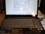
Today I wanted to ride an easy ride, to help my legs in the recovery process from yesterdays' ride. So I set out on a local ride over easy roads. The weather was warm and sunny but there was still a nasty wind blowing. Another change in my daily routine since I took delivery of a brand-new laptop, a shiny HP HDX 16, which is a welcome change from the PC I have been working on since my main desktop PC crashed in th beginning of this month. The 64-bit Vista is surely fast and the screen quality is HDMI, which simply means its amazing.
Fortunately all my programs seem compatible with the 64 bits version of Windows Vista, either in 64-bit mode or in 32-bit mode. I just have to dabble along to get myself acquainted with all the new and different functions Vista has over Windows XP.
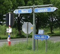
As for the ride today, it went well, my legs were not too tired and I focused on leg speed/pedal rotations on this short ride which took me over Bierbeek towards Neervelp, Opvelp, Beauvechain and Hamme Mille.
Ride Stats: 28K and 205/203 heightmeters (Polar/Garmin) in 1h09mins
3578/33610
22-05-2009, 20:12 geschreven door Big Bad Wolf
|
|
|
|
|
| 21-05-2009 |
| O2 Bikers Roadbook Polleur |
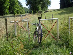
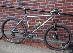
After having ridden the excellent - technical, beautiful scenery, masses of heightmeters - O2 Bikers roadbook of Nonceveux last year, I kept my eye open for similar pearls . When I saw the Polleur roadbook in the April 2009 issue I didn't have to think twice. I wanted to ride it, asap. I know the region between Remouchamps, Banneux, Verviers, Theux and Spa pretty well and I haven't been disappointed when riding there. The area is very beautiful, the valleys are deep and lush with big forests and fields vying for every bikers' attention. The region is also very Ardennesque, with rocks and roots galore and a plethora of steep and technical ascents/descents. Furthermore, this roadbook descents towards the river Hoegne, known to me from my Longest Downhill adventures. And recently also by riding the Verviers World marathon Championship tracks. In short, I wanted to go. The weather forecast called for dry weather but with increasing thunderstorm possibilities in the late afternoon. After having checked Meteox this morning and seeing not a menacing cloud within a couple of 100 kilometers I rode my car to Polleur.Around 10am I parked the red Mazda in front of the librairie de Polleur, straight across the church. This church is a bit special, I already mentioned this in my Verviers blog entry, but for those who are new here, just check out the rotation in the roof.After 15 minutes I was on my bike and already riding uphill. The track quickly descents towards Neufmarteau where I meet the river Hoegne. The trails are wet, this added a couple of points on the difficulty scale. It is utopic to expect an Ardennes ride to be dry, but the less water the better. They call this area 'l'Ardenne Bleu', and I'm sure the Blue stands for water. I asked the locals and they said they had a big thunderstorm 2 days ago. Ceci explique Cela.. This explains that.The first couple of climbs have me looking for a good rhythm. I have stopped taking the Aerius hayfever pills last week and I'm not feeling too well. Still, I'm persistent I might not need them anymore. We'll see. The tracks are difficult, wet, rocky, steep and demanding . Yip, thats the way I like them. My pace is slow but I'm enjoying every minute of it. Slowly I crawl out of the forest for a bit of field before descending towards Surister. Then a long drop back towards the river Hoegne. Tricky and the wet rocks demand the utmost of my concentration. But I am determined to ride it all and amazingly, I make it.
Into Royompré and then a beautiful singletrack ondulating high above the Hoegne towards the Croupets du Moulin. A tough one, wet and rooty and the drop on the left doesn't look very forgiving. A fallen tree has me climb over it, bike in hand. Another long climb leads me through the Bois de Rassouster. Dropping back towards Royompré, crossing the N629 and I have to walk the first couple of meters of the following climb. Too rocky, too wet. After a while I leave the forest and follow a narrow singletrack towards Les Bansions. When I arrive on a bigger trail I take some time to eat. The next couple of kilometers are a bit easier along the Bois des Gattes but with a nasty descent - rocky and wet - at Le Sarpey before reaching Polleur again. Here the trail merges with the Red Theux route and climbs into the majestic Bois de Staneu. The trail crosses deep under the E42 bridge and then follows a track parallel to the Red route. This track is the most difficult of the day, actually riding in a rivulet, its bed riddled with rocks. The Moots has to work hard here, and its rider even harder, the wheels keep slipping, bumping against rocks, process is slow but steady. This bike was made for this. The trail then descents towards the road leading from Polleur to Theux, but just before reaching it you have to take a sharp left and brace yourself. A steep climb follows. I made it but it cost me a lot of energy. Then follows a wet section, lots of puddles, as the trail remains on the same heightline for a while . It drops back down again, turns to the left again and the biggest baddest of climbs follows. I admit, I didn't make it this time. I did when riding the Red last year with the Merlin, but the trail was dry then. It was wet now and the big rocks make every mistake a bad one. About halfway to the top my rear wheel slipped and I didn't have the strength or speed to correct it. OK, walk this way. After a while the slope became less steep and I could ride on. The trail is then dropping for the last time towards the road heading to Theux. Normally the roadbook follows this tarmac road into Theux but I decided to add another climb following the Red route upwards towards Rainonfosse. Then I zoom back down into Theux.
Next target was the Chateau de Franchimont. I had spotted it already a couple of times when riding in the Bois de Staneu but now I was at the bottom of the climb leading up to it. You have 2 options, one is 1350 metres long , the other 350 metres. No points for guessing which one I took. The hill was short and steep. 32% to be precise. Luckily it was also dry so I made it without too much difficulty. After having stopped to take some pictures I started on the last 7 kilometres leading me towards the top of the Thier de Polleur, a 26% drop into the town of Polleur where I had to be careful one last time before reaching the end of the roadbook.
Ride Stats : 36K and 790/820 heightmeters (Polar/Garmin) in 2h38mins

Hill Factor: 22
GPS Track on Motionbased : CLICK
3550/33405
21-05-2009, 00:00 geschreven door Big Bad Wolf
|
|
|
|
|
| 17-05-2009 |
| Copycat |
|
Todays'
ride was in many aspects a copy of yesterdays' effort. Again the
weather was cloudy, with scattered showers and a lot of wind in the AM.
So I waited until 6PM when things seemed to clear out a bit, to leave
for another road ride. The wind was still present though and I made a
loop over Bierbeek and Meldert towards La Bruyere and further on to the
spot where I left the blue/yellow arrows yesterday. I followed them
towards the Bois de Beaumont and Grez Doiceau, and continued towards
Archennes and Eerken. Here the arrows pointed towards Ottenburg but I
rode on towards Pecrot and Nethen to return over Sint Joris Weert and
the Weertse Dreef. It bothers me that even on a sunday people still use
the Weertse Dreef with their cars. There are barriers but they only
close them occasionally. Closing the Weertse Dreef during the weekend
would be a great idea.
Ride Stats : 49K and 295/305 heightmeters (Polar/Garmin) in 2h05mins
3514/32615
17-05-2009, 21:00 geschreven door Big Bad Wolf
|
|
|
|
|
| 16-05-2009 |
| Windy Interlude |
It was dry but cloudy and a lot of wind was blowing from westerly directions when I rode out this saturday morning. I wanted to follow some yellow arrows on blue fields which I saw earlier this week so I set out through the Weertse Dreef to catch up with them in Sint Joris Weert. As soon as I got out of Meerdael Forest I noticed the strength of the wind and I was thinking this ride might get tougher than I had anticipated. The trail went over Nethen towards Hamme Mille and Beauvechain and then turned towards La Bruyere and moved up into the direction of Pietrebais. In the plains next to the Beauvechain Military Airspace the wind blew straight into my face.I also noticed that the clouds in the direction of Leuven were getting darker very fast. When I arrived at the crossroads between the N51 and the N91 I decided to abandon my arrows and head back to Hamme Mille.
From there I added another loop back over Nethen , Sint Joris Weert and past the Zoete Waters towards Oud-Heverlee and Heverlee to finish in a light drizzle. With just a little more than 2 hours I wasn't completely satisfied with the ride but in the given circumstances I think I did OK.
Ride Stats : 48.5K and 305/291 heightmeters (Polar/Garmin) in 2h05mins3465/32320
16-05-2009, 15:27 geschreven door Big Bad Wolf
|
|
|
|
|
| 14-05-2009 |
| Split cable |
Today
rain was forecast so I was surprised that it stayed dry until 4pm
wgen I decided to ride out for a quick dash along the Meerdael BLOSO
routes. I started out on the Moots and commenced my ride with the Green
route. There was a faint hint of dark clouds on the western horizon. I
had seen on meteox.be that there was intense rain over Brussels but
thought I would be safe for at least a couple of hours before things
could get dangerous over here. And indeed things were going fine during
the first bit of the ride - tracks were dry or slightly moist at
the worst and my legs felt rather surprisingly good after yesterdays'
fast ride - when all of a sudden - an hour into the ride - I
noticed I couldn't shift on the big ring in front. Uh-oh, whazzup ? I
stopped to check, half expecting a branch or small stone to block the
passage of the derailleur cage, when I noticed that the XTR cable had
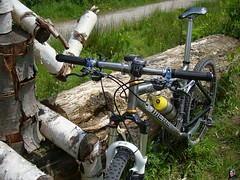
split in half, thereby losing a lot of its tension.
Ride Stats : 23.5K and 155 heightmeters in 1h06mins
3416/32015
14-05-2009, 19:24 geschreven door Big Bad Wolf
|
|
|
|
|
|
|
| Gastenboek./.Guestbook |
Druk op onderstaande knop om een berichtje achter te laten in mijn Gastenboek. /
Press the button below to write in my Guestbook.
|
| Email Me |
Press the button to send me a mail
|
|
|
|