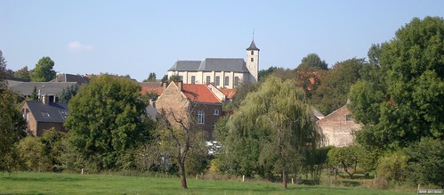
A beautiful sunny morning and I couldn't wait to get on the Moots and hit the road. Short road section to Bierbeek and the start of the "Meerdaal 2000" ride I was going to recon today. This organised ride is taking place on Sunday the 25th of October,starting next to the Borre and the football fields. Please mark this ride on your calenders, it will be worth it.
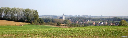
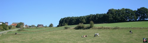
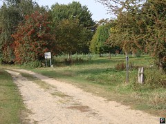
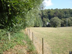
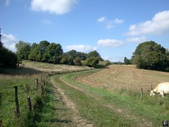
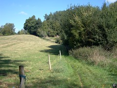
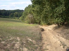
The organisers gave me the GPX track to the longest distance, supposedly 65K. The track was made by someone connecting the dots on a map, and what that meant I was about to find out later. Starting at the Borre the track veers to the left towards the southeasterly section of Meerdaal Forest. The forest was still fairly cold but the sun was heating up the fields I arrived in after a first section of trees. I noticed the trail on my GPS was not exactly following the road lines on the map, and at one time I was sent into a track that dead-ended. Mm, first drawback of drawing tracks on a map, you are never sure if the road you select is still there. But no worries , I turned around and chose another road to arrive where I should arrive. After all, this is my backyard and I know every nook and cranny here. A passage through the fields into and out of Tourinnes la Grosse. The sun is out in full september force and warms up my skin. Life is great.
 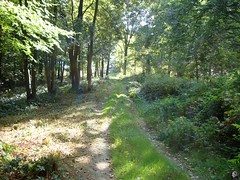 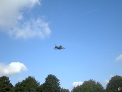  
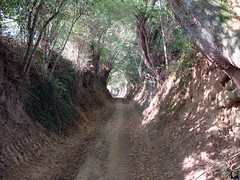
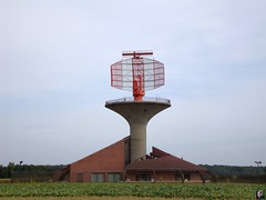
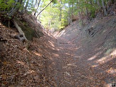
Crossing the N91 and making my way towards the south I notice a hunting party to my left. But the guns are pointed in the other direction, no worries. A very nice section leading up through a difficult stony and rubbly track into the Bois de Linsmeau and then back down into Cocrou. Crossing another busy road and I'm making my way towards yet another forest patch. A 20% uphill makes me sweat and at the top I turn left for a quick downhill on tarmac. My GPS dictates me into a very narrow singletrail I know from the 2008 Belgian Championships Marathon track . Going down it is easier to negotiate the narrow track with a rivulet running parallel to it. Its dry now and everything is fine but I can imagine a lot of slipping and sliding when this trail is wet. At the bottom I cross a concrete bridge and then follow the track towards a tarmac road. Taking left here and then after 500m turning right for a very beautiful climb in a hollow road in the Bois de Beausart. At the top of the climb I stop for a little snack. While I'm eating I'm noticing 2 F-16 jetfighters passing. They are making fly-by's on the Beauvechain airstrip and I advance into the fields to make a couple of pictures. The powerful jet engines make the air tremble - chicken skin on my arms and legs.
When I look at my GPS I notice something is wrong. It is pointing me back to the north, back to the start. What has happened ? I stop, manually stop the navigation, select my track again and let it re-navigate and check my position. To my surprise I'm way off the trail! I turn to the south down into Pietrebais to reconnect with the proper trail I should be following. A bit further I see that the track veers off again. The Edge beeps and re-calculates its position when it loses the track, and when it does that it doesn't navigate you back to where the track lies, but it navigates you back to the start !
So that is what happened before as well. At one point it must have lost the track, and it can recalculate very quickly. So quickly you don't even notice it. In fact, there is only one way you CAN notice it has recalculated you towards the start. There is NO trail behind you ! Normally when navigating a gpx track you see a purple trail before you, but there is also a purple trail behind you. When it has re-calculated, you only see one part of the track. Check the pictures to understand what I mean.
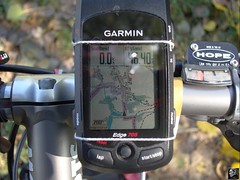 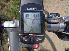
Surely enough, now that I begin to pay more attention to the track I notice there are often moments when it runs next to the lines on the map. This is because it has been drawn on a PC, and is not an actual track made by riding on the trail. And when cutting a corner, or by plainly sending you into the field or the forest, the GPS gets confused, "loses" the track and promptly recalculates. OK. Lesson learned. I would have to stop at least 15 times, more frequently towards the end of the trail. Perhaps the trail drawer got sloppy I don't know, but it surely breaks the rhythm.
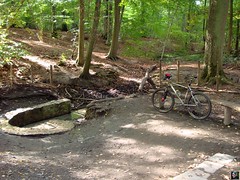
Ok, back to the trails. In Pietrebais there is a very nice singletrack climb bringing me towards the "Ferme de la Sarte" . This is Biez and there now follows a nice loop bringing me up towards Longueville. At the Chapel they choose a track that leads down into a deep gully, passing this and a very steep and difficult climb awaits. Great, I'm really enjoying this part of the ride. Long downhill down into Bonlez and directly turning to the right for a long climb up the ridge again. Dropping into downtown Biez and then taking the trail towards la Royenne. I notice my rear tyre seems to be slowly losing air and I stop to put some more pressure in it. I take the difficult and steep singletrack up towards Biez and after the church another singletrack leads me down towards Grez-Doiceau. This is "Accro Bike" country and the trails are very familiar to me. The heightmeters quickly accumulate and the pace needs to be watched, lest you overstrain yourself. The track now turns to the north and of course the singletrack climb towards Gottechain could not be left out. Great and difficult track. Will be slippery when wet though.
   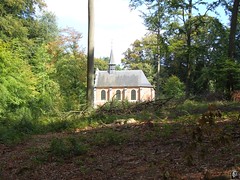 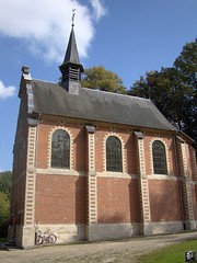
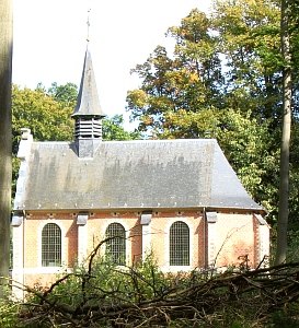
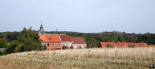
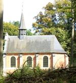
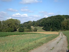
After Gottechain the trail then heads for Archennes, using another rarely used trail. Care has to be taken. The grass has been mown but still there are some ruts hiding and waiting to catch the wheels of the unwary. The climb out of Archennes and onto the La Malaise plains will surely start a lot of bikers wondering why they did not choose one of the shorter distances. Full attention is needed for the downhill that almost brings you into Florival. But the next hill is already waiting around the corner and after that a sweeping trail through the fields brings you high above Pecrot. Down along a sandy forest track with roots, ruts, drops and back up again in a long hollow road. Arriving in the Bois de la Hocaille, passing the beautiful white chapel, crossing the Rue de la Malhaise and veering left into a singletrack taking me eventually down towards the railroad. But not quite since the track turns right and then left to follow the railway for a while towards the Bois de Beaumont. Arriving in Nethen and passing the La Hetraie camping I am back in the Meerdael forest. And a 22% climb makes sure immediately that the ride is not over yet. Past the Weertse Dreef into the Kouterbos the terrain finally becomes less hilly and in the neighborhood of the Zoete Waters I have another bite to eat and put some more pressure into my rear tyre again. The last couple of K's into the Mollendaalbos and past the Blanden cemetery make for a nice cooldown .
I arrive back at the start with close to 70K on my counter and indeed almost a 1000 heightmeters. Not to be under-estimated, and I hope the trails will be dry on October 25th. The region is beautiful and demanding but the reward is a very nice ride and some challenges along the way, both technical and physical.
Ride Stats : 84.5K and 1015/1145 heightmeters (Polar/Garmin) in 4h50mins
7447/75795
25-09-2009, 21:27 geschreven door Big Bad Wolf
|