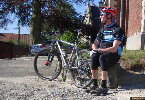
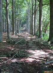
It had been a while since I first rode the O2 Bikers roadbook that starts in Lubbeek. In fact you can read my account of the first encounter here. I rode the Moots over Bierbeek and Korbeek Lo to pick up the trail on the ridge overlooking Korbeek Lo. I used the same version of the track as last year but the Garmin Edge 705 has seen some software since then. Which makes for a better refresh rate after corners and also the version of the topographic map is now in higher contrast and better colors. The first sections to reach Pellenberg are a good intro into what this route offers. A couple of tracks in the forest, a tricky downhill and a very steep ascent on a small singletrail. The trail then worms itself in the direction of Lubbeek. I noticed it must have rained considerably in this region yesterday because the trails looked pretty washed . Also, the storm of July 14th has left a lot of trees decapitated. I passed the section where I flatted last year with some reservation but all went fine today. No flat tyres. I don't hate mending a tyre but stopping also means that horseflies have a chance of finding their way to my body. I wore long trousers - imbibed with my custom insect repellent - and sprayed Autan on my exposed arms. I didn't have any problems with insects, luckily. The weather was sunny but a very noticeable northwesterly wind kept the temperatures in the lower 20ies. Degrees Celcius that is. A fine day for a ride.
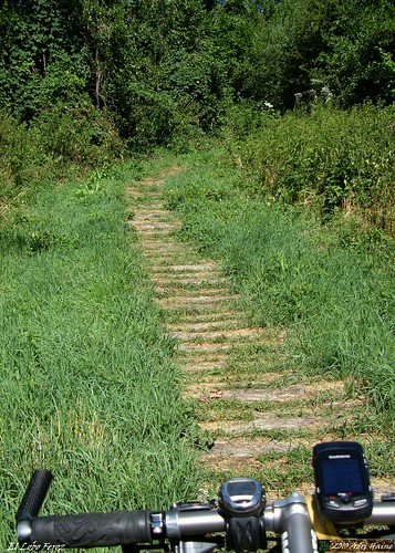
When I passed the start in Lubbeek I paused to restart the navigation on my GPS and before long I was enjoying singletracks again. The climb to the Calvarie Berg was very steep and also very difficult due to fallen branches and washouts form yesterdays' thunderstorm. Before crossing the N2 I was hesitating again when the track directed me into what looked to be private property. But I went for it and indeed, it was allright to pass. The Sassenbeek walking route, with the logs still in place, made me wish I had a full suspension bike instead of the YBB but it was only 200 meters long. The trail then moves towards Tielt Winge and follows a local mountainbike trail, called the Solveld route. Great passage in the forest here, with steep uphills and a couple of very fast downhills. I later noticed I clocked 60kph at one time. I was almost tempted to ride this section again but decided to move along the route instead.
The trail now moved along small singletrails through the fields. The wind was playing its part and I was feeling my legs from yesterdays' ride. But nearing Linden another passage in the forest awaited. And a great one. This time I didn't miss part of the loop - although I nearly took a wrong direction again at the point where the track almost converges with itself. I noticed I was wrong and had to backtrack a little. But then I could enjoy a downhill into Linden and a nice long uphill along some winding singletrack in the forest. From Linden the track crosses the N2 again and then follows the GR route up the ridge overlooking Korbeek Lo. Hey, I've come full circle.
Beautiful track, and one of the better O2 roadbooks in my region for sure. You can download the track at the O2 Bikers website. Just search for Lubbeek. Officially its around 40K and has 550 heightmeters. I won't argue with either figure, they are correct. You have to take care in some of the forest passages because there are plenty of trails crisscrossing and the track has not a lot of trackpoints. I could provide a higher quality version of todays' track if needed, just pop me a mail.
Ride Stats : 60K and 730/815 heightmeters (Polar/Garmin) in 3h16mins
5677/59345
24-07-2010, 18:10 geschreven door Big Bad Wolf
|