|
I wanted to do a long ride today, so I chose to ride the Merlin to 7 Fontaines in Dworp, where I could start a roadbook I found on utagawa.com. This roadbook looked promising with 36K and 749 heightmeters in the Hallerbos and Braine-Le-Chateau area. From past experiences I knew the Hallerbos could provide a lot of heightmeters on a short distance but I was a bit sceptical on the total. Well, lets find out shall we?
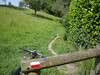
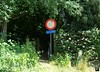
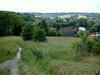
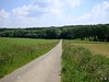
Riding towards the Hallerbos from Meerdael can roughly be divided into 3 sections, the first being the ride towards Duisburg and the entry of the Sonian Forest, the second being the ride through the Sonian forest and the third part the ride through Sint Genesius Rode and Dworp towards the lakes of the 7 Fontaines area. When I arrived I switched my Edge 705 to course mode and set out along the roadbook. The first couple of K's were very familiar of earlier rides I've done here. Riding around the lake and then entering a small singletrack which leads along the edge of a field towards a long climb into the Hallerbos. Reaching the Hallerbos I had a bit of difficulty with the GPS not being able to follow the course anymore. The track passes twice at this area, perhaps that was the reason. Oh well, I could still see the track on my map so I continued following that. A nice ondulating passage in the forest and some steep descents and ascents before leaving the forest to cross the R0 highway. The track than follows a bit of tarmac before turning into a nice singletrack zooming down into the outskirts of Braine Le Chateau.
 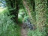    
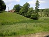
Some more tarmac here but every now and again also some narrow trails which are hard to spot. Descending towards the N28 and after crossing that the track goes up again, sometimes very steep, making its way towards the Lembeekbos. This is a great section of trails, I have to constantly watch the map on my GPS because the track keeps turning left and right, going up and down all the time. Here the heightmeters are won very easily and the hot sun when leaving the forest makes me drink more than I had anticipated. I narrowly escape landing into a rivulet which crosses the trail unexpectedly. The landscapes are beautiful here but it is also important to keep an eye on the trail. A very long descent on a straight track in the forest, great. What goes down must come up again, and indeed, the following climb add another 50 heightmeters to the counter. The trail is turning towards the north again and I stop for a snack upon exiting the Lembeekbos. A bit later I cross the N28 again and enter Hallerbos once more. A bit further I undercross the R0 again and another section in the Hallerbos - which curiously enough smells of onions this time of year - has me enjoy this beautiful forest to the fullest. If I didn't know better I could imagine myself being in the Ardennes . The pine trees, the narrow tracks, the constant climbing and descending. Great ! But this trail comes to an end, not before a last succession of backroads and narrow trails in downdown Halle. I arrive at the 7 Fontaines again with 36K and 660 heightmeters for this lap. Not bad. When I upload the track to Motionbased another 70 heightmeters are added bringing the total to 730. This indeed corresponds with the figures of the roadbook.
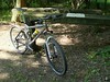     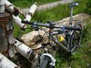
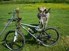
I have a bite to eat before starting the return loop towards Meerdael. The wind, which had been favorable this morning, was now blowing against me. This, coupled to the fatigue of the already more than 75K in my legs, made this a difficult ending of a great ride. My drinking bottle was empty and I was glad to be able to refill it at the well near the Zoete Waters. I need to bring along a second bottle on trips like these, or stop along the way to refill my bottle. The bike performed flawlessly, todays trails offering only a fraction of the technicality and difficulty it has to endure when riding in the Ardennes. Still, the sections of singletrail where beautiful and I had to put the chain on the small ring a lot, some very steep ascents. Kudos to whomever made this GPS track, not a single forbidden trail was used in the Hallerbos. Also, the extra section towards Braine Le Chateau and the Lembeekbos was a fine addition.
Ride Stats : 109.5K and 1170/1173 heightmeters (Polar/Garmin) in 5h35mins
Hallerbos Roadbook : 35.5K and 660/730 heightmeters (Garmin/Motionbased) in 2h18
Hill Factor : 18.6/20.5
GPS track on Motionbased : CLICK
3928/37740
|


