|
|
|
| Tales from the Woods |
|
|
| 19-10-2008 |
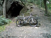
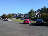
 Meerdaal 2000 pre-ride Meerdaal 2000 pre-ride |

Today was a fine day to try a longer ride. I had set my sights on the 55K distance of the upcoming Meerdaal 2000 TT, starting in Bierbeek next sunday. I got the map of the organisers so I made a GPS track out of it using Mapsource. Saving it as a gpx track, converting it into a course my Garmin Edge understands and hey presto, I was ready to go. Only uncertainty was how my lower back would behave. Since I already stressed it yesterday I wasn't sure I would be able to complete the whole ride.Riding up to the start in Bierbeek the sentiment I got from my muscles was good. I needed to warm up exhaustively, and my overall average was around 18 kph. Not much but I managed to go the whole distance, and that is what counts. The ride, then, takes you first into the fields surrounding Bierbeek and Mollendaal , with some nice little singletrails and a bit of mud from time to time, but nothing drastic. In fact, the few puddles that remain are easily contoured. Some cobble sections as well but fortunately, these are only short passages and they were dry, which made it easy to tackle them. Looping back towards Meerdael Forest for the first time, the trail follows the inside edge of the forest and then heads back into the fields. A tricky downhill into a hollow road down from the Cayberg ,with a big puddle smack in the middle of the singletrack made me hope that it would stay dry next weekend. The trail now more or less descents to the south and into Beauvechain where a first rest stop will be situated some 21K into the ride. It then meanders on towards Tourinnes-La-Grosse. Care has to be taken when crossing the bigger roads. A nice little climb takes me out of Tourinnes and another singletrack awaits me to get me closer to Hamme Mille. A steep climb on tarmac takes me to the outskirts of the Meerdael Forest again but I need to be patient just a little more. After 30K at last a hollow road takes me into the forest - mud hole alert - and the next 24K will be spent in the shade of the majestic trees. The autumn colors the leaves in all shades of brown, yellow and red . Already a lot of leaves have fallen onto the trails, making them a lot trickier. You hardly notice the potholes, roots, branches and other dangers so you have to be very alert - always expecting something to try and pull you off of your bike. The trail follows the Meerdael BLOSO tracks for a while - it is nearly impossible to get permission for anything else from the Forestry - but they are fun and almost dry. Around the Chateau Chavenel it takes the Blue trail in reverse direction, which means a steaming fast downhill followed by a sandy passage along the ancient wall. Then the trail goes up towards the Herculessalon and again the next downhill takes the fast and furious in a few minutes towards the Kluis. Another climb follows. I had to be careful because the BLOSO trails are always filled with bikers - this time coming downhill towards me . Close to Sint Joris Weert another tricky section awaits me; the downhill with steps. I was with the Litespeed - which means front suspension only - and I nearly lost it. The steps are eroded and some gullies and roots demand a lot of courage to let go of the brakes. But the bike did it, and the long climb afterwards was made easy because they opened up the trail a bit and cleaned out all the branches and trees . A nice twisty singletrack section before arriving where the 2nd rest stop will be. I now have 40K on my GPS counter. The remainder of the trail takes me into the Kouterbos with a passage along the Zoete Waters and then loops back over Pragen and the Lange Delle towards Blanden. Here we cross the N25 and disappear into the Godensalon for a nice little stretch through the Mollendaalbos. From Haasrode the remainder of the trail takes you down some tricky cobble road and then the last climb up to the finish. The numbers were 56.8K and 625 heightmeters for this lap. I can deduct 300 metres because at one point I was looking for a trail that wasn't there anymore and I had to retrace my steps. So lets make it 56.5K . Here is the profile of the ride . You will notice that the first 20k or so are reasonably flat, with some more height differences when you enter the Meerdael Forest.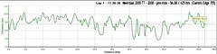
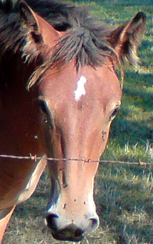
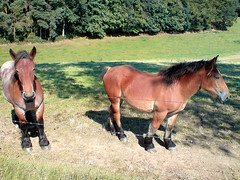
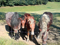
The trip back home nearly got me involved in a crash when a fool with a BM double U ignored my right of way. Good thing I was too tired to get into an argument. Upon arriving home I felt tired but very satisfied because I had made this long ride. The glorious weather obviously made it a blast to be outdoors. The forest was full with walkers, runners , bikers and horses and they all enjoyed this sunny day to the fullest.
Ride Stats : 69K and 690/726 heightmeters (Polar/Garmin) in 3h48mins8404/83400
19-10-2008, 18:21 geschreven door Big Bad Wolf
|
|
|
|
|
| 18-10-2008 |
| Meerdael Blues |

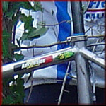
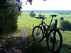
Today the sun was out, it was rather frisky in the morning so I decided to leave around noon for a spin around the Blue Meerdael BLOSO. This is the toughest of the three Meerdael BLOSO's so I was sure to get a good workout for my muscles and lower back tension. This proved to be correct since my back was protesting when I was on the steep climbs. I did not press the issue and stood up instead of remaining seated when the steepness of the climb demanded too much hip power. I had mounted my GPS with 2 zip ties but I'm putting the stem mount from my Merlin on for the remainder of the Fall and Winter. 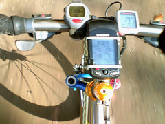
18-10-2008, 15:13 geschreven door Big Bad Wolf
|
|
|
|
|
| 13-10-2008 |
| Neanderthaler |

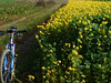
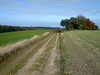
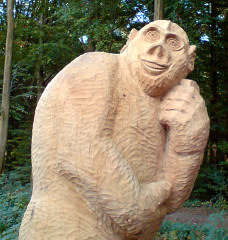
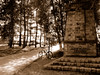
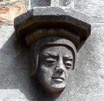
Wow, almost 23 degrees C when I got home around 4pm. No way I was going to miss this occasion to ride out. I had decided yesterday to try some offroad and I had equipped my Litespeed with big fat tyres. In front an old green Michelin tyre and a trusty Big Jim in the back. I had to get used to the straightforward action of the Michelin. Its high side knobs almost prevent you from taking a turn, and you feel as if the whole thing will collapse when you are actually making the turn. The high knobs make for excellent traction on sloping berms but demand a firm hand when taking turns. I won't start about how they behave on wet cobbles - it raises your hair. But I was warned and in all I had no troubles. I started out with a fast pedalling pace to warm up my legs and hips. To my surprise the ride turned out to be easier on my back than the tarmac ride I did last saturday. Of course the Green BLOSO is not exactly one of the most technical or hilly rides imaginable and the fat tyres and front suspension make for a comfortable ride. The titanium bike obviously also helps but my Hilset is also made of this material even though it is a bit less comfortable than the Litespeed frame-wise. The high temps made for a pleasant ride. I made a little detour on the Green Loop to check out Ad Wouters' latest forest sculpture - called the Neanderthaler. The pics will show you why. Check out some more pics of Ads' work in this gallery with pictures made by one of the Foresters . Being out in the forest again felt great . Autumn in settling itself and the leaves are changing color and beginning to drop. The wetness of the morning dew never dries out anymore but the warm southern wind managed to make it pretty warm today. I had completed the loop and returned home very satisfied and with good hopes for the future.Ride Stats : 27K and 185/197 heightmeters (Polar/Garmin) in 1h16mins8292/82465
13-10-2008, 20:05 geschreven door Big Bad Wolf
|
|
|
|
|
| 07-10-2008 |
| Revalidation hour |

Today I was set for a full hour on the rollers. Yesterdays' kine session had loosened up my muscles and today I felt good . The emphasis today was on making the full hour. Not an easy task on the rollers to begin with but the companionship of Doro Pesch on the MP3 player and a furher reading in Arthur C. Clarkes 2010 novel got me through it just fine. I upped the resistance a bit and my back felt fine throughout the ride and also afterwards no strange twinges were noticed.Ride Stats : 23K in 1h8187/82035
07-10-2008, 20:30 geschreven door Big Bad Wolf
|
|
|
|
|
| 03-10-2008 |
| More Revalidation |
|
Today saw me for another half hour on the rollers. May seem like nothing but if you know where I'm coming from its quite an achievement. Another half an hour of concentrating and looking for signals coming from my lower back. No signals today which is fine. I think I will leave it alone for a couple of days now and concentrate on next week for perhaps a first ride outside.
Ride Stats : 11k in 30 mins
8147/82035
03-10-2008, 19:42 geschreven door Big Bad Wolf
|
|
|
|
|
| 02-10-2008 |
| Revalidation |

Another easy 30 minutes on the rollers today. Went to the kine this morning and he did some things with my neck I didn't believe possible. Even though I have the green light to ride outside I want to take it one step at a time and do some controlled riding before venturing out in the great wil yonder. The rollers gave me the opportunity to catch up on my reading again .I am currently reading 3 books at once; "Ik Ben God Niet" by Frank Vandenbroucke ; "Ik,Sven Nys" by Sven Nys and also "2001, a Space Odyssey" by Arthur C.Clarke. It is that last one that I am reading for the moment - for the 15th or so time - and when its finished I must re-read its culmination in 2010 - Odyssey Two. I just noticed that Arthur C. passed away earlier this year. He certainly was an icon if SF literature. Ride Stats : 11K in 30mins8136/82035
02-10-2008, 15:27 geschreven door Big Bad Wolf
|
|
|
|
|
| 30-09-2008 |
| Revalidation Begins |

It has been exactly 14 days since I last rode a mountainbike. I experienced a disc slippage in my lower back - L5-S1 to be exact - and have been forced to wait for the pain to reside and - with the help of a kinesist - for the disc, and more importantly the surrounding structures to re-settle where they should be settled. To compound things a bit more, I contracted a cold that has kept me from getting on the rollers a few days more. Yesterday it felt like the kinesist pulled my spine out of my body by the coccyx. Damn, it hurt but it did good also because there was an enormous pressure in the coccyx area that was relieved by that manupilation. I was a bit curious as to how I would feel this morning but I felt surprisingly almost no pain. Just the usual dull tiredness that occurs after cranial-sacral manipulation. So I got on my rollers for a 30-minute try-out. See how it felt. And it felt fine, obviously my supercompensation has long dwindled away - not helped by the cold - but the legs felt good and my back didn't protest. I was glad to get my mind on cycling for even this short while. The organisation of the Belgian and Dutch championships has taken a lot more out of me - especially emotionally - than I took for granted. It was fun and felt great to be able help out with the organisation of such an event. Even though the resources were limited and the time was short I think that in general we can be very pleased with how things went. Obviously there are some issues that need further evaluation but those issues are not linked directly to the organiser. Instead , the Belgian Cycling federation should seriously consider updating their marathon reglementation. More specifically the part where stayering is forbidden for female participants. That rule is a bit sexist to say the least. There is no mention it is forbidden for juniors, masters or even elites MALE riders to crawl into the wheel of another participant, only the women are targetted by this rule. I know for a fact that a lot of male participants are unable to follow some of the women participants so why this rule? I have been reading the UCI MTB rules and have not been able to find anything remotely like rule 5.3 in the Belgian marathon rulings.
Ride Stats : 11K in 30mins
8126/82035
30-09-2008, 00:00 geschreven door Big Bad Wolf
|
|
|
|
|
| 16-09-2008 |
| Theux - Signal de Botrange - Theux - light version |
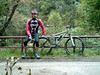
I was not sure if I should go today or wait another day but when I saw the sun out I decided to ride to Theux anyway and do the longest uphill followed by the longest downhill. My cat looked a bit sad as if he wanted me to stay home. I would think about him a few hours later.. please read on.When I arrived at the chateau de Franchimont overlooking Theux the sun was hiding behind clouds and with 15 degrees C it wasnt exactly very warm. I know from experience that the temperatures up on the Fagnes would be 4-5 degrees less so I dressed warm. The first couple of kilometers went very well - only the usual trouble with my Polar when passing alongside the railroad track in downtown Theux. I started off by following the Blue route down from the chateau along a very nice downhill. Afterwards at the foot of the majestic Bois de Staneu I changed over to one of the Spa marked routes following the little Clémentine river up towards the Crois Brognard. After crossing the busy road I dropped down the slope to arrive at the start of a very nice and sometimes very steep singletrack leading me up towards Tiege. There I followed a bit of tarmac until I crossed the E42 and another nice track brought me towards the N640. Here I dropped down a steep trail towards the Petit Normand area where you can cross the river Hoegne, either riding though it or riding over a small wooden bridge. Unfortunately I decided to take the bridge. As I was lifting my front wheel to engage the steps leading up towards the bridge I felt something twitch in my lower back. A little muscle spasm. Damn. I could continue riding but I know from past experiences that these little spasms lead to a couple of days of stiffness and generally a lot of pain.I decided to continue since the trail leading upwards from the Petit Normand is not too difficult and I was on a full suspension bike anyway. I also decided that it would be impossible to ride down from Signal de Botrange afterwards using my usual route - following the river Hoegne offroad towards Polleur. This route is quite challenging and demands a lot from bike and biker.
I could feel some pain in my lower back but as long as I was on reasonably large gravel roads I would be fine. The long climb on tarmac and gravel towards the Vecquee went easy enough but the rocky descent down towards the river Hoegne bridge near Hockay already made me realize I should avoid bumpy roads as much as possible.Another steepish climb brought me to another bridge over the river Hoegne where I paused for a photograph. When I got off my bike I could feel the pain getting worse. So I made the picture very fast and continued on my way up towards 700 metres, now over large gravel roads. At the Signal I went to the point of view overlooking Germany and had something to eat. There was a cold wind blowing from the Northeast so I didn't stay longer than necessary. I took out my maps to have a look at my downhill options. From earlier rides I remembered that I could take a fairly easy road from le Petit Normand towards Theux if I followed the N640 towards Sart and Tiege. Then after Tiege I could cross under the E42 , take left and cross over the E42 again to arrive into the Bois de Staneu. There is a narrow tarmac road riding over the crest of the Bois de Staneu hill all the way to Theux. This would all more or less be downhill. The only real climb I would have to do is the one towards the Chateau de Franchimont again, but here I could also choose the tarmac option. And so it was done. I was glad I made it, with the lower back you never know how bad it can get. I felt sad for not being able to complete this ride like it should be - I have been doing this ride for many years now, refining an old O2 Bikers description of it and adding a lot of offroad to the uphill sections - but thnigs being what they were I believe I made the right choice .
The next few days, perhaps even weeks, will see me doing a lot of tension exercises and warmth treatment of my lower back muscles , some easy riding on the rollers and resting to give my back the time to get back in shape. Ride Stats : 63.5K and 985/975 (Polar/Garmin) in 3h30minsGPS Track Analysis on Motionbased : CLICK8115/82035
16-09-2008, 22:35 geschreven door Big Bad Wolf
|
|
|
|
|
| 14-09-2008 |
| Relax 2 |

Pretty cold this morning, but the sun was out so I decided to ride out, albeit very well covered in wind-tight apparel. Another easy ride on the road that took me towards Archennes and Dion-Valmont. On a climb in Morsaint I noticed 3 bikers who looked like they were doing the Belgian Marathon Championship track. I was pretty certain they were when they returned after having missed a turn into the fields . They looked pretty muddy but at that point they were nearly 50K in the ride so with the rain we had the last few days one thing surely explains another. The wind was blowing fiercely in my face when I looped over Chaumont Gistoux and Dongelberg towards Jodoigne. I noticed that one of the churches also has a tor roof so I took a little picture of that before venturing on towards Hoegaarden and Meldert on my way back home. Once past the Ravel in Hoegaarden I had the wind in my back which felt great.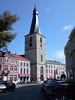 Ride Stats : 80k and 640/697 heightmeters (Polar/Garmin) in 3h30mins8012/80690 Ride Stats : 80k and 640/697 heightmeters (Polar/Garmin) in 3h30mins8012/80690
14-09-2008, 16:49 geschreven door Big Bad Wolf
|
|
|
|
|
| 12-09-2008 |
| Belgian and Dutch MTB Marathon Championships - update |

Just a little update to tell you that I have edited the GPS track on a few points and also added a list of road crossings which should make life easier for people following the race to see their friends and provide them with upport and assistance. You can download the 7-ZIP file by CLICKING HERE.For those not familiar with Rapidshare - just click on FREE USER, wait a few seconds for the countdown to finish , then fill in the code that appears in the box and click on the download button. The download should start after that. To unzip the file I believe you can use WINRAR or else get the 7-ZIP program HERE.
12-09-2008, 16:42 geschreven door Big Bad Wolf
|
|
|
|
|
| 11-09-2008 |
| Theux Red and then some more |
Today I rode to Banneux to ride the Red Adeps route of Theux. I always start in Banneux because that way the most difficult parts of the ride are at the start - the Forges de Thiry descent and the climb out of Theux towards Sassore. My plan was to also include a trip into the valley of the Ambleve - Ninglinspo, Chaudiere and Vieux Chera - and do some extra heightmeters there.
I arrived in Banneux around 10.30am. I had to look a bit to find the parking spot I prefer - it is more than a year ago since I last was here and things fade easily. When I left the parking lot I came on the N62 and from there I could easily get on the Red trail. I didn't feel very fit in the beginning of the ride and the Merlin took some getting used to. I suspect I put a little bit too much air in the tyres. The descent into the Forges de Thiry was as I remembered it. Steep with some nice switchbacks and sadly still blocked at a couple of places by fallen trees. I mean, its more than a year ! Can't someone do something about this? Getting around them meant sliding down the steep slope - man and bike. But I arrived safely at the Hoegne borders and before long I was climbing up to the Maison-Bois. I had been here recently on the Verviers marathon WC track recon and it was a lot dryer now. Which suited me fine. The sun was out and it was hot, with a warm wind blowing from the south and thunderstorms forecast later in the day. I was secretly hoping for cloud cover because I forgot to bring some sun cream. The Theux trails are very typical, lots of loose stones, embedded rocks and a lot of thorn bushes next to the trails when they go though the fields. I would have to walk with my bike in my hand on a few occasions because they had been pruning the thorn bushes and left all the fallen branches on the trail. I have NoTubes but still that doesn't mean that I can ride though anything. I found the trail to be better arrowed at some places, but still lacking at others. You still need a map because at some crucial points arrows are missing. The trail going out of Au Fays up to Laboru was wet with big puddles filled with yellow water - I suspect they never dry up - and the track following the E42 demanded a lot of concentration because of deep gullies. In all the times I've ridden the Red this was the first time I came here. I always seemed to have missed this section. But now the arrowing is fine here. A bit later I was dropping down the Tier de Polleur into this nice little town with its twisted church. I had a little bit to eat here before attacking the climbs into the Bois de Staneu.
In this forest I was also treated to a section I've never done before. After the split with the Blue route my map shows the trail dropping towards the road from Theux to Polleur. But just before reaching this busy road I noticed an arrow pointing back up the hill. Yeah, another climb and a steep one - a VERY steep one. The trail then stays on the plateau for a while before dropping down again, and going up again. This time over a track with lots of loose rubble and also over pure bedrock. I was so glad it was reasonably dry and I had a full suspension bike. I made the steep climb and the following downhill was a real bonecrusher. Wow. A nice extra section. Riding though Devant Staneu as usual and then I was preparing for the long climb towards La Reid. Dropping down on tarmac towards Sur Le Thier a funny thing happened. Braking hard on the steep slope I felt my tyre go flat.. just like that. Indeed, the unthinkable had happened. My front tyre - NoTubes and all - had flattened. Hmm, perhaps the heavy braking forced a thorn out of the tyre, I heard the hissing of the air escaping and the fluid could not close the hole. So I had to put in an inner tyre - after peering out 3 other thorns - which went surprisingly easy. I had expected a sticky mess with the NoTubes fluid but it was all but dried up. I think its overdue to be changed. Anyways, after 10 minutes - and a chat with a passing biker who was on the Blue route - I could continue. Towards Banoyard and Vert Buisson I managed to stray from the trail - I'm sure there is a Red arrow pointing to the right which is WRONG.. but thanks to the GPS and the map I could quickly connect back to the trail.
The sun was hiding behind some clouds now and I was thinking about giving the Ninglinspo a miss. But no, this was dreamland and I was here so I had to go . Down following the Ruisseau des Blanches Pierres and the blitzing fast and steep stony track after passing the Point de Vue Drouet. The bike felt good by now - there was a bit less pressure in my front tyre - and I blazed down - but always keeping the speed under control. I managed to squeeze one Pepsi Cola out of the machine at Sedoz and felt a couple of drops of rain while I was eating my second powerbar and sipping my Pepsi. I wanted another drink but the machine wouldn't take my 2 coins. On the Nonceveux ride I had discovered a steep uphill along the Vieux Chera and I decided to take that again and see where it would take me. As it turned out it took me from 164 to 340 metres before I foudn a way back down towards the Ninglinspo valley. Great, at the point where the Chaudiere drops into the Ninglinspo I could commence the long uphill back to the Porallee at 410 metres. Great , I did nearly 13K in this area and it yielded me 530 heightmeters.. and that distance includes the downhills. Thats a Hill Factor of 40. So all who want to do some climbing - you know where to go. And the downhills are mean as well.
After this intermezzo my legs felt a bit fried and I still had some way to go towards Banneux. Especially the long uphill towards Menobu was hurting. I could see the heightmeters accumulating on my GPS but I knew the trail would mellow out a bit on the uphills. Not on the downhills though, and on one I had to go heavily in the brakes because 4 or 5 big trees where blocking a very steep section. Took a bit of mountaineering to get me past this barrier but after that I was nearly home. With more than 1700 heightmeters accumulated today I had a great but tough ride. And remember, I wasn't feeling my best so I was glad I did make all the climbs and survived the downhills as well. When I arrived at Banneux again even the sun came peeping back though the clouds.
Ride Stats : 72K and 1715/1733 heightmeters (Polar/Garmin) in 4h50mins
Hill Factor : 23.9
Ride Profile : 
7905/79865
11-09-2008, 22:59 geschreven door Big Bad Wolf
|
|
|
|
|
| 09-09-2008 |
| Meerdael and Overijse BLOSO routes combined |

Today I wanted to do a long offroad ride, taking advantage of the fine weather. So I decided to combine the Meerdael and Overijse -Two Valleys- BLOSO routes. That would yield me 54 and 34 K + the interconnection between the two which is about 4K one-way. The trails were marvelously dry and fast and I set out on a pace aiming for an average on 20kph. Some parts of the Overijse trails had been paved with heavy gravel, making it more difficult for bikers and even downright dangerous in one of the downhills. Also, on the Meerdael BLOSO, the descent into Sint Joris Weert has been evened out. Instead of a moderately tricky descent it is now an easy one. You only need to take care because the soil has not stabilized yet so your wheels can wander off in the loose earth. I'm sure give or take a couple of months it will settle but I fear that with the first heavy rain a lot of that loose soil will end up in downtown Sint Joris Weert. Unless they plan to fill it up with gravel as well, making it even more dangerous for bikers than it was before. Even though I never had the impression I needed to go deep - an average heartrate of 129bpm can attest to that - I still managed to get an average speed of more than 21kph in the end. So I am really pleased with my ride. Obviously the bike helped too even though my jockey wheels were screaming like skinned cats in the end. Ok, I need to apply some WD40 that will silence them for a while. The documents for the 2008 Belgian and Dutch MTB Marathon Championships are ready as well and I have combined them together with the latest map and gps track in a 7-Zip file you can download by clicking HERE. Ride Stats : 95K and 960/1044 heightmeters (Polar/Garmin) in 4h29mins7833/78150
09-09-2008, 16:24 geschreven door Big Bad Wolf
|
|
|
|
|
|
|
| Gastenboek./.Guestbook |
Druk op onderstaande knop om een berichtje achter te laten in mijn Gastenboek. /
Press the button below to write in my Guestbook.
|
| Email Me |
Press the button to send me a mail
|
|
|
|