|
|
|
| Tales from the Woods |
|
|
| 03-10-2008 |
 More Revalidation More Revalidation |
|
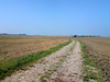
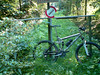
Today saw me for another half hour on the rollers. May seem like nothing but if you know where I'm coming from its quite an achievement. Another half an hour of concentrating and looking for signals coming from my lower back. No signals today which is fine. I think I will leave it alone for a couple of days now and concentrate on next week for perhaps a first ride outside.
Ride Stats : 11k in 30 mins
8147/82035
03-10-2008, 19:42 geschreven door Big Bad Wolf
|
|
|
|
|
| 02-10-2008 |
| Revalidation |

Another easy 30 minutes on the rollers today. Went to the kine this morning and he did some things with my neck I didn't believe possible. Even though I have the green light to ride outside I want to take it one step at a time and do some controlled riding before venturing out in the great wil yonder. The rollers gave me the opportunity to catch up on my reading again .I am currently reading 3 books at once; "Ik Ben God Niet" by Frank Vandenbroucke ; "Ik,Sven Nys" by Sven Nys and also "2001, a Space Odyssey" by Arthur C.Clarke. It is that last one that I am reading for the moment - for the 15th or so time - and when its finished I must re-read its culmination in 2010 - Odyssey Two. I just noticed that Arthur C. passed away earlier this year. He certainly was an icon if SF literature. Ride Stats : 11K in 30mins8136/82035
02-10-2008, 15:27 geschreven door Big Bad Wolf
|
|
|
|
|
| 30-09-2008 |
| Revalidation Begins |

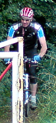
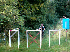
It has been exactly 14 days since I last rode a mountainbike. I experienced a disc slippage in my lower back - L5-S1 to be exact - and have been forced to wait for the pain to reside and - with the help of a kinesist - for the disc, and more importantly the surrounding structures to re-settle where they should be settled. To compound things a bit more, I contracted a cold that has kept me from getting on the rollers a few days more. Yesterday it felt like the kinesist pulled my spine out of my body by the coccyx. Damn, it hurt but it did good also because there was an enormous pressure in the coccyx area that was relieved by that manupilation. I was a bit curious as to how I would feel this morning but I felt surprisingly almost no pain. Just the usual dull tiredness that occurs after cranial-sacral manipulation. So I got on my rollers for a 30-minute try-out. See how it felt. And it felt fine, obviously my supercompensation has long dwindled away - not helped by the cold - but the legs felt good and my back didn't protest. I was glad to get my mind on cycling for even this short while. The organisation of the Belgian and Dutch championships has taken a lot more out of me - especially emotionally - than I took for granted. It was fun and felt great to be able help out with the organisation of such an event. Even though the resources were limited and the time was short I think that in general we can be very pleased with how things went. Obviously there are some issues that need further evaluation but those issues are not linked directly to the organiser. Instead , the Belgian Cycling federation should seriously consider updating their marathon reglementation. More specifically the part where stayering is forbidden for female participants. That rule is a bit sexist to say the least. There is no mention it is forbidden for juniors, masters or even elites MALE riders to crawl into the wheel of another participant, only the women are targetted by this rule. I know for a fact that a lot of male participants are unable to follow some of the women participants so why this rule? I have been reading the UCI MTB rules and have not been able to find anything remotely like rule 5.3 in the Belgian marathon rulings.
Ride Stats : 11K in 30mins
8126/82035
30-09-2008, 00:00 geschreven door Big Bad Wolf
|
|
|
|
|
| 16-09-2008 |
| Theux - Signal de Botrange - Theux - light version |
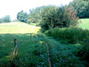
I was not sure if I should go today or wait another day but when I saw the sun out I decided to ride to Theux anyway and do the longest uphill followed by the longest downhill. My cat looked a bit sad as if he wanted me to stay home. I would think about him a few hours later.. please read on.When I arrived at the chateau de Franchimont overlooking Theux the sun was hiding behind clouds and with 15 degrees C it wasnt exactly very warm. I know from experience that the temperatures up on the Fagnes would be 4-5 degrees less so I dressed warm. The first couple of kilometers went very well - only the usual trouble with my Polar when passing alongside the railroad track in downtown Theux. I started off by following the Blue route down from the chateau along a very nice downhill. Afterwards at the foot of the majestic Bois de Staneu I changed over to one of the Spa marked routes following the little Clémentine river up towards the Crois Brognard. After crossing the busy road I dropped down the slope to arrive at the start of a very nice and sometimes very steep singletrack leading me up towards Tiege. There I followed a bit of tarmac until I crossed the E42 and another nice track brought me towards the N640. Here I dropped down a steep trail towards the Petit Normand area where you can cross the river Hoegne, either riding though it or riding over a small wooden bridge. Unfortunately I decided to take the bridge. As I was lifting my front wheel to engage the steps leading up towards the bridge I felt something twitch in my lower back. A little muscle spasm. Damn. I could continue riding but I know from past experiences that these little spasms lead to a couple of days of stiffness and generally a lot of pain.I decided to continue since the trail leading upwards from the Petit Normand is not too difficult and I was on a full suspension bike anyway. I also decided that it would be impossible to ride down from Signal de Botrange afterwards using my usual route - following the river Hoegne offroad towards Polleur. This route is quite challenging and demands a lot from bike and biker.
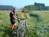
I could feel some pain in my lower back but as long as I was on reasonably large gravel roads I would be fine. The long climb on tarmac and gravel towards the Vecquee went easy enough but the rocky descent down towards the river Hoegne bridge near Hockay already made me realize I should avoid bumpy roads as much as possible.Another steepish climb brought me to another bridge over the river Hoegne where I paused for a photograph. When I got off my bike I could feel the pain getting worse. So I made the picture very fast and continued on my way up towards 700 metres, now over large gravel roads. At the Signal I went to the point of view overlooking Germany and had something to eat. There was a cold wind blowing from the Northeast so I didn't stay longer than necessary. I took out my maps to have a look at my downhill options. From earlier rides I remembered that I could take a fairly easy road from le Petit Normand towards Theux if I followed the N640 towards Sart and Tiege. Then after Tiege I could cross under the E42 , take left and cross over the E42 again to arrive into the Bois de Staneu. There is a narrow tarmac road riding over the crest of the Bois de Staneu hill all the way to Theux. This would all more or less be downhill. The only real climb I would have to do is the one towards the Chateau de Franchimont again, but here I could also choose the tarmac option. And so it was done. I was glad I made it, with the lower back you never know how bad it can get. I felt sad for not being able to complete this ride like it should be - I have been doing this ride for many years now, refining an old O2 Bikers description of it and adding a lot of offroad to the uphill sections - but thnigs being what they were I believe I made the right choice .
The next few days, perhaps even weeks, will see me doing a lot of tension exercises and warmth treatment of my lower back muscles , some easy riding on the rollers and resting to give my back the time to get back in shape. Ride Stats : 63.5K and 985/975 (Polar/Garmin) in 3h30minsGPS Track Analysis on Motionbased : CLICK8115/82035
16-09-2008, 22:35 geschreven door Big Bad Wolf
|
|
|
|
|
| 14-09-2008 |
| Relax 2 |

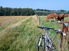
Pretty cold this morning, but the sun was out so I decided to ride out, albeit very well covered in wind-tight apparel. Another easy ride on the road that took me towards Archennes and Dion-Valmont. On a climb in Morsaint I noticed 3 bikers who looked like they were doing the Belgian Marathon Championship track. I was pretty certain they were when they returned after having missed a turn into the fields . They looked pretty muddy but at that point they were nearly 50K in the ride so with the rain we had the last few days one thing surely explains another. The wind was blowing fiercely in my face when I looped over Chaumont Gistoux and Dongelberg towards Jodoigne. I noticed that one of the churches also has a tor roof so I took a little picture of that before venturing on towards Hoegaarden and Meldert on my way back home. Once past the Ravel in Hoegaarden I had the wind in my back which felt great. Ride Stats : 80k and 640/697 heightmeters (Polar/Garmin) in 3h30mins8012/80690 Ride Stats : 80k and 640/697 heightmeters (Polar/Garmin) in 3h30mins8012/80690
14-09-2008, 16:49 geschreven door Big Bad Wolf
|
|
|
|
|
| 12-09-2008 |
| Belgian and Dutch MTB Marathon Championships - update |

Just a little update to tell you that I have edited the GPS track on a few points and also added a list of road crossings which should make life easier for people following the race to see their friends and provide them with upport and assistance. You can download the 7-ZIP file by CLICKING HERE.For those not familiar with Rapidshare - just click on FREE USER, wait a few seconds for the countdown to finish , then fill in the code that appears in the box and click on the download button. The download should start after that. To unzip the file I believe you can use WINRAR or else get the 7-ZIP program HERE.
12-09-2008, 16:42 geschreven door Big Bad Wolf
|
|
|
|
|
| 11-09-2008 |
| Theux Red and then some more |
Today I rode to Banneux to ride the Red Adeps route of Theux. I always start in Banneux because that way the most difficult parts of the ride are at the start - the Forges de Thiry descent and the climb out of Theux towards Sassore. My plan was to also include a trip into the valley of the Ambleve - Ninglinspo, Chaudiere and Vieux Chera - and do some extra heightmeters there.
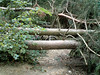
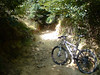
I arrived in Banneux around 10.30am. I had to look a bit to find the parking spot I prefer - it is more than a year ago since I last was here and things fade easily. When I left the parking lot I came on the N62 and from there I could easily get on the Red trail. I didn't feel very fit in the beginning of the ride and the Merlin took some getting used to. I suspect I put a little bit too much air in the tyres. The descent into the Forges de Thiry was as I remembered it. Steep with some nice switchbacks and sadly still blocked at a couple of places by fallen trees. I mean, its more than a year ! Can't someone do something about this? Getting around them meant sliding down the steep slope - man and bike. But I arrived safely at the Hoegne borders and before long I was climbing up to the Maison-Bois. I had been here recently on the Verviers marathon WC track recon and it was a lot dryer now. Which suited me fine. The sun was out and it was hot, with a warm wind blowing from the south and thunderstorms forecast later in the day. I was secretly hoping for cloud cover because I forgot to bring some sun cream. The Theux trails are very typical, lots of loose stones, embedded rocks and a lot of thorn bushes next to the trails when they go though the fields. I would have to walk with my bike in my hand on a few occasions because they had been pruning the thorn bushes and left all the fallen branches on the trail. I have NoTubes but still that doesn't mean that I can ride though anything. I found the trail to be better arrowed at some places, but still lacking at others. You still need a map because at some crucial points arrows are missing. The trail going out of Au Fays up to Laboru was wet with big puddles filled with yellow water - I suspect they never dry up - and the track following the E42 demanded a lot of concentration because of deep gullies. In all the times I've ridden the Red this was the first time I came here. I always seemed to have missed this section. But now the arrowing is fine here. A bit later I was dropping down the Tier de Polleur into this nice little town with its twisted church. I had a little bit to eat here before attacking the climbs into the Bois de Staneu.
In this forest I was also treated to a section I've never done before. After the split with the Blue route my map shows the trail dropping towards the road from Theux to Polleur. But just before reaching this busy road I noticed an arrow pointing back up the hill. Yeah, another climb and a steep one - a VERY steep one. The trail then stays on the plateau for a while before dropping down again, and going up again. This time over a track with lots of loose rubble and also over pure bedrock. I was so glad it was reasonably dry and I had a full suspension bike. I made the steep climb and the following downhill was a real bonecrusher. Wow. A nice extra section. Riding though Devant Staneu as usual and then I was preparing for the long climb towards La Reid. Dropping down on tarmac towards Sur Le Thier a funny thing happened. Braking hard on the steep slope I felt my tyre go flat.. just like that. Indeed, the unthinkable had happened. My front tyre - NoTubes and all - had flattened. Hmm, perhaps the heavy braking forced a thorn out of the tyre, I heard the hissing of the air escaping and the fluid could not close the hole. So I had to put in an inner tyre - after peering out 3 other thorns - which went surprisingly easy. I had expected a sticky mess with the NoTubes fluid but it was all but dried up. I think its overdue to be changed. Anyways, after 10 minutes - and a chat with a passing biker who was on the Blue route - I could continue. Towards Banoyard and Vert Buisson I managed to stray from the trail - I'm sure there is a Red arrow pointing to the right which is WRONG.. but thanks to the GPS and the map I could quickly connect back to the trail.
The sun was hiding behind some clouds now and I was thinking about giving the Ninglinspo a miss. But no, this was dreamland and I was here so I had to go . Down following the Ruisseau des Blanches Pierres and the blitzing fast and steep stony track after passing the Point de Vue Drouet. The bike felt good by now - there was a bit less pressure in my front tyre - and I blazed down - but always keeping the speed under control. I managed to squeeze one Pepsi Cola out of the machine at Sedoz and felt a couple of drops of rain while I was eating my second powerbar and sipping my Pepsi. I wanted another drink but the machine wouldn't take my 2 coins. On the Nonceveux ride I had discovered a steep uphill along the Vieux Chera and I decided to take that again and see where it would take me. As it turned out it took me from 164 to 340 metres before I foudn a way back down towards the Ninglinspo valley. Great, at the point where the Chaudiere drops into the Ninglinspo I could commence the long uphill back to the Porallee at 410 metres. Great , I did nearly 13K in this area and it yielded me 530 heightmeters.. and that distance includes the downhills. Thats a Hill Factor of 40. So all who want to do some climbing - you know where to go. And the downhills are mean as well.
After this intermezzo my legs felt a bit fried and I still had some way to go towards Banneux. Especially the long uphill towards Menobu was hurting. I could see the heightmeters accumulating on my GPS but I knew the trail would mellow out a bit on the uphills. Not on the downhills though, and on one I had to go heavily in the brakes because 4 or 5 big trees where blocking a very steep section. Took a bit of mountaineering to get me past this barrier but after that I was nearly home. With more than 1700 heightmeters accumulated today I had a great but tough ride. And remember, I wasn't feeling my best so I was glad I did make all the climbs and survived the downhills as well. When I arrived at Banneux again even the sun came peeping back though the clouds.
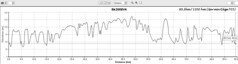
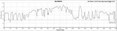
Ride Stats : 72K and 1715/1733 heightmeters (Polar/Garmin) in 4h50mins
Hill Factor : 23.9
Ride Profile : 
7905/79865
11-09-2008, 22:59 geschreven door Big Bad Wolf
|
|
|
|
|
| 09-09-2008 |
| Meerdael and Overijse BLOSO routes combined |

Today I wanted to do a long offroad ride, taking advantage of the fine weather. So I decided to combine the Meerdael and Overijse -Two Valleys- BLOSO routes. That would yield me 54 and 34 K + the interconnection between the two which is about 4K one-way. The trails were marvelously dry and fast and I set out on a pace aiming for an average on 20kph. Some parts of the Overijse trails had been paved with heavy gravel, making it more difficult for bikers and even downright dangerous in one of the downhills. Also, on the Meerdael BLOSO, the descent into Sint Joris Weert has been evened out. Instead of a moderately tricky descent it is now an easy one. You only need to take care because the soil has not stabilized yet so your wheels can wander off in the loose earth. I'm sure give or take a couple of months it will settle but I fear that with the first heavy rain a lot of that loose soil will end up in downtown Sint Joris Weert. Unless they plan to fill it up with gravel as well, making it even more dangerous for bikers than it was before. Even though I never had the impression I needed to go deep - an average heartrate of 129bpm can attest to that - I still managed to get an average speed of more than 21kph in the end. So I am really pleased with my ride. Obviously the bike helped too even though my jockey wheels were screaming like skinned cats in the end. Ok, I need to apply some WD40 that will silence them for a while. The documents for the 2008 Belgian and Dutch MTB Marathon Championships are ready as well and I have combined them together with the latest map and gps track in a 7-Zip file you can download by clicking HERE. Ride Stats : 95K and 960/1044 heightmeters (Polar/Garmin) in 4h29mins7833/78150
09-09-2008, 16:24 geschreven door Big Bad Wolf
|
|
|
|
|
| 08-09-2008 |
| To Dion or Not To Dion |
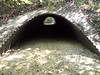
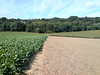
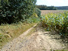
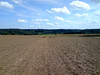
Taking it easy today I decided to go and check the area where we come into Dion from the Bois des Gottes. We need to put in an extra loop in order to make the track of the Belgian and Dutch MTB Marathon Championships an even 90K long. I had a couple of ideas and when I arrived in Dion I checked them all out. Unfortunately one led under the N25 through a tunnel and there was no option to go back to the other side of the N25 without making a big loop towards Gastuche, where another tunnel is to be found. The other existed of following a very narrow track up towards the N25 - nothing more than a footpath between two fields - called the "Sentier du Champ des Cailloux" - following a track parallel to the N25 and then coming back down leading straight through a field. Well, there is supposed to be a road there but the farmer just ploughs it under every year. An option I didn't explore but which was brought to my attention is to go up towards the tunnel, but instead of going through it take a singletrack to the right just in front of the tunnel . I saw the track but it seemed blocked. But it seems to be ride-able so I have incorporated that option into the latest version of the GPS track and also on the latest version of the map (Version 5)
It was also brought
to my attention that the start will be at the centre of Pecrot - rue Constant Wauters to be exact - rather
than right before the train station of Florival. This also makes the track 1
km shorter. You win some, you lose some I guess.
The total distance according to my GPS program is 89.4K but in reality I think it will be closer to 92K. The heightmeters are still around the 1200 metre mark, with the extra climb bringing around 47 extra heightmeters.
After exploring that region I rode over to Pietrebais to have a go at that region and check for possible places for feed zones. The wind was blowing noticeably today but I rode on a very relaxed pace.
Track Profile V5:
Track Map V5:

GPS TRACK V5 DOWNLOAD : CLICKRide Stats : 65K and 610/649 heightmeters (Polar/Garmin) in 3h09mins7738/77190
08-09-2008, 19:23 geschreven door Big Bad Wolf
|
|
|
|
|
| 04-09-2008 |
| Dreamland revisited in Nonceveux |
It
was about time I visited the Ardennes again and today I felt like I won
the lottery. I rode to Nonceveux , not far from Remouchamps in the
Ambleve valley to ride the O2 Bikers roadbook . From the figures it
looked like one of their toughest roadbooks ever, both physical (5/5 stars) and
technical (4/5 stars) as well as offering almost 1100 heightmeters on a 36K
distance. What more does a real biker need?
It starts easy from the
little church of Nonceveux, over the river Ambleve and then taking the busy N633 for a couple of 100
metres and then the first offroad climb takes me through a few hairpins up towards the Tilleul des
Pendus. The climb is steep and the legs have to get in gear. But I feel
fine and the Merlin is in top shape too. I am following the track on my
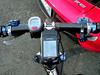
Garmin Edge 705 and I would experience no major problems with that throughout
the whole ride. I saved the track in Course format (.crs file) which
proves to be THE format the Edge 705 really likes. Only in some of the
deep valleys did it hesitate a few moments because satellite reception was not
optimal.
That being said, lets continue the ride. A
rocky path takes me down towards the N697 which I follow briefly before
climbing on a tarmac road towards Pierzay. At the top I turn left into
a freshly mown path - brambles and other thorny branches lie scattered
over the trail. I am on NoTubes but still I felt like having a flat
every moment. But nothing happens, and the trail gets gnarly as it
changes into a rocky underground and the downhill gets steeper - better keep concentrated. A few switchbacks
and I am at what looks to be an old quarry. The soil is red and there
are some puddles here. I follow the little Gergova river upstream
before crossing the N697 again. I follow this busy road for a short while before
an impossible climb takes me right up a plateau and on to what looks like a Fagnes track. Before long I turn right and head back towards the Tilleul des
Pendus. Wow, 10K far and already almost an hour of biking.
A
broader track drops me down towards Sedoz where a very steep climb
takes me up to meet with one of the many small rivers that drop down
from the plateau towards the Ambleve valley. My pace is little more
than crawling and it is very dark and damp under the dense tree cover.
My GPS loses signal for a few seconds from time to time but I have no
trouble following the set track. I cross the little river and cross
over towards the Chaudiere valley. This little ruisseau I follow - the little
rivulet in a deep valley left of me - down to where it crashes into the
Ninglinspo. I have a little bite to eat at this point, enjoying the
elfin quality of the little babbling brooks. The climb that follows now
- following the Ninglinspo river upstream - is very well known to me. I
relax in a comfortable pace and start the 200m vertical ascent. Along
the way I cross the little Ninglinspo river several times before making my way
away from it towards Blanches Pierres. A fast downhill brings me close
to the Tour Drouet and I decide to have a look at this magnificent
viewpoint. This means I have to climb back up again around 50
heightmeters to take the rocky road into the Hé des Graviers. Steep
sections strewn with rocks take me towards the 370m mark. I have to
follow another fagnes road, with wet patches and a lot of roots. The
Merlin laughs at these conditions, its suspension working like a charm
. In the Bois Bablette a fast downhill takes me to the bords of the
Chefna river.
This
might easily be one of the most beautiful spots on this ride. The climb
with the little river babbling on my right is tough, steep and rocky.
Luckily it is reasonably dry. I have been here before but the beauty of
the terrain still gets me. At the top I take almost an 180 degree turn
to follow the river on its other side down again. This descent is a
difficult one. Wet patches, rocks, roots and gullies force me to be very attentive
and I enjoy the Merlin again whilst I lead it over the rubble
downwards. Two big deer cross my path and scatter themselves with unseen grace down the steep slope towards the Chefna. I stop and watch them in amazement. After a while the track gets broader and I storm down
into the Ambleve valley.
Crossing the Ambleve only one more climb
awaits me. The first bit is amazing. Pure bedrock and steep steep steep , there are
no words for it. I admit I had to walk a few bits. When the dense forest
opens up I have an amazing view over the valley and I see the lush green forests
on the other side of the Ambleve, where I was less than half an hour
ago. At Rondai Fontaine I am sent into what seems to be an off-limits
road, there is a sign stating that no entry is permitted. But what can
I do but follow my GPS track, right? The track drops down slowly at
first, approaching the E25. But then it gets serious - and wet with the
first real mud I saw today - and I have to hit the brakes hard from
time to time to keep the speed on the safe side of sorry. Just before
dropping into Nonceveux it gets downright dangerous when the track
turns into some kind of rocky garden.
Wow,
what a great ride this was. 36K and indeed a whopping 1100 positive
heightmeters - my GPS and Polar agreed on the number for once - and at
times the track was indeed very challenging and technical. The climbs
were of the steep kind and you need a bike that provides traction over
rocks, loose stones, roots and bedrock. A great trail but not for the
meek.
Ride Stats : 36K and 1100 heightmeters in 3h3minsHill Factor : 30.5Ride Profile : CLICKMaps (GPS and NGI) :
 
7584/75540
04-09-2008, 00:00 geschreven door Big Bad Wolf
|
|
|
|
|
| 03-09-2008 |
| Mastering the 705 |
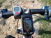
Today my original plan was to go to Nonceveux and ride the O2 route there, but when I noticed on meteox.be that it was raining I decided to stay home and try out some stuff with my Garmin Edge 705 GPS. I had made a Course file of the 2008 Belgian MTB Marathon Championship trail and decided to ride a chunk of that. First I put the .crs file on my GPS's SD card but that proved to be the wrong option. Turns out the GPS only selects Courses that are saved in its internal memory. So from the start in Pecrot, I biked back home, moved the .crs file from the SD card to the Garmins' memory and headed back to the start.
Obviously I was getting a good workout in the meantime because the area between Meerdael and Pecrot is not exactly flat. In Pécrot I selected the 'Do Course' option on the Edge, and hey presto, I got the trail on my screen and I could start. One thing I noted was that as soon as you press the 'Do Course' option, the Edge resets all counters to zero. That is not a problem because the history files can be downloaded afterwards on your PC (or is that uploaded ?) and all is there. But its nice to know and it isn't in the manual.. just one of those things.If you remember my entry a few days ago I was complaining about the 705 powering off during the navigation along a .gpx file. Obviously it is made to follow Courses, because today it didn't power off, and I had all the history without losing as much as a metre along the way.
My theory is that navigating along a gpx track demands too much of the units' processor, causing it to bunk and bail out by powering off... When you follow a course it doesn't have to do any navigating, just indicating where you are on the map and keep tabs of your speed, heightmeters and other parameters. You don't get any warning before an upcoming turn, but you do get an audio and visual warning when you venture off of the Course. And when you get back on it you get a beep and a message as well. Great, looks like Courses are the way to go. Now lets ride !
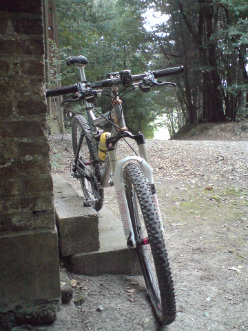
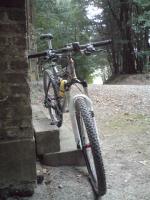
So I did the first 20K of the Championship trail today. The first kilometers after that start next to the railway station in Pecrot, are on tarmac , with a long and steady climb ending in a turn to the left into what could be called a double singletrack. From there on , the track twists and turns and eventually has a very dangerous downhill dropping you into Nethen. This downhill consists of a series of washed-out gullies, with big stones and other debris making it very hard to keep the rubber side down. In Nethen, you then take some cobble and tarmac before arriving at a very steep climb , very narrow and I don't think anyone will be able to ride this. Check the picture. After that, a little singletrack takes you around the plateau before dropping you back down along a narrow track. Then there is the famous 'jungle' hollow road, which I didn't do because it is unrideable. Instead I took a little detour which I believe the organisers should take too. It consists of another hollow road going up parallel to the jungle track but with better traction and above all, no deep gullies. Then the trail moves towards Bossut before turning to the left towards the Varadero manege. Here I hit the 'End Course' button. With 20K on my lap counter I decided to call it a day. I will do the rest of the trail in the coming days. I took a turn towards the Meerdael Forest where I had a bit of fun on my secret Meerdael trails before arriving home. GPS track (in gpx format) of the first 20K : CLICKTrail map of the first 20K:
 Ride Stats : 61.5K and 725 heightmeters in 3h11mins7547/74440 Ride Stats : 61.5K and 725 heightmeters in 3h11mins7547/74440
03-09-2008, 19:23 geschreven door Big Bad Wolf
|
|
|
|
|
| 01-09-2008 |
| Connecting the dots |
Or trying to. Thats what I wanted to do today. I head out for the region south of the Bois de Bercuit to do some recon of the possibilities to pass there with the track for the Belgian (and Dutch) Championships Mountainbike Marathon . Saturday I had less time to explore all possibilities but today I checked every little trail. And the result was disappointing. I made little map of the area where you can see which areas are private and which tracks are passable, but with a price to pay.
One track is only for walkers, and includes a heavy iron gate.. So having a race pass there.. I don't think so. The other one is the track going down from east to west next to and then in to the forest. I take this one when I do the Accro Bike. It only has one disadvantage ; there is a bit of mud at its lowest part. Today it was almost ride-able but I still had to walk a few metres. Well, thats the input I also gave to the track responsables in our club, lets see what they come up with
The Merlin proved once again to be a great bike, even for terrain like this it brings extra comfort and also some extra speed in the climbs and downhills. Although I took it easy today, legs still a bit grilled from last weekends' rides.
Ride Stats : 50K and 550/568 heightmeters (Polar/Garmin) in 2h33mins
7486/73715
01-09-2008, 19:59 geschreven door Big Bad Wolf
|
|
|
|
|
| 31-08-2008 |
| Ronde van Leuven |
I felt tired from yesterdays' offroad debauchery so I decided to do some onroad riding instead. The Ronde van Leuven is an event I like to ride although it seems to be getting smaller in K's every year. This year their was a big lap of 58K on offer, with control points in Blanden - where I started - Bierbeek, Lovenjoel, Linden, Kortrijk-Dutsel and Winksele. Even though I was biking very relaxed I passed a lot of people while nobody passed me. Some tried to follow my pace but had to let go. Still, this is a family event and I can only applaud people getting on their bike for a change. That way they can also appreciate what it is like to be a biker instead of an automobilist. I just read an article today with a plausible explanation why automobilists don't seem to notice bikers. They form no threat to them. Car drivers are focussed on all things that can cause them harm, like other cars, trees and the like. But bikers can not harm cars, so they go unnoticed because of that. Hmm, there might be some truth in that.I met two female bikers I recognized from the mountainbike races. They were both wearing 2 Mega Saeco jerseys and I recognized Ilke de Jongh immediately. I think the other girl was Kim Saenen but I'm not sure. I chatted a bit with them about why they weren't racing today and stuff. Seems that they had a race yesterday at Sint Katelijne Wavre and another one tomorrow. So today was their day off. And it was a nice day for an easy ride, sun was out and there was just enough wind to keep things from getting too hot. When I arrived at the Blanden starting place, I got a reflective band for my efforts and an apple for my thirst. Had a good ride and really enjoyed the flowing landscapes around Leuven.Ride Stats : 61.5K and 370/389 heightmeters (Polar/Garmin) in 2h30mins7436/73165
31-08-2008, 00:00 geschreven door Big Bad Wolf
|
|
|
|
|
| 30-08-2008 |
| Recon track 2008 Belgian and Dutch MTB Marathon Championships |
Last wednesday I got the preliminary map of the 2008 Belgian and Dutch Mountainbike Marathon Championships that is organised by my club, the Velo Club Blancs Gilets, from Laurent Saublens with the demand to go and ride it and check out all the passages and produce a height profile if possible. So I prepared a GPS track with Garmin Mapsource and downloaded that on my Edge 705. Following the track proved to be very easy. Unfortunately I must have made a mistake because it didn't get any records of todays ride so I can't check the amount of heightmeters on the Garmin or produce a GPS track Luckily I always take my trusty Polar S710 along so I did get the rides' profile.
With nearly a 100K - I did make a few extra loops when the GPS wasn't sure of the direction or when I had to go around closed tracks or private sections - and 1200 heightmeters this will be a tough cookie to chew on. Race distance will be closer to 95K but the amount of heightmeters is correct.
My friend Roger had agreed to accompany me until noon, when he needed to be somewhere else. We met at the races' start near the little train station in Pécrot. This was the first time I was going to follow a pre-made track on my GPS so I was kinda curious. I am pretty disappointed with the manual Garmin provides. There is only the mention that you can navigate pre-recorded tracks but no mention of the different screens, etc.. Its all very instinctive as I was going to find out but still. I also believe that when navigating along a pre-recorded route, the Edge 705 is at the edge of its capabilities. During the navigation the unit powered itself off 4 times. I had to restart it and could continue where I left off but when I got home I found out that only the part getting to the start, and the part from the end of the track towards home, was logged correctly. The part where the unit had to navigate AND record at the same time showed some lapses and I couldn't upload it to my PC to check it on the map. Only the amount of kilometres was correct, I 'lost' almost 2 hours of recording. Strange. But anyways..what is this trail like?
When I looked at the map I saw a track that was criss-crossing all over the Grez-Doiceau community. Starting in Pécrot and making its way towards Nethen, and then towards Bossut and Gottechain.Then it passes near de Bois de Linsmeau and into Pietrebais. The wet grass made our bikes glisten and acted as a magnet for dirt and debris. Some of the downhills proved to be very tricky and technical, with big holes, lots of stones and other debris. Of course the famous jungle hollow road is also in the track. We had to walk because the washed out gullies were too deep to ride.
The trails were dry and Roger and I had taken our full suspension bikes because the added comfort proved to be very welcome. Anyone who ever rode the Accro Bike race knows what racing in this part of Brabant Walloon means. Short climbs, fast descents , twisting and turning singletrails and some passages through the fields where the weaker riders can relax a bit and the stronger riders can make the difference. Don't be fooled by the relatively low amount of heightmeters. The continuous succesion of short climbs at high speed will take their toll. The averages will be around 25, perhaps even more when it stays dry on the days before the race - September the 28th.
After the passage around Cocrou Roger decided to return to the start and I had to continue on my own. The trail then departs towards the eastern edges of Grez Doiceau, namely Roux-Miroir and Longueville. Long field passages but also some nasty passages through singletrack . At the Longueville chapel, exactly 45K into the ride, I had a little snack. The sun was getting hot and I was glad I applied sunscreen before riding out this morning. The track now meanders towards the Bois de Glabais with a tricky downhill in loose sand and with deep gullies. Again people riding the Accro Bike and some of the organised rides around this area will know these trails and have a certain advantage. The trail then goes towards lower Heze and finally arrives in Grez-Doiceau before heading to the southwest again for a loop towards Bonlez and Dion Valmont. Here I had to improvise because the trail that was marked on the map seemed to be gone. At one point I stood before a private section and at another point I was riding straight through a cornfield (well, walking actually - corn is though). The map shows a trail here, but the map seems to be wrong - or outdated. Surely the trail will have to be rerouted here. I was starting to feel a bit tired here and again I was thankful to be on the Merlin full suspension bike. Back in Grez-Doiceau I stopped to buy something cool to drink before tackling the last 20K.
The track now goes back towards Gottechain and ultimately over Bossut and La Malaise where a succesion of tough uphills will wring the last ounces of force out of the riders' legs. The last downhill is another killer - dangerous when you are tired. I think spreading ones' forces over the entire ride will prove to be the secret to success here. Riders who do well on short powerful climbs and also have the ability to go fast on tricky downhill will excel here. In short, the type of rider that can go fast, has lightning reactions and has sufficient power to do so for 95K . Some nice singletrack brings me back into Pécrot where I cross the finish line. The Edge has guided me well . I hit the lap button again and return home passing at the well near La Hetraie to have an extra refreshing sip of its water.
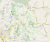
Rides' Profile (Polar S710) : CLICKThe Map: 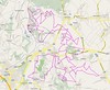 Ride Stats : 122.5km and 1400 heightmeters in 6h50mins7375/72795 Ride Stats : 122.5km and 1400 heightmeters in 6h50mins7375/72795
30-08-2008, 00:00 geschreven door Big Bad Wolf
|
|
|
|
|
| 28-08-2008 |
| Meerdaal 2000 |
With the approach of autumn the Meerdaal 2000 organised ride is coming closer. Another organisation I like to help out. Today with the KBC MTB club we were guided by one of their ranks around the base loop. Some 25K in length. Near the end of the ride I was asked to include some twisting singletrack until it got too dark in the forest to safely bike. I think I supplied some nice trails. Yesterday I had a meeting with my club, the Velo Club Blancs Gilets , about the fusion which is about to take place with the Royal Velo Club d'Ottignies. Two big clubs - one more focused on mountainbiking, and one who has a 'royal' status and has a lot of road racers in their ranks. Budgets will be higher and also facilities will be enlarged. More can be read here.On another note, the Belgian and Dutch MTB Marathon Championships will be organised by our club on September the 28th. I received the - unofficial - parcours map so I can go and check it out and make a GPS profile. The map will appear on the Clubs' website shortly . It can change but as it stands the race spans between 92 and 93K. More info when I will have had a chance to actually ride it. All info about the upcoming race can be found HERE.Ride Stats : 40K and 360/415 heightmeters (Polar/Garmin) in 2h10mins7252/71395
28-08-2008, 00:00 geschreven door Big Bad Wolf
|
|
|
|
|
|
|
| Gastenboek./.Guestbook |
Druk op onderstaande knop om een berichtje achter te laten in mijn Gastenboek. /
Press the button below to write in my Guestbook.
|
| Email Me |
Press the button to send me a mail
|
|
|
|