|
|
|
| Tales from the Woods |
|
|
| 12-09-2010 |
 Lyme Lyme |
|
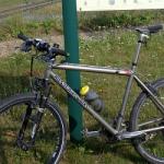
A little update for those who are wondering why I am not biking anymore.
Last sunday I noticed a little red rash on my right calf. I didn't make much of it since I had several bites from mosquitos, and also some rashes from nettles and other bushes.
The next day the red spot was a little bigger but on wednesday it had grown considerably and to my surprise I noticed the typical bulls-eye (erythema migrans) pattern associated with Lyme's Disease . I went to the doctor that same day and she put me on strong antibiotics. I have been taking them for 5 days now and the rash seems to be subsiding.
That being said, I do remember pulling a tick out of my calf after my forest ride on the 24th of August. My blood has been examined and there was no sign of migrating Lyme. So if the antibiotics do their job it may be that we can stop the disease from entering the next phase.
Obviously, these last couple of days, the antibiotics have been hitting me like a hammer and my mind has been far from riding my bike. I have to take the antibiotics till friday so this week won't see me riding either.
12-09-2010, 17:48 geschreven door Big Bad Wolf
|
|
|
|
|
| 07-09-2010 |
| Easy |
|
Yesterday my muscles were very sore from the 8K walk so I decided to rest a day and do an easy ride today. My legs felt better and I actually felt good riding at a leisurely pace on tarmac. I got 3 new inner tyres but when I got home I noticed I had taken the wrong valves, a fat one instead of a thin one. This means I can not use them on all of my wheels .So tomorrow I will try to have them swapped at the store.
Ride Stats : 30.5K and 180/205 heightmeters (Polar/Garmin) in 1h23mins
6842/72695
07-09-2010, 18:18 geschreven door Big Bad Wolf
|
|
|
|
|
| 03-09-2010 |
| O2 Bikers Roadbook Ben-Ahin |
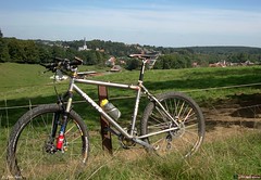
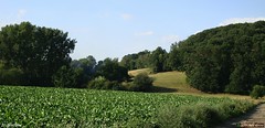
Time to get Mr.Merlin out and do some serious biking in the Ardennes. Or, in this case, the gates to the Ardennes, Ben-Ahin which is a suburb of Huy, near the river Meuse. The O2 Bikers roadbook of Ben-Ahin is already an old one, dating from their number 70 issue from June 2001. It is however, a roadbook that received a lot of credit as being tough, both uphill and especially downhill, with the drop from the Tour Joseph back to the town of Huy as being the epitome of downhill tracks in the region. So today, at last, I rode my MPS towards Huy and parked at the parking lot opposite the Hotel du Fort.
  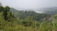 
The mist that hung over the country was slowly getting dissipated by the sun so things looked good weather-wise. The roadbook promised nearly 900 heightmeters over close to 34K. More was not needed to draw me out and give it a try.
From the start a section of tarmac brings me along the borders of the river Meuse towards the roundabout where a tarmac climb starts. I pass the Chateau of Ben-Ahin - I think thats what the sign said - and then I am riding offroad and getting used to my first couple of kilometers on the Merlin again. The route climbs gently out of the valley and on top of a long climb I am presented with a magnificent view of the river deep below, with some shrouds of mist still hanging over the faraway hills. The trail drops down again and some sharp rocks remind me that I am in the Ardennes and care has to be taken. Below I follow a river upstream until where a multitude of tracks come together on my Garmin screen. I know this is the spot where the trail comes 2 times but I am not sure which direction I should take first. I fumble with the screen and see there is a loop lying ahead of me. I decide to go for that and it takes me onto small singletracks vlimbing more or less all the time. Sometimes a fallen tree blocks the track and getting over it isn't always easy. At one point I make a wrong turn but I can see on my GPS that I will connect to the track again a little bit further. I arrive at Solieres and after some tarmac I drop down on a rooty singletrack into the forest again. Getting my feet wet riding through a little river and then a long steep climb though a hollow road. Steep but just manageable. After a while a tricky downhill brings me into Ben-Ahin where I am taken on a second loop.
This loop starts with a very beautiful but very steep and dangerous downhill. Think in the region of 25% grade, even more. Near the end I am literally sitting on my rear tyre to keep the weight back while I control the speed of the bike. Luckily there are some ground patches between the rocks where I can apply the brakes without risking a washout. I arrive on a tarmac road I follow briefly before entering the forest again. Another climb takes me to a next patch of tarmac and another trails brings me ultimately into Boussale. From there I move towards Andenne, where - at the Col de la Flismes - the track at last veers to the right and brings me back to the river Meuse. Some very nice trails here in the forests.
I follow the river Meuse for a while and if I might give a tip to anyone wanting to ride this track, take advantage of this flat section to recuperate because the climb that will follow is a very nasty one. You follow the Meuse valley until you reach Ben, and there starts a climb that will have you dig deep into your strenght and technical prowess. In fact , you are following what looks to be a little dried-out river and it takes you up along the outskirts of a rocky outcrop. Later when I download the track to my PC I moticed peaks of 24% in this climb. It takes a while before it gets less steep and then brings me back into Ben-Ahin, where I have started this second loop a while ago. Seems like I did the first loop in the reverse direction so I decided to do it again, in the right direction this time. So back to Solieres and back down along the track with the many fallen trees. Back at the junction I am taken to another very steep climb.
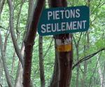
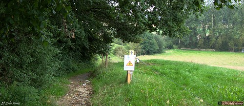
There is a sign with 'Pietons Seulement' - pedestrians only - and I'm betting that most will be indeed going on foor here. The climb is steep, and the trails is riddled with rocks making it very difficult to find traction and keeping the wheels spinning. At the top I follow a narrow track taking me through a field with two basculating gates. The trail then turns back into the forest for another drop down the slope. At the end I nearly have to make a 180 turn that brings me on a small singletrail following a river. The trail ascents and after a while it again becomes too steep to ride. So I walk another 100 meters before the slope lessens. The peak grade on this slope shows 38%. No mere mortal can ride that I'm sure. I arrive in Saint Leonard and have to climb some more on tarmac roads before reaching the Tour Joseph.
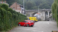
All that is left now is a 150 meter drop along some switchbacks down towards Huy. This is one difficult downhill. At first there are so many trails and tracks crisscrossing it is very difficult to choose the right one. They are steep and with hairpin turns. At times I just stop the bike and make the turn on foot. After a while some trees block the road. I climb over them and continue. I can see the town 50m below me when all of a sudden the track is blocked to the right. There is a small track leading left and it looks like my only option. At times I am very close to a big abyss to my right , I realize that there is no room for error here. Mind you, the trail is dry, I would not want to do this when the trail is wet. A steep drop brings me to the mouth of a railroad tunnel. I'm nearly there.
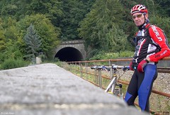 
Crossing the tunnel and I arrive at a bridge from where I see my car down below on the parking lot. Some steps take me down to the road and I am very happy to have survived this difficult ascent at the end of a very physical ride.
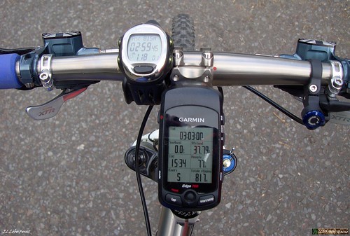
When I look at the numbers on my Polar and Garmin screen I realize that the 900 heightmeters announced were a bit optimistic. certainly so if you take into account I did one 4K loop 2 times,adding perhaps 70 heightmeters to the normal number. Afterwards on the PC the Garmin software gives me 870 heightmeters. And I can live with that. Especially since most of them were very hard-fought, steep height differences. I realized today that I need some more Ardennes rides to get into better form. I have the endurance but it has been a while since I had to tackle long steeps climbs and descents.
Ride Stats : 38,5K and 815/870 heightmeters (Polar/Garmin) in 3h00mins
Hill Factor : 22.5
O2 Bikers Roadbook Ben-Ahin at EveryTrail
Plan your trips with EveryTrail iPhone Travel Guides
6756/71510
03-09-2010, 00:00 geschreven door Big Bad Wolf
|
|
|
|
|
| 31-08-2010 |
| St Verone |
|
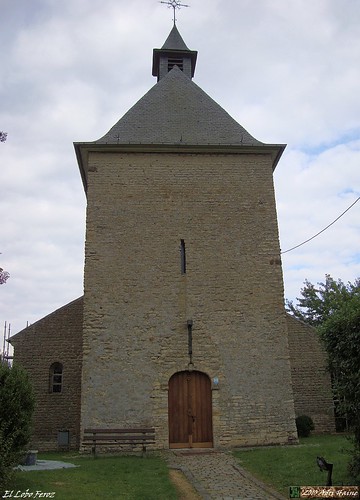
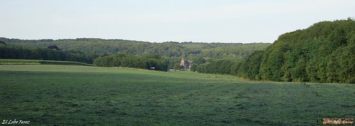
After a couple of really cold, wet and windy days the weather seems to take a turn for the better. Even though the temperature was only 16 degrees on average during my late afternoon ride, and it was really dark with clouds, it stayed dry . This enabled me to do an easy ride for a couple of hours. Roughly making an elliptical loop along Heverlee , Egenhoven and Bertem, I came along the Sint Verone Chapel. It is undergoing some cleaning but I still managed to get a picture, albeit it a bit sombre due to the weather conditions.
From Bertem I made my way back up the plateau and then set towards Leefdaal and the outskirts of Neerijse. Huldenberg and then Overijse were next. In Overijse I climbed towards Maleizen and then turned left towards Wavre . From Wavre I set towards Ottenburg and then down to Sint Agatha Rode and Sint Joris Weert. I closed the loop over the Zoete Waters and Vaalbeek. Nice little ride netting me nearly 60K and 2h30 of riding.
Ride Stats : 59K and 400/480 heightmeters (Polar/Garmin) in 2h29mins
6718/70640
31-08-2010, 20:18 geschreven door Big Bad Wolf
|
|
|
|
|
| 29-08-2010 |
| Ronde van Leuven |

Due to other obligations I could only start around noon for the Ronde van Leuven. The skies were looking threatening but after checking meteox.be I decided it would not rain anytime soon and started for this loop around Leuven. Starting in Blanden meant first riding towards Bierbeek, then Lovenjoel. Followed by Linden and Kortrijk Dutsel. There was a very strong wind, blowing cold from the northwest. This hampered me between Kortrijk Dutsel and Winksele. There was not a lot of traffic on the ride, partly due to the adverse weather conditions but also due to the fact that you could start at 5 or 6 different places. When I reached Winksele I only had a little while to go. Egenhoven and then Heverlee and I was back at the start in Blanden. The skies darkened and I began to feel a couple of raindrops when I arrived home. Pity the weather was not more inviting, I might have added another small loop in Blanden. But as it stood I arrived shortly before 3pm and they were already taking away the arrows anyway. The last start was sheduled for 3pm.

Ride Stats : 59K and 360/405 heightmeters (Polar/Garmin) in 2h37mins
6660/70160
29-08-2010, 19:35 geschreven door Big Bad Wolf
|
|
|
|
|
| 28-08-2010 |
| Lucky |
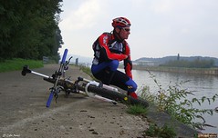
In the morning it looked like a fine day. Sun was shining and even though a nasty wind was blowing cold air from the northwest I decided to ride out. I wasn't sure which way to go so I started out along the track of the Ronde van Leuven starting from Blanden. But they were still arrowing the ride so I switched to the Kroem Foerce arrowing in Bierbeek and decided to follow this hilly trail through Linden, Holsbeek, Kortrijk Dutsel and Sint Pieters Rode until I reached Lubbeek. From there I rode up the hill towards Pellenberg but took a smaller road taking me towards Boutersem instead of following the big road. When I looked towards Bierbeek I noticed with a shock that there was a big black mushroom cloud hanging over Bierbeek, exactly in the direction I was planning to ride. I also felt the wind becoming stronger, no doubt hurrying out in front of the squall.
The only option I had was trying to avoid being hit by the rain so I followed the Tiensesteenweg towards Korbeek Lo, thus leaving the cloud to pass at my left. It seemed to work because I only felt a couple of raindrops when I crossed the outskirts of the depression. Arriving at the Mol I took the expressweg towards Haasrode and Blanden. When I reached the bridge of the E40 the road became wet. I stopped to take another picture, this time from the back of the cloud.

A bit later I arrived home and I had indeed escaped a lot of rain. So I was lucky today, being able to complete my ride in complete dryness.
Ride Stats : 51K and 440/505 heightmeters (Polar/Garmin) in 2h17mins
6601/69755
28-08-2010, 16:10 geschreven door Big Bad Wolf
|
|
|
|
|
| 24-08-2010 |
| Climb-it |

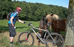
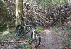
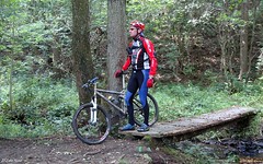
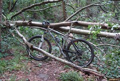
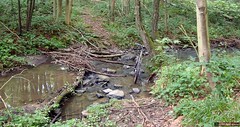
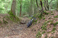
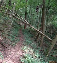
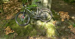
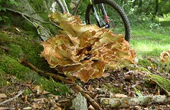
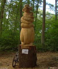
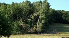
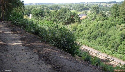
Had a good rest yesterday and today I wanted to ride out again. There were nasty winds blowing so I decided to stay in the forest and indulge myself in some exploratory riding, concentrating on climbs and descents. The temperature was a mild 20 degrees C and the sun through the leaves left me with a good feeling without overheating. I twisted and turned, following small tracks , sometimes 2 times in a different direction, just for the fun of it. Forget consistent loops, I was just adding the trails I wanted to ride. It struck me that a lot of the small tracks were washed out and there were quite some fallen trees as well.
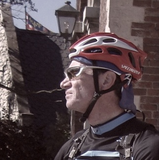
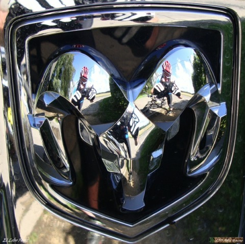
When I paused briefly for a snack near the forest edge in Nethen, I spotted some roedeer deep down below. You can see them on one of the pictures I posted. When I arrived at the top of the Haye du Wez in Nethen I spotted a big Dodge Ram jeep. I kinda liked the reflections of myself in the big ram badge so I added this pic to the series.
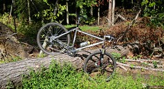

The tracks were great. Some rain late on sunday left them moist at places, and I had to watch a couple of times not to slip on some wet leaves covering roots. My legs felt surprisingly good and strong and as always, the Moots was a joy to steer over the most technical bits, bot uphill and downhill. I didn't have any troubles with insects, I had expected at least some gnats but nothing. So much the better.
At the end I had a surprising amount of heightmeters with a hill factor of over 20. Not bad for a couple of hours training in my local forest.
Ride Stats : 31.5K and 580/660 heightmeters (Polar/Garmin) in 2h11mins
6325/68995
24-08-2010, 20:22 geschreven door Big Bad Wolf
|
|
|
|
|
| 22-08-2010 |
| Natuurvrienden Haasrode 65K |

When I got out of bed this morning I still felt a bit tired from yesterdays' ride. I didn't have high hopes for my condition today but I had promised to be at the start in Haasrode at 7am so I rode out anyway. After a couple of hellos I rode off with another biker who would accompany me during the first kilometers until the 52 and 62K distance split. Meerdael forest was glistening with dew and the bikes were wet from riding through the grass on our way to the forest. It was warm with 19 degrees C but the forecast called for possible rain later in the day, even thunderstorms in the late afternoon. So the early biker got the worm today.
When my bike companion for half an hour took a left at the 52/62K split I was riding alone through an awakening forest. My job was to control the signage , if needed replace broken or stolen signs and make sure the riders, who could officially start at 7.30am, would not get lost . When the trail is ridden in this direction - counterclockwise on the map - the toughest bit of the ride comes first. A loop with some solid climbs and tricky descents on the Nethen side of the Meerdael forest. The sand in the Savenel area was deep and stuck to my wet bike. The long climb up to the plateau again was immediately followed by a fast descent towards the Kluis. It made my glasses foggy with the contrasting warmth of my body against the crisp forest air. The loop through the Bois de Beaumont led me down the long hollow road towards Nethen. When I was near the end, I saw a rope that had been spanned over the road. There was a festival of some sorts in the fields surrounding the track and the two fields had been connected by ropes. I stopped and had a talk with one of the festival people. I explained him that there was a mountainbike event passing here and that it would be better to remove the ropes. So we did just that.

After this intermezzo I rode on and when I arrived at Nethen I noticed an arrow had been removed at a crucial spot. A left turn . I replaced the arrow so that the bikers would not take the Bruyere de Wez going straight up - an 18% tarmac climb - but instead turned left for a steep offroad climb ending with a small step. A bit more of a challenge for a mountainbiker. I crossed someone from Mountainbike Tour Trips at the top of the climb. He was possibly also confused about the missing arrow. A bit further I descended back towards Nethen and stood at the start of the infamous Lianenklim. There is also an easier track, not through the deep and wet gully but following tarmac, cobbles and a track though the fields instead. I took the easy option. I wasn't sure about the condition of the track in the Lianenklim and I didn't want to be stabbed to death by gnats or even horseflies.
I continued towards and through Bossut and after 20K into the ride I arrived at the first rest stop high up in Gottechain. There still were no bikers here, only members of the organisation. I told them of the missing arrow and advised they sent someone over to re-check. I then rode on, taking a very steep downhill that might make some victims among the 52 and 62K bikers that pass here.
The 42K and other distances split off just after the rest stop so now I was on long-distances-only trails. Into and out of Grez and then crawling up the steep cobble climb to Biez. This is the start of a very intense section in Brabant Walloon, where a lot of heighmeters, some marvelous views and sheer fun are to be had for the mountainbiker. When I arrived at the first rest stop, I already had around 350 heightmeters, but the next section of 15K would easily double that amount. I was still riding alone and was enjoying the first rays of sunshine . The sections in the Forest de Glabais are some of the finest in the area. At times one could imagine being in the Ardennes.
The sun was frequently obscured by clouds but it remained dry. The small grassy track leading down into Pietrebais demanded my full attention. Even though the grass had been mown a couple of days ago, there were still dangers hiding below the greenage. Hidden ruts and even stones can easily topple the unaware biker over. A long climb on tarmac takes me back out of Pietrebais and then downhill again through a forest on a dangerously washed-out track. I drop into Cocrou. Here care has to be taken, the small road to the right is easily overseen. But the signage is OK and only the fast and the furious will miss the turn. For them, we have put some extra signs further down into Cocrou village that will lead them back to the trail, eventually. The long climb through a beautiful hollow forest road from the Fond du Moulin up to the plateau through the Bois de Beausart stresses my legs.
But I also know that this is amongst the last really tough climbs. I am nearing the 2nd rest stop at the edge of the Bois de Linsmeau and here I encounter the first real muddy puddles. But those who are 'in the know' can take a little singletrack that runs parallel to the muddy track. I take a break at the rest stop and have a little chat with the volunteers manning the stop. Thanks has to go to each and every one of them. They also sacrifice their free time to help us organise this ride.
The following downhill is a bit less dangerous than yesterday because the tree that had fallen over the trail has been removed. I also notice that the sandy bit is a little deeper than yesterday. I see my first bikers on the trails when I join the 42K riders coming from the left. From now on I can up my tempo a little bit and play catch-me-if-you-can with the other bikers. Some can catch and pass me , others try but die in my wheel. Life is fun.
The ride now mellows out a bit going though the fields between Gottechain and Tourinnes le Grosse. We cross the language border near Valduc and disappear into Meerdael Forest once again. A loop that takes us from the Walendreef and the Weertse Dreef to Mollendaal, the highest point of the forest, and then down into Bierbeek. A last climb following the De Betstraat hurts because it is long, grassy and difficult. Then I am back at the Haasrode Sports Complex where I started 65K , 3h48mins and over 900 heightmeters earlier. Riding back home I take a couple of backroads and small trails just for the fun of it. I had a good ride today.
Ride Stats : 73K and 930/1020 heightmeters (Polar/Garmin) in 3h56mins
Stats TT Haasrode : 65K and 935 heightmeters (Garmin)
Track on EveryTrail :
TT Haasrode Natuurvrienden 65K at EveryTrail
Plan your trips with EveryTrail iPhone Travel Guides
6393/68335
22-08-2010, 14:47 geschreven door Big Bad Wolf
|
|
|
|
|
| 21-08-2010 |
| Haasrode TT arrowing |

Tomorrow takes place the Haasrode TT, traditionally one of the better organised rides in my region, and certainly the one offering the best distance to heightmeters ratio. It is also one of the rides where I have the privilige of being in the organising committee. So today we set out to put in place the arrows. Each team of 2 people had a section to provide the arrows for. I was paired with Jan, one of the fittest riders of the lot. Fortunately we maintained an easy pace as we rode with 6 bikers to the farthest loops in deep Brabant Walloon. We split up at the reststop in Gottechain (check the map) and there Jan and I had to cover a bit of ground to takes us to the start of our section. Starting in Heze and making our way through the Bois de Glabais. A descent along the Rue de la Gorge du Loup. Sharp left and then a long climb towards the Chapelle du Cheneau in Longueville. We had a spot of bother with a little dog that wouldn't leave us. So I rode back down into the Gorge to take the dog back to its owner. Jan continued meanwhile placing the arrows. I was really surprised the trails were almost dry. It had rained considerably last week and except for a big puddle here and there , there was not much evidence of any wetness. Great trail conditions, a little moist, also due to the morning dew no doubt, offering perfect traction. From the chapelle a long downhill back into the Residal awaited us. Another climb taking us then to the Avenue Felix Lacourt leaving Heze. We passed the Grand Sart and then made our way into Cocrou were we met 2 other team-members who also had finished their part of the trail. We proceeded to another rendez-vous point down at the Rue de Linsmeau . We had to wait a little bit for the 3rd team to arrive and then we rode back towards Haasrode. I took some pictures along the way so people who were in doubt of the trail condition can check out how they are today. With no rain and 25 degrees C today the trails will be dry tomorrow for sure.
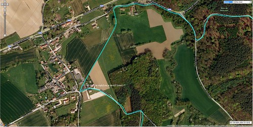
There is one point on the trail where I want to warn the people doing the 52 and 62K, to be careful which turn they take. When you arrive in Cocrou there are arrows pointing to the right. But you might not see the small trail on the right, the one which you are SUPPOSED to take, and instead take the tarmac into Cocrou. We did foresee an arrow in downtown Cocrou to lead the sheep that were led astray back to the right track. Here is a Google satelliet view with the track on it, explaining how you should proceed on that spot.
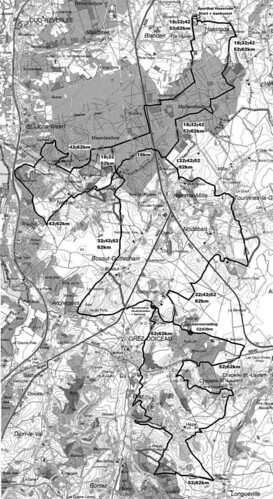
For those who want to figure out the track, here is a black and white rendition of the trail maps.
Ride Stats : 42.5K and 525/595 heightmeters (Polar/Garmin) in 2h17mins
6420/67315
21-08-2010, 12:59 geschreven door Big Bad Wolf
|
|
|
|
|
| 14-08-2010 |
| Kroem Foerce 125K |
Because my friend Roger insisted that the Kroem Foerce was worth the while I decided to follow this track from Blanden onwards. And indeed, when it reached Korbeek Dyle things began to intensify. In Linden and Holsbeek the Meesbergpad and Chartreuse are calf-biters and the legs were feeling it when I followed the track towards Lubbeek and Kerkom. Some not-too-busy roads and nice backroads through lovely landscapes.
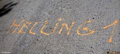
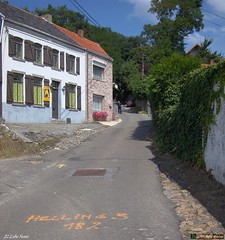
The weather was OK, sun was out most of the time and the temperature was bearable with around 22 degrees Celcius on average. The Kroeme Foerce tour starts in Sint Truiden but once I got in the region of Tienen I decided to skip the last part - flat no doubt - and cut to the right on the route national from Diest to Tienen. Riding straight through the city of Tienen had me guess a bit but at long last I arrived on the Hannuitsesteenweg in Bost. From here I came to Goetsenhoven whence I now my way since the Vlaanderen Stedenroute passes there. Just before Hoegaarden I connected to the Kroeme Foerce tour again and soon I was at the first climb - Helling 1 - which led me to the plateau where the Marollen Chapel stands. Taking a break there before riding onwards .
From Meldert the second climbs brings me towards Opvelp where the track veers to the left to connect Beauvechain and Hamme Mille. In Nethen I had to look a bit to find the 3rd climb - an 18% grade no less - which I took on the smallest gear. I had close to 81K in my legs and then 18% is a lot. I stopped at the well near the Camping La Hetraie to drink some cool water before engaging the last 10K
The trail then moves towards Sint Joris Weert where climb number 4 takes me to the gendarmerie. Here it turns left again and reaches the Zoete Waters, from where it moves towards Vaalbeek and back into Blanden. A surprisingly good ride with a solid 800 heightmeters in this configuration. A good training ride indeed. When I got home Roger passed by and he immediately guessed which ride I had done. He wanted to ride in the Ardennes tomorrow but in view of the weather forecast I gently declined.
Ride Stats : 95K and 765/815 heightmeters (Polar/Garmin) in 4h15mins
6330/66340
14-08-2010, 16:21 geschreven door Big Bad Wolf
|
|
|
|
|
| 11-08-2010 |
| Heverlee road BLOSO |
 I know this track, I call it the Heverlee road Bloso. It starts at the Kazerne in Heverlee and there is a Blue and a Red track. The Blue is 30K and the Red is 50K. I did the 50K today. Leading me over the Zoete Waters, Sint Joris Weert, Sint Agatha Rode, Ottenburg, Terlanen with the Moskesberg (20%), the Keiberg and the Smeysberg, then towards Neerijse and Leefdaal and through Egenhoven and Arenberg towards Heverlee. Nice trail, with some climbing and never boring. The weather was OK, with the sun bursting through the cloud cover from time to time and temperatures around 23 degrees Celcius.
Ride Stats : 55K and 470/525 heightmeters (Polar/Garmin) in 2h23mins
6235/65525
11-08-2010, 19:13 geschreven door Big Bad Wolf
|
|
|
|
|
| 09-08-2010 |
| Some FK |

Today I started following the FK markers I discovered a couple of days ago. Its seems the circuit starts near Sint Truiden somewhere. I followed it through Blanden towards Haasrode and Bierbeek but when it looked to go towards Korbeek Lo I lost interest and continued along the "Haasrode" trail towards Neervelp, Willebringen, Hoksem and Oorbeek. I stopped near the Goudberg Geosite , where a petrified forest was discovered and protected some years ago when they were building the HST trail. Enjoying an energy bar and the warm August sun on my skin I paused for a while.
I then set on towards Hoegaarden when I discovered the FK markers. These must be near the beginning of the loop because when I arrived in Meldert there was a marking on the road with 'Helling 2' , meaning the second climb. I followed the track towards Opvelp and Beauvechain and onwards to Hamme Mille and Nethen. I must have missed 'Helling 3' because when I exited Sint Joris Weert I was on 'Helling 4'. I also learned there were 2 distances when I discovered a split near Meldert. The 75K distance breaking to the right towards Willebringen, and the 125K distance which I followed until I reached Vaalbeek and Blanden again. Could be interesting to ride towards Korbeek Lo one of these days and see whether the track goes into the hilly region near Pellenberg and Lubbeek. For now I had a good ride at an easy pace.
Ride Stats : 60K and 410/470 heightmeters (Polar/Garmin) in 2h37mins
6180/65000
09-08-2010, 20:02 geschreven door Big Bad Wolf
|
|
|
|
|
| 06-08-2010 |
| Haasrode TT 65K recon |
Had the idea to ride the track from the 2008 Haasrode TT again. Or at least what I call the raw track. The actual TT cut some corners here and there to soften things up a bit and keep the actual distance below 65K. This is what you might call the heavy duty version. I put the track into my Edge 705 and reversed it. I also rode this track in november 2008 so you can check my story there for more details and a view of the map.
I didn't pass through Haasrode today since I cut the track short starting in Blanden and staying in Meerdael Forest instead of riding the last and first couple of K's to and from the start.
First passing in Mollendaalbos and then exiting the green and cool Meerdael forest near Valduc where the sun was awaiting me. Through Tourinnes la Grosse and then moving south towards Gottechain. Here the serious things start as the ride moves towards Pietrebais and Cocrou. Even further south to reach Longueville where a lot of heightmeters make the gears, and my legs , grind. When I finally reach Heze I already have 600 heightmeters and 47K.
I then move towards Grez Doiceau and Gottechain again where a mean climb awaits me. Towards Archennes and then up the crest to connect to Nethen. Disappearing into Meerdael Forest for a loop that takes me back down towards Nethen. Here I have to climb towards the Bois de Beaumont where I can enjoy a lovely view of Nethen basking in the evening sun.
Down towards Nethen again and passing the camping La Hetraie I stop and have a drink at the well. Climbing again towards the Kluis where I join the Blue Bloso. Down past the Kluis main building , up the hill and back down again towards the Savenel. The passage in the deep sand just before the climb makes me dig deep into my strenght. And I am glad when I close the loop I started at the Naamsesteenweg. This is indeed a difficult track and it would be a real challenge to let the TT riders to this track. But the final track will differ I'm sure. Nevertheless it will make a lot of riders suffer on August 22nd, when the organised ride starts at the Sports Complex in Haasrode. This is one of the better rides in this region, so why not try it yourself?
Ride Stats : 70K and 830/975 heightmeters (Polar/Garmin) in 4h5mins30secs
6088/64305
06-08-2010, 21:33 geschreven door Big Bad Wolf
|
|
|
|
|
| 01-08-2010 |
| Blue Green Blue Red Blue |

Sunny and not too warm, ideal weather for a ride in my local forest. I decided to do the 3 Meerdael BLOSO trails, connecting them starting with the Blue, then hop on the Green and do that until it meets the Blue again, near the Zoete Waters, then follow the Blue for what is the more hilly part of these trails. The Blue then connects to the Red which again I follow completely until it connects with the Blue again. Then it is just a short bit left to where I started my loop a while back.
The trails were in good condition, although the part near the wall in Nethen was extra sandy, almost to the point of being impossible to ride. But looking at the clouds as I type this, I think we might see some rain soon, which will certainly harden up the sandy bits.
Ride Stats : 55,5K and 465/560 heightmeters (Polar/Garmin) in 2h48mins
5958/62550
01-08-2010, 14:09 geschreven door Big Bad Wolf
|
|
|
|
|
|
|
| Gastenboek./.Guestbook |
Druk op onderstaande knop om een berichtje achter te laten in mijn Gastenboek. /
Press the button below to write in my Guestbook.
|
| Email Me |
Press the button to send me a mail
|
|
|
|