|
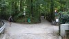
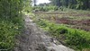
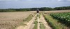
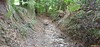
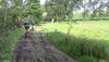
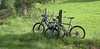
Tomorrow takes place the Haasrode TT, traditionally one of the better organised rides in my region, and certainly the one offering the best distance to heightmeters ratio. It is also one of the rides where I have the privilige of being in the organising committee. So today we set out to put in place the arrows. Each team of 2 people had a section to provide the arrows for. I was paired with Jan, one of the fittest riders of the lot. Fortunately we maintained an easy pace as we rode with 6 bikers to the farthest loops in deep Brabant Walloon. We split up at the reststop in Gottechain (check the map) and there Jan and I had to cover a bit of ground to takes us to the start of our section. Starting in Heze and making our way through the Bois de Glabais. A descent along the Rue de la Gorge du Loup. Sharp left and then a long climb towards the Chapelle du Cheneau in Longueville. We had a spot of bother with a little dog that wouldn't leave us. So I rode back down into the Gorge to take the dog back to its owner. Jan continued meanwhile placing the arrows. I was really surprised the trails were almost dry. It had rained considerably last week and except for a big puddle here and there , there was not much evidence of any wetness. Great trail conditions, a little moist, also due to the morning dew no doubt, offering perfect traction. From the chapelle a long downhill back into the Residal awaited us. Another climb taking us then to the Avenue Felix Lacourt leaving Heze. We passed the Grand Sart and then made our way into Cocrou were we met 2 other team-members who also had finished their part of the trail. We proceeded to another rendez-vous point down at the Rue de Linsmeau . We had to wait a little bit for the 3rd team to arrive and then we rode back towards Haasrode. I took some pictures along the way so people who were in doubt of the trail condition can check out how they are today. With no rain and 25 degrees C today the trails will be dry tomorrow for sure.
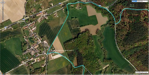
There is one point on the trail where I want to warn the people doing the 52 and 62K, to be careful which turn they take. When you arrive in Cocrou there are arrows pointing to the right. But you might not see the small trail on the right, the one which you are SUPPOSED to take, and instead take the tarmac into Cocrou. We did foresee an arrow in downtown Cocrou to lead the sheep that were led astray back to the right track. Here is a Google satelliet view with the track on it, explaining how you should proceed on that spot.
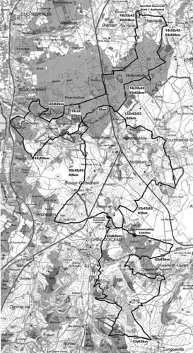
For those who want to figure out the track, here is a black and white rendition of the trail maps.
Ride Stats : 42.5K and 525/595 heightmeters (Polar/Garmin) in 2h17mins
6420/67315
|


