|
|
|
| Tales from the Woods |
|
|
| 02-09-2009 |
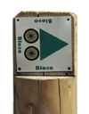
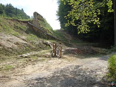
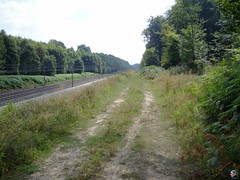
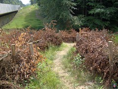
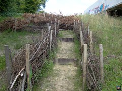
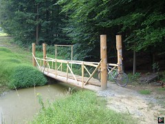
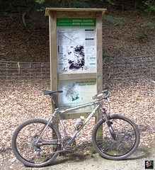
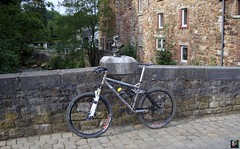
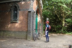
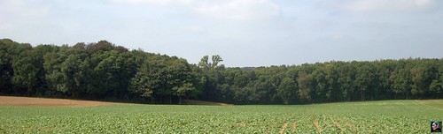
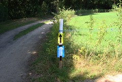
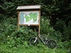
 Overijse BLOSO routes and extras Overijse BLOSO routes and extras |
Yesterday it was raining lightly most of the afternoon and when I rode aout today I was surprised the forest and other terrain was dry again. I decided to go offroad and do some more K's on the Moots.
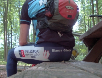
I received some bad news from ABC Fietsen about the Tune bearings. Seems the Tune importer for the Benelux - Peza trading I believe - decided to pack it in , leaving ABC without a source for Tune goodies and putting the responsability to get the bearings with me. I contacted Tune about direct delivery to me, but they are slow reading their emails it seems. ABC Fietsen is OK with installing the bearings once I have received them.
I rode through Meerdael Forest and St Agatha Rode towards the Overijse BLOSO routes and with a menacing sky above did all 3 of them, adding some extra climbs in the process. My Moots YBB has been making creaking noises for the last couple of rides and I was trying to figure out where the noise came from. It only happened when I pedalled and being seated or standing up didn't make a difference. Weird.
So it either came from the XTR bottom bracket or perhaps from the small YBB suspension unit which has 5 years in it and is in need of a rehaul. The aluminium slider is getting worn by the continuous movement. I already have a replacement part but am not very keen to do the overhaul myself. Perhaps I will ask Filip Sport to do it for me when I turn the bike in for its yearly checkup.
Anyway I blocked the rear suspension and the creaking seemed to lessen, but did not disappear completely. Having the Moots turned into a front-suspension-only bike didn't add to the comfort and I quickly loosened the rear suspension after a couple of kilometers. The clicking sounds seemed to increase until all of a sudden they disappeared completely for the rest of the ride. Funny things, titanium bikes, aren't they?
I felt very good today and had a strong average and good feeling in the many climbs. Near the end of the ride, making my way back into Meerdael Forest for some last climbing, the skies got dark but still no drops fell.
Ride Stats : 55K and 805/870 heightmeters (Polar/Garmin) in 2h53mins
6693/65895
02-09-2009, 20:20 geschreven door Big Bad Wolf
|
|
|
|
|
| 29-08-2009 |
| Theux Green and Blue and Red and Ninglinspo Valley |
Yes, this morning I took my Mazda and drove it to the Franchimont castle in Theux. My plan was to start on the Green, hop over on the Blue and then on the Red. On the Red I would then descent into the Ninglinspo valley, looping over the Blanches Pierres and the Tour Drouet, ascent along the Ninglinspo and then follow the Red again, hop over on the Blue and finish in Theux. At 10am I was ready to roll. It was fresh with only 14 degrees C but at least it promised to be dry. It took a little while to get back into Ardennes mode but once I found my rhythm I found my legs to be better than I expected. The tracks are rocky here, so I took care to add a couple of psi to my tyre pressure. Even with a full suspension bike, and especially on tough circuits like the Theux Adeps routes, a little bit more goes a long way. The tracks were surprisingly dry as I thundered into Polleur where I rejoined the Red route for a little while climbing into the outskirts of the Bois de Staneu. The Red then goes straight while the Green veers to the left for the first long climb of the day. I could do the climb on my middle chainring but after a while I decided it might be better to put it on the little ring in front. Better not tyre my legs unneccessary. Arriving on top I had to follow the tarmac road for a while before coming to the first long descent. A rocky number this one, and I had to change lines quite a few times in order to stay on the bike. But as usual, the Merlin did its magic and inspired me with the confidence needed when doing rides like this one on your own. Into the valley and hopping onto the Blue route for another long climb, back over 300 metres. Another descent and I was on the road to Spa. Crossing it and then disappearing into the forest again for the next - very rocky - climb. After a while you leave the forest and I noticed the sun was shining intermittently, just warming things up a little bit. The cool temperatures were great for my form because I was really feeling strong. Onto the Red route and slowly climbing up to the 400 metre mark.
   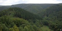 
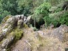
Just before reaching that I came to the edge of the Ambleve valley. Here I left the Adeps route for a descent into the valley I call dreamland. Descending towards the Blanches Pierres rivulet and on a big forest track making good speed on the 18% slope before arriving at the Tour Drouet, which offers a great view over the Ninglinspo valley. The Ninglinspo is a little river that drops from the plateau down towards the Ambleve river, some 270 metres deeper. I took a break at the Tour Drouet, some 26K into the ride. Having a bite to eat and taking some pictures, I notice som white constructions on the horizon. Strange, they look like big blocks, but what is their purpose? Time will tell for sure.
Deeper down into the valley and I was ready for the long ascent, following the little Ninglinspo river on its trail. Some 3K long and offering a height gain of 250 metres, this is a nice climb and especially today, when it was very dry and offering good traction to my Nobby Nics. I met up with a runner who was a local and was doing a 16K run in and out of this valley. Strong guy! When I arrived at the top I had already decided I would abandon my plan to get back on the Blue and follow that into Theux. I felt good and so I decided to follow the much more difficult Red route. This offers quite a bit more climbs, and some tricky descents, especially the drop into the Forges Thiry is to be treated with respect. As is essentially every descent on the Red route, which has its toughest section near the end.
Near the end I was suffering on the last climb, a very steep number climbing from downtown Theux up towards the Franchimont castle. The slope is between 11 and 18% and even reaches 20% at one point. After 60K in this kind of terrain is a tough cookie. But i managed it and with some relief I saw my red Mazda standing still on the parking lot near the Franchimont castle. This combination of the 3 routes + the descent into the Ambleve valley is a nice ride, not for the meek I hasten to tell, the terrain is not to be underestimated and has surprises around every corner. A good bike and some experience in the Ardennes is a must on these kinds of rides. There are some sections that offer a bit of recuperation but - especially on the red route - most of the time you are either climbing or trying to ride one or the other technical downhill. I nearly lost it when my front wheel washed away over some stones in a corner whilst descending a 14% slope on a double trail field track. The tracks were narrow and extremely rockstrewn and only a quick reflex and possibly a combination of a good bike with good tyres saved me from a trip to the hospital. Things like that tend to happen near the end of the ride, when concentration is a bit less and fatigue is building up. But they might just as well happen in the beginning, when you underestimate the trail and/or overestimate yourself. So be warned, stay safe and keep the rubber side down.
Ride Stats : 63K and 1500/1550 heightmeters (Polar/Garmin) in 4h00mins
GPS Track on Garmin Connect : CLICK
6560/64500
29-08-2009, 20:03 geschreven door Big Bad Wolf
|
|
|
|
|
| 26-08-2009 |
| Easy ride |
|
It didn't look like it would stay dry when I left, but it was warm enough and the sun did shine through the clouds from time to time. So I went for a road ride, following more or less the 30K road BLOSO starting in Heverlee. My tune sixpack axle is still wandering around but I already contacted ABC Fietsen in Merksem to order a new set of bearings. I just have to knock it back in place each time I get home.
The ride went well, very relaxing pace - 107bpm average - along Sint Joris Weert, Sint Agatha Rode and over to Loonbeek and further on to Everberg and Egenhoven. A little loop into the Arenberg castle park and I was in Heverlee and nearly home. And yes, it stayed dry and after a while the skies cleared out completely.
Ride Stats : 39K and 325/355 heightmeters (Polar/Garmin) in 1h47mins
6436/62455
26-08-2009, 19:39 geschreven door Big Bad Wolf
|
|
|
|
|
| 24-08-2009 |
| Valduc |
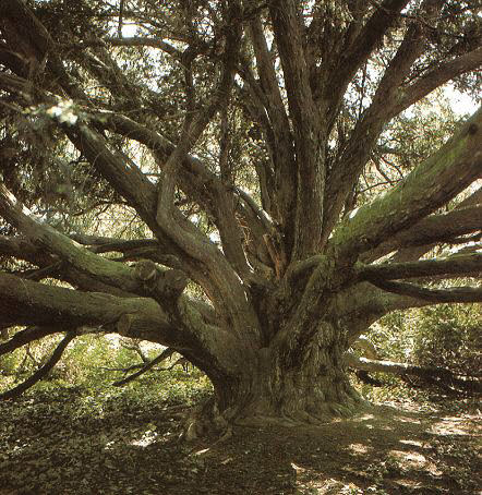
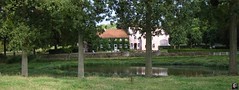
Intrigued by a book I read , I rode towards the Chateau de Valduc today, on the east side of the Meerdael Forest, not far from Hamme Mille. The parc of this chateau , which stands on the grounds of an old abbey, is said to hold the oldest pine tree in Belgium, a taxus which is estimated at being 770 years old. Since the Cistercienzer abbey was founded in 1232, this might be a correct assumption. Obviously the grounds are private but I managed to penetrated through a hole in the wall and check out some parts of it. Unfortunately I could not find the taxus. I did spot some very big trees though, proving that there are indeed some very old vestiges of greenery here. I must return here and ask about the tree, but I only saw a farmer and some playing children on the castle grounds. Neither of them seemed to be bothered by my passing on what are after all private grounds.
After this I set my course towards Archennes where I dabbled along in the Dyle valley. Looking for a possibility to cross over from Archennes to the Bois de Laurensart, but I didn't manage to find a way. The river was blocking me and there seemed to be no bridges between Gastuche and Florival.
I set towards Gastuche next to ride up to the Bois de Laurensart on its western border , with the steep climb near the Tomme. I had spotted some dark clouds gathering in the southwest, and decided to hurry home over Pecrot and Nethen and through the Meerdael Forest. In all I had a pleasant low-effort ride and with the cloud cover the temperature was manageable as well, around 26 degrees C.
Ride Stats : 39k and 365/435 heightmeters (Polar/Garmin) in 2h19mins
6397/62100
24-08-2009, 20:26 geschreven door Big Bad Wolf
|
|
|
|
|
| 21-08-2009 |
| Dion Maze |

Yesterday was the hottest day of the year. Temperatures soaring way over 30 degrees C - 34 degrees in Ukkel and a record-breaking 38,2 degrees in Kleine Brogel. No way you could go out and bike in that kind of weather. The heavy thunderstorm that reached us in the early evening dropped the temperatures by 25 degrees and cooler air reached Belgium after that.
So today evening it was great biking weather. The warlth got washed out of the skies and the trails were moist but not overly wet. I took the Moots out for another exploratory ride in Brabant Walloon. But since the weather was more favorable I made it a much bigger loop than last wedsnesday. Starting out in the usual way over Nethen, La Malaise, Bossut and Archennes and then making my way to Gastuche and over the crest towards Dion. Having a bite to eat near the two Chapels close to Wavre and then I was following the big road to Perwez for a while to arrive in Dion Valmont. Here I spotted some white arrows pointing into small tracks and decided to try and follow those for a while. With my GPS on I could see they were actually leading somewhere so I discovered some interesting new singletrails. Pity some of the trails are barred by neighboring owners. They just put a gate in the middle of the track, sticking a ' Propriete Privée' sticker on it and be done with it. I once rode into what looked like a road going somewhere only to find a gate on the far end. The owner of one of the houses next to the road rode up to me - he was sitting on one of those big lawnmowers, people are generally well off in this area - and began making a lot of noise. Not to be shaken I told him my GPS indicated a road implicating I had every right to be here. He gave up and motored away while I opened his gate and let myself out into the other side of the road.
Some of the tracks were real jewels, in downtown Dion le Mont - or it might have been Dion Valmont - I found a little track starting off between a high wall and a dark patch of forest. Going up very steep , going down again and up once more before arriving at a busy road. Crossing the road there was a flight of stairs going down - I didn't ride those - and the track meandering again uphill. The heavy rains had cleared most of the tracks and left a hard trail, sometimes debris and washed-out holes made things a bit technical but also added to the enjoyment.
Making my way into another garden, the owner pointing me in the right direction in a very friendly and bilungual manner, I slowly arrived in the neighborhood of Bonlez. Here I encountered some more familiar trails from the Accro Bike or other O2 Bikers roadbooks. I felt good throughout the ride and decided to make a big loop here before slowly returning towards Biez and Cocrou. The heightmeters were accumulating nicely but I still was surprised at the amount when I arrived home. I included a loop in Gottechain - sister town to Bossut - and nearly rode the church stairs. But I chickened out at the last moment. Stairs don't agree with me unless I am on a real full suspension bike. After Gottechain I made my way towards Hamme Mille and Valduc before entering the Meerdael Forest for a quick visit to the Dikke Eik and then returning home over Hoog Blanden. I had a very agreable ride and was a bit surprised at my fitness level. Not feeling very strong in the beginning but getting better throughout the ride.
Ride Stats : 60.5K and 810/975 heightmeters (Polar/Garmin) in 3h34mins
6317/61225
21-08-2009, 23:55 geschreven door Big Bad Wolf
|
|
|
|
|
| 19-08-2009 |
| Simons Diablo |

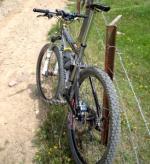
It was very hot today, around 34 degrees C still when I left home for a ride that would take me to Gastuche. I chose the Moots because I wanted to ride as much as possible offroad though the forests. Through Meerdael towards Nethen and then Bossut and down to Archennes. A bit of tarmac now and I was at garage Francorchamps in Gastuche. I had heard Simons' Lamborghini Diablo SV Conversion was there for some maintenance and I would like to see the beast in real life. The car was there but it opened up and there were lots of people working on it so I chose not to take any pictures, instead I will upload a picture to this topic.
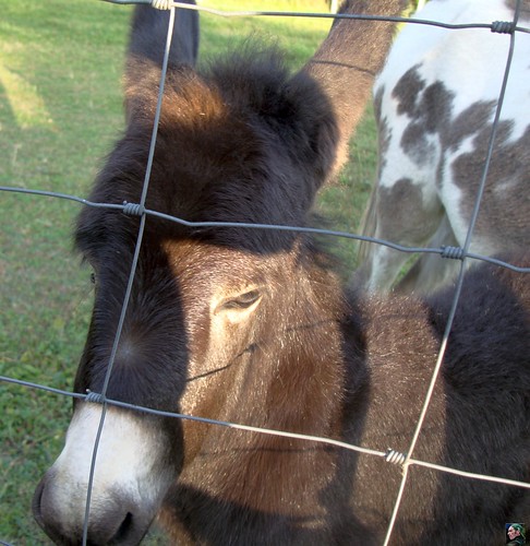
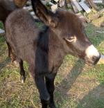
Next I moved on up the hill towards the N25 and then dropped back into Gastuche to cross the N268 and move towards Ottenburg. I climbed up the hill and then took the private road through the Bois de Laurensart towards Eerken. Followed the Red Bloso for a while to end up in Sint Agatha Rode to check up on the young donkey that I had seen there a week ago. The little one had grown quite a bit and he wasn't shy at all.
I next rode towards the Meerdael Forest again to finish with a little loop towards the Kluis and the Zoete Waters. Temps had dropped to a more reasonable 26 degrees C when I arrived home.
Ride Stats : 43.5K and 425/429 heightmeters (Polar/Garmin) in 2h20mins
6256/60250
19-08-2009, 21:21 geschreven door Big Bad Wolf
|
|
|
|
|
| 16-08-2009 |
| Blue and Red Meerdael Bloso routes |
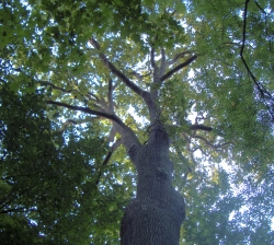
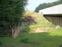
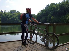
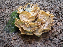
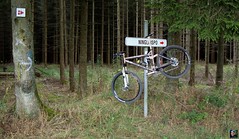
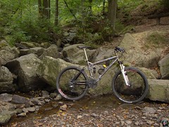
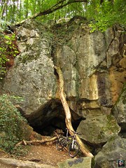
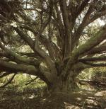
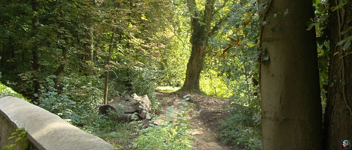
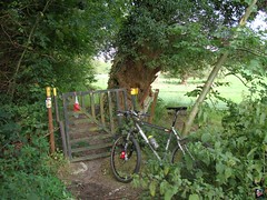
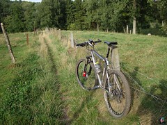
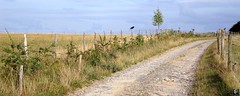
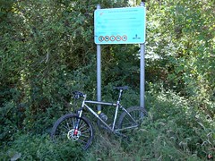
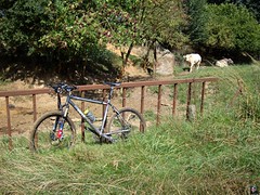
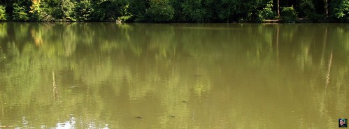
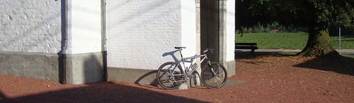
In contrast to yesterdays high summer temperatures this morning the sun was hidden behind clouds and the temperatures were 10 degrees less. But in the afternoon things were bound to brighten up. I wanted to do an easy ride and decided to go for a combination of the Blue and Red Meerdael Bloso loops. Riding out at 2pm at first things were dark in the forest due to the combination of clouded skies and heavy foliage. But when I passed the ripening grapes at the Chardonnay Meerdael estate, the sun came peeping through and pretty soon the clouds were all but gone. My legs felt pretty good considering the heavy ride I had yesterday. My buttocks were a bit sore though, more specifically the parts that touch the saddle. There were a lot of people in the forest, enjoying the sunday and the sunny afternoon. I leave you with 3 pictures I took today.
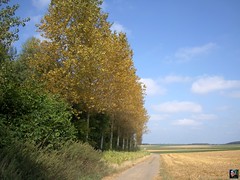 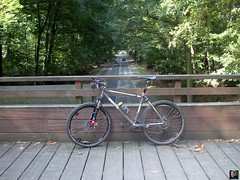
The first one is a shot of the tallest tree in Meerdael Forest, the lone poplar close to the Dikke Eik at the southeast of the forest. The next one is taken in the same vicinity, riding along the forest edge towards Mollendaalbos, and depicts the leaves turning yellow due to the sun no doubt. The last one is of my bike, standing against the railing of the Ecoduct spanning the Naamsesteenweg.
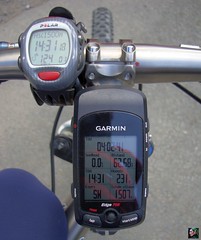
I decided to take the heightmeters of my Garmin Edge 705 as reference instead of the Polar figures. Looks to me the Garmin is more accurate, taking into account both barometric readings and accurate positioning viz-a-viz the satellites.
Ride Stats : 40K and 415/487 heightmeters (Polar/Garmin) in 2h2mins
6213/59825
16-08-2009, 18:57 geschreven door Big Bad Wolf
|
|
|
|
|
| 15-08-2009 |
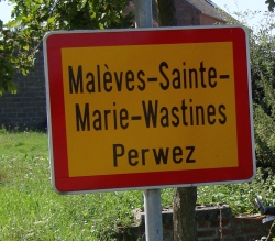
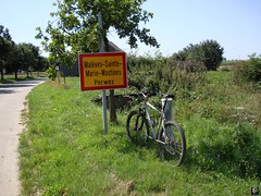
| Maleves Sainte Marie Wastines |

The weather forecast for today was one out of a thousand. Unclouded skies, a little bit of cooling wind and temperatures rising to 28 degrees C and more. So I was out there. The plan for today was to ride to Maleves Sainte Marie Wastines, a little village somewhere in the area between Opprebais and Perwez, find the start of the organised ride that is taking place there tomorrow, and ride most of the 50K distance. Getting there was an adventure on its own. I started towards Bossut and Gottechain, because I knew that the ride was going to pass there. Sure enough I found the blue/white O2 Bikers-sponsored arrowing. But I had no idea where exactly on the loop I was. Was I near the start, or on the return loop? How many K to go, how much already done at that point? I had no clue, so I needed to get as close to the start as possible to do as much of the ride as possible. The ride crosses another organised ride, the Haasrode one, so people taking part in either og those two rides tomorrow will have to be vigilant to stay on the right track. I have no free time tomorrow morning , thats why I decided to do this ride today. Normally I help the Haasrode organisation but the 16th of August is the day my mother died, and there is a commemorative service each year on the sunday closest to that date. Unfortunately for the Haasrode guys, the service coincided with their ride. So no way I was going to be available tomorrow. I met up with a few of the guys when I reached Gottechain, they had to place arrows but had forgotten to load them - or something..
I rode on towards Longueville and then to Incourt. I had not yet seen any markings towards MSMW (Maleves Sainte Marie Wastines) so I decided to ask for directions. A very friendly man explained I had to ride towards Opprebais - look for the white mill - and then follow straight on and I would arrive in MSMW. And indeed I did.
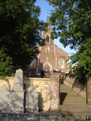
MSMW is a very small town, with a nice little church and what looks to be an old abbey. I started circling around in the town centre to pick up on the markings or find the start of tomorrows' ride. I succeeded in neither and after a while I decided to ride back towards Opprebais and follow the first markings I came upon. Sure enough, I spotted the orange arrowing on the tarmac and a little further the first blue/white arrows . Yippee, I was on the track. The first part of the ride is pretty much confined to field tracks, leading towards the north. Arriving in Longueville and pushing further on towards Cocrou things get a little more hilly and also some forest passages are thrown in. Below Gottechain the track meets the Haasrode track and both run parallel to each other towards Grez Doiceau. In Grez I stopped at a local shop - it was open despite this being a holiday in Belgium - to refill my drinking bottle with some Coke Zero. Yeah I know, but it was cool and got me going again. The heavy part of the ride was when the trail lead me towards Bonlez and later towards Chaumont Gistoux. Here they take in a couple of nice climbs and also - unfortunately - a muddy passage leading towards the Chaumont Gistoux menhir standing in a field amidst the cows. This menhir - called 'Le Cheval de Goffe' - is said to be 5000 years old. I was starting to feel the pounding of the sun now and decided to call it a day after the track rode down into Chaumont again. I returned towards Longueville and Grez Doiceau. Stopped at the little store in Grez again for another Coke Zero refill - thanks to the lovely girl opening the shop today ! I then rode home over Bossut and Les Claines. Into Meerdael forest and its cooler shade. It was a long ride, a hot ride and I was pretty tired at the end of it. Not sure what tomorrow will bring but I already got one satisfying ride in this weekend.
Ride Stats : 94K and 970/1090 heightmeters (Polar/Garmin) in 5h10mins
6173/59340
15-08-2009, 19:35 geschreven door Big Bad Wolf
|
|
|
|
|
| 14-08-2009 |
| Sanatorium |
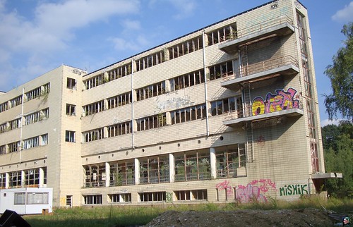
A beautiful sunny late afternoon and I rode my Hilset to Filip Sport. Needed some Power bars and new gloves for mountainbiking. I decided on some Pearl Izumi summer long finger with Pittards carbon fiber reinforced leather pads. Sounds tricky , lets hope they do their job. When I rode home I couldn't resist having a peep at the Tombeek sanatorium. It has been abandoned for 20 years - some asbest thing - and has been decaying ever since. But the caretaker, who saw me taking pics and came over for a chat, told me that they would be renovating it soon. It certainly deserves to be alive again. Lets hope they get all the asbest out before they make condominiums out of it. I came home with a nice distance under my belt and set for more during the weekend.
Ride Stats : 56K and 370/458 heightmeters (Polar/Garmin) in 2h28mins
6079/58250
14-08-2009, 22:36 geschreven door Big Bad Wolf
|
|
|
|
|
| 10-08-2009 |
| Overijse routes |
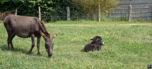
Today I wanted to do the Overijse BLOSO routes again. I also decided to do them as they were, without any diversions to the left and the right. I rode over Sint Agatha Rode - where I spotted a lovely young donkey - and then got on the routes for a quick ride. I could maintain a good speed even though it was rather warm and I wore long trousers. But the sun wasn't always out and there was a cooling breeze. Just enough to make things bearable. The routes were dry and hard but the Moots coped with them very well. I could really let the bike go in the descents and had no trouble finding a good rhythm in the many uphills. When I returned I tried out a new singletrack I had spotted in Sint Agatha Rode. I then stopped at the donkey family again to take some pictures of the youngster. Even though he was scared at first after a while I could get close enough to touch him. Soft and very cuddly. Mam was always around though watching over the youngster and keeping an eye on me as well.
Ride Stats : 53.5K and 620/719 heightmeters (Polar/Garmin) in 2h44mins
5988/57665
10-08-2009, 20:12 geschreven door Big Bad Wolf
|
|
|
|
|
| 09-08-2009 |
| Opprebais |

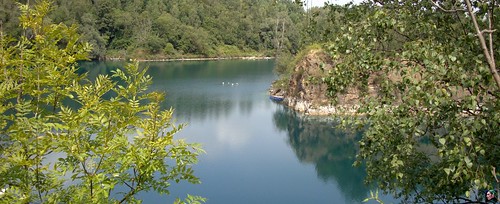
When I rode out today I wasn't thinking of riding far. I could feel my legs were well recuperated but I imagined an hour or 2 would be more than enough. I rode towards Sint Agatha Rode and Ottenburg and then decided to descent into Basse-Wavre to climb out of it again towards the road to Perwez. It was a while since I followed this one past Chaumont Gistoux so I decided to try that. The bikepath, which in the past was deplorable, seemed to have been remade from Chaumont onwards. Great for biking now, without any potholes and other cracks in the road. I veered to the left towards Opprebais and decided to have a look at the Opprebais water reserve. Many decades ago this was the place where I did my first deepsea diving lessons. Well, needless to say, things have changed quite a bit since then. The site which was once abandoned is now completely filled with houses and it took me some time to find the entrance where we used to ride though to get to the clubhouses. There is only one clubhouse left, the one from DDT Tienen. The carriere is completely surrounded by a fence and there is a walkers/bike path going around it. Here and there you can catch a glimpse of the bluegreen water reserve captured in between the rocky walls. There is still diving going on here, but on a far lesser scale than 20 years ago. Access is limited and this has provided peace in the area as well as in the water itself. In my days it was not uncommon to have hundreds of divers visiting the site during the day and until late in the evening. Needless to say, the noise and light pollution did not go unnoticed and the Opprebais councel decided a while back to close the site as a diving spot and develop more houses next to it. The site has been opened again, but with strict limitations. When I rode around the pond it struck me that I remembered it to be bigger.
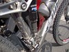
After that I followed the blue M markings for a while, taking me towards Dongelberg - another sweet water reservoir and dive-site - and Lathuy. I noticed that my bottom bracket had moved towards the left. Probably because I let some oil onto the axis a while back. When I shifted on the big ring in front, the front derailler cage rubbed against the middle chainring. First I taught one of the crankarms was getting loose but after a while my right crankarm began touching the right side of the frame. A sure sign that the axis itself was shifting. Ah that Tune Bigfoot crank , it is a very light crank but it has its peculiarities. One of them is the continuously loosening of the crankarms on the axis and another is the shifting of the titanium axis itself, moving through the bearings. When I got home I gave it a couple of jams with a heavy hammer and surely enough it moved back where it should be. I must change the bearings soon because the crankarms turn very badly. I finished my ride looping over Sart-Melin and back towards Hamme Mille. The weather was calm and with 23 degrees C not too hot. The sun came through during the afternoon making it alltogether a very enjoyable ride.
Ride Stats : 66K and 550/598 heightmeters (Polar/Garmin) in 3h2mins
5934/57045
09-08-2009, 16:17 geschreven door Big Bad Wolf
|
|
|
|
|
| 06-08-2009 |
| Hot Eizer |

Another very hot summer day and at first I wasn't sure if I should ride out, but when I got home I just went for it. Pace was relaxed of course but the stiff northeasterly breeze didn't make it unbearably hot. At least when you rode with the wind in your face. I had the wind in my back during the first part of the ride, making my way over Heverlee and Egenhoven towards the field roads above Leefdaal. Following that I took a right towards Vossem and then rode all the way to the Tervuren ponds. Here a welcome shade from the outskirts of the Sonian Forest offered some relief. Turning towards the east I began to feel the wind when I rode towards Eizer and Huldenberg. The Smeysberg - I took the Huldenberg city climb, less steep but longer - had me gritting my teeth but on top the dry wind blew straight in my face. Making my way towards Sint Agatha Rode and later Sint Joris Weert, the sun was burning a hole in the back of my helmet. The Zoete Waters offered some relief and I saw the big fish gasping for air at the surface. That surely is a sign it is hot and the water lacks oxygen.
Ride Stats : 50K and 340/379 heightmeters (Polar/Garmin) in 2h13mins
5769/55635
06-08-2009, 18:50 geschreven door Big Bad Wolf
|
|
|
|
|
| 05-08-2009 |
| Zetrud |
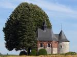
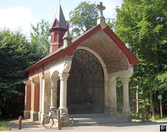
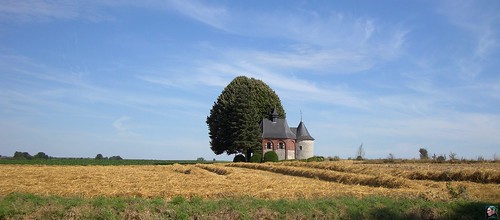
The weather was very hot today and the sun was making overtime when I left home around 20 to 4. I planned on riding to Beauvechain and pick in on the 100K loop of the Chaumont Gistoux ride. Having followed the 50K version a few days ago I wasn't expecting too much. And indeed, the ride followed mainly big roads towards Tienen, Hoegaarden and Jodoigne. I stopped in Zetrud Lumay to take a picture of a beautiful chapel in the fields. A bit further the ride turned left but due to the heat I decided to take a right turn towards Wavre. Another busy road that I followed until i could turn towards La Bruyere and then I returned home over slightly less busy roads passing through Beauvechain, Opvelp and Bierbeek. The sun had disappeared behind some clouds by now but the temperatures were still close to 30 degrees C. High Summer as we call that here.
Ride Stats : 63K and 320/349 heightmeters (Polar/Garmin) in 2h41mins
5719/55295
05-08-2009, 19:41 geschreven door Big Bad Wolf
|
|
|
|
|
| 04-08-2009 |
| Eastern Meerdael Forest |
First I planned to ride towards Overijse and do some BLOSO routes over there, but the warm weather made me decide to stay closer to home and in the forest. So I set out into Meerdael Forest, crisscrossing the part East of the Naamsesteenweg. The average temperature in the forest was 6 degrees less than out in the open and the tracks were still damp from last Sundays' rain. I did venture out into the fields towards Gottechain all the way to the Chapelle Sainte Corneille in Tourinnes la Grosse before returning towards the forest for a last couple of K's back to Blanden. In all I had a fine relaxing ride, not too hot and no insects to bother me either.
Ride Stats : 30K and 290/391 heightmeters (Polar/Garmin) in 1h36mins
5656/54975
04-08-2009, 20:06 geschreven door Big Bad Wolf
|
|
|
|
|
| 01-08-2009 |
| Nandrin revisited |
Yes, good weather forecast this morning and time to spare. So I rode my MPS to Nandrin to do another lap on my favorite trails. I have been coming here for many years now and each time I continue to ba amazed at the way this track is laid out, sometimes easy, sometimes difficult, but destined to leave me tired and happy at the end of the ride.
The Merlin was purring happily as I rode out around 11am . The weather was warm, but not too warm with the sun hiding from time to time behind some clouds. I made good progress as the trails were surprisingly dry - nandrin dry that is - with only the occasional puddle. The trails were pretty clean and some of the grass had been mown. Nevertheless I recommend wearing long trousers since the tracks are sometimes overgrown and filled with nettles and brambles. I got a nasty sting from some nettles before entering the Bois des Gottes. Speedy downhill followed by a tough ascent on medieval cobbles. Then another fast downhill where my Merlin worked its magic and I could ride screaming fast without being worried of getting out of control. The trails then settles a little bit with some more relaxed climbing towards Ellemelle. This is about as far south as it will go and from Ellemelle I make my way up into the Bois d'Herberlain, with its 300 metres the highest point of the route. The track here is also surprisingly dry. But during the hollow road descent I do discover some hidden puddles - ouch.
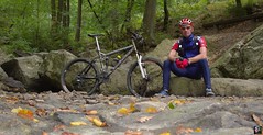
In Tinlot I switch from the White route that I have been following onto the Red route. This is the more difficult route and things get really serious quite fast. Past Stree and into the Bois de Lonfontaine where I encounter the first really muddy patch. Yeah, Nandrin wouldn't be Nandrin without at least one mudhole. Into Outrelouxhe for a descent along a little river. This is by far the most beautiful part of the route and today I wanted to check out an option for an extra climb. Descending all the way along the Bois des Dames and then make my way up the crest. Well, I was walking up that crest. The narrow and steep track was just too difficult to ride. It looked more like a gully with rocks, and muddy . So I walked 3/4th of the climb until the slope got a little less steep and the track dried out. From then on I could ride. I descended along the track I normally ride up. This track is rock-strewn and very difficult to negociate. I left the speed a bit high and luckily the Merlin carried me over the rocks without flinching. I believe any lesser bike might have meant a bad fall. Down the slope and I turn to the left to follow the river upstream a bit until I turn left again for a very steep climb. This one is dry but covered with a lot of tree rubble left behind by forestry works. I have to dig deep but I make it all the way to the top. The descent towards the culminating rocks gives me time to recuperate. I stop to eat a bit, check out the bike and take some pictures.
I'm well into the ride now and only have about 15k left to ride. The singletrack leading from the rocky outcrop over the ridge and then down towards the Rue d'Oxhon is overgrown and I have to ride low to avoid the branches. At the bottom I check my body for spiders and ticks. Some Deet keeps most of the bugs away but it doesn't hurt to check now and then. The last climbs - the first 2 on a narrow tracks between two barbed wire fences and the last one in a forest, steep and long, sap the last of my strenght out of the legs. But then I'm back in Nandrin. When I look at my average it is the highest I ever done here. Even with the walking section. I believe this is mostly due to the bike and the exceptionnally dry trails I found here today. Still, I'm very pleased with my ride, I felt strong in the beginning, only beginning to fade after the walking session but I was able to find some extra strength to complete the ride in good speed. I have added a link to the GPS track of today. Please take note that the northernmost section includes a very difficult walking section.
Ride Stats : 49K and 840/912 heightmeters (Polar/Garmin) in 2h50mins
GPS Track on Garmin Connect : CLICK
5625,5/54685
01-08-2009, 19:50 geschreven door Big Bad Wolf
|
|
|
|
|
|
|
| Gastenboek./.Guestbook |
Druk op onderstaande knop om een berichtje achter te laten in mijn Gastenboek. /
Press the button below to write in my Guestbook.
|
| Email Me |
Press the button to send me a mail
|
|
|
|