|
|
|
| Tales from the Woods |
|
|
| 15-11-2011 |
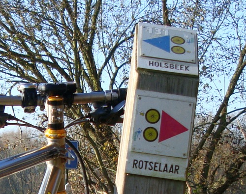
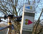
 Bloso routes Holsbeek Bloso routes Holsbeek |
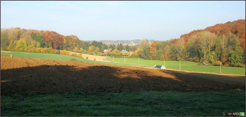
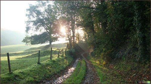
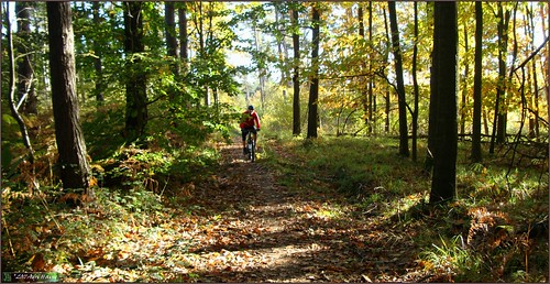
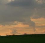
Had a day off from work today and I was looking to do a long offroad ride to enjoy the dry november weather. The night saw the first freezing temperatures and when I rode out around 11AM the temperature was still a fresh 3 degrees C.
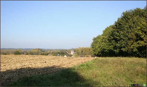
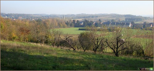
The plan was to connect over the road to the place where the Holsbeek BLOSO routes come closest to the church of Linden. So I rode 15K through Korbeek Lo and Linden and met up with the route near the place they call the "bed of Napoleon". Legend has it Napoleon Bonaparte slept here during one of his outings in our country.
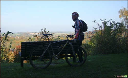
Starting the track on my Garmin Edge 705 and I was off on the Blue track of the Pynnock routes , as they are also called. Nice descent to start with and the route meanders to Kortrijk-Dutsel. Some field roads, some backtracks and the occasional singletrack. Going gently up and down I am now on the Red route and in the neighborhood of Sint-Pieters-Rode. A lot of field roads here and also some tarmac. I see a nice hill to the east but the route does not seem to be concerned with climbing and it turns back to the north.
Missing the Horst castle which is very close - one wonders why they did not pass here, it is a beautiful castle - and now the track arrives in the neighborhood of Nieuwrode. Here, it makes a lot of loops to connect some nice tracks, some uphill, some downhill. This is a very nice and intense section which ends when the track comes on the Sint-Jobs route and turns towards the west.
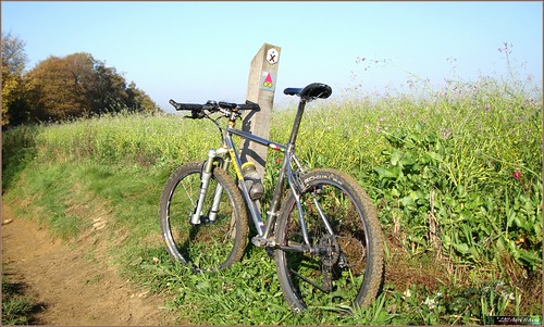
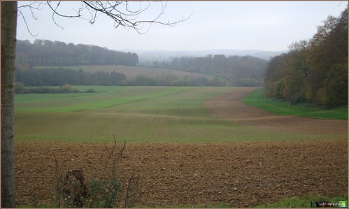
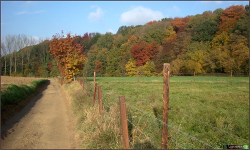
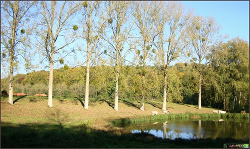
The sun is at its highest point now and I enjoy its rays whilst I ride to the south of a forest. There are a lot of appletrees here . The route now comes in the neighborhood of Holsbeek and I have long forgotten which color of arrow I am following now. The track I have on my GPS incorporates all the routes and I have seen Red and Blue arrows , then Red again and now I arrive at a section where the Red Rotselaar Bloso route shares the same road as the Blue Holsbeek one. A little further the tracks split up.
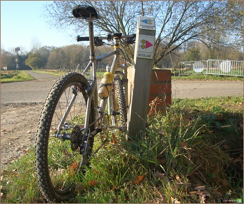
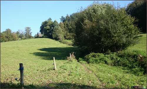
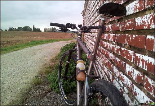
I follow my track and I can report that there are no arrows missing. They all seem well-placed and properly maintained. I leave Holsbeek and I am now on the Green track. Things get serious when I arrive in a big forest. The track meanders up and down and keeps on doing so for more than 10K. This is for sure one of the highlights of the Holsbeek BLOSO routes. The steep hills and tricky downhills keep you busy. Meanwhile I am nearing my starting point. The complete track is nearly 56K long and has close to 700 heightmeters. Not to be scoffed at for sure.
I feel my legs are well spent and I am more than satisfied with my ride on these tracks. There are some sections which incorporate long stretches of tarmac and field roads, but they are used to connect to more interesting tracks and hilly sections. Use the tarmac to recuperate, it is well-needed.
Riding back to Linden and following the GR track over the ridge towards Korbeek Lo. Another 10K to go and I am back in Blanden, with a solid ride under my belt.
Endomondo track
Ride Stats : 86K and 965/1075 heightmeters (Polar/Garmin) in 4h41mins
11887/103315
15-11-2011, 00:00 geschreven door Big Bad Wolf
|
|
|
|
|
| 13-11-2011 |
| Ottenburg |
Since I was unable to attend the Ottenburg TT last friday, today I did the next best thing. I got the GPS track of the 50K - the longest distance - and decided to ride it on my own. I noticed the track incorporated a lot of small loops and even some crossings, so I was forewarned that following it on the GPS might not be easy at those points. But lets see what happens. Leaving home around 10AM with a thick layer of fog still around. The Meerdael Forest was shrouded by layers of low cloud. The temperature was around 5 degrees C and it would not rise a lot throughout the ride. So an extra layer of clothing and thicker gloves were worn. I would regret neither of them.
Picking in on the 50K loop at camping La Hetraie in Nethen the track was still very much notice-able from the many bikers that passed here 2 days ago. This was an advantage, it made following the right trail easier and the trail itself was beaten to a pulp by the many wheels. The grass was wet with condensation but overall trail conditions were good. A little bit moist but not wet. The Ottenburg TT is known for its many hills and this version would indeed honor that tradition. Constantly going up and down, incorporating some fine singletrails and in general connecting the areas' finest climbs and descents, I passed the Bois the Beaumont , rode up into La Malaise and then dropped down towards Florival where they had devised a heavenly loop up and down in the Bois de la Hocaille and then along the singletrail overlooking the railroad. Down into Pecrot the trail followed the valley and then crossed the river Dyle before climbing up into the Langerode forest. Here I would encounter the first problem with the GPS track. Arriving at the top of the long climb I saw three possible trails to follow. My GPS remained stumm - or I did not see the track when it was displayed - so I had to choose. I chose wrong, I arrived in the lush green valley after a steep descent and then went up the steppy downhill on the Red Bloso route. No signal from my GPS that I was on the right track so I decided to try one of the purple lines and dropped down the Tomme. Following the track I chose to take a left towards Wavre. When I arrived at the round point I decided this was no use and rode towards the Start in the Bloemenstraat.
Here I re-started my GPS navigation and this this time I was on the right track immediately. Down into a field and then towards Terlanen. Up and down the Sint Agatha Rode bos ridge a couple of times and then taking another Bloso track in the reverse direction. The heightmeters were accumulating nicely and my energy reserves were being drained at the same time. Arriving at the Langeheidestraat for the second time today, after a mean and steep climb, I now followed the track in the good direction, down the steppy downhill and into the lush green valley again. And then up the very steep ascent towards the top of the Langerodebos. HAving a good look at the GPS I saw the little white arrow just in time to take the right one of the 3 purple lines. Down the Tomme again and then into Gastuche for a little trip into Brabant Walloon and the Dyle valley. Some nice backtracks lead me towards Archennes where another nasty climb was awaiting me. Climbing up to La Malaise the track now veered towards Bossut. Down the singletrack towards the Grand Royal and bedore long I was at the hollow road descent we call the Lianenklim. Stones and steps kept me concentrated until I was at the bottom and then looped back up along a parallel track to complete this very fine little loop. I can imagine some flat tyres and possibly people falling off during the descent of the Lianenklim. It is a nasty one but at least today it was dry and without mud.
Another big challenge awaited a couple of K further down the track. A very difficult climb in a hollow road littered with stones and ruts. One foot to the ground was all I had to sacrifice during this very intense and technical climb. Great stuff. Down into Nethen and I was back at the Savenel from where it was only a short stretch to where I had entered the Ottenburg loop.
Riding back home along the Denteneerspad I was very satisfied with my ride today. Pity I missed a little stretch around Wavre but looking at the overall distance and heightmeters I did not miss out on too much. Next time.
Endomondo track
Ride Stats : 65K and 945/1015 heightmeters (Polar/Garmin) in 4h04mins
11801/102240
13-11-2011, 17:19 geschreven door Big Bad Wolf
|
|
|
|
|
| 12-11-2011 |
| Recovery |

Today called for an easy recovery ride. After yesterdays' long offroad ride I wanted to ease my legs into recovery. The sun was out from the start of the day and it was already past 10 degrees at 10AM. There was a little breeze blowing from the northeast. Ideally suited for a recovery ride so I got the Hilset out and rode to Heverlee and Arenberg on my way to the Sint Jansberg Steenweg. This would take me from Egenhoven to Neerijse where I took a left turn towards Sint Joris Weert. From Weert I rode to Nethen and Hamme Mille. Crossing the N25 I rode through Tourinnes and Beauvechain.
From Beauvechain I took a left turn again and then followed the long cobbled road into Bierbeek. Passing the Vuilenbos and at the Lindenboom I took a left turn and followed the Geldenaaksebaan until I reached the Expressweg. Left turn again for the last stretch into Blanden. A good ride with low heartrate and in warm circumstances. With an average temperature of 13 degrees C during the ride.
Endomondo track
Ride Stats : 43K and 240/285 heightmeters (Polar/Garmin) in 1h58mins
11736/101225
12-11-2011, 14:31 geschreven door Big Bad Wolf
|
|
|
|
|
| 11-11-2011 |
| Hallerbos Extravaganza 3 |

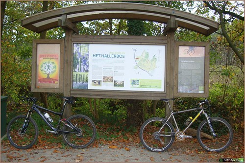
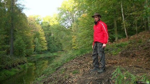
Connecting 4 forests, that is about what this ride comes down to. I made an appointment with my friend Johan H. to start at 9AM and we left Blanden whilst the weather was still cloudy and temperatures were no higher than 6 degrees C. I wore more than enough insulation and I would certainly not regret this. We rode into Meerdael Forest to ride towards Sint Joris Weert where we left the forest and made our way out of the Nethen valley and over the crest into Neerijse. The valley of the Ijse provided us with our next climb and we made our way towards the Ganspoel and down into Duisburg. Up again to the twin water towers and before long we were into the majestic Sonian Forest.
In Sint Genesius Rode we exited the Sonian and made our way along the Zonienwoudlaan towards the edges of the Hallerbos. At the Sept Fontaines starts a GPS track that would bring us into the Hallerbos and further south towards Braine l'Alleud and then through the Lembeekbos back to the Hallerbos. This is a pretty neat track with some 700 heighmeters for its 36K distance. Always up and down, and sometimes very steep as well. Draining our legs with every climb so we made sure to eat and drink regularly.
Around 1PM the sun came bursting though the low cloud cover and the area brightened up considerably. The wealth of autumn colors now shone in full splendour in the rays of the sun. For the first time today I felt a little warmth instead of the dry southeasterly wind. Arriving back at the Hallerbos for the last stretch of this impressive track we could enjoy a myriad of leaves on the forest floor, hiding sometimes dangerous adversaries, like roots, stones, gullies, mud patches and more of the kind. But we came through without any trouble.
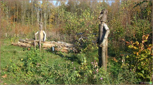
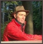
With a little less than 80K on our counters we started on the way back towards the Sonian Forest and beyond. Arriving at the edge I paused to make a picture of the 2 Stooges. They have been moved and have received new heads and limbs. Picture proves it.
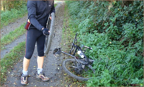
I decided to ride back along a slightly different way so we rode to the edge of Tervuren and then through Duisburg and towards Leefdaal. Johan had a flat front tyre and I paused while he fixed it like a pro. A big injection of Co2 into a new inner tyre and we were quickly on our way again for the last stretches towards Heverleebos and ultimately Meerdael Forest.
Arriving in Korbeek Dyle and riding towards Oud-Heverlee the Korbeekdamstraat was painful to the legs. Into Heverleebos and Vaalbeek where we split up. Johan was close to home and I only had a little stretch to ride along the edge of Meerdael Forest before I arrived home myself. A very tough and long but also satisfying ride. With an average temperature of 8 degrees C the forecast 12 degrees were never reached. But it was dry so I did not complain about the weather. On the contrary, we should consider ourselves very lucky to have such conditions in mid-november.
I noticed I crossed the 100.000 heightmeter mark during this ride. Which means I reached one of my goals for biking already this year. The other one being the 12.000km mark.
Endomondo track
Ride Stats : 112K and 1370/1480 heightmeters (Polar/Garmin) in 6h09mins
11693/100940
11-11-2011, 17:22 geschreven door Big Bad Wolf
|
|
|
|
|
| 08-11-2011 |
| Mollendaal and Meerdael |
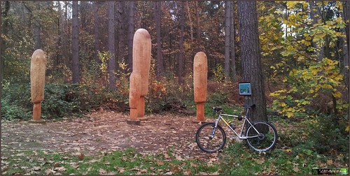
It was a bit misty and overcast when I rode out in the late afternoon. After a days' rest I wanted to do another offroad ride in my home forest. Starting out on the lap I did a couple of days ago, but in the opposite direction , I rode through Mollendaal forest and then decided to ride to the Hercules Salon in Meerdael forest to have a go at my climbing lap. This consists of three climbs and descents in about 4K. When I arrived at the Hercules Salon I saw that Ad Wouters had made another sculpture. Taking a picture before starting on the first of 2 laps of my climbing lap.
The forest floor was dry and hard, and grip was good. The only problems consisted of a multitude of fallen leaves blocking the view on the various roots and ruts. Especially in the downhills this was tricky and necessitated good concentration of the rider. Me .
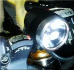
The climbs went well and I returned to Mollendaal forest along the same path as I came. Another passing along my lap there and I was close to home. The last 10K had me blazing my Lupine because darkness was falling fast. The temperature was a mild 11 degrees C and they forecast 15 to 16 degrees in the next couple of days.
Endomondo track
Ride Stats : 37K and 520/560 heightmeters (Polar/Garmin) in 2h13mins
11582/99460
08-11-2011, 18:35 geschreven door Big Bad Wolf
|
|
|
|
|
| 06-11-2011 |
| Owl Hollow |

Felt tired in the morning so I decided to wait until dusk to ride out. This meant another nightride which I solved by riding laps again into Mollendaalbos. I had very bad GPS reception, my Garmin failed to find any satellite and the Endomondo tracker also took a lot of time to give the GPS OK message. I fear the total amount of heightmeters which my Garmin gave me might be a little on the optimistic side, since I started out at 5m altitude and it picked up 60 metres during the first couple of kilometers into the ride. So 450 to 460 might be more realistic than the 515 it gave me at the end of the ride. The GPS signal remained bad throughout the ride.
The first 2 laps were completed in the quickly fading light. I had expected the tracks would be wetter than last friday, because it rained a bit in the night from friday to saturday, but to my surprise they were actually dried out almost completely. The leaves on the tracks were still making them very treacherous, especially since I slightly modified my loop to incorporate another singletracks which has quite a few roots crossing it. The last 3 laps I had the Lupine Tesla on and the speed remained as fast as the first laps. There was quite a bit of noise in the forest, some owls for starters, and I saw one or two of them flying along at the edge of my lightcone. When darkness fell completely the last walkers had left the trails and I was all alone - with a million creatures lurking just beyond my beacon of light. Or so I imagined. A vivid imagination can run some shivers down your spine in these conditions but at least you do not see what lies in the darkness.
Back to the ride, that went fine, my legs were not in tiptop shape but I left my backback at home which saved me almost 3 kilograms of weight. I figured that since I did not venture further than 3-4K from my home, having a flat would not cost me more than a 30-40 minute walk. I could take one of my Vittoria Pitstop bottles with me on these kind of rides, which might inflate a flat just enough to ride home.
Riding without a backback is indeed allowing me to breather easier and puts less strain on my shoulders and neck. I might consider doing this more often.
Endomondo track
Ride Stats : 42.5K and 395/515 heightmeters (Polar/Garmin) in 2h14mins
11545/98900
06-11-2011, 19:40 geschreven door Big Bad Wolf
|
|
|
|
|
| 05-11-2011 |
| Cobbly ride |

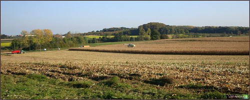
The past night saw some rain falling so this morning, when the sun came bursting through I decided to take the Hilset and do an easy recovery ride. Setting out along Haasrode, Bierbeek and Bremt I passed Willebringen , Kumtich and Oorbeek on my way to the Marollenkapel in Houthem. Stopping there for an obligatory break, enjoying the sunrays whilst the wind was just a slight breeze from the east. Riding down into Hoegaarden I set towards Zetrud-Lumay where I was greeted with a long climb on cobbles towards Saint Remy Geest. The Hilset is not bothered too much by cobbles so I decided to take another kilometer-long stretch of cobbles bringing me to Jodoigne.
By now I had more than enough of the rounded stones and I followed the N240 until I could take a right towards Melin. From Melin I rode to Sart-Melin, coming on the N240 briefly again, before turning right towards La Bruyere and Beauvechain. From here I rode to Tourinnes and Hamme Mille and then followed the N25 through Meerdael Forest towards Blanden. The temperature throughout this ride was a gentle 16 degrees C and I arrived home with a satisfied feeling in my legs. The bike looked a bit muddy from the small tarmac roads which where still wet and muddy from the passing of agricultural devices.
Endomondo track
Ride Stats : 61K and 445/505 heightmeters (Polar/Garmin) in 2h45mins
11502/98385
05-11-2011, 14:14 geschreven door Big Bad Wolf
|
|
|
|
|
| 04-11-2011 |
| Laps into dusk |

November is upon us. That means that the evening rides are turning into night rides. I started out with the Litespeed Obed along a loop I walked yesterday. Into Mollendaal forest and back over Hoog Blanden. The loop is about 9K long. The first 3 laps were completed in the fading light and the last 2 ones I needed the Lupine Tesla to light my way. By then I did of course know the track by heart, the leaves made it a very rustly ride. The loop is a good mix of singletracks and wider forest roads. Incorporating one steep but short climb and a longer one that goes up to the highest point in this forest. The track then goes down towards the edge of the forest and follows that into Hoog Blanden, alongside the cemetery and then past the Rooikapel Hoeve. A bit further I turn into the Lijstersstraat and back into Meerdael Forest for another lap.
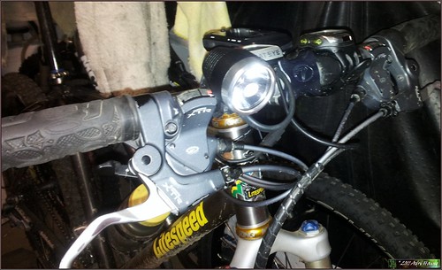
As the light began to fade and the darkness came upon me I switched on the Tesla I had mounted on my handlebar. It illuminated my path just fine. I will need to get some clear glasses for this time of the year and leave the colored ones at home. I think I will have a look at some option chez Chainreaction Cycles later this evening.
Endomondo track
Ride Stats : 46K and 350/420 heightmeters (Polar/Garmin) in 2h16mins
11441/97880
04-11-2011, 19:10 geschreven door Big Bad Wolf
|
|
|
|
|
| 30-10-2011 |
| Bierbeek - Meerdaal 2000 organised ride |

The winter hour was upon us and this meant that we all could sleep an hour more in preparation for todays organised ride. I was helping the organisation of the Bierbeek organised ride and when I left home just before 7AM the temperature already was a mild 12 degrees C and the sun was still hiding behind the horizon. My Lupine Tesla helped me find my way in the semi-darkness and when I reached the start at Bierbeek, the rest of the guys were already busy preparing for an invasion of bikers.
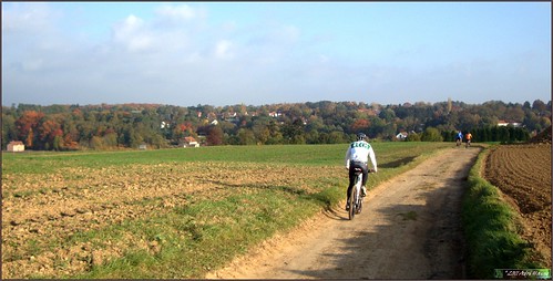
I left with Joel to ride the first stretch up to the rest stop at Gottechain. The arrowing was still very much present and we only had to stop once to change a dubiously placed arrow. When we arrived at the rest stop Joel continued on the 45K loop while I chose the 55/65 track. There were a lot of scouts in the Grez-Doiceau area this weekend so care had to be taken in the descents. I met up with Bart who told me that someone had removed the signposts which marked the 55/65 split, just before Heze. He took a shortcut to that spot while I followed the track through Cocrou . When I arrived at the split, Bart was already there, guiding the bikers on either of the 55 or 65K track. A new signpost would be delivered soon. I continued into Heze and started on the long climb that would lead me to the Chapelle du Cheneau in Longueville. The cobbles were wet and the sun was shining in my face through the foliage of the trees alongside the hollow road.
A little bit further , I met up with Frank who informed me that a small disaster had struck. Seems that every arrow since the 55/65 split had been systematically removed. I rode past him and indeed, all arrows were gone. It became even more serious and devious. Past the Chapelle du Cheneau and entering Longueville, a new track had been signed !
I had the original track on my GPS and when I arrived at a crossroads where I knew our track veered to the right, I saw arrows pointing straight ahead. I thought it must have been a last-minute track change so I continued and followed this new track until I came on the fields overlooking Gistoux. Here all arrowing stopped.
So not only did they remove 10K of arrowing, they also took the time to put up some new arrows, clearly with the intention of leading the passing mountainbikers into oblivion. Organised crime at an organised ride?
I made sure to put new arrows leading from this spot back to the original track. Further along I was passed by bikers which meant that my arrowing was working. In the mean time, Bart and Frank were also doing their best to re-arrow the rest of the 65K loop back into Heze.
Past Heze a long singletrack took us up into Biez and another singletrack brought us back down and into Grez Doiceau.
Here the signage appeared to be OK again. Completing the 55/65K loop I now rejoined the bikers on the 45K loop. There were masses of them. I could enjoy the beautiful weather a little bit more whilst riding my bike through Archennes, La Malaise and then towards Pecrot. The trail was beautiful but the succession of climbs was demanding on the legs .
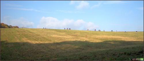
The arrowing was impeccable now . It appears only the extra loop of the 65K had been targeted. Still, I can imagine a lot of bikers who were mislead. I encountered big groups of them and they were very happy that someone could point them in the right direction. I could feel the fatigue in my legs and I also felt hungry when I reached the end of the ride. I was told that there were 1700 bikers today, which is some kind of record for this organisation I'm sure. I hope they all had a great ride and for those who had to look for arrows on the 65K, my sincere apologies but we did our best to get the arrowing back in place as soon as possible.
Endomondo track
Ride Stats : 77.5K and 870/985 heightmeters (Polar/Garmin) in 4h01mins
11287/96290
30-10-2011, 13:41 geschreven door Big Bad Wolf
|
|
|
|
|
| 29-10-2011 |
| Nil Saint Martin |
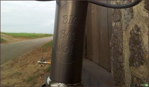
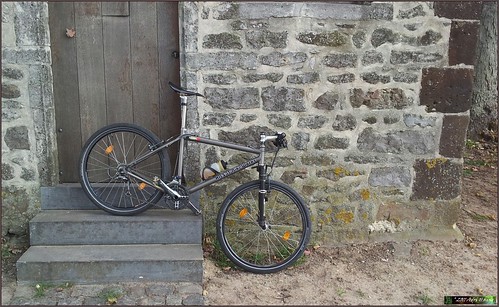
Legs felt still OK after yesterdays' ride so I rode out again today. Taking the Hilset "Big Bad Wolf" custom titanium bike I decided to do a little exploration of the area past Corroy Le Grand. I started out over Sint Joris Weert and Ottenburg, riding into Basse Wavre, climbing out of it and then taking a right towards Dion le Val. Following a parralel road to the Chaussee de Huy I rode towards Vieuw-Sart and then onwards to Corroy Le Grand. There are a lot of small tarmac roads in this area, mostly to help the farmers get to their fields. But following a direction in this maze of roads is not easy. I more or less concentrated on keeping the sun to my right to judge which road to take.Before long I reached Nil Saint Martin where I had to decide whether I would take a right towards Mont Saint Guibert, or take the other option and try to make my way towards Sart-Risbart and Incourt. I chose the latter option and had a peek at my GPS screen to make sure which tarmac road to take. I did not want to go too far because I have an obligation to the organisation of the Bierbeek organised ride tomorrow. Doing too much today would hamper my fitness, much needed on the 65K offroad track that awaits me tomorrow.
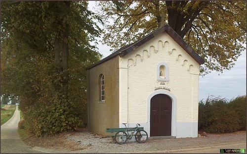
Undercrossing the E411 , leaving Libersart to my right, I made my way towards the Chaussee de Huy and after crossing that took a plunge towards Sart-Risbart. Stopping for a snack besides a chapel dedicated to Sainte Wivine, I also took the opportunity to take a picture.
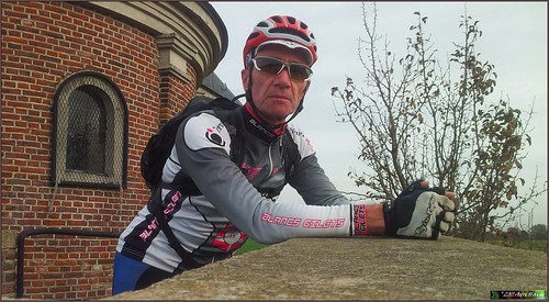
In Sart Risbart I came on better-known territory and quickly puzzled out my way towards Longueville. Stopping at the well-known Chapelle du Cheneau I took a couple of pictures of the Big Bad Wolf.
When I left Longueville and made my way towards Heze, the sun shich had been hiding behind a veil of clouds, came out and the autumn colors brightened up my horizon. Into Grez and then the N25 towards Hamme Mille. I arrived home with a solid ride behind me. I have changed the light but stiff and uncomfortable Crossmax 1 wheels for a set built around 1992 XTR hubs. This set is a lot more comfortable and also rolls smoother. Even after all these years, soon 20 , the XTR hubs still do their job silently and precise.
Endomondo track
Ride Stats : 61.5K and 465/525 heightmeters (Polar/Garmin) in 2h40mins
11210/95305
29-10-2011, 16:01 geschreven door Big Bad Wolf
|
|
|
|
|
| 28-10-2011 |
| Warm day |

Leaving around 4pm the temperature was still an exceprional 17 degrees C. Exceptional because after all, we are nearly november. I took the Hilset out for an LSD ride along Bierbeek, Meldert, L'Ecluse and into La Bruyere. Here I returned towards Beauvechain, Opvelp, Neervelp and ultimately Bremt. The bike still feels awkward to ride , I am still not used to riding a mountainbike on the road after the plentitude of kilometers on the Vortex these past 5 months. Still , the average speed was getting better than the last couple of rides. It is hard to imagine I have already done thousands of kilometers on this bike. But I am sure I will get used to it as I ride it more and more during the cold and dark months ahead.
I tried another tracker today, Garmin Fit, at the same time as my usual Endomondo tracker. With the Garmin Fit application the data is saved into your Garmin Connect account.
Endomondo track
Ride Stats : 45K and 255/310 heightmeters (Polar/Garmin) in 1h56mins
11149/94780
28-10-2011, 18:34 geschreven door Big Bad Wolf
|
|
|
|
|
| 26-10-2011 |
| Meerdael climbing |
Yesterday saw a spot of rain but today the sun was out again. Good thing because I had an appointment with Johan H. for a mountainbike ride into our local forest. It had drizzled so the tracks were a little bit moist and here and there a puddle gave proof to fact that the sun's drying force was mostly gone . There was quite a breeze blowing from the west so the plan was to stay in the forest as much as possible. Johan told me to lead so I set out on a loop that would bring us towards Nethen for a spot of climbing and descending. I love the little twisty tracks there, steep, eroded and quite a challenge to ride, be it uphill or downhill. As it turned out we accumulated quite some heightmeters here. The tracks were great and challenging.
After a while we left the forest and rode into Nethen. We left it climbing along the Ruelle du Cure towards the Bois de Beaumont. Rounding this small forest we arrived in Pecrot. Following the GR up to the ridge and then we could ride down along a long hollow road towards Nethen again. Taking a right turn onto a cobbled road which emerged into the La Malaise fields. Here a sharp left turn had us riding down a very difficult hollow road riddled with a lot stones and very deep ruts. Quite a challenge. Into Nethen again where I chose to slowly ride towards the Meerdael Forest. A steep climb and then another technical drop into Nethen before we took a right and followed the Savenel wall for the long climb along the Blue Bloso track. Taking a right at the top and another one after a twisty singletrack and we joined the Savenel wall again. We were now close to La Trace and we rode through the farm with the same name . Things mellowed out a bit as we rode down and past the Warande ponds - another steep climb here nevertheless. On top of that we rode towards - and crossed - the Naamsesteenweg to make our way to Valduc. Down into Hamme Mille, following a track along the Ry Saint Martin towards the Valduc estate. The forest colors were striking as the sun slowly dropped towards the horizon. Passing the forestry house overlooking the fields of Mille, we entered the forest again for a last stretch along the Eleonore Dreef and the Margrietendreef into Blanden.
Endomondo track
Ride Stats : 37.5K and 555/565 heightmeters (Polar/Garmin) in 2h21mins
11104/94470
26-10-2011, 19:24 geschreven door Big Bad Wolf
|
|
|
|
|
| 23-10-2011 |
| Meerdaal 2000 65K far loop |

As expected the weather remained good during this second day of the weekend. So I went out again for an offroad ride. This time I planned to first ride to Gottechain to the point where the 45K loop - which I did yesterday - splits off from the longer distances of 55K and 65K. The forest was still cold when I followed the Naamsesteenweg to Hamme Mille and then made my way to Bossut and Gottechain, crossing the Lambais valley.
The plan was to do the extra 20K loop of the 65K . From Gottechain the trail leads me southwards to Cocrou and things start to get serious right away with a long difficult climb up into the Bois de Beausart. The roots on the track require extra attention and a certain belief in yourself and the bike to make it over them without stalling or stopping. Luckily the technical prowess is there and with the track being completely dry I can drive the bike over them without even a wheel spinning.
Down along a cobble track into Cocrou where another climb takes me all the way up to the Grand Sart farm . Down into Heze and then back up for a long climb, starting over wet cobbles and ending in the fields where the Chapelle du Cheneau marks the end. From here I ride into Longueville and then down an exciting downhill into the Bois de Bonlez. The track is wet here from a little rivulet that follow and crosses it. But I manage to keep my bike as good as dry by carefully choosing where I place my wheels.
Down into Bonlez and then taking it easy on a very long climb - again - taking me up to the Bois de Glabais. From here its down into Heze again. Then along a sandy track towards Morsaint where a very steep climb along a nice singletrail awaits me. I'm in Biez now and riding past the church I enter another singletrack leading down towards Grez-Doiceau. It is wet here, the trails lies in the shade, so care has to be taken. A beautiful view of Grez makes me stop to take a picture.
Leaving Grez to my left I quickly regain the last climb, back into Gottechain. A difficult trail, very steep and rutty. But I make it.
I am back where I started exactly 20K earlier. This was the far loop of the 65K Bierbeek ride. If you want to ride it, be there next sunday.
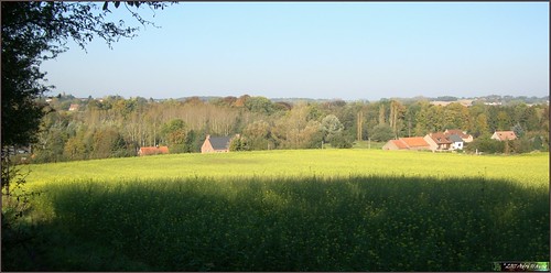
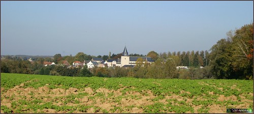
Having completed my reconnaisance task I decide to ride over to Tourinnes-la-Grosse and pass through the Valduc estate . Past Gottechain I make my way into Nodebais and then upwards following the field tracks to get a good view of Tourinnes' big church. Taking a picture while it is basking in the sun. The sun was really out today and the average temperature throughout this ride was 12 degrees, which is 4 degrees more than during yesterdays' ride.
From Tourinnes I ride to Valduc and then into Meerdael Forest for a last stretch in the now warmed up forest. The sun on my back felt great whilst cruising home.
Endomondo track
Ride Stats : 46K and 610/670 heightmeters (Polar/Garmin) in 2h36mins
11027/93420
23-10-2011, 17:34 geschreven door Big Bad Wolf
|
|
|
|
|
| 22-10-2011 |
| Meerdaal 2000 45K loop recon |
Had to wait until today to ride a bike again. My cold was better and riding should help drain my nose and sinusses from the last remainders of the virus. I chose to do a recon of the upcoming Meerdaal 2000 ride - sunday the 30th of October in Bierbeek - and decided to start out easy with the 45K distance. The weather was cold but clear skies and a breeze from the east. Around 11am the temperature had risen well above 0 so I donned my new Assos Fugu socks and Early Winter gloves. Both turned out to be amazingly suited for the purpose.
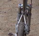
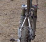
The trail was dry and my bike - the Obed - performed well. Only bother was that I could not get my Polar to receive a signal from the speed sensor. Oh, I would have to do without that during this ride. I could still record my heartrate and that was the most important. Upon arriving home I discovered what was wrong - the sensor on the fork had shifted downwards. Probably during the maintenance that it received last week.
Talking of that fork, it performed beautifully.
My heart rate was still rather high during the ride but my legs felt strong . You can check out how the loop goes on the Endomondo link below this entry. The first bit was mellow and going through a very cold Meerdael Forest. When I arrived in Valduc I felt the warmth of the sun and the ride became a lot more comfortable. The wind was noticeable but I was well-protected by multiple layers of clothing.
Entering Gottechain where the split between the 45K and the 2 longer distances of 55 and 65K was, I took to the right into the valley and towards Bossut.
In and around Archennes the track becomes more challenging with a couple of demanding climbs and tricky descents. Afterwards riding towards Pecrot and entering the Meerdael Forest again in Nethen, things mellow out again. By then I began to feel my legs though and the last couple of K's towards the Zoete Waters and up to the Keiberg were done pretty relaxed to spare my legs and avoid going too deep into my reserves.
Arriving home I noticed the average temperature was 8 degrees C, which is not bad on a sunny late October day .
Endomondo track
Ride Stats : 46K and 545/600 heightmeters (Polar/Garmin) in 2h36mins
10980/92750
22-10-2011, 15:22 geschreven door Big Bad Wolf
|
|
|
|
|
| 20-10-2011 |
| Forest walks |
Howdy. I have been suffering a cold since last friday so I had to take it easy for a couple of days. Stayed in throughout the - wonderfully sunny - weekend and when I started to feel better on monday I decided to go out for a walk in the Meerdael Forest. Walking is another way to enjoy the beauty of the forest and it gives you another perspective on all things that roam around. I started out with a 1h30 walk which netted me a little less than 7K.
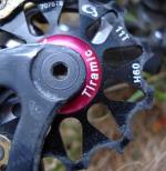
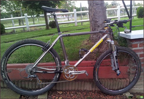
In the meantime I also had my Litespeed Obed serviced at Filip Sport. The Fox RLT80 fork has been overhauled and I also put on a new chain and XTR cassette. Some glamour in the form of a golden jockey wheel was also welcome. This bike will carry me through the muddier rides which are sure to come in the next couple of months.
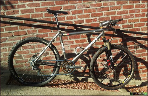
If it is cold and dry I will opt for the Moots, which also was overhauled and received a new chain and middle ring. The chain is a blue Wippermann 920 teflon and the middle chainring is a Middleburn 36T . I also replaced the big ring by a Goldtec 46T which has been gathering dust for almost 10 years waitng for the old Race face 46T to wear out. .
Yesterday I went for another - slightly longer forest walk which took me towards the Warande ponds and back . Almost 9K this time in just a tad over 1h50mins.
I'm looking forward to this weekend, my cold is better and the forecast calls for sunny weather again.
20-10-2011, 18:34 geschreven door Big Bad Wolf
|
|
|
|
|
| 12-10-2011 |
| drizzly |
Today saw a mix of light rain and dry periods, still a lot of wind and temperatures around 15 degrees C. It was dry when I left on the Hilset for a ride that would take me on a loop through Bierbeek, Opvelp and Meldert. From here I turned right and then left into L'Ecluse. From L'Ecluse I quickly reached La Bruyere and set towards Beauvechain. I noticed the dark clouds coming nearer and before long I began to feel a light drizzle falling down. I wore a sleeveless windstopper over my long sleeved jersey and the rain did not bother me much. Riding through Tourinnes-la-Grosse and Nodebais I stopped for a little break and took a picture of the Hilset overlooking Hamme Mille in the distance. Riding the Hilset differs in many ways from riding the Vortex. The Hilset offers a harsher ride. Looking at the saddle one can imagine the comfort offered by the Tune Speedneedle is far less than that of the Brooks on the Vortex. But the wheels as well are more jumpy as is the frame. The aluminum stem, carbon handlebar and Pace fork add to the whole experience. Good thing the frame and seatpost are made of titanium, otherwise this bike would feel like a pogo-stick.
From Hamme Mille I followed the Naamsesteenweg into Blanden and rode on through the Brainestraat and towards Heverlee where I did a double right into Heverleebos to return to Blanden to finish my ride. The light drizzle remained with me until the end of the ride.
Endomondo track
Ride Stats : 45.5K and 295/335 heightmeters (Polar/Garmin) in 1h56mins
10934/92150
12-10-2011, 18:44 geschreven door Big Bad Wolf
|
|
|
|
|
| 10-10-2011 |
| Return on the Big Bad Wolf |

Three days of rest because we had 3 days of rain. As it turned out my legs felt stiff but I could feel there was also power hidden in there. Today was the first time I was back on the Hilset BBW custom titanium hardtail. This is the bike I use for road rides in winter and the wet months of fall and spring. After more than 8000km road kilometers on the Litespeed Vortex - a proper roadbike - it will take some getting used to ride slower and on a bike that is not as lenient as the magnificent Vortex. The Tune Speedneedle made itself feel during the first part of the ride. Like I said, this bike will take some getting used to.
I rode out over the Weertse Dreef and into Sint Joris Weert. Then to Nethen and in Pecrot I rode up the hill towards Malaise and over the cobbles to Bossut. I paused briefly at the farm where my dad was born to take some pictures.

Moving on and into the harsh wind I rode down to Archennes and then towards Dion Valmont. Crossing the Chaussee de Huy and then riding parallel to it, enjoying the peace and quiet of the little backroads. Steep, narrow but the Hilset is well-geared to taken on even the steepest climbs. In Gistoux I was glad to have the wind in my back and when I climbed on the plateau again to reach Longueville I was making good speed. Down towards Heze and further into Grez I had the wind from the side and it was trying to topple me over. Some black clouds as well but luckily it remained dry throughout the entire ride. Entering Bossut for the second time and then down towards Hamme Mille. Following the Naamsesteenweg into Blanden I decided to add another loop, taking advantage of the fine weather - well, the dry weather - riding along the Naamsesteenweg to La Chasse and then taking a right towards the Commemoratory graveyard, there a right again towards Blanden again. Notwithstanding the wind and the stiff legs I had a fine ride.
Endomondo track
Ride Stats : 62.5K and 555/650 heightmeters (Polar/Garmin) in 2h45mins
10889/91815
10-10-2011, 19:36 geschreven door Big Bad Wolf
|
|
|
|
|
|
|
| Gastenboek./.Guestbook |
Druk op onderstaande knop om een berichtje achter te laten in mijn Gastenboek. /
Press the button below to write in my Guestbook.
|
| Email Me |
Press the button to send me a mail
|
|
|
|