|
|
|
| Tales from the Woods |
|
|
| 21-06-2011 |
 Forest and Field Forest and Field |

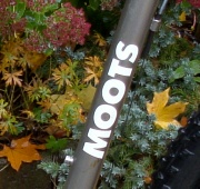
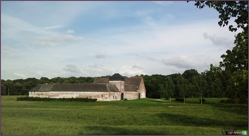
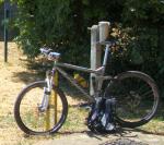
After some showers during the night and the morning it stayed dry from noon on so when I got home around 5pm I decided to take the Moots out for a spin through Meerdael forest. First taking some small tracks making my way towards Mollendaal. It was rather warm and moist in the forest and I was glad there was a bit of wind when I left the forest to enter the fields towards La Bruyere and l'Ecluse. The field tracks were dry with the occasional small puddle. Working my way towards Melin I turned more and more into the wind. Passing the big Wahenge farm near Sclimpre I stopped to take a picture with my Galaxy S II. I am quite pleased with the quality of its pictures. The Galaxy S I already had a fine camera which made super macro pictures. The new one has 8 megapixels (from 5 for the I) and also incorporates a flash.
Riding into Pietrebais I followed the little river with the same name for a while before climbing up to the church and riding through the fields again towards Gottechain. Crossing the N25 near Guertechain and making my way past the Grand Royal and the Petit Royal. In Nethen I climbed back into Meerdael forest near Les Claines. The last stretch into the moist forest brought me back home. The longest day was a bit clouded but when I arrived home around 8pm the sun was still high up.
Ride Stats : 44.5K and 350/415 heightmeters (Polar/Garmin) in 2h18mins
4720/47755
21-06-2011, 21:39 geschreven door Big Bad Wolf
|
|
|
|
|
| 19-06-2011 |
| Foes and Friends |

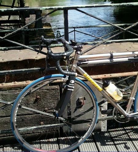
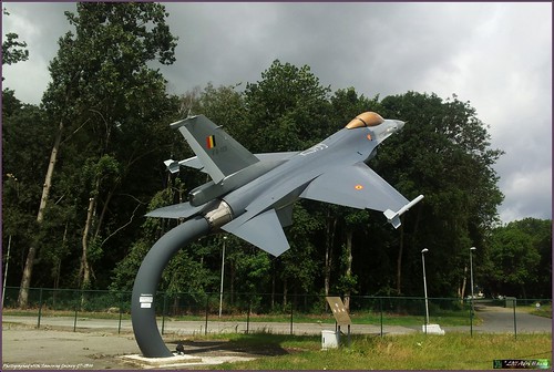
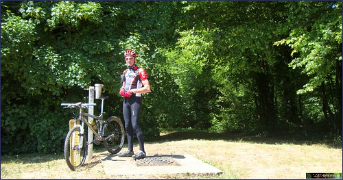
Looked like it would stay dry after a night full of showers. Offroad would be very wet so the Vortex came out again and I set off for an LSD ride starting out towards Bierbeek . I was thinking about friends and foes of a biker when the wind was blowing me up the hill out of Blanden. The wind can be a friend but it can also be a foe, as I was about to experience whilst my ride developed further. From Bierbeek I rode towards Opvelp and then took a right towards Beauvechain. The wind was blowing in my face now. Not straight on, more of 3/4th from the front. But it was blowing hard and gusty. So I had to take a firm hold of my handlebar. Downhill towards Beauvechain and then straight through towards La Bruyere. Little umleitung here taking me to the entrance of the 1st Wing Airbase. Stopping to take a picture with my new Samsung Galaxy S 2. It has a build-in GPS and when switched on you can add the GPS coordinates to the picture. Cool.
From La Bruyere I rode towards the big road to Eghezee. The cloud cover was menacing but I decided to take my chances and hope to avoid the other bikers' foe; rain. From Happeau I rode towards Longueville. On the road towards that little town I overtook 3 bikers. I decided to stay with them for a while, so they became my friends while we took turns in the front against the wind. In the downhill from Biez towards Grez I went too fast, or they decided they wanted to slow down. Anyways, I was on my own again riding through Grez and then taking the road towards Hamme Mille. Wind was blowing from my left side now and a little from behind so I was soon doing 45kph in the long downhill. Turning left at the lights and here was my foe again, blowing straight in my face while I battled to reach Nethen and the relative cover of houses next to the little river. From Nethen I took my usual stretch , taking me from Sint Joris Weert to the Zoete Waters. Another loop into Oud-Heverlee and then from Heverlee along the Naamsesteenweg into Blanden. Only a couple of stray drops so the forecast on meteox.be was proving to be correct. Lots of clouds but no rain to speak off. Another friend of the biker , that www site.
Ride Stats : 61K and 445/445 heightmeters (Polar/Garmin) in 2h14mins
4676/47340
19-06-2011, 14:31 geschreven door Big Bad Wolf
|
|
|
|
|
| 18-06-2011 |
| Mountainbike intermezzo |
Great, it was cold, damp and wet in the forest. That meant I could risk riding in there and the frisky temperatures meant I did not sweat my ass off wearing protective layers of clothing. There was a fierce wind blowing which kept most insects out of the air as well. I was elated I could go offroad after 3 weeks of riding exclusively on the road with my Litespeed Vortex.
I decided to do the Meerdael Bloso routes, starting with the Blue, hopping onto the red and finishing off with a little bit of green. There was not much use riding the complete green because that meant leaving the protective shelter of the forest and being exposed to the wind, and to a lesser extent , to one of the rain showers.
The Moots felt like a comfortable rolls royce and my long rides on the road were proving to be very good training for being able to push the big gears. I was wearing my TLD protective trousers to add an extra layer of clothing between the horseflies and my skin. As expected, I remained bite-free throughout this ride. I was enjoying riding offroad again, even on the relatively easy Bloso routes.
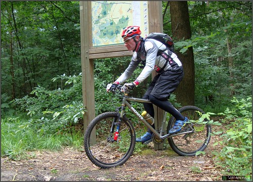
Encountering a couple of mountainbikers , one single girl I passed twice, and a group consisting of 2 men and a girl when I was arriving at the Blue/Red split. I was lucky with the weather remaining mostly dry, only 2 slight showers during my ride. But the heavy cover of the leaves was protecting me from the raindrops. And even then, my double trousers and 2 layers of longsleeved jerseys would not have mad eit easy for the wetness to reach my skin. With an average temperature of 14 degrees C these were the ideal circumstances for me to ride my mountainbike in summer.
Ride Stats : 46.5K and 495/585 heightmeters (Polar/Garmin) in 2h24mins
4615/46895
18-06-2011, 14:33 geschreven door Big Bad Wolf
|
|
|
|
|
| 14-06-2011 |
| Faster |

Well rested and feeling recuperated I set forth for a quick ride around the block in the late afternoon. The sun was out but it wasn't too warm with some clouds obsuring it from time to time. There was a mild wind blowing from the west.
Once past the climb out of Bierbeek I put the chain on the big ring and it didn't come off that ring until I was back home. Maintaining speed wasn not easy on some of the hills, and with the wind in my face it became tougher still. Also the traffic was hampering my going from time to time, making me have to avoid stopping cars by jumping on the footpaths.
And cars are not expecting you to drive that fast as a cyclist either. On the flats I was pushing around 33kph, even up to 37kph with the wind in my back. The loop taking me through Haasrode, Bierbeek, Opvelp, Beauvechain, Tourinnes, Hamme Mille and then towards Nethen and Sint Joris Weert to finish along the Zoete Waters and Vaalbeek was just 31K long, and finishing it in one hour made it easy to calculate my average speed. With an average heartrate of 123bpm I didn't even feel tired afterwards. Good supercompensation after a couple of days riding and a days' rest.
Ride Stats : 31K and 155/185 heightmeters (Polar/Garmin) in 1h00mins
4468/45505
14-06-2011, 18:04 geschreven door Big Bad Wolf
|
|
|
|
|
| 07-06-2011 |
| Ludo Dierckxsens |

Do the Ludo, that was my plan for this afternoon. Starting around 4pm the weather was overcast but warm and there was no rain forecast for the next couple of hours. Yesterday we got - at last - a good amount of rain that will do a world of good for the thirsty nature and the crops on the fields. It rained for most of the day which was sweet.
But today the rain stayed away so I decided to ride out with the Vortex. The Ludo, for those who are new to his blog, is a version of the Ludo Dierckxsens ride that goes into Brabant Walloon. I usually pick it up in Bierbeek and I did so again today. Passing Opvelp, Beauvechain, La Bruyere and the outskirts of Pietrebais before turning towards Risbart and Incourt. I chose the big road instead of the smaller tarmac connections. There was no wind and that road is wide and good-running. In Dongelberg I took a left and then rode to Chaumont. From Chaumont a climb up to the chaussee de Wavre , a quick dip into Dion Valmont and then riding towards Dion Le Mont and ultimately Archennes. Then the track veers towards Ottenburg but turns right again towards Sint Agatha Rode. Not much longer I was in Sint Joris Weert riding towards the Zoete Waters. Adding another loop into Oud-Heverlee and Heverlee, passinge the Caserne and then taking the Expressway towards Blanden. Had a good ride with a good average speed and a low overall heartrate.
I also got my Samsung Galaxy S back from Proximus today. They put the lastest software releases on it so it is now running smoothly on Android 2.2 (froyo). The Galaxy S II is running on Android 2.3 (gingerbread) and has a 1.2 Gigaherz dual core processor, making it as fast as an average PC.
The Galaxy S is for sale, if you need more info, send me an email .
Ride Stats : 75K and 510/605 heightmeters (Polar/Garmin) in 2h40mins
4096/42840
07-06-2011, 19:42 geschreven door Big Bad Wolf
|
|
|
|
|
| 03-06-2011 |
| and the wind shouts back |
Another sunny day and I left around 10.30am for a ride that would take me to Filip Sport. When I came in Terlanen I saw markings of a race that was going to be held this sunday, so I decided to follow those as long as they did not let wander too much of the chosen path to Hoeilaart. The trail was quite hilly with the Smeysberg for starters, then dropping into Huldenberg and out again in the direction of Duisburg. Passing the ganspoel I could feel the wind tearing at the back of my shirt so I already knew that the return journey would be a difficult one. But hey, the sun was shining and I felt surprisingly good after yesterdays 100+ ride. In Duisburg the race track turned to the right but I chose the direction of Eizer. From Eizer straight on towards Overijse and then dropping onto the road to Hoeilaart.
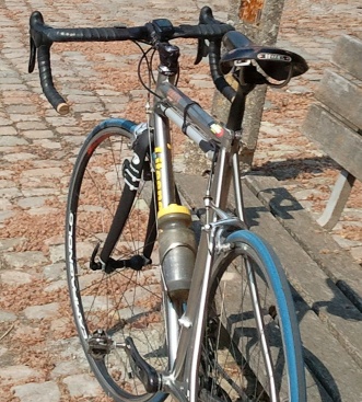
Talked with Filip about the headbadge of my Vortex and it looks like he will be able to install it soon. Pro memoria, he had to order a special type of glue to attach the aluminum headbadge to the titanium frame. We also talked about the upcoming Harre mountainbike ride. I am a bit weary to ride offroad because the old enemy, the horsefly, is around and I don't want to risk getting bitten. But I want to do this ride so I will take all precautions I can take - long trousers, lots of Deet and my special anti-horsefly mix - and then hope I can survive 5 hours of riding in the forests. To be completely at ease I have asked for the guide to mail me the GPS track of the ride, so that I can check if it can be cut short, should the need arise, and where we are back into civilization. Waiting for a reply..
I left Filip and because of the fine weather I decided to add some K's to my original 50-60K plan. Towards Maleizen I rode, and then down into Rosieres and up again towards Rixensart. Wavre and onwards to Dion Valmont. Adding quite a bit of hills to the ride, just to see how the legs would take those. And they took it fine. From Dion I rode towards Bonlez and then onwards to Longueville. Another long hill and now I began to feel the wind . When I turned towards the north I got it full on. I had to think about some lyrics from a Judas Priest song:
"Been inclined to wander
Off the beaten track
That's where there's thunder
And the wind shouts back"
No thunder luckily but the wind was indeed blowing with a vengeance. But the air was cool and crisp into my eager lungs. From Longueville I rode towards Pietrebais to avoid the high plateaus and return more or less protected by the valleys. Into Grez and then upwards to Bossut. From Bossut the road took me on a half cobble-half tarmac road towards Pecrot. Up the steep hill - this one really hurt after 80K - towards Nethen. And then the last stretch from Sint Joris Weert to the Zoete Waters and Vaalbeek. Good ride.
I got my Samsung Galaxy S II today. I ordered one when my Galaxy S turned into a brick. The S is still chez Samsung to be repaired but now I already got its much faster successor.

At first touch it looked fast. But I want to wait until I receive the NoReve leather case before I start using it. Better be protected..
Ride Stats : 101K and 915/920 heightmeters (Polar/Garmin) in 3h58mins
3894/41240
03-06-2011, 16:23 geschreven door Big Bad Wolf
|
|
|
|
|
| 02-06-2011 |
| Perwijs |
 Looked like a fine sunny day for a long road ride so around 9.45AM I started with the Litespeed Vortex on a big lap that would take me all the way to Perwez. Taking the Ravel in Hoegaarden and then split off towards Perwez just past Huppaye. I could have followed the ravel a little further towards Gembloux but the strong wind was making me weary about going too far west and then having to return with the wind in my face. So I settled for Perwez and then made my way towards Chaumont-Gistoux and Wavre, following the N243. Some badly maintained bikepaths between Chaumont and Wavre but once past Wavre I took the direction of Overijse and things gor better. From Overijse I turned into the wind and made my way past Huldenberg and Neerijse towards Bertem. Aiming for a century I decided to follow the N3 to Leuven and then ride round Leuven on the R23 until I found the N3 again, this time going towards Tienen.
Following the N25 and then turning towards Haasrode and Blanden saw me arrive home with a solid ride and a good average despite the windy conditions.
Ride Stats : 110K and 810/810 heightmeters (Polar/Garmin) in 4h01min
3793/40320
02-06-2011, 14:52 geschreven door Big Bad Wolf
|
|
|
|
|
| 28-05-2011 |
| Meerdael Hills by proxy |

Arriving at Theux around 10am I noticed I did not have my GSM with me. Furthermore there was an archery contest claiming all the forest around Franchimont. I did not want to start my planned ride without a GSM so I decided to return home and postpone the ride to another date.
Arriving home I switched bikes and jerseys and took out the Moots for a spin through Meerdael Forest. Feeling rather good except for my right hand which was hurting since yesterday evening, some bad move I made I guess, I decided to do the hilly section of the 18th Meerdael Classic organised ride again.
It had rained yesterday and even though there was no mud you could see by the amount of gnats that it was wetter in the forest. I added a couple of climbs to the loop and arrived at a solid 1000+ heightmeters ride, which was a good consolation for the missed Theux ride.There was a lot of wind and the sections out of the forests were difficult, especially with the wind straight in my face.
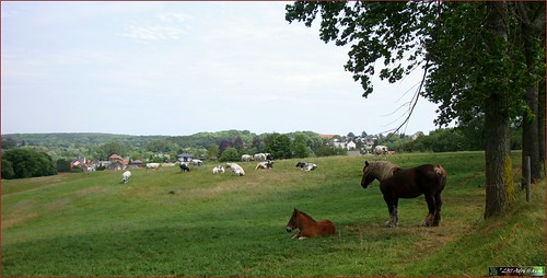
One hill at a time the heightmeters kept on adding up. Stopped to have a look at a young Brabander fowl near Huldenberg but I quickly moved on because the wind made it cold in the open fields. Returning to Meerdael Forest I added a last loop before arriving at the starting point, near the edge of the forest in Blanden. If you want a solid hilly ride in the valleys of the rivers Nethen, Dyle, Yse and Lane this is a good challenge.
Meerdael Classic Hills at EveryTrail
EveryTrail - Find trail maps for California and beyond
Ride Stats : 63.5K and 1000/1165 heightmeters (Polar/Garmin) in 3h42mins
3547/38535
28-05-2011, 18:03 geschreven door Big Bad Wolf
|
|
|
|
|
| 26-05-2011 |
| Meerdael consolidation |
 Looked like it was going to rain and there was a lot of wind so I decided for a relaxing ride in my home forest. Good opportunity to check out some of the lesser known trails and consolidating some other I was not sure would be free of timber after some heavy forestry works. The sun was playing hide and seek the whole time and I chose my tracks carefully so as not to include too much climbing. At the end of my ride I could feel some raindrops but I'm afraid a lot more than that is needed to quench the forests' thirst.
Ride Stats : 24K and 235/305 heightmeters (Polar/Garmin) in 1h26mins
3484/37370
26-05-2011, 19:57 geschreven door Big Bad Wolf
|
|
|
|
|
| 25-05-2011 |
| Ben-Ahin condensed |
I have taken the Ben-Ahin O2 bikers roadbook, thrown away some superfluous sections and what was left could be called a very condensed trail with lots of heightmeters and some very steep ascents and descents.
Starting out at the parking lot near the river Meuse in downtown Huy I decided to do the ride in the opposite direction as the O2 Roadbook. Not starting through the tunnel but rounding the cathedral and then taking the first very steep climb of the day, the Chemin de la Cave. I have to admit, I did not ride it. Only just on the bike I did not want to risk hurting my muscles so soon in the ride. So I rode as far as I could - the grade gets to 35% at one point - stepped the steepest bit and then got on the bike again when the slope got under 21%. Taking me from 80 to 210 meters that is 130 heightmeters and only a couple of K away.
Then I made my way towards the Bois Mavelin for a great downhill section into a gorge. Again, percentages here are way above 25% but with the dry conditions there is no reason to worry. Just make sure your brakes work !.
Making almost a U-turn at the bottom and I was settling in for the second long climb of the day. The Merlin was doing fine and my legs were warmed up now. Taking a right turn and following a track along a field that had its long grass, nettles and thorns freshly mown. When I arrived in the forest again I greeted the workmen that were mowing the trails. I wore long trousers out of precaution for horseflies but the last time I was here you also needed long trousers against nettles and other pricklies. Not this time, everything was being mown.
Downhill again, rocks and steps, care needs to be taken. Down the track veers to the left. This is a difficult point because the trails converges here but since this is my third time I begin to understand how the trail goes. So no hesitation this time and I was riding along steep singletrails into the Bois Melart and the Bois Mavelin. Arriving at the ponds I discovered a new track that avoided crossing a stream. But then I took a wrong turn and did cross a stream too much. Twice because I had to return. The trails is a maze here and I wonder how many times I have to pass here before I figure it out.
Steep climb again , with sections of 28 and 29% , and I reach the highest point of this track, 245 meters, and ride into Solieres. Steep downhill followed by a nice steep uphill. You figured it out already I'm sure, this is no trail for the meek.
Reaching Ben-Ahin and now one of the steepest sections - both up and downhill - follows. Taking the rocky trail downhill had me sitting on my rear wheel a couple of times and the last bit is really difficult with lots of stones and rocks. But I make it to the road, turn left and left again and a long steep uphill awaits me. You have 2 trails here and I would suggest taking the second. It is steep at the start, you will need to walk, but the rest is around 24% and perfectly ride-able. I took the first to the left and this gets steep (25%) and even steeper (41% maximum at one point ) and I had to get off of the bike and walk the last bit. Damn.
Stopping for a well-deserved snack before heading back towards Ben-Ahin, closing this little and very intense loop. In Ben-Ahin take a sharp left on tarmac and you arrive at another very steep downhill. Be careful here, it is 29% at its steepest and there is barbed wire on your left . Turn left at the bottom and then you descend to reach an abandoned quarry. Look at the top of the rocks, that is where you will need to ride to. Climbing again on a twisty rocky trail among low trees. The sun is burning fiercely. Looking to the left I have a beautiful view on the river Meuse . Not too close to the edge, it is very deep down. Nice singletrail through the foliage and then the trail zooms down towards the Chateau de Ben-Ahin. But just before you reach it, take a sharp right and prepare yourself for another climb that variates between 20 and 30% . This is a section I added to connect back to the trail high in the Bois Madame.
From here I take a left turn and ride back to Huy using the same trail I took at the beginning of this ride. I arrive at the steep Chemin de la Cave again and I see the towers of the nuclear plant of Tihange.
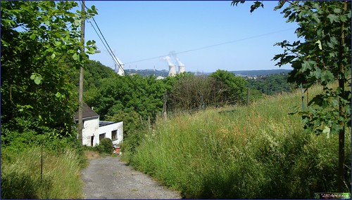
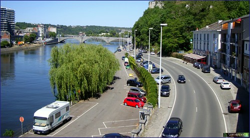
I hope the picture gives you an idea of how steep this road is. A bit further down it becomes a rocky trail and before long I am on the Rue Cherave, this time taking the railroad tunnel to get back to the other side of the Citadel rock. I overlook the parking lot and see my red MPS still standing where I left it.
This is a great ride, very condensed and intense. You need good legs and a bike that is in tip-top shape. Especially the brakes need to be good or you might want to walk some sections of the downhills. They are THAT steep. About the uphills, there are quite a few and none of them is easy, so again, be prepared to walk. Track conditions were dry today, wet trails would make most of the uphills too slippery to ride, so if you plan to try this ride, wait for the end of a dry spell of at least a week .
Ride Stats : 23K and 665/675 heightmeters (Polar/Garmin) in 1h44mins
Hill Factor : 29
3460/37065
25-05-2011, 18:50 geschreven door Big Bad Wolf
|
|
|
|
|
|
|
| Gastenboek./.Guestbook |
Druk op onderstaande knop om een berichtje achter te laten in mijn Gastenboek. /
Press the button below to write in my Guestbook.
|
| Email Me |
Press the button to send me a mail
|
|
|
|