|
|
|
| Tales from the Woods |
|
|
| 03-06-2011 |
 and the wind shouts back and the wind shouts back |
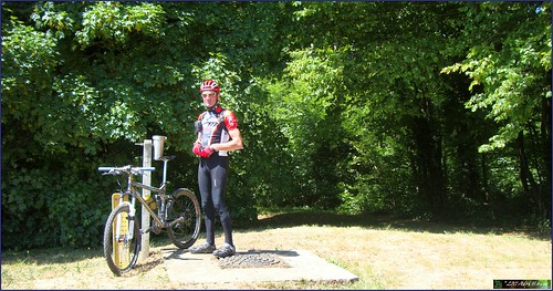
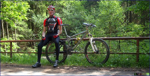
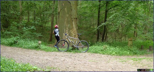
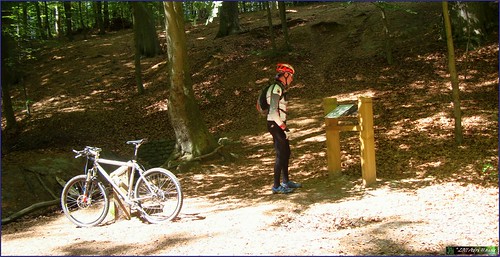
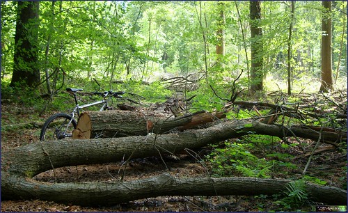
Another sunny day and I left around 10.30am for a ride that would take me to Filip Sport. When I came in Terlanen I saw markings of a race that was going to be held this sunday, so I decided to follow those as long as they did not let wander too much of the chosen path to Hoeilaart. The trail was quite hilly with the Smeysberg for starters, then dropping into Huldenberg and out again in the direction of Duisburg. Passing the ganspoel I could feel the wind tearing at the back of my shirt so I already knew that the return journey would be a difficult one. But hey, the sun was shining and I felt surprisingly good after yesterdays 100+ ride. In Duisburg the race track turned to the right but I chose the direction of Eizer. From Eizer straight on towards Overijse and then dropping onto the road to Hoeilaart.
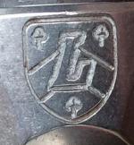
Talked with Filip about the headbadge of my Vortex and it looks like he will be able to install it soon. Pro memoria, he had to order a special type of glue to attach the aluminum headbadge to the titanium frame. We also talked about the upcoming Harre mountainbike ride. I am a bit weary to ride offroad because the old enemy, the horsefly, is around and I don't want to risk getting bitten. But I want to do this ride so I will take all precautions I can take - long trousers, lots of Deet and my special anti-horsefly mix - and then hope I can survive 5 hours of riding in the forests. To be completely at ease I have asked for the guide to mail me the GPS track of the ride, so that I can check if it can be cut short, should the need arise, and where we are back into civilization. Waiting for a reply..
I left Filip and because of the fine weather I decided to add some K's to my original 50-60K plan. Towards Maleizen I rode, and then down into Rosieres and up again towards Rixensart. Wavre and onwards to Dion Valmont. Adding quite a bit of hills to the ride, just to see how the legs would take those. And they took it fine. From Dion I rode towards Bonlez and then onwards to Longueville. Another long hill and now I began to feel the wind . When I turned towards the north I got it full on. I had to think about some lyrics from a Judas Priest song:
"Been inclined to wander
Off the beaten track
That's where there's thunder
And the wind shouts back"
No thunder luckily but the wind was indeed blowing with a vengeance. But the air was cool and crisp into my eager lungs. From Longueville I rode towards Pietrebais to avoid the high plateaus and return more or less protected by the valleys. Into Grez and then upwards to Bossut. From Bossut the road took me on a half cobble-half tarmac road towards Pecrot. Up the steep hill - this one really hurt after 80K - towards Nethen. And then the last stretch from Sint Joris Weert to the Zoete Waters and Vaalbeek. Good ride.
I got my Samsung Galaxy S II today. I ordered one when my Galaxy S turned into a brick. The S is still chez Samsung to be repaired but now I already got its much faster successor.

At first touch it looked fast. But I want to wait until I receive the NoReve leather case before I start using it. Better be protected..
Ride Stats : 101K and 915/920 heightmeters (Polar/Garmin) in 3h58mins
3894/41240
03-06-2011, 16:23 geschreven door Big Bad Wolf
|
|
|
|
|
| 02-06-2011 |
| Perwijs |
 Looked like a fine sunny day for a long road ride so around 9.45AM I started with the Litespeed Vortex on a big lap that would take me all the way to Perwez. Taking the Ravel in Hoegaarden and then split off towards Perwez just past Huppaye. I could have followed the ravel a little further towards Gembloux but the strong wind was making me weary about going too far west and then having to return with the wind in my face. So I settled for Perwez and then made my way towards Chaumont-Gistoux and Wavre, following the N243. Some badly maintained bikepaths between Chaumont and Wavre but once past Wavre I took the direction of Overijse and things gor better. From Overijse I turned into the wind and made my way past Huldenberg and Neerijse towards Bertem. Aiming for a century I decided to follow the N3 to Leuven and then ride round Leuven on the R23 until I found the N3 again, this time going towards Tienen.
Following the N25 and then turning towards Haasrode and Blanden saw me arrive home with a solid ride and a good average despite the windy conditions.
Ride Stats : 110K and 810/810 heightmeters (Polar/Garmin) in 4h01min
3793/40320
02-06-2011, 14:52 geschreven door Big Bad Wolf
|
|
|
|
|
| 28-05-2011 |
| Meerdael Hills by proxy |

Arriving at Theux around 10am I noticed I did not have my GSM with me. Furthermore there was an archery contest claiming all the forest around Franchimont. I did not want to start my planned ride without a GSM so I decided to return home and postpone the ride to another date.
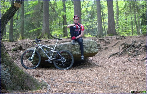
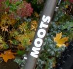
Arriving home I switched bikes and jerseys and took out the Moots for a spin through Meerdael Forest. Feeling rather good except for my right hand which was hurting since yesterday evening, some bad move I made I guess, I decided to do the hilly section of the 18th Meerdael Classic organised ride again.
It had rained yesterday and even though there was no mud you could see by the amount of gnats that it was wetter in the forest. I added a couple of climbs to the loop and arrived at a solid 1000+ heightmeters ride, which was a good consolation for the missed Theux ride.There was a lot of wind and the sections out of the forests were difficult, especially with the wind straight in my face.
One hill at a time the heightmeters kept on adding up. Stopped to have a look at a young Brabander fowl near Huldenberg but I quickly moved on because the wind made it cold in the open fields. Returning to Meerdael Forest I added a last loop before arriving at the starting point, near the edge of the forest in Blanden. If you want a solid hilly ride in the valleys of the rivers Nethen, Dyle, Yse and Lane this is a good challenge.
Meerdael Classic Hills at EveryTrail
EveryTrail - Find trail maps for California and beyond
Ride Stats : 63.5K and 1000/1165 heightmeters (Polar/Garmin) in 3h42mins
3547/38535
28-05-2011, 18:03 geschreven door Big Bad Wolf
|
|
|
|
|
| 26-05-2011 |
| Meerdael consolidation |
 Looked like it was going to rain and there was a lot of wind so I decided for a relaxing ride in my home forest. Good opportunity to check out some of the lesser known trails and consolidating some other I was not sure would be free of timber after some heavy forestry works. The sun was playing hide and seek the whole time and I chose my tracks carefully so as not to include too much climbing. At the end of my ride I could feel some raindrops but I'm afraid a lot more than that is needed to quench the forests' thirst.
Ride Stats : 24K and 235/305 heightmeters (Polar/Garmin) in 1h26mins
3484/37370
26-05-2011, 19:57 geschreven door Big Bad Wolf
|
|
|
|
|
| 25-05-2011 |
| Ben-Ahin condensed |
I have taken the Ben-Ahin O2 bikers roadbook, thrown away some superfluous sections and what was left could be called a very condensed trail with lots of heightmeters and some very steep ascents and descents.
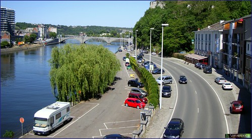
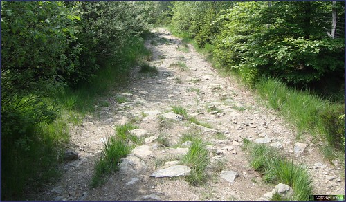
Starting out at the parking lot near the river Meuse in downtown Huy I decided to do the ride in the opposite direction as the O2 Roadbook. Not starting through the tunnel but rounding the cathedral and then taking the first very steep climb of the day, the Chemin de la Cave. I have to admit, I did not ride it. Only just on the bike I did not want to risk hurting my muscles so soon in the ride. So I rode as far as I could - the grade gets to 35% at one point - stepped the steepest bit and then got on the bike again when the slope got under 21%. Taking me from 80 to 210 meters that is 130 heightmeters and only a couple of K away.
Then I made my way towards the Bois Mavelin for a great downhill section into a gorge. Again, percentages here are way above 25% but with the dry conditions there is no reason to worry. Just make sure your brakes work !.
Making almost a U-turn at the bottom and I was settling in for the second long climb of the day. The Merlin was doing fine and my legs were warmed up now. Taking a right turn and following a track along a field that had its long grass, nettles and thorns freshly mown. When I arrived in the forest again I greeted the workmen that were mowing the trails. I wore long trousers out of precaution for horseflies but the last time I was here you also needed long trousers against nettles and other pricklies. Not this time, everything was being mown.
Downhill again, rocks and steps, care needs to be taken. Down the track veers to the left. This is a difficult point because the trails converges here but since this is my third time I begin to understand how the trail goes. So no hesitation this time and I was riding along steep singletrails into the Bois Melart and the Bois Mavelin. Arriving at the ponds I discovered a new track that avoided crossing a stream. But then I took a wrong turn and did cross a stream too much. Twice because I had to return. The trails is a maze here and I wonder how many times I have to pass here before I figure it out.
Steep climb again , with sections of 28 and 29% , and I reach the highest point of this track, 245 meters, and ride into Solieres. Steep downhill followed by a nice steep uphill. You figured it out already I'm sure, this is no trail for the meek.
Reaching Ben-Ahin and now one of the steepest sections - both up and downhill - follows. Taking the rocky trail downhill had me sitting on my rear wheel a couple of times and the last bit is really difficult with lots of stones and rocks. But I make it to the road, turn left and left again and a long steep uphill awaits me. You have 2 trails here and I would suggest taking the second. It is steep at the start, you will need to walk, but the rest is around 24% and perfectly ride-able. I took the first to the left and this gets steep (25%) and even steeper (41% maximum at one point ) and I had to get off of the bike and walk the last bit. Damn.
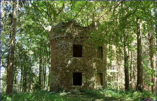
Stopping for a well-deserved snack before heading back towards Ben-Ahin, closing this little and very intense loop. In Ben-Ahin take a sharp left on tarmac and you arrive at another very steep downhill. Be careful here, it is 29% at its steepest and there is barbed wire on your left . Turn left at the bottom and then you descend to reach an abandoned quarry. Look at the top of the rocks, that is where you will need to ride to. Climbing again on a twisty rocky trail among low trees. The sun is burning fiercely. Looking to the left I have a beautiful view on the river Meuse . Not too close to the edge, it is very deep down. Nice singletrail through the foliage and then the trail zooms down towards the Chateau de Ben-Ahin. But just before you reach it, take a sharp right and prepare yourself for another climb that variates between 20 and 30% . This is a section I added to connect back to the trail high in the Bois Madame.
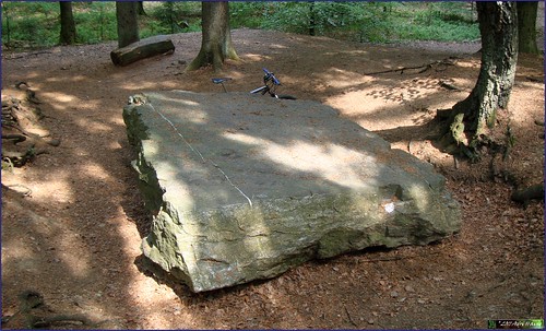
From here I take a left turn and ride back to Huy using the same trail I took at the beginning of this ride. I arrive at the steep Chemin de la Cave again and I see the towers of the nuclear plant of Tihange.
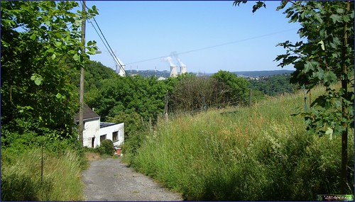
I hope the picture gives you an idea of how steep this road is. A bit further down it becomes a rocky trail and before long I am on the Rue Cherave, this time taking the railroad tunnel to get back to the other side of the Citadel rock. I overlook the parking lot and see my red MPS still standing where I left it.
This is a great ride, very condensed and intense. You need good legs and a bike that is in tip-top shape. Especially the brakes need to be good or you might want to walk some sections of the downhills. They are THAT steep. About the uphills, there are quite a few and none of them is easy, so again, be prepared to walk. Track conditions were dry today, wet trails would make most of the uphills too slippery to ride, so if you plan to try this ride, wait for the end of a dry spell of at least a week .
Ride Stats : 23K and 665/675 heightmeters (Polar/Garmin) in 1h44mins
Hill Factor : 29
3460/37065
25-05-2011, 18:50 geschreven door Big Bad Wolf
|
|
|
|
|
| 22-05-2011 |
| Easy Meerdael |
|
Normally I would have preferred doing an easy road ride to day, to allow my aching muscles to relax and recuperate. But there was a fierce wind blowing so I decided on taking the Moots out for a spin on some easy Meerdael roads. Doing more or less a perimeter ride I could relax and enjoy the crisp air whilst the wind was blowing outside the forest. There had been some rain somewhere last night because I noticed some small puddles and the greens looked greener than a week ago.
Ride Stats : 19.5K and 155/205 heightmeters (Polar/Garmin) in 1h2mins
3377/35970
22-05-2011, 20:22 geschreven door Big Bad Wolf
|
|
|
|
|
| 21-05-2011 |
| Theux - Signal de Botrange - Solwaster - Theux |

A perfect day for a long ride in the Ardennes. So I took the Merlin to Theux and the Chateau de Franchimont to have a go at my longest descent.
Arriving in Theux and parking before the Chateau I started out taking the steep downhill into Theux and then the "longest uphill" could start. The weather was promising, with an open sky and a temperature of around 15 degrees C already at 10am. It would remain sunny throughout the ride with tempetures around 20 degrees C.
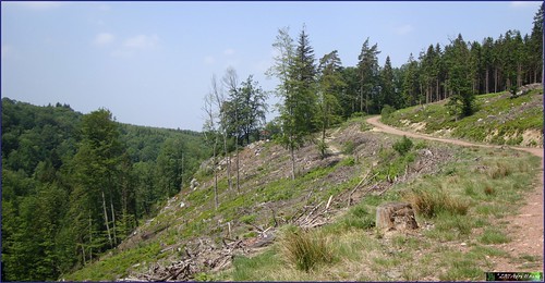
The first part of this ride consists of climbing towards the highest point of Belgium, the Signal de Botrange. Over the years I have worked out a route that incorporates a lot of offroad stretches without becoming too difficult. On my way up to the Golf de Spa I encountered some bikers that were laying out chalklines. They told me that tomorrow there was a Randonnee at Tiege. That is certainly a good way to discover this region. I would encounter their markings a lot during the ascent and the descent back to Theux.
After a little more than 2 hours of biking I arrived at the Signal. The tracks had been dry and even on the fagnes one could note the effects of the long period of dry weather our country had been suffering during these last couple of months.
I had a snack overlooking the Fagnes towards Germany but moved on when a big group of tourists arrived. All they were interested in was where the fire had been.
Starting the downhill then. This is the most difficult part of this ride. First I had to follow a very beautiful track taking me to the Vecquee. I would consequently follow this ancient trail towards the Hoegne. Here I also noticed how dry everything was. Usually there are always some 'boggy' sections, where you had to move into the forest next of the trail to circumvene mud and water. But now everything had dried up offering good traction and a steady path. The last section was a very rocky descent but the Merlin took me through that without any problems. This might not be the best region to ride a hardtail.
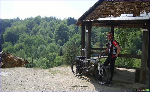
From the Passerelle du Centenaire at the edge of the river Hoegne I followed a path that took me to a little belvedere, a pavillion overlooking the deep valley of the Hoegne
The ensuing downhill along this track was a great one. Crossing little rivulets from time to time and over rocks and stones at other occasions. I arrived at Belleheid where I would change the track on my GPS. I had decided to make a detour to have a look at the Dolmen of Solwaster and the Rochers de Bilisse. I had been there before but this was over 20 years ago. I made a track on Mapsource taking me there and back again. This was a track I now activated on my Garmin Edge 705.
It started by following the GR573 that would bring me to these artefacts. The climb back up the ridge was steep and hurt my legs after the long downhill sections from the Signal. But since it was a GR riding a bike here was challenging. Arriving at the Dolmen and later at the Bilisse rocks, I took some time to take pictures and then started to follow a walking track next to the River Statte.
On the map this had looked fine but it was impossible to ride my bike here for more than a couple of meters at a time. Even walking proved very difficult. Beautiful wild landscape indeed. Rocks and steps, bridges and roots. Oh well, I moved on and at last reached a road where I could get on my bike again. For those who decide to follow the GPS track, I would advise following the GR and climb up the twisty track behind the Rochers de Bilisse. This will save you some 20 minutes of walking .
Riding down towards Solwaster again was great, some really beautiful tracks and a long sweeping downhill to reach the river Hoegne . Following this river I am now back on my usual Theux - Signal de Botrange - Theux track. Arriving at Polleur this means getting back up the slope to arrive in Sassor. I could not resist turning to the right before reaching the road to the Chateau de Franchimont. This meant another uphill but also took me to the steep downhill along the GR route into Theux. But I rode it completely, including the steps at the end dropping me to face the Insitut Saint Roch. Riding back towards the chateau I took the long version of the climb this time instead of the short steep one I took when descending at the start of this ride .
Ride Stats : 70.5K and 1275/1315 heightmeters (Polar/Garmin) in 4h18mins
3358/35765
21-05-2011, 00:00 geschreven door Big Bad Wolf
|
|
|
|
|
| 19-05-2011 |
| KBC MTB Club Ride |
Today saw an overcast day but once again no rain fell. In the late afternoon the KBC MTB Club rode out for what would prove to be a slightly different ride. Instead of going into Meerdael Forest the guide took us through Heverleebos for starters and then through the Arenberg campus and Egenhoven. Here we kinda got lost and had to ride though fields and even someone garden to make it back onto a road. But then someone else took over and we set sails towards the Bertembos. Here we did some fine succession of climbing and descending on bonedry and and sandy roads. Some great biking to be had here but also to be avoided when it has rained.

But it hadn't rained for quite some time so we could enjoy the dust in the descents and through the fields we rode back towards Egenhoven and Heverlee. Here once again we entered the Heverleebos. In all a very special ride I'm sure we all enjoyed in the end. In the beginning it looked like we would get stuck in the city of Leuven but once we got through Egenhoven and the past the Fire Brigade site things were falling into place.
Ride Stats : 43K and 345/400 heightmeters (Polar/Garmin) in 2h14mins
3288/34450
19-05-2011, 21:28 geschreven door Big Bad Wolf
|
|
|
|
|
| 16-05-2011 |
| Meerdael Bloso routes more or less |
It was raining slightly when I rode the Moots out into Meerdael Forest. I wanted to do an easy ride so I chose to do the Meerdael Bloso's. To spice things up I rode them in the reverse direction. Because of the rain I chose to stay in the forest as much as possible so I cut some corners and added a few bits. I did not feel too tired but I chose to ride an easy pace to relax and enjoy the scenery. When I came to the Green loop I decided to cut the big section going towards Oud-Heverlee and stay in Heverleebos instead. This would yield me a ride of about 2h30 which was more than enough. While I was at it I added a climb or two. Still my average heartrate was only 104bpm, which is not bad considering my average speed and the amount of climbing in this loop.

Feeling better than when I started I finished the ride. The rain had long stopped, and it was only a couple of drops anyways. Hope the weather will pick up in the next days since I only had 15 degrees C as the average temperature this evening.
Ride Stats : 46K and 505/575 heightmeters (Polar/Garmin) in 2h27mins
3122/32980
16-05-2011, 20:33 geschreven door Big Bad Wolf
|
|
|
|
|
| 15-05-2011 |
| More Meerdael Loops |
Tonight saw some long expected rainfall in our region so this morning the trails were bound to be less dusty than yesterday. I decided on another mountainbike ride in my 'home' forest, exploring some more singletracks and riding some hills at a leisurely pace.
More or less like the snail I captured with my Sony DSC-300 whilst biking . The wet spell caused a lot of snails to appear -apparently out of nowhere.

I started out again in the eastern side of the forest, exploring some lesser-ridden trails and some possible additions to my Secret Meerdael Loop. Some of them were very difficult to ride due to vegetation and fallen trees. But I did not have to turn around so all the tracks are basically OK to ride, with some technical prowess needed from time to time. When I crossed the Naamsesteenweg I came to the hiller section of Meerdael Forest and tried a descent I hadn't done for quite a while. To my surprise it was completely clear of debris. I then incorporated a succession of climbs and descents working my way towards the outskirts of Nethen. Here I took the little walking trail next to the Savenel wall. This was difficult to ride due to the crops that made the track very narrow. But I made it and then took the steep downhill into Nethen

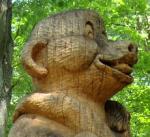
Some more interesting trails brought me towards The Kluis where I noticed one of the sculptures of Ad Wouters. There is a trail that connects all of these oeuvres d'art , the trail is called Het Pad van Ad.

From there it didn't take me much longer to complete my riding, taking the hairy descent into Sint Joris Weert and the uphill towards the Speelberg on my way to the August Denteneer pad. Just a couple of nice trails left and right and then I was back in Blanden where I finished the loop at the Naamsesteenweg. My legs felt OK and the weather remained dry with the exception of a couple of raindrops when I was near the Herculessalon. But it quickly stopped and the trails were not even wet.
Ride Stats : 39.5K and 595/680 heightmeters (Polar/Garmin) in 2h42mins
3076/32405
15-05-2011, 18:13 geschreven door Big Bad Wolf
|
|
|
|
|
| 14-05-2011 |
| Adris' Meerdael Loops |
 With rain forecast for today I decided to stay home and ride my Secret Meerdael Loops once more. These roughly consist of 2 parts, the first bit in the eastern part of Meerdael Forest focusses on twisty singletrails and little trails. It is about 24K long and has roughly 300 heightmeters. With trail conditions being dry and fast it was a great time riding these trails. Normally there are always sections with a little mud but this time the only difficult track conditions came from deep tyre tracks for the forestry machines and fallen trees. Some sections were completely blocked so I had to invent new loops to circumvene them. I also added a new loop to the south of the Limietendreef. I am not completely happy with that loop and I think I already saw an opportunity to make it better. But for today it was fine.
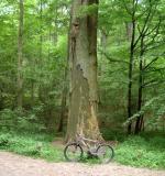
After a while I arrived at the Dikke Eik and this left me with only a couple of kilometers to go on this side of the forest. I stopped to take a couple of pictures of this majestic oak. It is the oldest one in this forest, 300 years or older.
A last little loop in Valduc before I am crossing the Naamsesteenweg which brings me to the second - hilly - part of my Meerdael Loops.
This is another piece of meat entirely. It gets serious with the climbing and descending. During the next 38K the trail goes up and down practically all the time. There are a lot of small loops here, trying to get the most out of the hilly section of Meerdael forest is not possible without the tracks crossing each other from time to time. I feel very good and the bike performs flawlessly. Climb after climb gets taken with confidence and ease. The downhills are a breeze with the Moots' strong disc brakes. But be aware, some of them are tricky and you need to stay focussed all the way. The heightmeters are adding up nicely and should you ride too fast in the first section , that will pay itself in cash here. If you decide to ride these trails, keep in mind that you have to spread your energy over the whole loop. The forest is beautiful and the forecast rain does not come. Instead, the sun comes shining through the clouds and the average temperature rises a couple of degrees during the last hour or so of this ride. I stop at the Hertebron and read that the water once again is good to drink.
But I still have enough in my drinking bottle and I continue for the last stretch of my Meerdael Loops. Bringing me at the Kluis and from there on another climb. But the forestry works are still ongoing here and I need to get off my bike to climb over lots of trees. I hope they clear out all of these trees during the next few weeks. Otherwise I might have to pay the Forestry a little visit.
Last loop now driving into Blanden and nearing the end, which I have placed at the little school. There is some parking space there and the start of the singletrack loop is only 400m away.
I had a good ride today and even though I normally get this ride done in under 4 hours, I was pleased with the time because I added another loop and found some new heightmeters, making it tougher than the previous versions. I leave you with a link to both sections of my Meerdael Loops.
If you want to ride them, please stay on the trails and I wish you a very good ride. Be careful because the track is a twisty one and you might wanna have a good look at it on mapsource or the likes because it consists of a lot of loops and you might get lost - or your GPS might - if you miss a turn.
Ride Stats : 60K and 1140 heightmeters (Garmin) in 4h7mins
3036/31725
14-05-2011, 18:52 geschreven door Big Bad Wolf
|
|
|
|
|
| 12-05-2011 |
| KBC MTB Club Ride |
 Looking for an easy ride to recover from yesterday's ride and I found it in the weekly KBC mountainbike club ride. I guided them through Heverleebos and then into Meerdael Forest where I treated them to an overdose of singletracks. Twisting and turning and the occasional root and fallen tree made it technical without being overly so. Not a lot of climbs but who needs them on such nice twisting trails.
The forest is very dry and even the young plants are starting to turn yellow. Rain is needed urgently.
But today it was still sunny and with a strong wind blowing riding in the forest was a good option.Just 2 hours of riding at an easy pace made me finish with an average heartrate of 104bpm.
Ride Stats : 37K and 315/400 heightmeters (Polar/Garmin) in 2h00mins
2920/30175
12-05-2011, 21:17 geschreven door Big Bad Wolf
|
|
|
|
|
| 11-05-2011 |
| O2 Bikers Roadbook Ben-Ahin revisited |

Ever since I rode this roadbook, in september last year, I have been wanting to come back to get a second chance at the many steep ascents I could not ride . Due to the Lyme disease which was already manifesting itself in my body, I did not get a fair chance to match my biking prowess against this wonderfully difficult roadbook.
So today was the day. I had asked Roger if he wanted to accompany me, and he agreed. We rode to the starting point in Huy and set off at 2pm for the 34K of the Ben-Ahin roadbook. I also wore my new shoes for the first time, so this would also be their testing ground.

For a detailed report on the roadbook I would like to refer you to my blog entry of 03-09-2010, where I explain the track in great detail. Now I just want to focus on some of the highlights of todays' ride. I made sure to get the difficult passage, where the track meets itself a couple of time, right. And still we managed to take a wrong direction for 100 meters or so after not riding the very steep uphill out of the forest into the fields which were to lead us towards la Sarte à Ben. But after that we could complete the first loop, leading us towards Andenne, without much trouble. Viewing the magnificent landscapes, and undergoing the technical downhills, singeltracks and very steep uphills we arrived back at La Sarte à Ben for the start of the second loop. Roger had been cursing his hardtail bike on the very difficult stony climb up the Bois de Mavelin. Whilst I was enjoying the gentle plushness of my Merlin full suspension bike.
 
 
Another fine loop with some very beautiful tracks, steep downhills and a very steep and rooty climb towards Solieres and we stopped to have a bite to eat and talk about bikes. Roger was thinking about selling the Sola and getting a full suspension bike again. He complained about the lack of traction and comfort on the roots and stones. When we arrived home I checked his tyres and found them to be pumped up rather firm. He says they are on 1.5 bar but I say he needs to check his pump. I'm sure they were well over 2 bars. Perhaps letting out a bit of air would soften the ride and considerable add to the traction of the rear wheel.
 

Closing the second loop we came to the last third of the roadbook, starting off with a very difficult and steep 21% slope on rocks and roots in the Bois Mélart. We both made it with flying colors and the singletrack next to the fields that followed had us both receiving a lot of nettle stings. With tingling legs we rode down into the valley of a dry river for the last and possibly toughest climb of the day. The singletrack next to and high above to the riverbed was superb. The steep climb after it was - steep. But we both made it. Sitting on the front of our saddles to keep the front wheel from lifting, the dry conditions provided grip so that we could keep the wheels turning and make the climb into the Bois Madame. My garmin says that the slope is 47% at its steepest but I think it is safer to say that it is between 30 and 40% at its steepest. Last time I measured it at 38% which will be about right.
Great, now a last stretch of offroad brought us to the top of the cote de Ben-Ahin where I wanted to try an alternative downhill instead of the impossibly steep drops from the Tour Joseph. This alternative is straightforward and even though it is steep - it is a 150 meter drop after all - it is completely ride-able and brings us nicely to the railway tunnel that takes us to the end of our ride. We are both very pleased with todays' ride. Small in kilometers but with a good amount of Ardennes' feeling and a lot of climbing and descending.
Ride Stats : 35K and 770/790 heightmeters (Polar/Garmin) in 2h33mins
2883/29775
11-05-2011, 21:12 geschreven door Big Bad Wolf
|
|
|
|
|
|
|
| Gastenboek./.Guestbook |
Druk op onderstaande knop om een berichtje achter te laten in mijn Gastenboek. /
Press the button below to write in my Guestbook.
|
| Email Me |
Press the button to send me a mail
|
|
|
|