|
I have taken the Ben-Ahin O2 bikers roadbook, thrown away some superfluous sections and what was left could be called a very condensed trail with lots of heightmeters and some very steep ascents and descents.
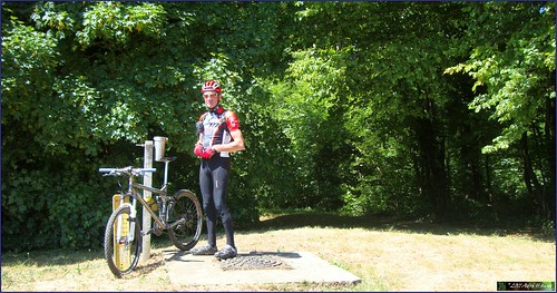
Starting out at the parking lot near the river Meuse in downtown Huy I decided to do the ride in the opposite direction as the O2 Roadbook. Not starting through the tunnel but rounding the cathedral and then taking the first very steep climb of the day, the Chemin de la Cave. I have to admit, I did not ride it. Only just on the bike I did not want to risk hurting my muscles so soon in the ride. So I rode as far as I could - the grade gets to 35% at one point - stepped the steepest bit and then got on the bike again when the slope got under 21%. Taking me from 80 to 210 meters that is 130 heightmeters and only a couple of K away.
Then I made my way towards the Bois Mavelin for a great downhill section into a gorge. Again, percentages here are way above 25% but with the dry conditions there is no reason to worry. Just make sure your brakes work !.
Making almost a U-turn at the bottom and I was settling in for the second long climb of the day. The Merlin was doing fine and my legs were warmed up now. Taking a right turn and following a track along a field that had its long grass, nettles and thorns freshly mown. When I arrived in the forest again I greeted the workmen that were mowing the trails. I wore long trousers out of precaution for horseflies but the last time I was here you also needed long trousers against nettles and other pricklies. Not this time, everything was being mown.
Downhill again, rocks and steps, care needs to be taken. Down the track veers to the left. This is a difficult point because the trails converges here but since this is my third time I begin to understand how the trail goes. So no hesitation this time and I was riding along steep singletrails into the Bois Melart and the Bois Mavelin. Arriving at the ponds I discovered a new track that avoided crossing a stream. But then I took a wrong turn and did cross a stream too much. Twice because I had to return. The trails is a maze here and I wonder how many times I have to pass here before I figure it out.
Steep climb again , with sections of 28 and 29% , and I reach the highest point of this track, 245 meters, and ride into Solieres. Steep downhill followed by a nice steep uphill. You figured it out already I'm sure, this is no trail for the meek.
Reaching Ben-Ahin and now one of the steepest sections - both up and downhill - follows. Taking the rocky trail downhill had me sitting on my rear wheel a couple of times and the last bit is really difficult with lots of stones and rocks. But I make it to the road, turn left and left again and a long steep uphill awaits me. You have 2 trails here and I would suggest taking the second. It is steep at the start, you will need to walk, but the rest is around 24% and perfectly ride-able. I took the first to the left and this gets steep (25%) and even steeper (41% maximum at one point ) and I had to get off of the bike and walk the last bit. Damn.
Stopping for a well-deserved snack before heading back towards Ben-Ahin, closing this little and very intense loop. In Ben-Ahin take a sharp left on tarmac and you arrive at another very steep downhill. Be careful here, it is 29% at its steepest and there is barbed wire on your left . Turn left at the bottom and then you descend to reach an abandoned quarry. Look at the top of the rocks, that is where you will need to ride to. Climbing again on a twisty rocky trail among low trees. The sun is burning fiercely. Looking to the left I have a beautiful view on the river Meuse . Not too close to the edge, it is very deep down. Nice singletrail through the foliage and then the trail zooms down towards the Chateau de Ben-Ahin. But just before you reach it, take a sharp right and prepare yourself for another climb that variates between 20 and 30% . This is a section I added to connect back to the trail high in the Bois Madame.
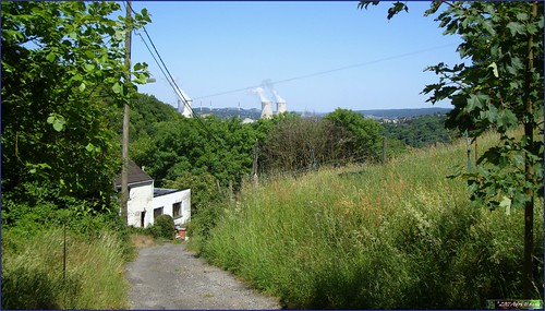
From here I take a left turn and ride back to Huy using the same trail I took at the beginning of this ride. I arrive at the steep Chemin de la Cave again and I see the towers of the nuclear plant of Tihange.
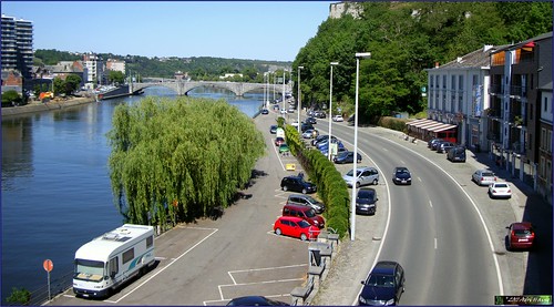
I hope the picture gives you an idea of how steep this road is. A bit further down it becomes a rocky trail and before long I am on the Rue Cherave, this time taking the railroad tunnel to get back to the other side of the Citadel rock. I overlook the parking lot and see my red MPS still standing where I left it.
This is a great ride, very condensed and intense. You need good legs and a bike that is in tip-top shape. Especially the brakes need to be good or you might want to walk some sections of the downhills. They are THAT steep. About the uphills, there are quite a few and none of them is easy, so again, be prepared to walk. Track conditions were dry today, wet trails would make most of the uphills too slippery to ride, so if you plan to try this ride, wait for the end of a dry spell of at least a week .
Ride Stats : 23K and 665/675 heightmeters (Polar/Garmin) in 1h44mins
Hill Factor : 29
3460/37065
|


