|
|
|
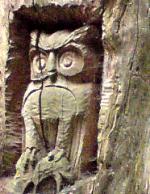
| Tales from the Woods |
|
|
| 31-08-2008 |
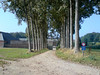
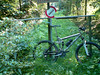
 Ronde van Leuven Ronde van Leuven |
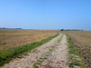
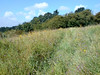
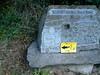
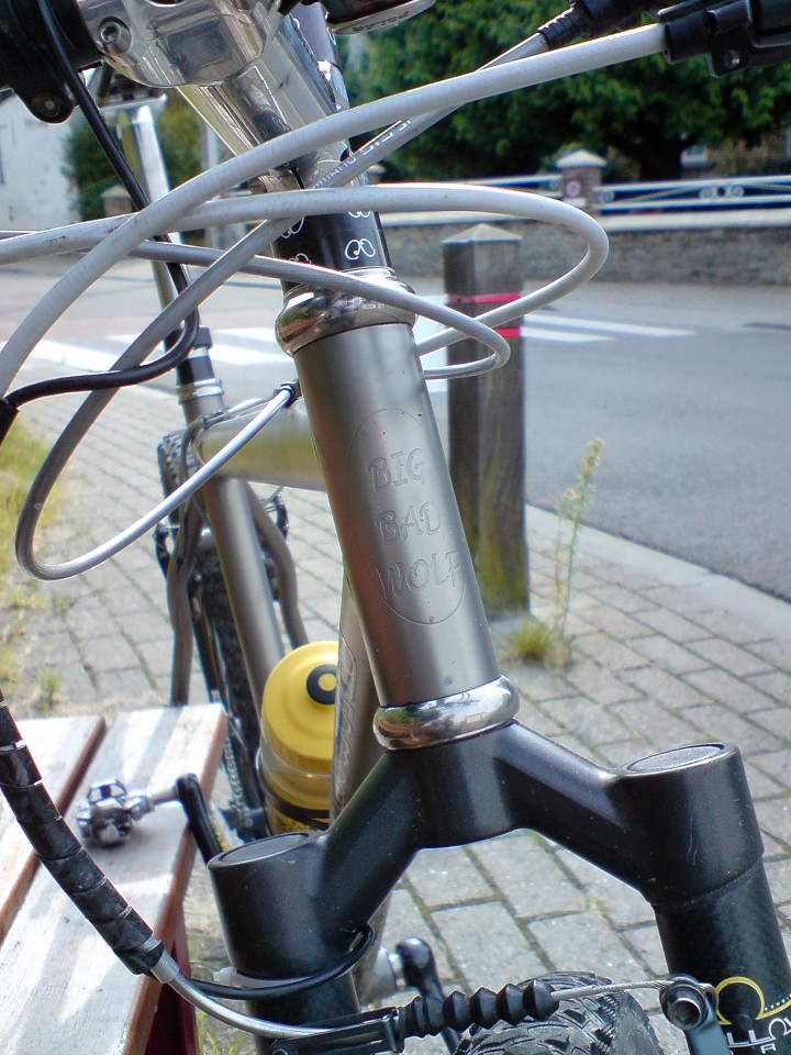
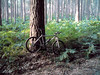
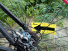
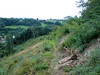
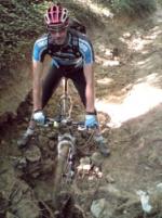
I felt tired from yesterdays' offroad debauchery so I decided to do some onroad riding instead. The Ronde van Leuven is an event I like to ride although it seems to be getting smaller in K's every year. This year their was a big lap of 58K on offer, with control points in Blanden - where I started - Bierbeek, Lovenjoel, Linden, Kortrijk-Dutsel and Winksele. Even though I was biking very relaxed I passed a lot of people while nobody passed me. Some tried to follow my pace but had to let go. Still, this is a family event and I can only applaud people getting on their bike for a change. That way they can also appreciate what it is like to be a biker instead of an automobilist. I just read an article today with a plausible explanation why automobilists don't seem to notice bikers. They form no threat to them. Car drivers are focussed on all things that can cause them harm, like other cars, trees and the like. But bikers can not harm cars, so they go unnoticed because of that. Hmm, there might be some truth in that.I met two female bikers I recognized from the mountainbike races. They were both wearing 2 Mega Saeco jerseys and I recognized Ilke de Jongh immediately. I think the other girl was Kim Saenen but I'm not sure. I chatted a bit with them about why they weren't racing today and stuff. Seems that they had a race yesterday at Sint Katelijne Wavre and another one tomorrow. So today was their day off. And it was a nice day for an easy ride, sun was out and there was just enough wind to keep things from getting too hot. When I arrived at the Blanden starting place, I got a reflective band for my efforts and an apple for my thirst. Had a good ride and really enjoyed the flowing landscapes around Leuven.Ride Stats : 61.5K and 370/389 heightmeters (Polar/Garmin) in 2h30mins7436/73165
31-08-2008, 00:00 geschreven door Big Bad Wolf
|
|
|
|
|
| 30-08-2008 |
| Recon track 2008 Belgian and Dutch MTB Marathon Championships |
Last wednesday I got the preliminary map of the 2008 Belgian and Dutch Mountainbike Marathon Championships that is organised by my club, the Velo Club Blancs Gilets, from Laurent Saublens with the demand to go and ride it and check out all the passages and produce a height profile if possible. So I prepared a GPS track with Garmin Mapsource and downloaded that on my Edge 705. Following the track proved to be very easy. Unfortunately I must have made a mistake because it didn't get any records of todays ride so I can't check the amount of heightmeters on the Garmin or produce a GPS track Luckily I always take my trusty Polar S710 along so I did get the rides' profile.
With nearly a 100K - I did make a few extra loops when the GPS wasn't sure of the direction or when I had to go around closed tracks or private sections - and 1200 heightmeters this will be a tough cookie to chew on. Race distance will be closer to 95K but the amount of heightmeters is correct.
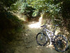
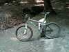
My friend Roger had agreed to accompany me until noon, when he needed to be somewhere else. We met at the races' start near the little train station in Pécrot. This was the first time I was going to follow a pre-made track on my GPS so I was kinda curious. I am pretty disappointed with the manual Garmin provides. There is only the mention that you can navigate pre-recorded tracks but no mention of the different screens, etc.. Its all very instinctive as I was going to find out but still. I also believe that when navigating along a pre-recorded route, the Edge 705 is at the edge of its capabilities. During the navigation the unit powered itself off 4 times. I had to restart it and could continue where I left off but when I got home I found out that only the part getting to the start, and the part from the end of the track towards home, was logged correctly. The part where the unit had to navigate AND record at the same time showed some lapses and I couldn't upload it to my PC to check it on the map. Only the amount of kilometres was correct, I 'lost' almost 2 hours of recording. Strange. But anyways..what is this trail like?
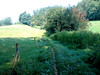
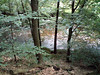
When I looked at the map I saw a track that was criss-crossing all over the Grez-Doiceau community. Starting in Pécrot and making its way towards Nethen, and then towards Bossut and Gottechain.Then it passes near de Bois de Linsmeau and into Pietrebais. The wet grass made our bikes glisten and acted as a magnet for dirt and debris. Some of the downhills proved to be very tricky and technical, with big holes, lots of stones and other debris. Of course the famous jungle hollow road is also in the track. We had to walk because the washed out gullies were too deep to ride.
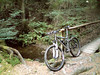
The trails were dry and Roger and I had taken our full suspension bikes because the added comfort proved to be very welcome. Anyone who ever rode the Accro Bike race knows what racing in this part of Brabant Walloon means. Short climbs, fast descents , twisting and turning singletrails and some passages through the fields where the weaker riders can relax a bit and the stronger riders can make the difference. Don't be fooled by the relatively low amount of heightmeters. The continuous succesion of short climbs at high speed will take their toll. The averages will be around 25, perhaps even more when it stays dry on the days before the race - September the 28th.
After the passage around Cocrou Roger decided to return to the start and I had to continue on my own. The trail then departs towards the eastern edges of Grez Doiceau, namely Roux-Miroir and Longueville. Long field passages but also some nasty passages through singletrack . At the Longueville chapel, exactly 45K into the ride, I had a little snack. The sun was getting hot and I was glad I applied sunscreen before riding out this morning. The track now meanders towards the Bois de Glabais with a tricky downhill in loose sand and with deep gullies. Again people riding the Accro Bike and some of the organised rides around this area will know these trails and have a certain advantage. The trail then goes towards lower Heze and finally arrives in Grez-Doiceau before heading to the southwest again for a loop towards Bonlez and Dion Valmont. Here I had to improvise because the trail that was marked on the map seemed to be gone. At one point I stood before a private section and at another point I was riding straight through a cornfield (well, walking actually - corn is though). The map shows a trail here, but the map seems to be wrong - or outdated. Surely the trail will have to be rerouted here. I was starting to feel a bit tired here and again I was thankful to be on the Merlin full suspension bike. Back in Grez-Doiceau I stopped to buy something cool to drink before tackling the last 20K.
The track now goes back towards Gottechain and ultimately over Bossut and La Malaise where a succesion of tough uphills will wring the last ounces of force out of the riders' legs. The last downhill is another killer - dangerous when you are tired. I think spreading ones' forces over the entire ride will prove to be the secret to success here. Riders who do well on short powerful climbs and also have the ability to go fast on tricky downhill will excel here. In short, the type of rider that can go fast, has lightning reactions and has sufficient power to do so for 95K . Some nice singletrack brings me back into Pécrot where I cross the finish line. The Edge has guided me well . I hit the lap button again and return home passing at the well near La Hetraie to have an extra refreshing sip of its water.
Rides' Profile (Polar S710) : CLICKThe Map: 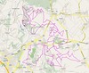 Ride Stats : 122.5km and 1400 heightmeters in 6h50mins7375/72795 Ride Stats : 122.5km and 1400 heightmeters in 6h50mins7375/72795
30-08-2008, 00:00 geschreven door Big Bad Wolf
|
|
|
|
|
| 28-08-2008 |
| Meerdaal 2000 |
With the approach of autumn the Meerdaal 2000 organised ride is coming closer. Another organisation I like to help out. Today with the KBC MTB club we were guided by one of their ranks around the base loop. Some 25K in length. Near the end of the ride I was asked to include some twisting singletrack until it got too dark in the forest to safely bike. I think I supplied some nice trails. Yesterday I had a meeting with my club, the Velo Club Blancs Gilets , about the fusion which is about to take place with the Royal Velo Club d'Ottignies. Two big clubs - one more focused on mountainbiking, and one who has a 'royal' status and has a lot of road racers in their ranks. Budgets will be higher and also facilities will be enlarged. More can be read here.On another note, the Belgian and Dutch MTB Marathon Championships will be organised by our club on September the 28th. I received the - unofficial - parcours map so I can go and check it out and make a GPS profile. The map will appear on the Clubs' website shortly . It can change but as it stands the race spans between 92 and 93K. More info when I will have had a chance to actually ride it. All info about the upcoming race can be found HERE.Ride Stats : 40K and 360/415 heightmeters (Polar/Garmin) in 2h10mins7252/71395
28-08-2008, 00:00 geschreven door Big Bad Wolf
|
|
|
|
|
| 25-08-2008 |
| Three Forest Ride |

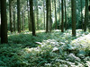
Had a good night of sleep and felt rested enough to try another long slow distance ride today. The plan was to ride to the Sonian Forest and then follow the Zonienwoudlaan towards Dworp to connect with the Hallerbos. I started out very relaxed but felt my energy levels were higher than expected. The sun was out, there was a little bit of wind but above all it was dry and relatively warm. And I had a couple of hours to waste. So everything went according to plan and after about 1h45 and 40K I was at the edge of the Hallerbos. Since I didn't know my way around very well and I wasn't really looking forward to get my tires wet, I rode from Information Sign to Information Sign and more or less did a big loop into the forest. It was quite wet even on the tarmac roads but I had quite a bit of fun in this hilly region. I noticed the trails looked very muddy and there were forestry trucks harvesting trees, so some of the trails were pretty messed up -again. The sun peeping through the thick leaf coverage made for some very pretty views.On the return loop I entered the Sonian Forest near the Middle Hut and then followed the Dubois Lane towards Groenendaal Station before looping over Hoeilaart and Maleizen towards Rosieres and the edge of Wavre. By now I knew this would turn out into another century ride but I still felt quite good when I rode into Ottenburg and decided to included a few extra climbs in Pecrot into my itinerary. I stopped at the little spring near the Hetraie camping and therefore I can say I connected the three big forests in Brabant today - the Meerdaelwoud, the Sonian Forest and the Hallerbos. Ride Stats : 106K and 970/1068 heightmeters (Polar/Garmin) in 4h56mins7212/71035
25-08-2008, 18:49 geschreven door Big Bad Wolf
|
|
|
|
|
| 24-08-2008 |
| Windy recovery |
Time to recover from yesterdays' ride. Instead of doing nothing I prefer doing an easy ride . Although today saw no rain and the sun almost looked as if she was going to break through the light cloud cover, the wind made a real recovery ride difficult. It gushed along quite forcefully. Nevertheless my average heart rate was below 100bpm on this ride with a max of 119bpm. I stopped for a snack in L'Ecluse, one of those little villages hidden away between the rolling hills just south of the language border.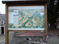 Ride Stats : 49K and 340/368 heightmeters (Polar/Garmin) in 2h10mins7106/70065 Ride Stats : 49K and 340/368 heightmeters (Polar/Garmin) in 2h10mins7106/70065
24-08-2008, 15:05 geschreven door Big Bad Wolf
|
|
|
|
|
| 23-08-2008 |
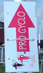
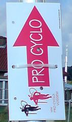
| Pro Cyclo Vossem |
This weather is simply unbelievable. I swear I can already smell autumn in the air. It was 13 degrees this morning and again it rained from time to time. I had already decided NOT to go to Houffalize this weekend. With yesterdays thunderstorms and my condition that isn't what it should be, I didn't feel motivated for a muddy 50K.
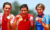
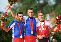
So today I could go out for a longer road ride. I already noticed yesterday that the Vossem Pro Cyclo tour passed in front of my door so I decided to follow that. On the web I found that they offered a 90K distance which seemed do-able to me. I left around noon - after seeing Sven Nys take a well-deserved 9th place at the Mens Olympic Cross Country mountainbike event but sadly also seeing Roel Paulissen fail miserably with a 19th place. As was to be expected Julien Absalon clinched the gold in front of his countrymen Jean Christophe Péraud with a surprisingly good Nino Shurter beating his fellow Suisse Christophe Sauser for the Bronze medal. I had also seen Sabine Spitz take a wll-deserved victory in the Womens' race earlier, proceeding amazing Maja Wloszczowska and World Cup winner Irina Kalentieva.
After going towards Linden and Sint Pieters Rode they spent a lot of time in the flat area south of Aarschot and Mechelen before returning over Meerbeek and Everberg towards Vossem. In the beginning of the ride were some more hills when they went towards Duisburg, Huldenberg and Sint Joris Weert.
I got another surprise upon arriving home : our Tia Hellebaut clinched the GOLD medal in the Womens' High Jump.. congratulations Tia !!

Ride Stats : 110K and 595/696 heightmeters (Polar/Garmin) in 4h42mins
7057/69725
23-08-2008, 18:27 geschreven door Big Bad Wolf
|
|
|
|
|
| 22-08-2008 |
| Drizzle |

It rained ever so slightly when I set out for a ride around 10am. I had hoped to watch the Olympic Mountainbike race for the Women but due to the heavy rainfall yesterday the race is postponed to 10am tomorrow. That means 4am our time.. Mm, thats early. The Mens' race is to follow around 9am our time.I felt like the weather today, drizzly. When I woke up I was already tired and I had to settle to a relaxed pace on the bike. I rode over to Filip Sport because I wanted to talk to him face to face about my forfait for his South Tirol week and the reasons for that forfait.For the Houffa marathon this sunday I managed to secure a slot on the 50K distance. A far cry from my original plan to ride the 125K. I would have preferred to ride the 75K instead but that distance was booked solid. So the 50K it will be. I will ride to Houffalize tomorrow evening to join some friends in a gite we rented. I will probably only stay one night but I look forward to meet up with them. It has been too long since we last met. The rain accompanied me until I got home, the road was wet enough to produce some spray but with a temperature of 18 degrees C (it IS august isn't it? I'm beginning to wonder) it didn't feel cold.
Oh, and CONGRATS to our girls who won the SILVER medal in the 4x100 metres Olympic final !!

Ride Stats : 70K and 690/726 heightmeters (Polar/Garmin) in 3h10mins6947/69130
22-08-2008, 17:19 geschreven door Big Bad Wolf
|
|
|
|
|
| 20-08-2008 |
| Meerdael Loop |
I wanted to ride my bike outside today, but nothing too tough, so I settled on the first part of my Secret Meerdael Loop. This is not too hilly but very twisty and with lots of singletrack. The forest floor was moist but not wet. Pity they are still foresting trees and the big machines have wreaked havoc on some of the smaller trails. Its a bit ironic when you see signs forbidding all manner of mechanical traffic and then some big machines makes its way into that trail, running over the sign in the process.
I have inscribed for the 50k distance at the Houffalize marathon this weekend. Initially I wanted to do a longer distance but I want to take it easy with my lower back playing up. I'm sure the 50k will give me a good taste of the region without having to stress my body too much
Ride Stats : 34K and 340/420 heightmeters (Polar/Garmin) in 1h59mins
6877/68440
20-08-2008, 20:34 geschreven door Big Bad Wolf
|
|
|
|
|
| 19-08-2008 |
| Darkness at the edge of town |

Due to lingering health problems I had been brooding for a while about some arrangements that were made for the beginning of September. I kept pondering over and over how I would solve the puzzle but in the end I decided to cancel the trip and focus on other goals that are more attainable and less perilous to my health. I will also have to change my Houffalize marathon plans but I will see later this week in what way.
This morning I was very stiff in my lower back so I decided to ride on the rollers today. I had a very intense ride and was at the same time able to be gentle to my lower back while riding . I have high hopes to go to Theux at last at the end of the week. It is mid August and I still haven't done either my "longest downhill" track or the marvelous Red Adeps route at Theux. The weather is to blame, and of course I can't get away from work in the weeks and my weekends are pretty tied up as well.But this friday I think I should be able to make it to Theux .
At the moment I am a bit sad because of the cancellation I had to do, and also because of my health problems that keep lingering without any hope of treatment. I can control the situation but that is all. And to be able to control the situation I need to stay at home, it is as simple as that. At the moment I feel like a werewolf that has to take pills to remain a wolf. If I stop taking the pills I change back to human form with all the troubles that brings. And those damn doctors aren't helping either.
On a more positive note, it seems our Rambo is recovering from his severe diabetes condition. We had been noticing he was having hypos so we figured his daily insulin shots were too highly dosed. Because the vet's replacement was a stupid oaf that didn't succeed in drawing blood from him, we had to wait until today - and the vet's return - to get his blood taken. His blood sugar levels were as low as 38 ! No wonder he was having hypo's all the time. I am so angry at that replacement vet! If I would have been there she would have gotten all my frustration and anger poured over her. Good thing my sister went.
In short, we were giving way too much insulin to Rambo, unknowingly , which might as well have killed him during the two weeks before we could have his blood examined . Luckily my instinct already told me to lower the size of the shots when I first saw him showing signs of hypoglycemea.
Jeezes, I am so angry ! But I have to control this anger and shape it into gratefulness and relief because Rambo is still alive and seems to be less dependent on insulin.
Now we have to HALVE his daily doses . Seems his pancreas has resumed to making some insulin by itself. Amazing how nature works sometimes.
Ride Stats : 28.5K in 1h03mins
6842/68110
19-08-2008, 00:00 geschreven door Big Bad Wolf
|
|
|
|
|
| 16-08-2008 |
| Haasrode TT pre-ride |
Since I don't have time tomorrow I agreed to pre-ride the 65K Haasrode track today when my friend Roger asked me if I wanted to accompany him . He also has other obligations tomorrow. So around 3pm we started on this fine track. The trails were perfect, with a little puddle here and there but 90% of the trail is dry. The heavy rainfall and thunderstorms did have another effect though. In many of the hollow roads in the climbs and descents , the sand has been washed away leaving only stones and occasionally deep holes . This makes at least two of the climbs simply unride-able and the other proved to be quite a challenge. The long uphill we call the 'lianenklim' in Nethen has holes in it that will swallow man and bike. Furthermore, the loose sandstones make it impossible to ride. Even with a full suspension bike I think no-one will ride this one..If anyone does, let me know.
There will be a lot of swearing bikers on that climb tomorrow. Another point of worry is a long sandy climb in the forest near Bonlez. There is a big tree that lies over the track at the bottom and the climb is so sandy and washed out that it will be a long procession of bikers walking up that hill. Pity because there was an alternative. We did not do that climb and took the alternative, which added a couple of K's but at least was ride-able. At the end of the ride I felt pretty tired. After all, 75K and almost a 1000 heightmeters is not what I consider an easy ride, especially taking into consideration the technicality of some of the climbs and a few hairy downhills. And even though the trail does mellow out a bit near the end, there is hardly room for recuperation. Roger felt this track is even better than the Zoenk ride and I am inclined to believe him.
For those going to ride tomorrow, it will be a great ride, but beware of the pitfalls of the terrain. There are some nasty potholes in some of the descents (Roger can point you to one in particular that had him falling over) and the climbs are difficult due to loose stones and other debris. I have included a map of the ride, you will see a double dotted line in the bottom part. The grey dots is the sandy climb we didn't take, the black dots going around it is the route we took. Fot all those going for it tomorrow - have fun and keep the rubber side down.
Some pictures from the TT on Sunday (Copyright Schijfrem) : CLICK
Ride Stats : 74.5K and 915/970 heightmeters (Polar/Garmin) in 4h16mins6813/68110
16-08-2008, 00:00 geschreven door Big Bad Wolf
|
|
|
|
|
| 15-08-2008 |
| Rando des 4 Chateaux |
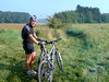
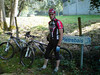
After a dry thursday it looked like we would have a nice and quiet ride in the sunshine today. When I got into my car at 6.50am the clouds were clear and there were wisps of mist hanging over the land. The river Meuse was breathing some heavy fog when I approached it and crossed the "Pere Pire" bridge in Huy. When I arrived at Stree there were already people getting ready to go. I met up with Geert aka Schijfrem. He also rides a Moots YBB and we decided to ride together as long as possible. I enscribed first and forked over 3.5 for the 55K distance. There were also rides of 25, 35 and 45K. When I asked at the inscription if they had an emergency number, they replied they did not. Some joker suggested I call 100 in case of trouble. Yeah, that one minus point I honestly did not expect on a ride that carries the Stany Smol tag. I later heard that in fact they did have an emergency number and they handed out cards with the number on it. So it seems that the early starters missed out on that.The Ride:Geert and I set off for the first couple of K's which plunged us almost immediately into Outrelouxhe. I recognized the trail from my Nandrin rides and knew we were in for a treat. The trail plunged into a rift and then followed a little river into a narrow valley. The dropoff was very steep - I walked it, later I noticed it was a 37% gradient on the GPS track ! - and the singletrail following the river was ondulating up and down just enough to keep the tension on the muscles. Great section. A little later we emerged on tarmac for a short stretch taking us down to the first heavy climb of the day. Over loose rocks and shifting pebbles we worked our way up the slope that approached 19% at places and took us some 100 heightmeters up the plateau. From there we dropped down again - this downhill is well known to me from the Nandrin trails were it has to be conquered uphill - and again care needed to be taken. Heavy rains have seriously deteriorated this track and at times the slope was 21%. Try doing that on loose stones and you get the picture. Very concentrated and a great experience. Below we followed the river again until we were at the lowest point possible in this forest. The Fond d'Oxhe as it is called. Obviously another 100 heightmeter climb was bound to follow. Not as steep as the first one but the trail was very beautiful, with rocks, roots and gullies making it tough to ride. At the top the 45 and 55K distances were splitting off and Geert decided to follow the 45, leaving me alone to continue on the 55K. I made a picture of him before we parted .
The trail now entered some kind of walking trail nicely circling through rock gardens and forest outcrops. We met some walkers here - girls with dogs - and it was nice to notice they were all very friendly. Especially the dogs. We stayed on the plateau a while and after an hours ride I came to the first ravito. This must have been some 17K into the ride. All distances merged here . There was some water and grenadine drink, cookies, waffles and also someone who was offering high-energy food and drinks of Nutrilite . I had a taste of everything and went on my way. I dropped down the slope again, before following a nice singletrail along the forest edge. On my right I could see the cooling towers of the Tihange nuclear plant. Impressive.
A long climb followed and gradually I was leaving the forest , coming out into the open fields before crossing the N66. A little later and after crossing the N641 there followed some very difficult climbs on rocks, roots and stones where I had to walk several times due to the slope and the wetness of the rocks. Just before Marchin I enjoyed the second rest stop of the day. This time there were some Red Bull girls to sheer us up and offer us some tasty beverage. I declined because I already have Red Bull mixed in my water bottle. But they were nice to look at.
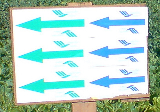
I passed the strangely curved church of Marchin and a tricky downhill - roots, stones, wet rocks - demanded my uttermost concentration to keep the rubber side down. A climb and descent into the field - with some grassy gullies to spice things a little and another steep descent before turning right onto what looked - and felt - like an abandoned railroad track. Nice section but I was glad I had a softtail bike here instead of a hardtail. The ondulating track brought me a few K's further before entering Modave. Here we had to follow some tarmac which led us to the entry gate of the castle grounds. Nice little downhill-uphill section here before I got to the 3rd rest stop of the day, exactly 40k into the ride. A great passage on the castle grounds followed , with a very tricky downhill and a passage through a ford. I didn't notice there was a bridge until I got my feet wet from the splashing water. But the sun was out and with some 20 degrees and no wind I didn't mind getting my feet wet. After Modave the slopes were getting a bit milder and before long I was out in the fields again. I noticed my rear tyre was slowly losing air so I decided to replace the inner tyre. Some stony fieldtracks and field passages giving way to amazingly narrow but very beautiful tracks brought me into Ramelot. Another ravito some 50K into the ride and the last couple of K's consisted of twisting trails into moist forests and a passage over a freshly harvested field. Crossing the N66 not far from Tinlot I knew what was coming. An uphill passage through a hollow road edged with trees but followed by a very wet downhill leading back towards Stree. I took the edge of the field on the left of the track instead of all the puddles and was rewarded by an almost clean bike when we finally made it back to the start. There Geert was already tasting some fine beer and we shortly exchanged our experiences . The Lowdown: What I liked:+ Great trails, with attention to lesser visited tracks+ the region and the use they made of what is offered+ dangerous downhills and road crossings well marked on shared trails for all distances+ distance splits well marked - before AND after the split+ arrowing sparse but suffiecient and very noticeable+ 4 rest zones - fruit, cookies , grenadine and water.
+ Red Bull and Energy Drinks stands.+ all this for only 3.5 What I did not like:- no cards with emergency numbers for the early starters- less heightmeters than announced- no danger signs on the 55K-only sectionsSynopsis: Obviously the trails were beautiful, in the beginning very tough in the forest section south of Tihange, with some very steep downhills and a couple of 100 heightmeters + climbs, difficult and long. In the end the ride didn't deliver the amount of heightmeters the organisation had promised, but I didn't really mind. We got nearly 1100 heightmeters on the 55K - that turned out to be almost 60K. And the tracks were never boring, instead surprising me all the time with nice finds and great views. A good knowledge of the local tracks leads the organisors to produce one hell of a ride. The arrowing was sparse at times - I missed an arrow twice - but the arrows used were very visible - black on yellow - and you could spot them from far. The distance splits were very well marked - both before and after the split. A minus point would be the fact that on the loops the 55K did seperately from the other loops, there were no danger signs before tricky downhills. They had danger signs on the shared loops with the other distances. Do they think that the 55k riders were all so experienced they didn't need to be warned? I would include the signs the next time.The 4 rest stops were well stocked, water and grenadine and some cookies, fruit and waffles. Nothing fancy but with some Energy drinks and food at the first, and the Red Bull girls at the second rest stop who can complain? And all this for a mere 3.5 ? Yes, indeed. I have no idea about the showers and the bike cleaning facilities since I didn't use either of them. I returned home happy and with a few more tracks to possibly include into my Nandrin trails. The only point that I would suggest the organisers fix urgently , is the lack of emergency numbers. Some of the downhills were really tricky and I saw a lot of people with broken chains and other mechanical problems. Provide an emergency number please.
The Bare Facts:
Profile of the Ride : CLICK
Profile the organisors provided:

Map of the Ride :

Pictures of the ride by Schijfrem : CLICK
[the Moots dude with the long pants is ME]
Ride Stats :
60K and 1090/1145 heightmeters (Polar/Garmin) in 3h46mins
Hill Factor:
18.17
6740/67195
15-08-2008, 00:00 geschreven door Big Bad Wolf
|
|
|
|
|
| 11-08-2008 |
| New Assos |

Ordered a new Assos biking short last week at Bike-Discount.de and got it delivered today. So I was keen to try it out. Its a 3/4 shorts aka as a knicker and I like it. It has the FI Mille inseam which I have grown quite fond of from the other Assos bibs I own. I also have one bib with the FI.13 seam but to be quite honest, despite its huge price I don't find this seam as comfortable as the FI Mille. Anyways, they delivered very fast and Assos makes the best biking gear ever. Period.Today I made the best of the fine weather - they were saying today would be the best day of this week - to do a nice and easy recovery ride along the Haasrode Tour.. starting from - you guessed it - Haasrode and then making my way over Bierbeek-Bremt, Willebringen, Hoksem towards the Goudberg geo-site where I took a little break.I added some extra little loops and made some pictures overlooking Hoegaarden before heading back over L'Ecluse and La Bruyere towards Hamme Mille. The pants performed nicely but I felt a little tired in the legs. Perhaps I should take a few days off from biking? I will see, if the weather turns bad the task of staying off of the bike will be made a lot easier.Ride Stats : 56K and 415 heightmeters in 2h20mins6679/66105
11-08-2008, 22:45 geschreven door Big Bad Wolf
|
|
|
|
|
| 09-08-2008 |
| Low Summer |

What a week this has been. From last wednesday evening almost every day brought a lot of rain. Even thunderstorms on thursday and yesterday. Today it has been sunny up till now but the forecast calls for more rain. One would almost think we are in autumn. I have scratched my plan to go to Chimay for the Raid des Sources. The amount of rain that has fallen there, coupled to an already wet environment, will make it a tough and muddy ride. I remember from last year how much we suffered on the 100K and then it had only rained the day before the event, not 25L/sq metre like it has done this week already. Another option is the Bataille des Ardennes, that takes place in Gomzé-Andoumont and that by some strange fluke I have never done before. It is situated in the beautiful area around Banneux-Aywaille-Stoumont-La Reid and Theux so it is a region I like very much. So it could be a unique chance to ride this tough ride.
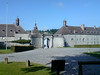
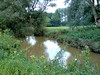
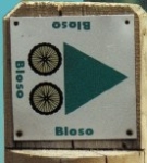
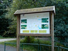
I will wait for the last weather forecasts to decide but the region over there is more stony so it can take in more water without becoming too muddy.Today I didn't feel very well, had a bit of a skin rash and felt tired. But I decided to take advantage of the sun and do an easy road ride. I followed the Red Bloso route that starts in Heverlee and loops over Sint Joris Weert, Sint Agatha Rode, Ottenburg, Terlanen, Neerijse and Korbeek Dyle. I took my GPS with me in my backpack just to record the ride. I took some time to stop at the Arenberg castle in Heverlee to make a few pictures and also in the beginning at the River Dyle. You can see how much water it holds, it has rained quite a bit.Ride Stats: 53K and 490/568 heightmeters (Polar/Garmin) in 2h16mins6545/65045
09-08-2008, 00:00 geschreven door Big Bad Wolf
|
|
|
|
|
| 06-08-2008 |
| Overijse and then some |

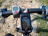
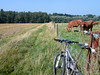
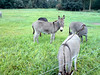
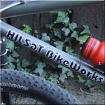
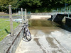
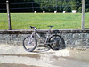
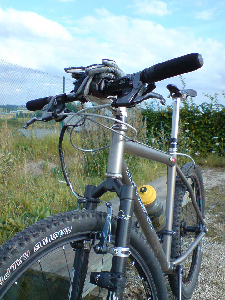
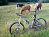
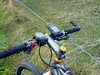
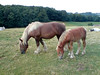
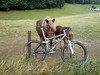
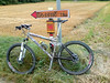
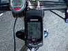
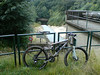
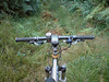
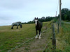
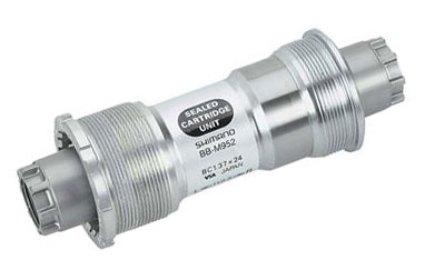
Had a few days rest to absorb last weekends' rides. Today it was rather hot when I rode out but I decided nevertheless to do an offroad ride. I set out into Meerdael forest and made the connection towards the Overijse Bloso routes in Sint Agatha Rode. The Moots was fitted with a new XTR bottom bracket and the play and noises were gone. Cool!I rode my version of the Two Valley Route, incorporating some shortcuts and an extra climb. Obviously I paused near the horses in Huldenberg to make a few pictures. You can also check out the placement of the Edge 705 on my handlebar on one of the pics.I had the Edge 705 fitted to my handlebar this time (there are two bikemounts provided in the box - one for the stem which went on the Merlin, and one for the handlebar which is on the Moots) and I was curious if it would stand up to the knocks of the terrain. But it didn't move and all went well. Its great to have the extra information the Edge 705 gives. I have it set up to display the time, the total distance, the direction, the height, the total heightmeters, the elapsed time and the current speed. I notice that it is a bit more generous with the heightmeters than my Polar S710, and when I upload the ride into the Garmin Training center it even adds some more heightmeters. I guess it re-calculates with the topographic map data. Anyway, since the Polar is coming along on all my bikes I will use its data for my calculations and yearly totals. The track today was fine, but at some places totally washed away. This must have happened last sunday when it rained quite a bit in a short time. The Moots isn't as nimble as the Merlin in those conditions but it took me where I wanted to go anyway. I went back into Meerdael after I completed the Overijse trails for some extra climbing and a few nice singletracks. The sun was already setting but it was still very warm and great for biking.Ride Stats : 54.7K and 655/821 heightmeters (Polar/Garmin) in 2h48mins6491/64555
06-08-2008, 00:00 geschreven door Big Bad Wolf
|
|
|
|
|
| 03-08-2008 |
| Loonbeek |
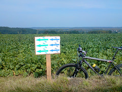
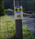
I initially wasn't planning on doing much this sunday. I stayed in bed late and after that made my ride report on yesterdays ride. Around noon my friend Roger passed by. He was very enthusiastic about the Loonbeek ride so I decided to ride out anyway and try to pick up on this ride. The weather was dry but with menacing clouds and quite a fierce westerly wind.The first 12K took me up and down through Meerdael forest. I was on the Merlin again and none of the trails proved to be a real challenge for this bike. When I climbed out of Nethen towards Pecrot I saw an arrow which I knew belonged to the Loonbeek ride. It was nearly 2pm so I was a bit surprised the de-arrowing team had not yet passed. Anyway, I followed the arrows and before long I rode through Sint Agatha Rode and the Margijsbos into Loonbeek were the official start was. The ride then made a loop around Huldenberg. Check the GPS map I have included below for the exact route. It proved to be a very nice loop but they left some challenging bits out. Probably didn't want to make the ride too difficult. The arrowing was sparse but sufficient. Obviously no feed zones but that didn't bother me, I always carry enough food and drink and not having paid any entrance I wasn't going to stop even if they had still been there. But all was gone, except the arrows and some danger signs. I didn't see any distance splits which was peculiar but since I was aiming for the longest distance anyway I didn't really care.
Roger had mentioned a steep climb and when the route looped back towards Sint Agatha Rode Bos I instinctively knew which climb it was going to be. Indeed, the 25% gradient climbing up into that forest proved quite a workout. But I know this climb very well and it proved no difficulty for the Merlin or me. But I can imagine a lot of people walking here. The trails then continued towards Archennes for a big loop into Brabant Walloon. Bossut, Gottechain, just shy of Grez Doiceau and then Hamme Mille before going back towards Nethen and the point where I picked up on the lap. I had around 62K and 750 heightmeters here, the Loonbeek ride was 50K and some 540 heightmeters. I looped back into Meerdael forest for a final stretch before arriving home.Ride Stats : 71K and 845/942 heightmeters (Polar/Garmin) in 3h39minsLoonbeek TT : 50K and 534 heightmeters (Polar)
MAP :

PROFILE :
(click)6436/63900
03-08-2008, 00:00 geschreven door Big Bad Wolf
|
|
|
|
|
| 02-08-2008 |
| On World Championship Trails part II |
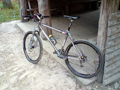
Today I had made another appointment with Albert Dumont to ride part II of the Verviers 2007 MTB Marathon World Championships trail. We met up at the Ardennes Outlet centre in Verviers. The weather had been dry and hot these last few days but now some menacing clouds and a stiff breeze made it less warm and in fact better suited for biking. Because the Moots was still at Filip Sport I took the Merlin out today.
From downtown Verviers we first had to make our way up to Heusy and next to Mangombroux to go offroad along the Domaine Militaire in the Bois de Jalhay. Albert was talking about the history of Verviers in its golden age but before long we had to concentrate on the track that was very stony and running uphill all the time - "french flat" Albert calls it . When the track evened out a little bit we were making our way over roots and next to big puddles. After crossing the N679 we had a good view of the dark forests lying in front of us. A fast stony downhill followed by a climb brought us to Surister. The Merlin was already proving its worth. The rear suspension providing more traction in the climbs and also having a 22 chainring in front was a blessing on the very steep hills (I saw many 20%+ gradients on my GPS profile) . And obviously, having 10cm of travel in front and rear was a big bonus in the downhills.
From Surister we had to make our way towards the River Hoegne. The descents were very technical at times and it was a joy to be able to ride them all - when they were not blocked by fallen trees that is. When we crossed the river Hoegne for the first time , we were in for a real treat. A singletrack meandering up and down high above the river brought us to the next crossing. When I ride my "Longest Downhill" I stay close to the Hoegne, but next time I will certainly try to use this singletrack which starts close to the Croupet du Moulin.
At the Croupet du Moulin we disappeared upwards into the Foret Domaniale de Gospinal for a series of tough climbs followed by tricky downhills. The forests were very beautiful but the loops were taking a lot of strenght out of my legs. Still, the pace was right and the bike was giving me more comfort than the Moots could do. When we came back down to the Hoegne at last we had around 22K and just short of 600 heightmeters.
Wow, this was one intense start. From the Hoegne we then made our way to the northeast and into Charneux. Time for a first snack before we arrived in Jalhay a few kilometres later. Not after another downhill followed by another climb of course. The track builder, Léon Hoenders, was in my mind a lot of time. This man not only seems to know all the nicest trails around here, but he also had a bit of a sadistic streak to him. But, obviously, this was not your "average organised ride" trail - with all due respect to those. No, we were on a World Championship trail and this was supposed to be a very tough and taxing ride.
At Jalhay we took a break to stock some food and drink. When we rode out of Jalhay and back to the trail, we had to take shelter because of a light rain shower. Mmm, some of those clouds were dense enough to contain showers. Still, the temperature was around 20 degrees and the shower seemed to be very local. We were lucky.
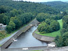
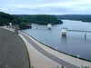
From Jalhay the trail made its way towards the majestic Westhertogenwald. Instead of the pine trees we would now enter a forest where broad-leaved trees are more common. The Hertogenwald extends over 12000 hectares and contains the Barrage de la Gileppe which we would soon encounter, but not after spending many many a drop of sweat. We were enjoying the majestic splendour of this forest and when we caught our first glimpse of the gigantic lake through the trees it would still elude us for many kilometres to come.
First we had to climb up to the highest point of our route - 456metres - next to the N68 before returning fullspeed into the Trou Malbrouck. Here Albert took me to the fawcett of the Tunnel de la Soor, a 2.5 k long tunnel dug to feed extra water into the Gileppe lake. He also told me about the disaster during its building, taking the lifes of 8 men when they drowned in that pipe during heavy rains. Now the outlet was only producing a trickle of water but after heavy rains the force of the water provides for a 50-metre long geyser. Impressive.
From the Trou Malbrouck the trail would now have us flirting with the Gileppe lake a couple of times, but we would have to climb away from it - and some very steep climbs at that - several times before we finally made it to the barrage. In the forest we also did a very nice singletrack downhill. We paused at the barrage to take some pictures of the famous Lion, looking very stern towards the Northeast.
From the barrage we now made out way up towards to a viewpoint - took a picture there - and then disappeared into the forest once more for another series of climbs and descents taking us through the Bois de Goë and the Bois de Hevremont towards Hevremont. The toughest bits were now behind us but Léon still provided for a few surprises. Some very nice tracks near Brou and some beautiful singletrack that would eventually drop us near the river Vesdre east of Ottomont. Some tracks through Verviers itself, with stairs running up and down to wring the last bits of strenght our of our legs and demand high concentration before we spotted the Ardennes Outlet parking lot and the end of our journey.
Another tough ride. The Hill factor was not as high as the first part, and the ride was less intense but still this is a tough ride. Especially the parts next to the river Hoegne and the Hertogenwald are very demanding - both the uphills and the technicity of some of the downhills - but the beauty of the surroundings make you forget a lot of the suffering. It is impossible to capture all the trails and tracks into writing, you just will have to ride this track to really understand the beauty and the difficulty of it. But be prepared, this is a ride that will take you anywhere between 4 and 6 hours or more to complete - riding time that is !
Thanks to Albert for guiding me around this majestic trails . The Merlin proved to be a great bike - again and we were lucky with the weather - again. Thanks also to Léon Hoenders, the architect of one of the toughest - and certainly most beautiful - trails in Belgium.
My first ride with the Garmin Edge 705 also proved to be a success. I was a bit worried it would jam the workings of my Polar S710 (which the older Garmin Geko did) but I had no trouble with that. Having all the information on one screen was great, and of course looking at the track afterwards provided a lot of information. Another one won over for GPS.
Ride Stats : 70km and 1665 / 1758 heightmeters (Polar / Garmin) in 5h00mins
Ride profile : CLICK
Hill Factor : 23.8
6366/63055
02-08-2008, 00:00 geschreven door Big Bad Wolf
|
|
|
|
|
| 29-07-2008 |
| Relaxing ride |
Today saw another very hot day. Nearly 30 degrees and around 5pm I set out with the Hilset for a relaxing ride. First I rode through Meerdael forest towards Hamme Mille and then I did a loop involving Sart Melin, Saint Jean Geest and Hoegaarden. Came back over L'Ecluse, La Bruyere and Pietrebais.
Some nice landscapes painted in summer colors. There was a nice breeze blowing from the west making the temperature bearable to ride in. I had a very relaxing ride. My average heartrate was 100bpm and I had a max of 127bpm somewhere. Lets hope we can shave a bit off of those high temps without attracting too much rain in the progress.
Ride Stats : 60.5K and 410 heightmeters in 2h36mins
6187/60600
29-07-2008, 00:00 geschreven door Big Bad Wolf
|
|
|
|
|
|
|
| Gastenboek./.Guestbook |
Druk op onderstaande knop om een berichtje achter te laten in mijn Gastenboek. /
Press the button below to write in my Guestbook.
|
| Email Me |
Press the button to send me a mail
|
|
|
|