|
|
|
| Tales from the Woods |
|
|
| 06-08-2008 |
 Overijse and then some Overijse and then some |

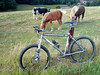
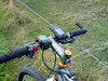
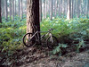
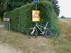
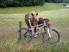
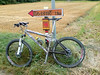
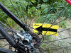
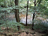
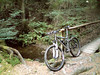
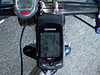
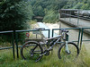
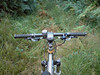
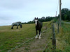
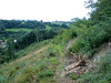
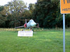
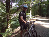
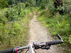
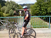
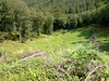
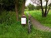
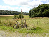
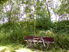
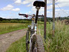
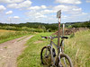
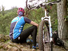
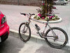
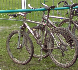
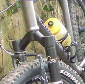
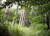
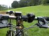
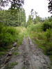
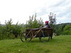
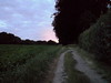
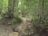
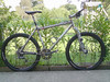
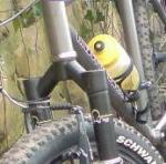
Had a few days rest to absorb last weekends' rides. Today it was rather hot when I rode out but I decided nevertheless to do an offroad ride. I set out into Meerdael forest and made the connection towards the Overijse Bloso routes in Sint Agatha Rode. The Moots was fitted with a new XTR bottom bracket and the play and noises were gone. Cool!I rode my version of the Two Valley Route, incorporating some shortcuts and an extra climb. Obviously I paused near the horses in Huldenberg to make a few pictures. You can also check out the placement of the Edge 705 on my handlebar on one of the pics.I had the Edge 705 fitted to my handlebar this time (there are two bikemounts provided in the box - one for the stem which went on the Merlin, and one for the handlebar which is on the Moots) and I was curious if it would stand up to the knocks of the terrain. But it didn't move and all went well. Its great to have the extra information the Edge 705 gives. I have it set up to display the time, the total distance, the direction, the height, the total heightmeters, the elapsed time and the current speed. I notice that it is a bit more generous with the heightmeters than my Polar S710, and when I upload the ride into the Garmin Training center it even adds some more heightmeters. I guess it re-calculates with the topographic map data. Anyway, since the Polar is coming along on all my bikes I will use its data for my calculations and yearly totals. The track today was fine, but at some places totally washed away. This must have happened last sunday when it rained quite a bit in a short time. The Moots isn't as nimble as the Merlin in those conditions but it took me where I wanted to go anyway. I went back into Meerdael after I completed the Overijse trails for some extra climbing and a few nice singletracks. The sun was already setting but it was still very warm and great for biking.Ride Stats : 54.7K and 655/821 heightmeters (Polar/Garmin) in 2h48mins6491/64555
06-08-2008, 00:00 geschreven door Big Bad Wolf
|
|
|
|
|
| 03-08-2008 |
| Loonbeek |
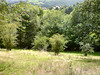
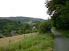
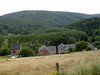
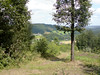
I initially wasn't planning on doing much this sunday. I stayed in bed late and after that made my ride report on yesterdays ride. Around noon my friend Roger passed by. He was very enthusiastic about the Loonbeek ride so I decided to ride out anyway and try to pick up on this ride. The weather was dry but with menacing clouds and quite a fierce westerly wind.The first 12K took me up and down through Meerdael forest. I was on the Merlin again and none of the trails proved to be a real challenge for this bike. When I climbed out of Nethen towards Pecrot I saw an arrow which I knew belonged to the Loonbeek ride. It was nearly 2pm so I was a bit surprised the de-arrowing team had not yet passed. Anyway, I followed the arrows and before long I rode through Sint Agatha Rode and the Margijsbos into Loonbeek were the official start was. The ride then made a loop around Huldenberg. Check the GPS map I have included below for the exact route. It proved to be a very nice loop but they left some challenging bits out. Probably didn't want to make the ride too difficult. The arrowing was sparse but sufficient. Obviously no feed zones but that didn't bother me, I always carry enough food and drink and not having paid any entrance I wasn't going to stop even if they had still been there. But all was gone, except the arrows and some danger signs. I didn't see any distance splits which was peculiar but since I was aiming for the longest distance anyway I didn't really care.
Roger had mentioned a steep climb and when the route looped back towards Sint Agatha Rode Bos I instinctively knew which climb it was going to be. Indeed, the 25% gradient climbing up into that forest proved quite a workout. But I know this climb very well and it proved no difficulty for the Merlin or me. But I can imagine a lot of people walking here. The trails then continued towards Archennes for a big loop into Brabant Walloon. Bossut, Gottechain, just shy of Grez Doiceau and then Hamme Mille before going back towards Nethen and the point where I picked up on the lap. I had around 62K and 750 heightmeters here, the Loonbeek ride was 50K and some 540 heightmeters. I looped back into Meerdael forest for a final stretch before arriving home.Ride Stats : 71K and 845/942 heightmeters (Polar/Garmin) in 3h39minsLoonbeek TT : 50K and 534 heightmeters (Polar)
MAP :

PROFILE :
(click)6436/63900
03-08-2008, 00:00 geschreven door Big Bad Wolf
|
|
|
|
|
| 02-08-2008 |
| On World Championship Trails part II |

Today I had made another appointment with Albert Dumont to ride part II of the Verviers 2007 MTB Marathon World Championships trail. We met up at the Ardennes Outlet centre in Verviers. The weather had been dry and hot these last few days but now some menacing clouds and a stiff breeze made it less warm and in fact better suited for biking. Because the Moots was still at Filip Sport I took the Merlin out today.
From downtown Verviers we first had to make our way up to Heusy and next to Mangombroux to go offroad along the Domaine Militaire in the Bois de Jalhay. Albert was talking about the history of Verviers in its golden age but before long we had to concentrate on the track that was very stony and running uphill all the time - "french flat" Albert calls it . When the track evened out a little bit we were making our way over roots and next to big puddles. After crossing the N679 we had a good view of the dark forests lying in front of us. A fast stony downhill followed by a climb brought us to Surister. The Merlin was already proving its worth. The rear suspension providing more traction in the climbs and also having a 22 chainring in front was a blessing on the very steep hills (I saw many 20%+ gradients on my GPS profile) . And obviously, having 10cm of travel in front and rear was a big bonus in the downhills.
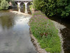
From Surister we had to make our way towards the River Hoegne. The descents were very technical at times and it was a joy to be able to ride them all - when they were not blocked by fallen trees that is. When we crossed the river Hoegne for the first time , we were in for a real treat. A singletrack meandering up and down high above the river brought us to the next crossing. When I ride my "Longest Downhill" I stay close to the Hoegne, but next time I will certainly try to use this singletrack which starts close to the Croupet du Moulin.
At the Croupet du Moulin we disappeared upwards into the Foret Domaniale de Gospinal for a series of tough climbs followed by tricky downhills. The forests were very beautiful but the loops were taking a lot of strenght out of my legs. Still, the pace was right and the bike was giving me more comfort than the Moots could do. When we came back down to the Hoegne at last we had around 22K and just short of 600 heightmeters.
Wow, this was one intense start. From the Hoegne we then made our way to the northeast and into Charneux. Time for a first snack before we arrived in Jalhay a few kilometres later. Not after another downhill followed by another climb of course. The track builder, Léon Hoenders, was in my mind a lot of time. This man not only seems to know all the nicest trails around here, but he also had a bit of a sadistic streak to him. But, obviously, this was not your "average organised ride" trail - with all due respect to those. No, we were on a World Championship trail and this was supposed to be a very tough and taxing ride.
At Jalhay we took a break to stock some food and drink. When we rode out of Jalhay and back to the trail, we had to take shelter because of a light rain shower. Mmm, some of those clouds were dense enough to contain showers. Still, the temperature was around 20 degrees and the shower seemed to be very local. We were lucky.
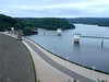
From Jalhay the trail made its way towards the majestic Westhertogenwald. Instead of the pine trees we would now enter a forest where broad-leaved trees are more common. The Hertogenwald extends over 12000 hectares and contains the Barrage de la Gileppe which we would soon encounter, but not after spending many many a drop of sweat. We were enjoying the majestic splendour of this forest and when we caught our first glimpse of the gigantic lake through the trees it would still elude us for many kilometres to come.
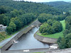
First we had to climb up to the highest point of our route - 456metres - next to the N68 before returning fullspeed into the Trou Malbrouck. Here Albert took me to the fawcett of the Tunnel de la Soor, a 2.5 k long tunnel dug to feed extra water into the Gileppe lake. He also told me about the disaster during its building, taking the lifes of 8 men when they drowned in that pipe during heavy rains. Now the outlet was only producing a trickle of water but after heavy rains the force of the water provides for a 50-metre long geyser. Impressive.
From the Trou Malbrouck the trail would now have us flirting with the Gileppe lake a couple of times, but we would have to climb away from it - and some very steep climbs at that - several times before we finally made it to the barrage. In the forest we also did a very nice singletrack downhill. We paused at the barrage to take some pictures of the famous Lion, looking very stern towards the Northeast.
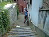
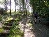
From the barrage we now made out way up towards to a viewpoint - took a picture there - and then disappeared into the forest once more for another series of climbs and descents taking us through the Bois de Goë and the Bois de Hevremont towards Hevremont. The toughest bits were now behind us but Léon still provided for a few surprises. Some very nice tracks near Brou and some beautiful singletrack that would eventually drop us near the river Vesdre east of Ottomont. Some tracks through Verviers itself, with stairs running up and down to wring the last bits of strenght our of our legs and demand high concentration before we spotted the Ardennes Outlet parking lot and the end of our journey.
Another tough ride. The Hill factor was not as high as the first part, and the ride was less intense but still this is a tough ride. Especially the parts next to the river Hoegne and the Hertogenwald are very demanding - both the uphills and the technicity of some of the downhills - but the beauty of the surroundings make you forget a lot of the suffering. It is impossible to capture all the trails and tracks into writing, you just will have to ride this track to really understand the beauty and the difficulty of it. But be prepared, this is a ride that will take you anywhere between 4 and 6 hours or more to complete - riding time that is !
Thanks to Albert for guiding me around this majestic trails . The Merlin proved to be a great bike - again and we were lucky with the weather - again. Thanks also to Léon Hoenders, the architect of one of the toughest - and certainly most beautiful - trails in Belgium.
My first ride with the Garmin Edge 705 also proved to be a success. I was a bit worried it would jam the workings of my Polar S710 (which the older Garmin Geko did) but I had no trouble with that. Having all the information on one screen was great, and of course looking at the track afterwards provided a lot of information. Another one won over for GPS.
Ride Stats : 70km and 1665 / 1758 heightmeters (Polar / Garmin) in 5h00mins
Ride profile : CLICK
Hill Factor : 23.8
6366/63055
02-08-2008, 00:00 geschreven door Big Bad Wolf
|
|
|
|
|
| 29-07-2008 |
| Relaxing ride |
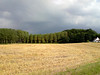
Today saw another very hot day. Nearly 30 degrees and around 5pm I set out with the Hilset for a relaxing ride. First I rode through Meerdael forest towards Hamme Mille and then I did a loop involving Sart Melin, Saint Jean Geest and Hoegaarden. Came back over L'Ecluse, La Bruyere and Pietrebais.
Some nice landscapes painted in summer colors. There was a nice breeze blowing from the west making the temperature bearable to ride in. I had a very relaxing ride. My average heartrate was 100bpm and I had a max of 127bpm somewhere. Lets hope we can shave a bit off of those high temps without attracting too much rain in the progress.
Ride Stats : 60.5K and 410 heightmeters in 2h36mins
6187/60600
29-07-2008, 00:00 geschreven door Big Bad Wolf
|
|
|
|
|
| 27-07-2008 |
| Merlin Magic |
Since the Moots would have to stay over at Filip Sport for a few days - getting the bottom bracket out proved not to be that easy - I took the Merlin out for a spin around the Meerdael BLOSO routes this morning. The weather was still hot and moist with a remote chance of thunderstorms. I checked the pressure in my shock and forks (105 and 105 psi) and they were still unchanged from the last time I rode this bike. Cool, so the seals are airtight.I started out very easy although with a bike like the Merlin Works 4.0 you have a tendency to go fast. It rolls very smoothly - I credit the DT Swiss 240s hubs for that - and the terrain around Meerdael is just too easy and accomodating for a bike like that. So taking it out here was a bit overkill but I overly enjoyed it nevertheless. Taking everything the trail throws at you with a big grin is just the mutts' nutts. There were quite a bit of bikers on the trails and from time to time I injected a little extra section - usually more technical stuff and/or an extra climb or downhill. Just for the fun of it. The Merlin does that to me. It makes me try that more difficult side of the road or jump that berm instead of riding around it. I discovered and Enduro track dropping down into Sint Joris Weert, unfortunately the last bit is blocked by trees. Would have been a nice alternative to the normal downhill in the hollow road, which, in itself is not easy also. But the trails were perfect. Dry or just a little bit moist where the sun didn't reach the forest floor.Met up with someone from work and we had a little chat during the short time our paths ran parallel. I'm not looking forward to go back to work again, but then again, the 2008 Tour de France is finished and I have had my fair share of rides these last 3 weeks so going back to work is not that bad. During the last 10K of the ride I was overtaken by a guy from Heverlee. I upped the speed a bit and we rode the last 10K together. Very fast pace and he only had to let me go on the more technical bits. Had a very satisfying ride today, even though my legs were still feeling tired from last fridays's ride. But looking at my average speed it seems like I had one of my better days.. or is it that magical Merlin that gave me wings?Ride Stats : 58K and 520 heightmeters in 2h46mins6126/60190
27-07-2008, 14:56 geschreven door Big Bad Wolf
|
|
|
|
|
| 25-07-2008 |
| On World Championship Trails |
Today I had made an appointment with Albert Dumont (aka Berthold on some mtb forums) to ride the first part of the 2007 World Championship Marathon trails in Verviers. We decided to meet in the little town of Banneux. Albert knows these trails like the back of his hand and if that should fail he also had a GPS with him. The complete World Championship track is downloadable from the O2 Bikers site. We decided to ride the first - and most intense - part of it.
The weather was great , sunny and luckily also a nice breeze was blowing . The trails conditions would also prove to be very favorable. Dry with only the occasional muddy patch.
From the Banneux church we quickly made our way into the forest on a descent into the Bois de Tancremont. Albert adapted an easy but steady pace which would prove to be ideal during the ride. I knew this was going to be a tough ride and the first downhill plunged me with both tyres into Ardennes reality. Mind where you are going, the trails are beautiful but very treacherous. We quickly dropped from our 300 metres high starting point to a mere 130 metres where we crossed a bridge over one of the many small ruisseaux - little rivers - that feed the river Vesdre. Into the Bois de Tancremont we had to climb all the way back up. The tracks were tricky, and the climbing very steep. Yep, this was going to be a tough ride. After crawling our way up again we crossed the N666 and in Tancremont we had a beautiful overview of the region with Theux and Juslenville among the visible highlights. We were ready for the plunge towards the Forges Thiry although before that we had to conquer a very steep singletrack through some brambles. The track then takes some broader paths than the Red Adeps route of Theux for the descent , but they were steep nevertheless. Albert and his 29er Specialized Stumpjumper seemed to float over all the rocks and roots and through the gullies . All I had to do was try to follow. This kind of track is hard on man and machine and I could hear the Moots groan from time to time. Other than the special sound of my Chris King freewheel and the crickety-crack of my worn out XTR bottom bracket I heard some clangs when a rock was thrown against my spokes or frame. The Moots is a great climber even though the climbs were a tad too steep to be really comfortable even on my 26/34 smallest gear combination. Perhaps a 24 or even a 22 smallest chainring would have been more suitable here. The climb along the ruisseau de Sohan - with some muddy patches as usual - brought us to the Chateau de Sohan. Here we stopped at a stone in memory for the people who were executed by the Germans in WWII. Now there would follow an amazingly beautiful singletrack around the western side of the Bois des Nids d'Aguesses. After that a steep climb on tarmac had me and my bike grunting. The sun was hammering down as well and I was glad to see the top of this hill. We had a little bite to eat and then dropped down again to complete the loop back towards the Chateau de Sohan.
Of course we had to climb again, this time towards the Chateau de Maison-Bois. We could see the valley of the Vesdre now to our left and after a few more thrilling trails we were in Ensival and ready for the drop into Verviers. I wanted to refill my drinking bottle so we took some time to look around for a place where we could buy something to drink. Another snack to keep up our strenght and then we made the connection downwards to the start. This is situated at the Ardennes Outlet Centre . We crossed the river Vesdre and began a long climb on tarmac towards Lambermont. Before long we were back offroad and were following an exciting singletrail on the slopes overlooking the Fond and ruisseau de Fierain. At times we were riding on pure bedrock so I was very happy it was dry. These things can get very slippery when wet. For now they were only very steep and proved to be quite a challenge. I had to walk a couple of times due to the sheer steepness and the roots which were protruding left and right of the track making it very difficult to remain riding upwards. Great challenges. At this time I could also start to feel my legs. During the long downhills they settled into some kind of recovery mode but each time the next climb announced itself the muscles protested and would only yield after a few hundred metres. And the toughest bit was yet to come !
Between Tribomont and Cornesse the track didn't drop as low into the valley thus making it more or less the easier bit of the ride. Take this with a grain of salt though. Even the easy bits are tough here !
Then a downhill towards the Vesdre announced itself and it was "Hail Sweet Mary and Joseph" time. Descending in a narrow gully filled to the brim with loose stony rubble demanded the utmost of my concentration. The bike bounced from left to right over and between the stones, my disc brakes were running hot and dropping for almost 2 kilometres in length this was one hell of a downhill. . And, alas, instead of crossing the Vesdre at this point , we had to ride all the way up again. On a very steep, narrow and at times very technical trail. This is one of the best and most difficult climbs of this ride and I enjoyed myself despite the pain and the fatigue in the muscles. At the top of this climb - in Goffontaine - we had to drop down again for some 2 kilometres towards the river Vesdre - again along a very technically challenging trail. Wow, this was mountainbiking in Belgium at its very best ! We had a little break at the bridge over the river Vesdre to look at the last challenge that awaited us. The long climb into the Bois de Fraipont - Albert calls it "Banneuxer Joch" - back towards Banneux. This proved to be quite a tough nut to crack and yes, we had a "schiebe' passage as well. The track was very eroded and just too steep to ride at one point, making us push our bikes upwards. 2.5K of climbing squeezed the last bit of strength out of my legs and I was glad when I made out the Chateau de Banneux between the trees .
Well, what can I say, this must have been one of the most intense rides I've done in Belgium. We had 52K in the end but you can easily subtract 3 K from that because we had to ride to and from the trail in Banneux and we did an extra loop in Verviers looking for something to drink. That makes it a 49K/1475hm ride and that is a Hill Factor of 30.
I knew the Theux - Pepinster region was among the most beautiful of Belgium and todays' ride certainly did confirm that. I must thank Albert for his excellent guiding and his thorough knowledge of all the places we passed made it somehow easier for me to remember where we have been . The local flora and fauna also has no secrets for him. Thanks Albert for a great day out !
Ride Stats : 52k and 1475 heightmeters in 4h12minsRide Profile : CLICK Hill Factor : 28.4 for the complete ride, 30 for the trail only6068/59670
25-07-2008, 00:00 geschreven door Big Bad Wolf
|
|
|
|
|
| 24-07-2008 |
| Ronde van Vlaams Brabant bis |

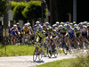
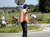
Today the "Ronde van Vlaams Brabant" passed right before my door. Time to take the trusty Nikon out and snap some shots while the peloton speeded through. Not easy when they make 50-60kph but at least the little twist into the Lijstersstraat made them slow down a little bit. The weather was glorious - not a cloud in the sky and since it is July it was hot - and a bit windy which was fine. Don't know who won but if you want to know click HERE
In the evening I joined the KBC MTB guys for a quick spin around the basic loop of our annual organised ride. This takes place on August 17th starting from the Sports Centre in Haasrode. It's a great ride so keep this date free. We went rather fast and I could feel my legs protesting. This was due to not having recovered from yesterdays' fast ride. Luckily someone had a flat tyre which allowed for a few moments of rest. I also had to get used to the Litespeed again after having enjoyed the comfortable fastness of the Moots for the last couple of offroad rides.  Ride Stats : 42K and 425 heightmeters in 2h04mins6016/58195 Ride Stats : 42K and 425 heightmeters in 2h04mins6016/58195
24-07-2008, 22:56 geschreven door Big Bad Wolf
|
|
|
|
|
| 23-07-2008 |
| Ronde van Vlaams Brabant |
Because the 2nd leg of the "Ronde van Vlaams Brabant" passes right before my door tomorrow , I obviously couldn't resist riding the loops . As it turned out I rode the big loop twice and the small one once. Had a bit of interval training on the finish climb with my legs burning nicely by the third time I passed there. Good average as well, I always tend to ride a little faster when I am on an official race circuit. But of course I had to take care at the crossroads and respect the red lights. Even then I was pretty fast today. Ride Stats : 58k and 475 heightmeters in 2h14mins5974/57770
23-07-2008, 21:35 geschreven door Big Bad Wolf
|
|
|
|
|
| 22-07-2008 |
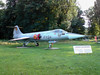
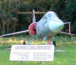
| F104 |
It had been a while since I did some road riding so today I took my Hilset out for a ride along the Ludo Dierckxsens circuit. Noticed they displayed a F104 Starfighter near the side entrance of the Beauvechain 1st Wing Airforce base. Of course I couldn't resist taking a picture. I remember when I was 14 or 15 years old I used to climb in the tallest tree in our garden to watch flocks of F104's flying over. Obviously, since then the amount of jet flying done by our Airforce has strongly diminished plus the F16's have moved away from Beauvechain to Kleine Brogel. Still, this bird brings back a lot of memories. Nice. 
22-07-2008, 21:55 geschreven door Big Bad Wolf
|
|
|
|
|
| 20-07-2008 |
| Ad's Owl |

I wanted to ride my complete Secret Meerdael Loop today, so I started out early because I know what a tough ride this is. It's secret so I can't say very much about it, except that the first part consists of mainly small trails and twisting singletracks and yields around 260 heightmeters in about 20K. I took an hour and 22 minutes for that part, so it's by no means easy going.
The second part is the really tough one, consisting of a relentless string of small steep hills that takes all the strenght out of your legs. This part is around 45K long and has a whopping 800 heightmeters in it. Not bad for Meerdael forest isn't it? I added a few extra bits and took out some others where the trails were blocked by fallen trees. The tracks were dry-ish in the beginning but during the ride it rained for 3 short periods, making the last bit also very slippery. I was a bit upset because until that last 5K or so, my bike was as good as clean. The last K's made it muddy though because of the top soil being wet . As usual I was swearing and cursing and basically dooming all horses to hell. Horseback riding is very popular these days and the hooves do a lot of damage to the trails. Of course they have their own trails but like most bikers they love to ride their steed also where it is NOT allowed, turning beautiful singletrails into pothole-ridden nightmares. Good thing I was with the Moots but still I could feel all the bumps in my upper torso and arms. Oh well, it's supposed to be a tough ride isn't it.
20-07-2008, 15:46 geschreven door Big Bad Wolf
|
|
|
|
|
| 18-07-2008 |
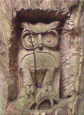
| Exploration |
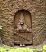
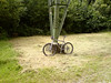
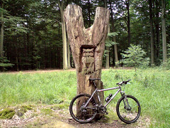
After a days' rest I was eager to get om my bike again. The weather was overcast but it looked like it would remain dry. Didn't feel like riding on the road, instead I took the Moots out for a bit of exploration in and around the Dyleland area. I had read about Ad Wouters sculptures in the Heverleebos and Meerdaelwoud so I wanted to check some of those out - again. I started out into the Heverleebos and rode up to the Arboretum where I saw the first of his sculptures. From there I made my way over to Oud-Heverlee and the Dyleland area. In Korbeek-Dyle I entered the Doode Beemde . This is a wet area surrounding the river Dyle. It was quite manageable despite the rain of the last days. But that rain was often just a few drops of light rain, as it would turn out not enough to really create deep mud. After crossing the Doode Beemde I rode over to Neerijse where I did a nice loop into the Margijsbos. Until now the ride had been quite flat but now the heightmeters were beginning to add themselves on my Polar and in my legs. Discovered some nice singletracks and then rode over the Smeysberg and into the St Agatha Rode bos. From there I dropped into Eerken and rode up the long hollow road into the Bois de Laurensart. Quick downhill into the field that lies in the middle of this forest and then I took the climb following the Overijse route. Some more exploring towards Gastuche and then straight through the Bois de Laurensart back down towards Florival. Here I climbed the slope towards La Malaise before dropping into Pecrot and back out of it along the railroad and then up into the Bois de Beaumont. From here it wasn't very far to the Meerdaelwoud where I first stopped for a drink at the Hertebron before climbing up towards the Kluis area. I crossed the Naamsesteenweg to have a look at some other Ad Wouters sculptures in the Walendreef. A fine ride and I passed some areas I hadn't been in for a while. The pace was relaxed and I only fell a few raindrops throughout the entire ride.Ride Stats : 62K and 730 heightmeters in 3h34mins5778,5/55655
18-07-2008, 17:08 geschreven door Big Bad Wolf
|
|
|
|
|
| 16-07-2008 |
| For a few heightmeters more. Part II : Accro Bike |
This morning I had an appointment with my friend Roger to ride the Accro Bike - or parts of it. Unfortunately when Roger arrived at my place it had started raining. I'm not too fond of starting out in the rain plus I still felt tired from yesterdays' ride. So Roger had to ride on his own, since he could not ride in the evening - the weather forecast called for drizzle in the morning and the early afternoon with dryer weather coming in later in the day. After the Tour de France finish I checked Meteox for the current rain forecast and all looked clear.
Around 5pm I rode out, very careful to warm up my sore legs. When I arrived in Grez-Doiceau I set on the Accro Bike track in the reverse direction. The rain didn't leave to many puddles, except for some place in the forest. The weather was still overcast so visibility was not high under the leaves either making some parts very dangerous ro ride.
Ride Stats : 65K and 935 heightmeters in 3h42mins5716/54925
16-07-2008, 22:56 geschreven door Big Bad Wolf
|
|
|
|
|
| 15-07-2008 |
| Nandrin White and Red and some extra |

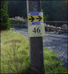
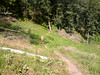
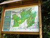
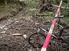
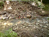
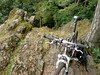
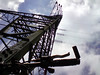
Today I was set to go to Nandrin. A little village a few klicks south-east of Huy where I know this beautiful loop local bikers conceived more than 10 years ago. No-one ever does these loops anymore because the signage is as good as gone and the trail maps cannot be had anymore. Still, I HAVE the trail maps AND the white and red loops are engraved in my memory. The trails are a mixture of forest and field roads, sometimes very rocky, sometimes rooty and always tricky and treacherous. The combination of the two loops yields around 48K and some 800 heightmeters. During my last visits I had noticed some newer signage, Red and Yellow ADEPS signs which might prove interesting to know where they went to. So when I crossed some Green Adeps arrows today I decided to try and follow them to see where they went.Tavier Intermezzo:I was lucky because after only a few kilometers I was at the starting point of this green route. It turned out to be the little village of Tavier. Together with neighbouring Anthisnes they have set up quite a few walking and cycling routes. The Green turned out to be the most interesting ones - getting 3 on a scale of 3 - and with 17K it looked do-able. So I tried to memorize the first couple of crossroads and set out on that route. I took some pictures of the trail map for future reference. Sadly enough the markings were not very good.At the first crossroads there was already nothing, except an empty pole where the signage used to hang. Damn ! Deciding it wasn't any use continuing I decided to study the route map at home, and come back when this map had been marked on an IGN map. That way I would have more chances of actually making the whole loop. So the Tavier loop is to be continued on another day.Back to the Nandrin routes:So I had to backtrack the Green route from Tavier to the point where it left the White Nandrin loop and continue on that one. The trails were remarkably dry - the occasional mudhole notwithstanding - and I was taking it easy enjoying the trails and the sunshine. The wind was blowing quite hard on the open spaces and I was glad to be in the forest from time to time. After the interconnection with the Red Nandrin route, just past Soheit-Tinlot, things get really serious. The route drops into Outrelouxhe and then disappears into some kind of crevasse formed by a little river. Here awaits the longest climb of the day. I have discovered that there are actually two tracks going up to the plateau so I usually do both climbs- yes I am a masochist. They put up a new trail map of this area - see the picture DCS00262 - and based on that I might even have another option to do a long steep climb. Another trail that waits to be explored. I take the first climb all the way to the top - it's very steep and very washed out but I make it. I then turn back and ride all the way down again , turning onto tarmac for the approach to the second climb. When I turn left into the forest and arrive at the bridge I normally take towards the other side of the river and the beginning of the long climb I get a big surprise. The bridge is gone, simply washed away during the heavy rainfall a few weeks ago. I have to take another approach and whilst doing the second climb I have all the trouble in the world to make it. There has been a lot of water here, all the sand has washed away between the stones and the rocks and the climb is very steep and now riddled with loose stones and rubble. You cannot make a mistake or you come to a standstill . I have to admit, I had to walk a short section on my second climb. On top I take a little break at the foot of a high voltage pylon before making the singletrack downhill towards the rocky outcrop overlooking Les Rochettes. I take a few pictures there as well.After that , an overgrown track - and I mean REALLY overgrown , I had to push the bike before me through the nettles and brambles - drops me back into Les Rochettes. From there on the trail only offers 3 more climbs. But they are nasty ones, 2 uphills between barbed-wired fields with overgrown gullies where scattered rocks want to make your bike tilt over and drop you into one of the wires. A lot of grinta, technique and power , is needed here. I am at Scry now and there is only one difficult climb left. Another washed away track makes me dig in deep into my power reservoir but I manage to make it, partly due to the excellent handling of the Moots and the Nokian NBX tyres. The remaining couple of kilometers I hurry back towards Nandrin where I arrive after 61K and just short of 4 hours of biking.
More pictures from earlier rides in Nandrin : CLICK
Ride Stats : 61k and 1090 heightmeters in 3h57mins5651/53990
15-07-2008, 00:00 geschreven door Big Bad Wolf
|
|
|
|
|
| 13-07-2008 |
| For a few heightmeters more |

Wow, bright and sunny skies this morning. The KBC MTB club sent me a message yesterday if I wanted to come along for a recon of the far loop of our annual organised ride. Since it had been raining a lot and I prefer getting muddy close to home I decided to go with them, see how far we got and add some extra training effort afterwards. The 52K loop was the one we set out for. This year we will do our loop in the reverse direction, which makes for quite a change. Fast downhills become tough uphills and some of the trickier uphills now become tricky downhill sections. We were with quite a bunch and the pace was reasonably high. Yves, the track builder, showed us some interesting alternatives around Longueville and after about 2h45 they decided to call it a day and head for the Sports Complex in Haasrode. The trails had been wet but always manageable. Some parts a bit muddier than other but never too bad. 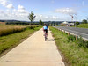 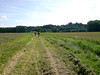 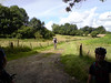 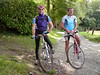 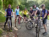 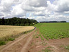 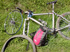  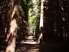 I still had a bit left so I when we reached Hamme Mille I decided to do some extra loops in and around the Meerdaelwoud. So I said my goodbyes and continued on my own. When dropping into Bierbeek via a hollow road I managed to flatten my front tyre whilst crossing a muddy section. Thats my first offroad flat this year. Put in another inner tyre, got my turbopump out and I was away in 10 minutes. My goal was initially to ride 60K but then I decided to make it an even 1000 heightmeters which meant I had to do a good part of my Meerdael Loop. Had to stop at the Hertebron to refill my drinking bottle. The cool water was very refreshing. By now, there were some clouds gathering and I wouldn't be surprised if it rained later this afternoon.
The Moots' crank was making creaky noises again - Filip Sport is looking for a replacement XTR bracket- but for the rest the bike performed as usual, flawlessly. The extra braking power - as opposed to the V-brakes on my Litespeed - is a blessing when you are getting more tired. Also, the Fox fork is a LOT stiffer than the SID on the Litespeed, which makes for very precise cornering and no twisting when taking tight turns on singletrails. Tomorrow is my birthday - and I'm going to treat myself to a rest day - and I would like to go to Nandrin this week. The weather forecast calls for rain from wednesday evening on, so I have either thursday or wednesday to do Nandrin. After that I would love to go to Theux - either with the Moots when it remains wet, or with the Merlin which I'm aching to try out for further rides before the big rides in August arrive.
6.30pm : After a good rinsing, cleaning and general checkout the YBB is ready for its next ride. I cannot stress the importance of regularly cleaning your bike. Not after every ride, obviously , but most certainly after a muddy and/or heavy ride. Cleaning the bike helps to discover eventual problems. Also, a clean bike is much more fun to ride with - for as long as it stays clean of course. I also fixed the flat tyre, and put the spare one back in my backpack.
13-07-2008, 18:37 geschreven door Big Bad Wolf
|
|
|
|
|
| 12-07-2008 |
| Chapel Lane |

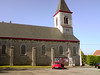
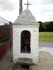
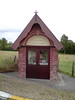
Another day where scattered showers ruined it for the bikers. I had to wait until after the Tour de France was in before the skies seemed to relax into just menacing clouds. My plan was to do a long offroad ride today but that didn't go through. Instead I opted for a road loop. I followed the Red Bloso road route which takes me over Sint Joris Weert, Sint Agatha Rode and Ottenburg to Terlanen. There I had to leave the loop because there was a road race taking place. So I veered to the left towards Tombeek and Overijse. In Huldenberg I re-connected with the remainder of the loop which brought me over Neerijse and Heverlee back to Blanden. Along the way I spotted a few chapels and decided to take some pictures. Not out of religious viewpoint but just because they are what kept Catholic Flanders together in the times before internet. The loop I did is pretty hilly and some of the hills are of the short and steep kind. Nevertheless I managed to keep my heartrate well down with a max of 130 and an average of 105bpm. Not bad considering the average speed which was 23kph.Ride Stats : 62K and 520 heightmeters in 2h41mins5507/51870
12-07-2008, 21:28 geschreven door Big Bad Wolf
|
|
|
|
|
| 10-07-2008 |
| Multidirectional wind |
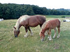
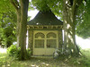
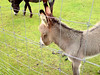
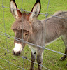
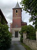
Wow, it's july and yesterday it didn't stop raining. Some geezer in the newspaper said that this is quite normal for july. yeah, let's put HIM on a bike for a couple of hours and we'll see how normal he will think it is after that.Damn, I should be doing 3-4 hour rides in the Ardennes now, not peering to the sky for a ray of sunshine to make a quick dash on the road.Oh well, this morning it looked quite good, so I set out for a small loop, accompanied by some scattered drops of rain and a menacing sky. As I reached Bertem I added another loop over Leefdaal and Neerijse, and upon reaching Sint Agatha Rode I felt confident enough to add another loop over Hamme Mille, Beauvechain, Opvelp and Bierbeek. So I got a nice little ride in at a good pace. Saw a nice little baby donkey in Bertem and of course I couldn't resist taking a few pictures. Hope you enjoy them.
The wind seemed to be blowing out of 3 directions today, and it was quite fierce as well. This meant that only one fourth of the ride gave me the impression to have it blowing in my back. But what a nice feeling that was.Ride Stats : 60K and 395 heightmeters in 2h27mins5383/50735
10-07-2008, 15:19 geschreven door Big Bad Wolf
|
|
|
|
|
| 08-07-2008 |
| Brabant Walloon |
I had to wait intil 6pm before the atmosphere seemed to stabilize itself. It had been raining for short periods during the whole day and the wind was fierce at times. I took the Litespeed because I wanted to explore into Brabant Walloon via offroad tracks. I set out and contoured Meerdaelwoud over its Northern edge until I entered it just past the Blanden graveyard. The trails were moist but not muddy. My skinny 1.8 Nobby Nics found all the traction they needed. I set out towards the little chapel in Nodebais , crossing Valduc , Hamme Mille and Tourinnes-la-Grosse. From the Chapelle Gosin I rode in the fields towards the Bois de Linsmeau, taking the technical climb from Gottechain upwards and then dropping down towards Cocrou. From here I took the long sandy climb up La Tienne towards Heze. In Heze I took the direction towards the Chapelle du Cheneau where I had a little snack.
As you might surmise I was looking for some climbing action all the way so from the Chapelle I rode towards the Glabais forest where I did a nice little loop before heading towards Heze again. I wanted to do some more climbing so I set out for Biez and Morsain, making my way up to the ridge where the Bois du Bercuit is situated. I encountered a few loose dogs - always tricky but they behaved and so did I - and when I saw that the sun was slowly setting I decided to head back home. Yet I was not finished with my climbing because upon entering Archennes I made my way up the tricky and sandy climb along the Bois de la Hocaille towards Bossut. From there on I added just enough loops to save me from total darkness because the forest was turning black when I finally arrived home, pretty pleased with a good ride.
Ride Stats : 63.5K and 785 heightmeters in 3h35mins
5323/50340
08-07-2008, 23:03 geschreven door Big Bad Wolf
|
|
|
|
|
|
|
| Gastenboek./.Guestbook |
Druk op onderstaande knop om een berichtje achter te laten in mijn Gastenboek. /
Press the button below to write in my Guestbook.
|
| Email Me |
Press the button to send me a mail
|
|
|
|