|
|
|
| Tales from the Woods |
|
|
| 08-07-2008 |
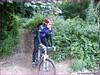
 Brabant Walloon Brabant Walloon |

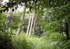
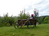
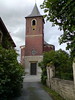
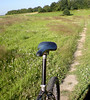
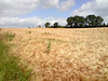
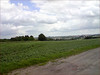
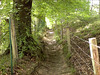
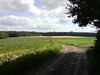
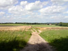
I had to wait intil 6pm before the atmosphere seemed to stabilize itself. It had been raining for short periods during the whole day and the wind was fierce at times. I took the Litespeed because I wanted to explore into Brabant Walloon via offroad tracks. I set out and contoured Meerdaelwoud over its Northern edge until I entered it just past the Blanden graveyard. The trails were moist but not muddy. My skinny 1.8 Nobby Nics found all the traction they needed. I set out towards the little chapel in Nodebais , crossing Valduc , Hamme Mille and Tourinnes-la-Grosse. From the Chapelle Gosin I rode in the fields towards the Bois de Linsmeau, taking the technical climb from Gottechain upwards and then dropping down towards Cocrou. From here I took the long sandy climb up La Tienne towards Heze. In Heze I took the direction towards the Chapelle du Cheneau where I had a little snack.
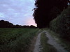
As you might surmise I was looking for some climbing action all the way so from the Chapelle I rode towards the Glabais forest where I did a nice little loop before heading towards Heze again. I wanted to do some more climbing so I set out for Biez and Morsain, making my way up to the ridge where the Bois du Bercuit is situated. I encountered a few loose dogs - always tricky but they behaved and so did I - and when I saw that the sun was slowly setting I decided to head back home. Yet I was not finished with my climbing because upon entering Archennes I made my way up the tricky and sandy climb along the Bois de la Hocaille towards Bossut. From there on I added just enough loops to save me from total darkness because the forest was turning black when I finally arrived home, pretty pleased with a good ride.
Ride Stats : 63.5K and 785 heightmeters in 3h35mins
5323/50340
08-07-2008, 23:03 geschreven door Big Bad Wolf
|
|
|
|
|
| 06-07-2008 |
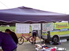
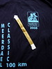
| 16th Meerdael Classic |
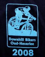
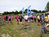
Left home at 7.10am to ride the short distance to the start of the Meerdael Classic, 16th edition. This traditionally takes place at the Football terrain of the 'Zwarte Duivels' in Oud-Heverlee. I was pre-inscribed for the 100K - the golden distance - so I was prepared for 5 hours of fun and enjoyment on my bike.The Ride:
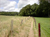
At 7.30am I was ready to roll. The track was in the opposite direction from previous years and they also promised some new sections. It started out easy going down towards the Zoete Waters and then ondulating into the Kouterbos towards Sint Joris Weert. Here a nice singletrack section was waiting for us before we made our way towards the Kluis area for a first climb where the chain had to go on the lowest gear. As usual I started out easy to get a good warmup and feel how the legs were. After the climb followed a tricky downhill - on the Blue BLOSO route towards Nethen. We crossed the road and made our way towards the Bois de Beaumont, again via a narrow track, this one between two fields and very demanding because it was slightly offcamber and sported some ruts. Following the railroad track towards Pecrot we were in for a nice treat here. First uphill towards the Chapelle Robert, zoom down into Pecrot and then the famous railroad singletrack was ours to experience. At the end of this track we had to climb all the way up to the plateau again, only to turn twice to the right and come down again, this time via a nice bermed trail the local freeriders use. After this we crossed the railroad down at Florival to make our way towards Ottenburg. Here they surprised me a first time by offering a track roughly following the river Dyle back to Pécrot. It was a little wet here but not muddy. All was very well manageable, surprisingly good even after yesterdays rain. Then we rode in the direction of Sint Agatha Rode for an easier part of the loop taking us all the way to Neerijse. Making our way towards Huldenberg we were offered some nice tracks - some very steep ones as well - taking us up on the Smeysberg. I was just beginning to wonder whether I missed the first rest stop when I spotted a sign telling us it was only 1K away. Great, but after 31K that is a bit on the long side.
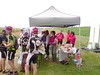
From the first reststop we dropped down a sandy road - with danger sign - to make our way into the Sint Agatha Rode bos. First via a nice singletrack between the meadows and later up on another track I didn't do before. Steep, narrow, wet and slippery and with barbed wire at both sides the preferred direction here is uphill. Which we did. We then made our way up to the little Chapel where we turned right - crossed the road towards Ottenburg and made our way down another fast singletrack only to climb steadily back up towards the Kouter. This part was on the Overijse BLOSO routes , but in the reverse direction. After Kouter, the 100K turned right towards the Vetsaart and further on into the Sint Agatha Rode bos again, where a steep downhill crowned a very nice passage through this protected area. Then it was time to make our way towards Ottenburg. A great and very difficult climb - I made it the last time but this time it was too slippery - over stones scattered freely and offering hardly any grip. Steep as well of course. I don't think a lot of people made this. After that we made our way towards the Noir Epine where we turned left again for some field roads taking us back towards Ottenburg where we were treated to a great descent along the BLOSO route - again in the reverse direction - and further along the edge of the field towards the second rest stop.
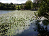
After this the long climb up towards the Tomme made us quickly digest our food. Great downhill towards Gastuche and back towards Archennes via de Chateau de la Motte. In Archennes the technical climb up the Hézidelle tested us on riding technique uphill. The sand was wet though so it was possible to make the climb without too much trouble. We know made our way towards Bossut for what would turn out to be an easier part of the ride. Less climbing, more field tracks but with still some nice challenges along the way. Amongst others a tricky downhill north of Grez Doiceau and a technical climb over roots leading into the Bois de Linsmeau. Then we looped back towards Bossut to find a thrilling descent over cobbles taking us to the 3rd rest stop just south of Nethen . This one was very crowded - possibly because all distances passed here. I had upped my speed with the passing of the kilometres and was now actively trying to follow faster riders that passed me. This took my average speed up suite nicely. We were now taken back towards the Meerdaelwoud for a passage along the Warande Ponds and after that the crossing of the Naamse Steenweg and a climb up towards Valduc. Here the 100K riders would split off from the lesser distances for a loop taking us more or less around Beauvechain. This also proved to be a loop offering not too many heightmeters, which obviously was good for the average and also clement on the legs for those who were starting to feel the fatigue. At the little Chapel in Nodebais a 4th and last rest stop was offered. Manned by women, this was obviously my favourite. I asked and received some oil for my chain and took a last offering of banana, cookies and sports drink. With a full stomach I set on for the last 16K. The drop into Meerdaelwoud offered another patch which might be called muddy but then we rode back in over the Mollendaaldreef and the Weertsedreef. So no more challenges except for the part in Vaalbeek and an ultimate little loop along some narrower tracks before rejoining the starting area. An Alpro drink was gladly received and I went into the Canteen to collect my T-shirt. The Moots had to wait in the garded bike park for a few minutes.
The Lowdown:
What I liked:
+ Great trails, with attention to lesser visited tracks
+ the region and the use they made of what is offered
+ emergency numbers provided
+ dangerous downhills and road crossings well marked
+ distance splits well marked
+ arrowing impeccable
+ 4 well-stocked rest zones - lots of choices
+ very friendly people at the rest stops
+ free T-shirt when entering the 100K with pre-inscription
+ all this for only 9 (10 if you don't have a licence)
What I did not like:
- the section around Beauvechain not providing any challenges
- spreading of the 1st rest stop was a bit off.. at 31K this was too late into the ride
Synopsis:
A
very good ride, the first half certainly being more demanding than the
latter part. Although this was demanding too, depending on the speed
you made. Some very interesting new tracks I learned today. They could
have made it tougher if they had descended south of Grez instead of
opting for the loop around Beauvechain. But perhaps this would take
them too far from the Meerdael area and this IS the Meerdael Classic
after all. Arrowing was flawless all along the 100K, splits were very
well marked - before AND after the actual split.
The weather was great as well - 18 degrees average temperature, sunny
and just a bit of wind on the plateaus coupled with the amazingly rich
biking regions we crossed today provided the right ambiance for a great
couple of hours on your bike.The Bare Facts:
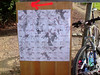
Profile of the Ride
Map of the Ride
Organisers Website
Ride Stats :
Meerdael Classic: 100K and 1155 heightmeters
total distance today :
110K and 1245 heightmeters in 5h22minsHill Factor of the Meerdael Classic: 11.555260/49555
06-07-2008, 00:00 geschreven door Big Bad Wolf
|
|
|
|
|
| 03-07-2008 |
| I'm tellin' ya dude, its gonna rain! |
Yesterday saw some thunderstorms and it rained a bit last night as well. So when we rode out with the KBC MTB club to recon the farthest loop of our annual Organised ride, I was curious about the state of the terrain. It turned out to be surprisingly dry. We rode towards Biez and there set out on the loop. Yves, the guy who plots the loop each year, made me discover an interesting alternative downhill in Biez. That will save me from the stairs of doom, but the alternative is also not without danger, it is rather steep and has a few corners with moss-covered concrete which makes it slippery when wet. But the rest is a nice little track. When we rode along towards Heze I discovered some menacing clouds on our right, over Bonlez . I pointed it out and saw the veils under the clouds - this meant rain. If course we were close to the fathest point on the loop, so no use turning back. 
03-07-2008, 21:13 geschreven door Big Bad Wolf
|
|
|
|
|
| 01-07-2008 |
| Warm |
30 degrees C today, and a lot less wind. So I waited until 6pm to ride out but it was still very warm. I turned immediately into the Meerdael forest which was nice and cool. Lots of bugs flying around so I was general with the Deet spray. Made my way towards Nethen to check out the jungle hollow road. Well, it was dry but very washed out. Deep gullies made it impossible at times to keep on riding. I had to dismount a few time and lift my bike out of a rut or over some sandy boulders. Other parts were fine but demanded a lot of determination, trail insight and just plain luck to keep things rolling. Upon emerging from the hollow I rode towards Bossut and then made my way down along another hollow road, this one very sandy and I needed to keep the momentum high just to keep rolling. Up again towards the football field where I checked my Moots because the cranks were making a ticking noise. Everything seemed fine from the outside so it must be the 2003 XTR crankshaft nearing its end of days. Mmm, it will not be easy to find a replacement. After Archennes I climbed back up to la Malaise , down into Pecrot and up again towards Nethen. Down into Nethen and then along the railway towards the Beaumont forest. Down into Fontenelle and then up towards the Herculessalon in the Meerdaelwoud again. A little pause next to the Ponds near the Kluis and after that another climb up to the Nethense Baan. From there I was gently riding home. At home I put some oil on the crankshaft in the hope that it will stop the creaking, but I suppose I better contact Filip Sport for a new one.Ride Stats : 31K and 395 heightmeters in 1h45mins5057/47550
01-07-2008, 21:08 geschreven door Big Bad Wolf
|
|
|
|
|
| 29-06-2008 |
| Haasrode recovery |
Just an easy ride along the Haasrode Tour today. Weather was the same as yesterday minus the rain but with the wind blowing strong from the west and the sun hiding from time to time . In Beauvechain I cut the Tour short to make it an even 50K - or almost. With an average heartrate of 97 this was indeed a very good recovery ride for me. Took a few pics of ondulating fields near Hoegaarden.
Ride Stats : 51K and 415 heightmeters in 2h18mins5026/47155
29-06-2008, 14:04 geschreven door Big Bad Wolf
|
|
|
|
|
| 28-06-2008 |
| Braine l'Alleud Green Route |
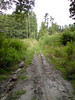
Light drizzle this morning so I decided to wait a while before heading out. When I finally rode out around noon it was still raining very lightly but the forecast called for sun so I decided to risk it. First I had to ride towards Halle and the 7 Fontaines area - where the Green Route passes. It took me around 1h45 to cover the 39K, riding over Duisburg, Jezus-Eik and then up to the Middenhut and Sint Genesius Rode . Around 30 minutes into the ride the drizzle stopped and it would remain dry for the rest of the day. Great! Just before the Kapucijnendreef in the Sonian Forest I was stopped by a Chinese (?) girl in the forest who asked for directions to the Tervuren museum.. Took quite a bit of explaining - I hope she eventually found it.At the 7 Fontaines I had to find the point where the Green Route passes but that didn't prove too hard to find. I had been here before, first with Minna and later on my own, so I remembered most of the route, or at least that was what I thought. I had a map with me that I got from Minna and that would prove of great value along the ride. After the first climb on some of the worse cobbles I ever saw - and yes, I rode Paris-Roubaix twice - the route remains on the plateau for a while on tarmac. Then it turns left and the fun begins. A nice little downhill into the Bois de Hamme followed by a climb up to the Chapelle Bon-Dieu de Gembloux. This little chapel is a point where the route passes 2 times. The track then bends to the right for a downhill into Sart Moulin. A great little section in the forest follows - I don't think Minna did this, the arrow is hardly visible - down and again up along a singletrail. Then a section where you have to go through a hollow road uphill to emerge on tarmac. Down it goes to the big road which is crossed. A section into an industrial area - mind the arrows - and then it goes into the Bois de Foriest and the Bois d'Ophain. Some of the arrows are very well hidden and at places they have put new arrows up . The Green, Blue and Yellow route have a common section here and its a really nice one. One known mudhole has been completely gone - they have simply filled the holes so there is no more puddles nor mud. A nice track leads you down to the Ry du Vervois. Just before that there is a sharp turn left with a passage through a little river and a nice uphill section in what appears to be a private forest. You emerge in a rural area where great care has to be taken not to loose the track. Its to the right and some 20 metres on the street you have to turn left into what appears to be a footpath. The arrows are all there but sometimes you have to REALLY REALLY look for them. Some are partially covered, others are hidden behind parked cars etc.. The trail then descends into Braine l'Alleud itself, with some twisty passages through the city. Take care, there are cars here and the track really twists and turns. You pass the church where the routes start- leave the church to your right and turn left or you will lose the trail. Then you descend towards the river Hain, cross it and commence a nice little climb out of the city on a small trail. You then more or less make your way back to the big road, which you have to cross again. Some climbing to be done now, some on tarmac, later on hardpack . You slowly make your way back to the aforementioned chapel. I stopped for a little snack. After the chapel, there is another really narrow trail turning right from the gravel road. Its overgrown with grass and there is a gully so be careful. You then make your way into the Bois de Clauseweide, provided you don't miss the arrow that is covered behind the foliage. Forest road with a golf track on your right and you are heading for a really nice downhill-uphill passage along a narrow trail. Great fun, remember to shift on time or you will be walking here. Before long you arrive back at the 7 Fontaines area. This is a very nice trail, with some interesting challenges, great tracks and you notice some effort has gone into finding good trails instead of taking the easy way out and incorporate another piece of tarmac. Not here. They have done a good job. The arrows are there but at some points you can use the map, so bring it . It's 100% ride-able, no mudtraps although at some points there are cobbles I would be very careful on when it has rained. The trail is some 26K long and incorporates 440 heightmeters. So you need a certain level of fitness , its not a beginners trail. When I was back at the ponds of 7 Fontaines I wondered if I should ride the trail again. The first time I had to look a bit for the arrows, so I couldn't ride it at a good speed. But seeing that I stil had to do 40K to get home I dismissed the idea. Perhaps I will do it again soon with Guna - who I had to disappoint today because she couldn't start as late as I wanted to - at least then I would not have to look for the arrows anymore.The ride back was nice because the sun was out in full force now AND the wind was blowing in my back. The joys of biking. I had to suppress the urge to close my eyes and dream away. Ride Stats : 106K and 935 heightmeters in 5h01mins4976/46740
28-06-2008, 23:33 geschreven door Big Bad Wolf
|
|
|
|
|
| 26-06-2008 |
| Overijse again |

After having spent the best part of the morning and early afternoon in the UZ Gasthuisberg in Leuven for some allergy tests, I wanted to ride out again. I had quite a bit of fun on the Red loop in Overijse yesterday so today I wanted to do all 3 of them . Riding thought the Meerdael forest towards Sint Joris Weert and Sint Agatha Rode, I picked up on the usual spot with my little extra loop in the Sint Agatha Rode Forest. The weather was great, partially cloudy, not too warm but sunny and dry.The kilometers went by at a good pace - here and there I injected a little extra climb to spice things up - and I was back in Sint Agatha Rode in little more than 1h40. Not bad for 34K and just shy of 500 heightmeters. On the way back I stopped at the Hertebron to drink its cool water before heading back over the Kluis and the Langendaalstraat towards Blanden.Ride Stats : 53k and 690 heightmeters in 2h47mins4870/45805
26-06-2008, 19:16 geschreven door Big Bad Wolf
|
|
|
|
|
| 25-06-2008 |
| Mixed Bloso |
Started out on the Blue Meerdael Bloso route. In Sint Joris Weert I followed the arrows connecting the Meerdael to the Overijse Bloso's and in Sint Agatha Rode I got on the Red Overijse route. An extra descent and an extra climb in the Sint Agatha Rode Bos and then the usual trickery of this fine route. At the little chapel next to the Sint Agatha Rode bos I had a little snack before making my way back towards the Meerdael Forest.Arriving in Sint Joris Weert again I continued on the Blue route, switching over to the Red one after the climb alongside the Savenel wall in Nethen. I passed two bikers here who were catching their breath after the Savenel climb. Making a little detour towards the Warande ponds I added another little climb before crossing the Naamsesteenweg and climbing up into Hamme Mille. I had another snack and saw the two bikers on the climb just before I started riding again. The wind was blowing in my back when I speeded through the fields towards Bierbeek. Obviously, when I climbed through the fields back towards the Meerdael Forest, it was blowing from right in front of me. At the beginning and at the end of this section I stopped to take a picture. After that the remainder of the Red route only brought one surprise, a nice mudtrap I didn't spot on time and which brought me to a full stop. The little track parallel to the Naamsesteenweg was still pretty wet and you had to cross from one side to the other to stay dry. It provided some fun. Back on the Blue I only had to do a few more kilometers. The weather was not as gloriously sunny as yesterday but still pretty warm and with a noticeable wind blowing from westerly directions.Ride Stats : 62.5K and 710 heightmeters in 3h06mins4817/45115
25-06-2008, 18:47 geschreven door Big Bad Wolf
|
|
|
|
|
| 24-06-2008 |
| Lost in Chastre |

Took an extra day off work today and it turned out to be a mighty fine day. The sun was out so I couldn't resist getting on my bike for a Long Slow Distance ride. I set out following the Maleizen Tour from Archennes over Chaumont Gistoux and up to Corbais. There I saw some other arrowing pointing towards Walhain Saint Paul, so I followed that. After a while the arrowing was gone so I had to play it by ear. I dropped into Chastre and was looking at the sun's position to judge which way I had to go. Of course, roads are not in a straight direction and before long, I had the feeling I was riding too much south of the line Gembloux-Wavre. I seemed to be turning around between Cortil-Noirmont, Gentinnes and Chastre, with no idea how to make it to either get to Court-Saint-Etienne or Mont-Saint-Guibert, from which I know my way home. 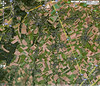 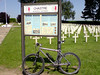
24-06-2008, 16:41 geschreven door Big Bad Wolf
|
|
|
|
|
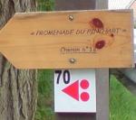
| 22-06-2008 |
| Rando des Coquelicots |
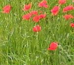
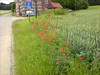
With thunderstorms forecast early in the afternoon - and also with yesterdays' ride in my legs - my original plan to ride in Lustin was set aside. I had noticed that this weekend also offered the Rando des Coquelicots in Chaumont Gistoux. A nice little ride in an area of Brabant Walloon I know very well and like very much. 6am saw me rise and ride the Moots towards the start. A nice 20K ride which should warm me up quite nicely for the Rando des Coquelicots. Temps already are around 17 degrees C so it's going to be a hot day.The Ride:
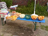
At a little before 8am I take the start in the Centre Sportif A. Docquier in Chaumont Gistoux. The organisors are still the same from a few years back when I last did this ride. The distances offered are 15, 30 and 45K . Naturally I go for the longest distance and pay 4 entry. I am the first biker on the track and enjoy the quiet and lonely tracks. We pass along some pastures where the wheels in the wet grass spray my frame , making dust and grass stick to it. I remember the track more or less from past attendencies so I am not too bothered with the sparse arrowing. At one point there is no arrow at all. I take to the right and at the next crossing I see the marker again. I can imagine a lot of people turning around in circles here. A succession of nice little tracks - but some fieldroads, cobbles and tarmac as well - brings me in Vieuxsart and on towards Dion le Mont and Dion le Val. The 30K splits off from the 45K and a little further, some 17K into the ride, a first rest stop awaits me. The people there - an elderly couple - are surprised to see me so soon and there is a real banquet waiting for me. Bananas, oranges, cake, chocolate wafers, water and Acquarius. The lady who mans the reststop wants me to taste it all. Her husband was briefly away adding an extra arrow to the crossroads just before the rest stop, at my request. I also mention to him the missing arrow near Vieuxsart. With my tummy a lot fuller than before I say my byebyes and get along with the ride.
It is getting hotter by the minute, but the sun is hiding most of the time behind shifting clouds. No sign of thunderstorms yet although in the west the skies look darker. The ride now turns towards Grez Doiceau with some nice little passages and a long sandy climb out of Cocrou up towards Longueville. But we are not there yet as the ride turns left into the fields for a long loop before entering Longueville. A well known passage along a singletrail between two fields grabs my attention. Fortunately it is dry here, the only bother is the high grass that clutters my gearing. A steep climb exiting a forest passage and I get ejected back into the fields before entering Longueville and passing the Chapelle du Cheneau. A wellknown passage in and around Bonlez follows with a tricky wet downhill on cobbles taken full speed. I am passed by a greying biker who makes a lot of speed in the downhills. I try to follow him but can only get a little closer during the uphills. He is the first biker I see and we arrive at the second reststop, some 40K into the ride. The 30 and 15K distances have joined us as well. Me and Mr Fast leave together and decide to ride the last 8K together. We ride into the Bois de Glabais and instead of taking to the left - as they did last time - they go straight up into a track that makes we think we are in the Ardennes. We ride through a riverbed with rocks and a lots of water. It goes uphill as well and it takes a lot of work to keep the bike rolling. This passage really is amazing and on its own makes this ride worth the while. We now ride towards Chaumont along another field passage and then have the choice of entering by road or taking the hollow road leading down towards the start. Obviously we opt for the offroad alternative and get presented deep gullies - and I mean DEEP - where we have to dismount for a few meters because of the slippery conditions. After a while things get dryer and meandering from left to right, in and out of gullies or trying to stay on top of them, we make our way down towards the start. I cannot comment on the bikewash facilities and/or showers since I did not use them. I talk a little more and it turns out he is a member of the Pietrebais organisation. I might have guessed he knew these trails by the way he attacked the downhills.
I ride back home along the first part of the 15K trail and making my way through the Bois de L'Etoile towards Heze and Grez-Doiceau. No thunderstorm in sight.
The Lowdown:
What I liked:
+ a great riverbed uphill passage in the Bois de Glabais
+ the rest of the region, also very beautiful
+ well-stocked rest zones - lots of choices
+ very friendly people at the rest stops
+ only 4 for this feast
What I did not like:
- no emergency numbers provided
- arrowing was sparse and inconsistent, at times simply lacking
- no danger signs at road crossings
Synopsis:
Trails were dry and speed was fast most of the time. Not too difficult but with some nice passages along singletrails between fields and especially the long climb into the riverbed in the Bois de Glabais. This was a first-class section where I assume a lot of lesser bikers would be on foot. They offer a good ride, not taking in everything the area has to offer but still providing a good sampling of the area.The Bare Facts:
Profile of the Ride
Some pictures (taken by Schijfrem)
Ride Stats :
Rando des Coquelicots: 48K and 550 heightmeters
total distance today :
90K and 980 heightmeters in 4h30minsHill Factor of the Rando des Coquelicots: 11.54665/43700
22-06-2008, 18:01 geschreven door Big Bad Wolf
|
|
|
|
|
| 21-06-2008 |
| Adeps Route Limelette |
Today I rode over to Ottignies and its Bois des Reves to try and follow the marked Adeps route that passes there. I rode over there with my bike, the weather was promised to be dry and warm. Took me some 31K getting there and when I reached the Bois des Reves entry I immediately set out on the Adeps route. The markings are new, big red Adeps/Bloso arrows with sometimes a number on them. Unfortunately, as I was about to find out, some vandals already removed some of the plaques from their poles. First you get a nice long climb around the Bois des Reves, followed by a great downhill. The trail then turns towards Louvain-la-Neuves urban jungle but the markings are all there and there are some nice little passages, among them a steep climb on cobbles that will set many afoot. Lots of tarmac here and it really takes quite a while before I get some dirt under my tyres. I pass the LLN Golf Course on some hardpack that lets me up the speed. A descent into the Bois de Lauzelle but again there seems to be no other option than a tarmac descent. On the left and right of the descent I spot some singletrails - pity they don't use those. When I emerge out of the forest into Limelette, I go straight down instead of turning to the left into the Rue Charles Dubois. About 500 metres further I realise my mistake and have to climb back up again. At this point the arrows are missing. I take a picture of the crossroads so that others may learn from my mistake and plunge into Limelette via the rue Charles Dubois. Its a 10 percent slope and I'm down there fast. Another bit of urban jungle, taking good care to spot the arrows and I leave the city to emerge into a series of field roads. The tracks are nice and dry and I can make good speed here, even though there is always a slope. From time to time a bit of cobbles are thrown in to make things interesting and at one point the arrows point me straight into a field. The trail turn counterclockwise around Ceroux-Mousty before crossing this little village - with a nice grassy Place Communale that gives a lot of shade due to the trees planted around it. After Ceroux another great track awaits me as I plunge into a hollow road. Some gullies here and they are wet.. after a while the hollow road deepens and yes, I've reached the circuits mudhole. Staying on the edge of the deep muddy gullies I try to bike it, but I am forced to walk a few times. Near the end of the trail a dog tries to outrun me. I'm faster.
I'm back in Ottignies now and some more tarmac brings me to the Bois de Reves entrance again. When I check my Polar I see that the red route was 29K long .Minus 1 K because of the extra downhill/uphill when I went straight in Limelette leaves 28K . There are some 320 heightmeters in it. Lots of tarmac, some nice passages as well but few and far apart. Still, some nice views from the plateau and except for the urban passages very quiet roads and tracks. Obviously I do the little Bois des Reves loop which adds some 3k and 90 heightmeters to the total. It would be a shame to miss it when you want to do this loop.
Riding back home I loop over Chaumont Gistoux to check out the starting place for tomorrows' Rando des Coquelicots" which I plan to ride. I insert some offroad passages going from Longueville towards Pietrebais and just as I am 500 metres from home I hear something rattling against my back wheel and upon arriving home I have a flat tyre. Talk about being lucky..
Some pictures taken along the way
Ride Stats: 99.5K and 1030 heightmeters in 5h01mins
4576/42720
21-06-2008, 20:36 geschreven door Big Bad Wolf
|
|
|
|
|
| 17-06-2008 |
| The year of the snail |
Has anyone noticed how many snails there are crawling around this year?? Its amazing, the forest seems to be filled with them. The wet intermezzos coupled to steamy hot days tends to really make them flourish. Its difficult not to kill at least a couple of them each ride. And they stick to your frame - they do.Anyways, I set out for an evening singletrack ride along my Secret Meerdael loop today. The goal was to ride for two hours and see how far I got. Well, I got about 35K far. The first bit is not too hilly, only a Hill Factor of 10 or thereabouts, but its all twisty and turning trails. They were pretty dry with the occasional slippery patch and still som mud in the deep forest, but traction was rather good. I had to float my bike over some deep mud from time to time but when I emerged out of the forest next to a field the bike was still pretty clean. Saw a donkey family with the youngster very cute and not shy at all. 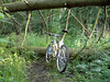
17-06-2008, 23:01 geschreven door Big Bad Wolf
|
|
|
|
|
| 15-06-2008 |
| Overijse BLOSOs and then some Meerdael |
The weather forecast called for rain this Sunday but when I woke up there was no cloud in sight. Around 11am I set out to ride up to Sint Agatha Rode in order to do the Overijse BLOSO routes. These are some 34K long and yield around 480 heightmeters. I set out on the loop in the reverse direction and quite quickly I noticed quite a few bikers who were doing the loop in the right direction. I had to inject a few extra climbs of course - mainly around Ottenburg where there is one climb that is next to impossible to ride in the reverse direction of the BLOSO loop - the downhill on the Red loop with the steps for those who know the loops.
So instead I added another steep but manageable climb, a tricky and very slippery descent back to the field and then the climb that the BLOSO route also follows back up towards Ottenburg where I rejoined the BLOSO route in my chosen direction.
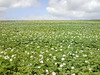
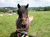
The tracks were a bit wetter than yesterday but only slippery in the shade of the forest. Still, the Overijse route is quite a handful with some steep descents and climbs. The one out of Overijse was made with great effort on my lowest speed. But I made it. The sun on my skin felt good but I could notice more clouds gathering as the minutes passed by. Next to Hoeilaart I stopped at the field where some beautiful Brabander horses were standing. Two of them with fowl.I ate a powerbar and made some pictures. The fowls were a bit scared of me but their moms didn't mind being fed some grass. Perhaps the fowls were too young to already eat grass. I got on my way - keeping in mind the dark clouds I spotted at the horizon - along a tricky downhill with deep gullies that nearly did me in. But somehow I managed to keep the rubber side down and finish the remainder of the loop. A little bit of exploring in the Sint Agatha Rode forest and I was off towards Meerdael. I still had some time so I set out on the Blue Meerdael BLOSO loop from Sint Joris Weert. A couple of uphills later I was next to the Naamsesteenweg and I incorporated another loop close to the Dikke Eik - where I spotted some interesting woodcarvings. The wind was blowing fiercely now and just before the first drops began to fall I was home. A very good ride, very relaxed pace and still a good average speed.Ride Stats : 61K and 820 heightmeters in 3h33mins4376/40840
15-06-2008, 17:53 geschreven door Big Bad Wolf
|
|
|
|
|
| 14-06-2008 |
| Rain rain stay away |

It looked like it would rain all morning but when the sun peeped through the clouds I decided to take my chances and do a local ride. Nothing more local than the Meerdael BLOSO routes so I tackled those. The trails were pretty dry, except for some muddy puddles which were easily avoided, in most cases. I had mounted my fenders so I didn't care either way. At one point I even began changing my mind about attending an organised ride tomorrow. It didn't look THAT bad so why not? But when I exited the forest I saw a big dark cloud looming and all I could think of from that moment on was to make enough speed to make it home dry. Well, I almost succeeded. I had lost some time when my front fender decided to break free on a tough downhill. Probably due to the shocks. I tried to attach it again - it is some kind of eccentric thing that attaches to the inside of the fork tube - but failed to make it stick. So into my backpack it went and I rode on without a front fender. When I arrived on the last bit of the trails it started to rain very gently but then the gentle drizzle changed into a downpour. Luckily at that point I only had about 2K to ride. Made it just a bit wet but before things really got torrential.Ride Stats : 55.5K and 510 heightmeters in 2h48mins4315/40020 Well, I almost succeeded. I had lost some time when my front fender decided to break free on a tough downhill. Probably due to the shocks. I tried to attach it again - it is some kind of eccentric thing that attaches to the inside of the fork tube - but failed to make it stick. So into my backpack it went and I rode on without a front fender. When I arrived on the last bit of the trails it started to rain very gently but then the gentle drizzle changed into a downpour. Luckily at that point I only had about 2K to ride. Made it just a bit wet but before things really got torrential.Ride Stats : 55.5K and 510 heightmeters in 2h48mins4315/40020
14-06-2008, 15:35 geschreven door Big Bad Wolf
|
|
|
|
|
| 10-06-2008 |
| Ravel |
A couple of days of nice warm weather so I couldn't resist taking a day off from work to do a long LSD ride. I set out over Bierbeek, Meldert and Hoegaarden towards the Ravel No2 Hoegaarden-Namur. This is an old train track that has been closed and instead there is a tarmac road for bikers and hikers. The slope is very gradual and at the end it drops nicely into Namur. It was warm and I took it very easy, keeping my heartrate around the 110bpm mark to stay on the edge of the fat-burning processes. Not that I have any fat to burn but that way you can literally ride for hours . In Namur I took a little break to eat a powerbar.Returning the same way the road is generally downhill but there was a noticeable wind blowing from the North so that kinda evened out the effort needed. A little over 5 hours riding time brought me back home. I just read in the paper that our "National Pride" , Tom Boonen, has been caught sniffing the white powder, cocaine. I hope they punish him - if not only to make him see that he is not above the law . It looks like he can't get his private life under control. Making a lot of money obviously the lure of drugs and other vices - he was caught speeding at 180 where 90 is allowed - is great. He would do better focussing on his biking. As far as I'm concerned Quick Step should fire him for this. Lesser drivers have been fired for lesser causes. I hope he recovers from this and doesn't turn into another VDB or Pantani. Ride Stats : 120K and 600 heightmeters in 5h03mins4210/39050
10-06-2008, 16:44 geschreven door Big Bad Wolf
|
|
|
|
|
| 07-06-2008 |
| Hagelandse Chrono |
The 8th edition of the Hagelandse chronorit would certainly be an edition to remember. It had been raining for 3 days in a row and obviously we were expecting a lot of mud. Even though during the race the rain halted and tracks dried out a bit towards the end, it was indeed a mudfest extraordinaire.Going to Langdorp this saturday morning was a little victory on my inner demons. I am not really a mud-adept but I was so keen to go I just got in my car and rode over there. The Ride:
Got a nice T-shirt and .5 back on my pre-inscription fee when I showed them my UCI licence at the Inscription. It was still drizzling when I prepared my bike - mudfenders and all - and rode up to the starter. Starting is on an individual basis so this means there is no crowd at the start but the faster riders are on your heels pretty soon. But there were only chrono riders on the track and all went very well. No fuss about passing, you just move over when you can and the faster guy - or girl - passes, usually muttering some thanks. The organized rides (distances of 20 and 40K offered) are for tomorrow. Very nice of the organising team to let the racerabbits run amongst themselves. The first loop took us towards the famous Bosberg, with around 5K of singletracks and steep uphills and descents showing us just about every trail on that mountain. It is sandy here and traction was still good. Coming back towards the start along the river Demer brought us the first really heavy mudsections. The upper layer - wet grass and clay - was very slippery and soon all gearing was covered in grime. No use oiling your chain, it was washed off in less than a couple of K's. My fenders kept me safe from flying mud but obviously the rest of the bike got covered pretty fast. I had mounted a JImmy up front and an NBX Lite in the back. Not bad but on the really slippery trails they were hopelessly looking for traction. After 11K we arrived back near the start and those who wanted could get something to drink at the first reststop. After this there would be 3 more rest stops. Spread evenly at 33K, 45K and 65K into the ride they provided us with all a marathon biker needs. Some yummy chocolate cake - full of fast sugars - and you could get a new drinking bottle, filled with energy drink or water. Great system this, and just one of the little niceties which show this organisation is pretty well honed and tuned to the needs of the biker. The ride was pretty straightforward, a repetition of steep climbs - usually only 20 to 30 heightmeters in one go - and sometimes very tricky descents. I recognized some names - Walenbos, Wijngaardberg - but basically every time we went into a forest the light faded - it was still raining lightly at this point - and things got slippery . I had to walk a couple of uphills, and also some downhills at this point.
Around the 42K mark I lost control of my bike - on a flat section in a field - and went into a deep gully which was running alongside the road. I went over the bars and landed on my hands and chest. Ouch. Nothing hurt but it kinda took the wind out of me for a while. I also needed a little time to become confident in my tyres again after that fall. Some 4 hours into the ride the rain stopped and gradually the trails became less slippery - drying out a bit or perhaps a change of soil. There still were many deep puddles but I didn't mind those. I had my Sealskinz on and riding through the puddles cleaned my drivetrain a bit which provoked less noise from my chain running over the dirty chainrings and cogs. I began to push a little harder on the pedals now, and made all climbs except the really steep ones. Also on the downhills things went better, except for the really freaky ones. My braking power wasn't what it used to be and it was difficult to control the bike with the brakes gripping on some parts of my rim and slipping on other parts. It provides wheelstalling and that is not something you want on a slippery floor. At certain points during the ride there were controls - people who put a marking on your race number to prove you had been there. A missing marker at the end means disqualification, obviously.The arrowing was sparse but very adequate. Little neon-yellow plastic arrows held by rubber strings. Very green as well, no tape, staples or nails needed. The only times I overran a turn was when it was into such a narrow track you barely saw it. The singletracks were amazing, especially on the Bosberg and also during the last 12K of the ride. Sweeping through the forest, demanding your full attention. The drop into Aarschot I remembered from earlier editions and I knew the last 2.5K was along a fast track on the Demer borders. Tired but very satisfied I made the end with some 5 and a half hours on my Polar. There was a bit of a queue for the bikewash which was well-stocked for usual days with 6 lances (3 of them high pressure) but when the ride is this muddy perhaps a few more would have made for a faster development here.
One more thing about the times necessary to get a Gold, Silver or Bronze brevet. They seemed unrealistic considering the meteorological circumstances. As it stands, only 2 riders got a Gold . I feel the organisation should have upped the times, taking into account the difficult circumstances.
The Lowdown:
What I liked:
+ the region, very beautiful.
+ well honed and experienced organisation.
+ well stocked rest zones - they had drink bottles with Energy drink so you could leave yours.
+danger signs at road crossings and some downhills
+ organisation provided emergency numbers
+ sparse but adequate and very visible arrowing
+ friendly people at the rest stops
What I did not like:
- the abundance of mud.. but what can you do?
- unrealistic target times for Gold, Silver and Bronze brevets, considering the weather conditions.
- only 6 hoses at the bike rinse.. with all the mud people were queueing and getting cold...
Synopsis:
I met a lot of old acquaintances, which was nice. Girls and boys - you know who you are - thanks for saying hello to me and taking some time to chat up, it really felt good. The ride for me was very satisfying, I hate mud and me making it and actually starting here was a small victory on myself. This whole ride was a battle with oneself - resisting the urge to turn in and surrender. Every person who made it is a bit of a hero. I have done this chrono 4 times now and I love the Hageland. But today it was not served by the meteorological conditions. Still, I made it and I am happy. The organisation gets the thumbs up - very honed and almost professional. The Bare Facts:
Profile of the Ride
Organisers website
Results (Zip File)
Picture gallery (Paul Helsen)
Movies of the ride by Fons Moors : Part 1 + Part 2 + Part3
Ride Stats : 85K and 975 heightmeters in 5h24minsHill Factor : 11.54044/38120
07-06-2008, 00:00 geschreven door Big Bad Wolf
|
|
|
|
|
|
|
| Gastenboek./.Guestbook |
Druk op onderstaande knop om een berichtje achter te laten in mijn Gastenboek. /
Press the button below to write in my Guestbook.
|
| Email Me |
Press the button to send me a mail
|
|
|
|