|
|
|
| Tales from the Woods |
|
|
| 26-05-2013 |
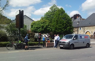
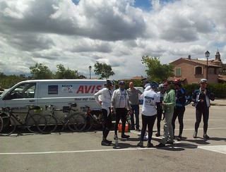
 KOTK Mont Ventoux day 9 : Bedoin - Mont Ventoux KOTK Mont Ventoux day 9 : Bedoin - Mont Ventoux |

This morning, the last day of our stay in the hotel Le Guintrand in Sainte-Colombe, the weather was looking good. The top of the Mont Ventoux was clearly visible and the sun was out. This would be D-Day. Anticipation by most if not all members of our group , especially those who never rode the Bedoin climb , was present at breakfast. I had doubts myself because I had only a 25 as biggest cog in my cassette, and I was not confident to be able to push that gear for the 18.5K of steep climbing awaiting after the famous courbe de Saint-Esteve. But I would give it a go, see how far I could take it.
 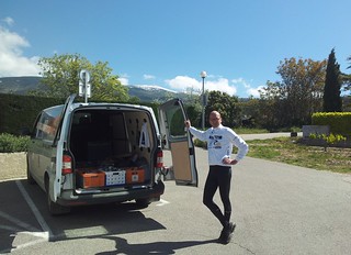  
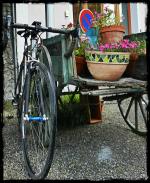
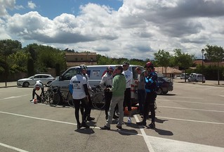
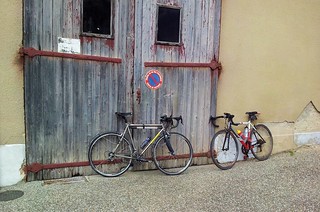
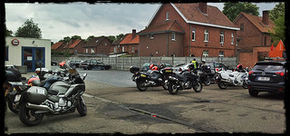
Riding down towards the official starting point in Bedoin , the group gathered and we were under way. I stopped when we passed the hotel because I had put on my clear sunglasses and the altitude sun demanded shaded spectacles. So the adaptive Specialized sunglasses came on. I had put on suncream this time, factor 50 for my nose, factor 20 for the rest of my face.
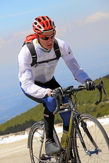
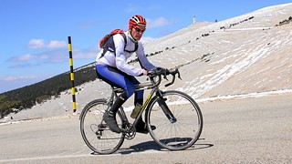
The climb is hell, as most of those who have ever done it will gladly testify. We were lucky because in the forest part - the steepest kilometers are to be found here - it was relatively cool. Only that gradient. Kilometers of 9.1% on average. I saw the gradient go to 10, 11, even 12% at times. When I reached the Chalet Reynard, in my mind I had given up so many times already. But I decided to keep on pushing, to the next corner, to catch up with the guy who seemed adrift, to pass that guy, mumbling 'Bon Courage' to him. Then I was being passed myself. A clean-shaven gladiator, bound for glory on the steep slopes of the Lonely Mountain. I looked at my front wheel and concentrated on my own pace.
Reaching the Chalet Reynard I took some time to eat and drink, go to the lavatory before I embarked on the last 6 kilometers. The first kilometers are easy, with gradients of 6 to 7%. Compared to the forest it almost seems to be going downhill. Almost.
The wind, what can I say . Each time you take a turn to the right it bangs in your face. The higher you get , the more fierce it becomes. With the snow on the side of the road and an ambient temperature close to O degrees it's almost as if you are entering a freezer with a couple a large fans in it . The Col des Tempetes, I have to reach the Col des Tempetes. After that , its a breeze. Reaching for the Col des Tempetes I pass several cyclists who have been stopped by the slope and by the wind. Some with their shirts open, chest bared. In these temperatures? My picture gets taken by several photographers who make a good living selling these at 17EUR a pop. I grab the cards they give me. I will order some when I get home. Proof.
Past the Col des Tempetes, I am passed by a young couple. I hook myself into the girls' rear wheel and ride the last couple of K with that as my bait. Being angled in by the big tower on top of the mountain.
My heartrate goes up 10 beats, passing 145. I will not fail.
 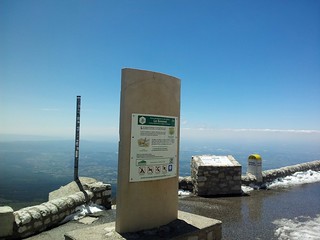 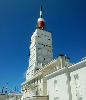
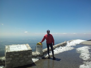
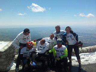
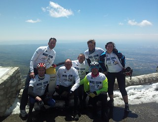
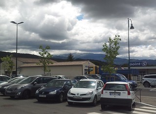
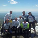
When I arrive on top I hear the cheers from my fellow teammates and the support team - Jan and Babette - and I am glad, relieved, elated, happy and feel like an icycle. the wind blows from the Alps and I need an extra layer of clothing. I put my bike against the camionette and hide inside to get out of the wind. We have to wait for all members of the team to come in. My bike drops on the floor, thanks to the strong wind. I put it against the side of the tower and check out the store. It's warm in here, let's stick around. I buy a ridiculously expensive 'Mont Ventoux' windbreaker.
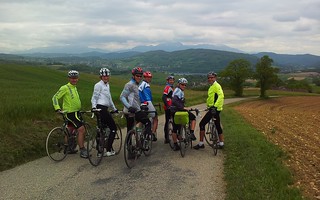
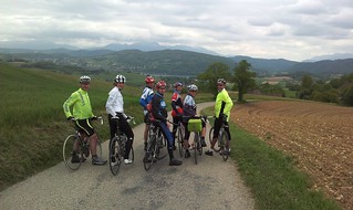
When the last member of our team comes in, it's time for the pictures. Well done guys.
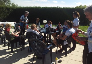
After warming up and catching our breaths, plans are made for the rest of the ride. We decide to descend to Sault , with a group of 3 cyclists. Others decide to ride down into Bedoin and call it a day.
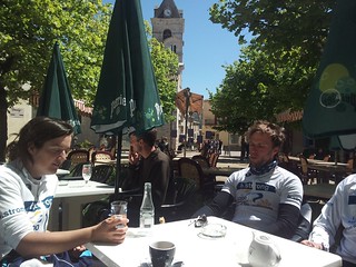
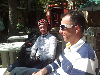
The descend is an icy affair. Speeds going up to 60kph and only past Chalet Reynard does it feel as if temperatures are above zero. The long descent takes its toll on hands, arms, neck muscles and brakepads. Down in Sault we gather for some warm coffee on a terrasse. Bliss and Joy .
From Sault we ride on downwards to Monieux where we follow the Gorges de la Nesque down into Villes-sur-Auzon. A long swooping descent going on for 20K or more. Great. From Villes , a difficult climb awaits us, wind full in our faces, towards Flassan. From Flassan its only a couple of kilometers further to reach the hotel at Sainte-Colombe. Yes. Great ride with another victory on the Mont Ventoux. My second time and the second time from Bedoin. A victory on the mountain - who couldn't care less - but especially a victory against my doubts, helped by the fantastic members of the b.strong team, who kept on believing in me, and kept pushing me to have a go. Thanks girls and guys, I dedicate this to all of you.
Endomondo
Ride Stats : 90K and 2000 heightmeters (Garmin) in 04h22mins
6425/30225
26-05-2013, 00:00 geschreven door Big Bad Wolf
|
|
|
|
|
| 25-05-2013 |
| KOTK Mont Ventoux day 8 : La Motte Chalancon - Bedoin |

This morning saw some snow on the surrounding hills. It had rained at 550 metres, the altitude where we stayed, but by the time we were ready to roll, the clouds were dissipating and a shy sun was peeping and warming us up. Today was the day we would ride to Bedoin and tackle the Mont Ventoux. D-day.
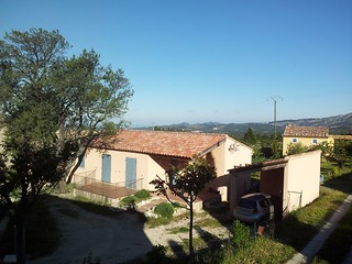
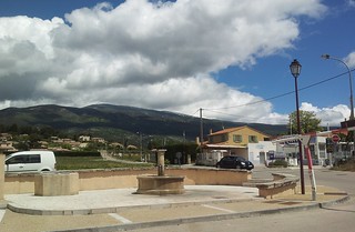
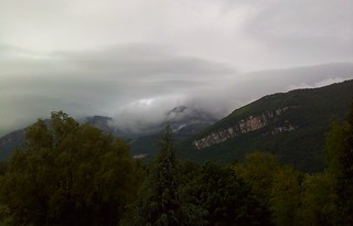
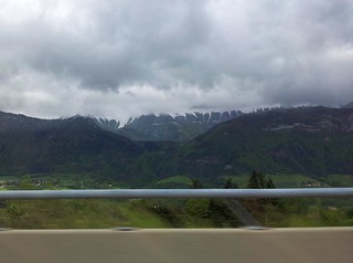
From the weather forecast it did not look to good for the attempt at the Mont. Snow from 1400 metres upward and a temperature of -5 degrees at noon! Ouch. Still, let's see how things develop as we ride to Vaison la Romaine and have a first look at it. This is what we saw looking out of our hotel.
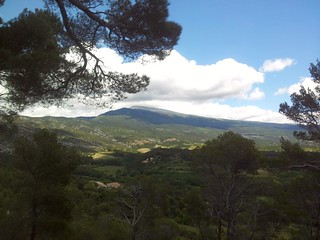
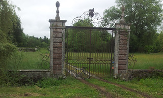
Temperature was low - 4 or 5 degrees, no more - when we straddled our bikes and started the long downhill past Remuzat and Sahune. Following the river l'Eygues we could enjoy magnificent rocks and hills surrounding us. No vautours in sight but we passed their domain when we passed St-May. The further we rode, the more the high rock outcrops seemed to give us a wide birth. The valley broadened and when we reached Nyons, a whole different terrain greeted us. Wide open space, with the occasional outcrop or hill. We made good pace, the wind more or less blowing in our backs and the sun shining in our faces. Before long we were in Vaison la Romaine, where we stopped for a break. The looks on the faces turned grim when we saw the Mont Ventoux, to our left and above, with its head encircled by a dark cloud and with snow on its flanks. The snow seemed to go down even below Chalet Reynard. Not looking good !
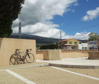
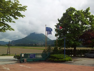
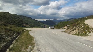
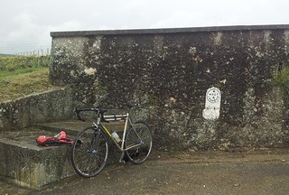
Malaucene was next and it was soon learned that the road leading up to the Mont Ventoux, was closed. We took the Col de la Madeleine and I took a picture past its crest with the Mont Ventoux and Bedoin on it.
When we reached Bedoin, we took another rest stop and talked about how we would continue our day. Some decided to ride up the Mont Ventoux to the Chalet Reynard, to check out the conditions.
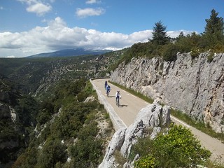
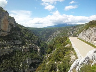
We decided to roll on towards Flassan and have a go at the long ascent along the Gorges de la Nesque. A miracle of nature I had seen last year but did not mind doing again. The sun was out and I felt it burn . Damn, forgot the sun creme. The Gorges where their usual magnificent selves and we leisurely rode to Monieux.
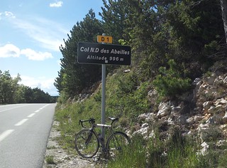
Here, it was decided to take a shortcut that would save is 10K to ride up to Sault and then back up the Col ND des Abeilles. The shortcut turned out to be quite something. Steep, steeper and steepest, with percentages reaching 27 at one point. When I saw the length of the climb still ahead, I decided to unclip and walk. Not a thing I easily do but the hill was just too steep. Reaching the big road leading up the Col ND des Abeilles, we paused until everyone of our group made it up the climb.
Moving onwards we tackled the Col ND des Abeilles, with its 3 steps, and then zoomed back down a very long descent into Flassan.
There was a thunderstorm rumbling in the far distance but we made it to our hotel in Sainte-Colombe still basking in the sun. A lot of wind though. During dinner that evening the group was together and telling tales from how each of them spent their day.
The forecast for tomorrow looked better, with a forecast of positive temperatures on top of the Mont Ventoux, and the dissipation of the snow on the route leading up to it.
Endomondo
Ride Stats : 133K and 1550 heightmeters (Garmin) in 05h35mins
25-05-2013, 00:00 geschreven door Big Bad Wolf
|
|
|
|
|
| 24-05-2013 |
| KOTK Mont Ventoux day 7 : Grenoble - La Motte Chalancon |

As forecast, the high slopes around the valley were covered with snow and during the morning more snow would fall below the 1000 metres barrier. The decision to cancel the ride was made yesterday so everyone was relaxed at breakfast. Todays' ride would have been the most difficult of them all, with nearly 2500 heightmeters. It would also have been one of the most beautiful. A lot of preparation has gone into this ride and it is a pity we were not able to actually ride it. But in the mountains, the weather is primordially important and even though we all wanted to ride, plain common sense dictated otherwise. This was the sight we woke up with in the Novotel at Voreppe:
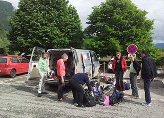
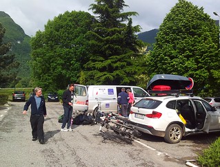
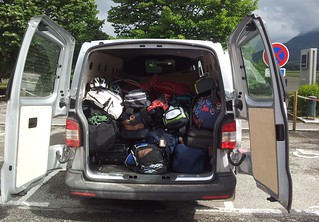
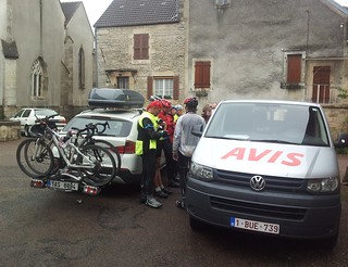
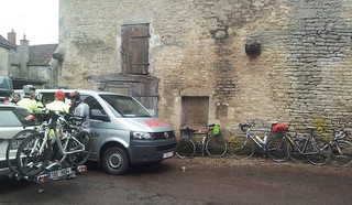
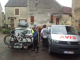
We prepared ourselves for a long journey in the car. We had 3 vehicles at our disposal to transport 13 bikes , all our luggage and 13 people. The group was very well atuned by now and we made the best of it, before, during and after the car trip.
Around 1000 metres of altitude we encountered the snow as predicted. The ride today would not have been possible on a bike. Good decision to cancel it.
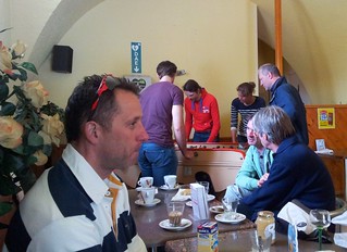
We stopped along the way for a bite to eat and some light entertainment on the "flipperkast"
Serious World Cup affair it turned out to be. A rematch is already planned !
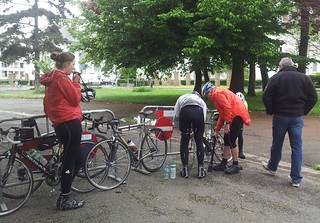
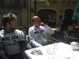
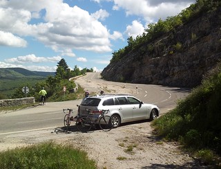
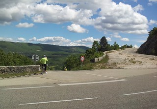
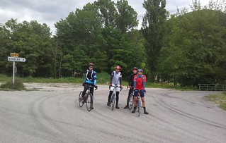
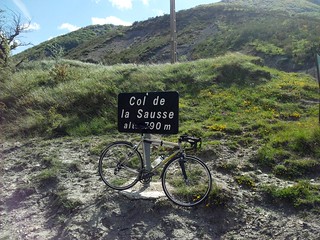
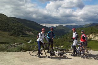
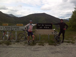
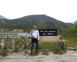
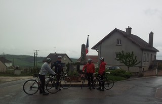
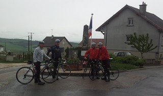
Arriving in our hotel in La Motte - Chalancon, some of the bikers decided they did not want to waste precious time and the opportunity to ride a few cols and plans were made for a 65 to 75 K ride , looping back to La Motte . This is the ride that is in the Endomondo link below. It is not what was initially planned but just a replacement ride that turned out to be a great adventure with 4 cols and some dizzying descents. The ride started with a long descent towards Remuzat and past Sahune. We took the road to Eyrolles and started climbing almost immediately. Down into Sainte-Ferreol Trente pas where another clim started. 7.5K up to the Col de Sausse. The wind blew in our faces and we did not stay long to enjoy the view on top of the col. Down again along a fast and sinuous road to reach Bouvieres. Here another turn to the rigth and we were climbing again, this time to the Col de Lescou. Each col being higher than the one before, this time we reached 820metres . The group split up into two subgroups. Johan and Jan were doing another 10K while Matthieu, Joris and myself began to a short downhill before attacking the next - and last - col for today. The Col de Pre Guittard was waiting for us at 919 metres. From here a long and beautiful downhill brought us along a ravine back to the route towards La Motte-Chalancon . Here are some pictures taken during the loop.
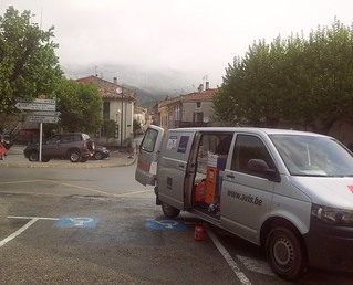
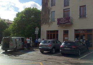
Arriving back at the hotel with a very satisfied feeling and ready for the last part of the trip that would bring us to Bedoin and the foot of our ultimate challenge, the Mont Ventoux ! We bedded in the Hotel des Voyageurs, in the Grande Rue. A hotel I would like to warmly recommend to each . It is very well situated, with a very friendly but determined hostess and a cute dog.
Endomondo
Ride Stats : 63K and 1085 heightmeters (Garmin) in 02h47mins
24-05-2013, 00:00 geschreven door Big Bad Wolf
|
|
|
|
|
| 23-05-2013 |
| KOTK Mont Ventoux day 6 : Bourg-en-Bresse - Grenoble |

Things were continuing to look good. It remained dry and the wind blew in our favor when we left Bourg en Bresse on our way to the gate to the Alps, Grenoble. The temperature was still in the low 10s but that did not bother me much. A light windbreaker took care of that.
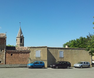
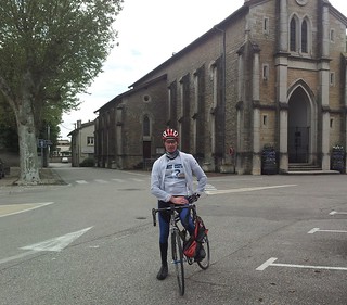
The first 70K, up to and over the river Ain, announced themselves to be rather flat and easy going, the occasional hill notwithstanding.. Our first rest stop was in Loyettes, just before crossing the river Ain Isere and entering the Rhone-Alpes region. I had a local gentleman taking a picture of me with the church as a backdrop.
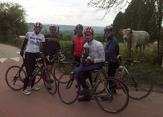
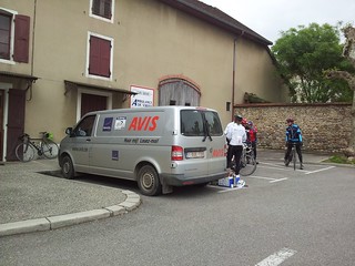
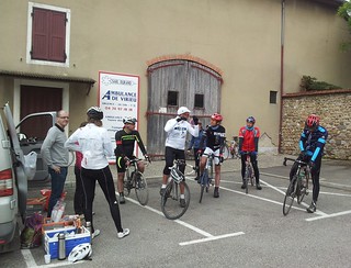
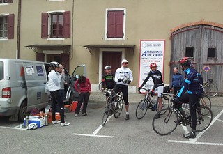
After Cremieux , things started to get spicy with hills reaching ever higher. After Saint-Savin, the next 12K would bring us from 285 to 505 metres of altitude. The first 4 to 5K were steep with a couple of swooping switchbacks and brought us to Premins. Here the climb relaxed a bit before entering a second stage - and a third - leading us ever higher and higher. Km100 saw us back down in the valley and we reached Cessieu where the next climb started to take us from 320m to 580 metres of altitude. It was a long climb with a very steep 17% section in Bouis. We made a segment for it on Strava, calling it the b.strong climb - . On the top of this climb the group - which had split during the ascent - came back together and some pictures were taken .
The following descent brought us to Virieux where the second rest stop of the day was planned. The sun was out now from time to time and things looked cheery. We ate and drank our fill because we were being told that there was a very steep climb ahead and we would need our strength
.
   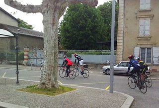  
Well, the prediction was right. If you are ever in Virieux, you need to climb the Rue du Chateau. A very steep monster, leading you from 425 to 280 metres in just under 3 kilometers. Zigzagging on the 18% bits, and gritting my teeth when things got less steep, I made it to the top. Some had to walk, one even fell off his bike when the climb became too steep for him and he could not get out of his click pedals fast enough. On top of the climb the group regrouped and we made some pictures with the Alps looming up in the distance, before riding onwards, all together this time.
The rest of the ride was basically one long descent into the valley of the Isere and to the Novotel in Voreppe, to the north of Grenoble. The foothills were looming over us. It had started to rain in the last half hour of the ride and the wind was just short of stormy.
In the evening, we were browsing the local weather reports and the news was not very good. Snow was forecast from 800 metres upwards, and the next day we had to pass a 1300 metres Col. Plans were made to cancel the ride and move the group to the next hotel by car and camionette.
Endomondo
Ride Stats : 155K and 1760 heightmeters (Garmin) in 07h10mins
23-05-2013, 00:00 geschreven door Big Bad Wolf
|
|
|
|
|
| 22-05-2013 |
| KOTK Mont Ventoux day 5 : Dijon - Bourg-en-Bresse |

Today saw the start of a new era in our adventure. It was dry at the start and the wind was no longer blowing in our faces. This would allow us to recover during the following days from the hardship - wind, rain and the long distances - we suffered the last 3 days.
Leaving Dijon we crisscrossed the Bourgogne wine-fields. Some small tracks which were covered with fine grit and puddles from the previous' days rain. One of our group had a flat tyre and she was assisted by two strong riders while the rest of the group continued along the tour of the wineries. Grand Crus to our right and left. The shy sun brought a smile to our faces while the road gently descended towards Nuits-Saint-Georges, where we crossed the A31 autoroute.
We were now entering the Cote-d'Or region and before long we crossed a filled-to-the-brim river Saone. Gently ondulating roads brought us to a first rest stop at Villegaudiin, next to the Chateau de la Marche.
Riding onwards the trail brought some more gentle hills, but with the wind in our backs and the sun peeping through from time to time, we did not mind the extra effort. Some gentle drizzle caught up with us before arriving in Bourg en Bresse, but we quickly setlled into the Ibis Styles hotel. The bikes could have a clean and the chains were lubricated before we headed out for dinner in Bourg center.
Today really was a milestone in this cycling journey. We are over halfway and the weather got better. The rain stopped and the wind decided to blow in our favor. The trip was becoming more of a holiday and less of an ordeal.
Endomondo
Ride Stats : 153K and 850 heightmeters (Garmin) in 06h09mins
22-05-2013, 00:00 geschreven door Big Bad Wolf
|
|
|
|
|
| 21-05-2013 |
| KOTK Mont Ventoux day 4 : Troyes - Dijon |
The fourth day of our journey announced itself as a long and tough ride. With almost 170km and over 1500 heightmeters it was going to be a handful, or should I say footful, being cyclists? . After 2 days of almost continuous rain we were glad to be greeted by overcast but dry conditions when we zigzagged out of Troyes. The track had to be changed overnight because the valley of the Seine was inundated and we had to stay higher up. A big word of thanks to Jan, who spend half the night retracking, saving and resaving the GPS trail.
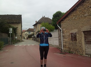
For the first hour the skies remained dry. Then the rain started to fall for the next couple of hours while we made our way through the valleys. We smiled when we passed through Coulmier le Sec (le Sec !) before reaching the pittoresque village of Villaines-sur-Desmois, where our reststop was planned. I had a look around in this village and took some pictures while eating and drinking to keep the strength for the rest of our ride.
Moving on it started to dry out and whilst we were gradually climbing higher and higher in the landscape, the small hills became bigger hills and nearing Dijon the landscape became Ardenesque. We passed close to the Source de la Seine and then followed a plateau for a very long time. It started raining again and we were briefly amused by a big hairy dog that followed us for a couple of kilometers along the road on one of the plateaus.
After a while the dog disappeared into the green fields and we were riding once again alone, accompanied from time to time by one or both of the accompanying vehicles , where friendly faces were cheering us on. Before reaching Dijon, we had another rest stop because there was still some climbing to be done. Again we were pampered by our followers. Following the big road to Dijon for a while we took a right turn towards de Foret Domianale de Plombieres where we descended into the beautiful and - surprise - dry valley of the river Ouche. We could see big hills before us and one of them we had to climb to Corcelles les Monts, before reaching a soaring and twisty descend into the suburbs of Dijon. Arriving in the sun at the Novotel was a pleasure and gave us good hope for the rest of the journey.
Endomondo
Ride Stats : 169K and 1560 heightmeters (Garmin) in 07h17mins
21-05-2013, 00:00 geschreven door Big Bad Wolf
|
|
|
|
|
| 20-05-2013 |
| KOTK Mont Ventoux day 3 : Epernay - Troyes |

Another day that announced itself long , wet and cold. The second set of rain trousers had to come out, the first one being insufficiently dry. None of us was equipped for this kind of prolonged wet weather. Who could have imagined that at the end of may we would have to experience days with temperatures barely reaching the low 10s and with days without seeing the sun? Leaving the Champenois area we followed a route with beautiful views on the champagne fields and houses. Gradually we climbed until we reached Le Mesnil sur Ogier. The rain was light but incessant and the wind was not in our favor either (did I already mention that? I'm sorry ) . The only thoughts we had was to continue, not to flatten, and to get dry at the end of the ride. Pity because the area we were riding through was very beautiful and after some 45K into the ride we were descending into the Seine valley. Again, the risk of inondation was big and we were glad we could still pass on roads that had not been closed. The risk for that happening was getting bigger each day. I managed to get another flat tyre somewhere. During the ride we were so happy that we could stop at the rest stops provided. Here we were being pampered by Fons, Nicole, Babette and Melinda, who made sure we got enough to eat and drink, and even provided us with hot soup. Also they kept our spirits high. Thanks guys, you were like guardian angels to us.
After 6 hours of cycling we arrived in Troyes and had to risk our lives riding through most of the city in the rain. In the evening we had a nice dinner in a local restaurant.
Endomondo
Ride Stats : 131K and 760 heightmeters (garmin) in 06h17mins
20-05-2013, 00:00 geschreven door Big Bad Wolf
|
|
|
|
|
| 19-05-2013 |
| KOTK Mont Ventoux day 2 : Charleville-Mezieres - Epernay |

The second day of our great adventure started out dry, leaving the Ibis hotel in Charleville-Mezieres , but soon it would start to rain, a little drizzle at first but that soon changed to light rain. The first part of the ride consisted of two gradual climbs and then we would descend into the valley of the Aisne. It had been raining quite considerably in the north of France the last couple of days and this could be seen by looking at the amount of water standing in the fields and the rivers. Gradually we made our way south, with the rain and a strong headwind as our companions . I got a flat rear tyre and changed it.
It is funny how quickly I adapted to the rain. Of course, I HAD to, but still it took some time to flick the switch in my head and just go ahead and ride. Never mind the rain, if it wants to fall, let it fall. There are much worse things in life. One only has to think about the cause for which we are riding. Cancer. Why be bothered by a little wetness from the sky? That is peanuts compared to what cancer does to people.
Entering the Champenois area would have been a much more exciting experience had the rain stopped. As it was, we climbed the Montagne de Reims in a subdued way, riding through the magnificent forest on top of it before descending into Mutigny. This was the first steep and long hill of the adventure, and it took the legs some getting used to, to get into the rhythm. The fresh young wine ranks were greeting us as we made it to the top of a steep hill, where we could overlook the Moet and Chandon winefields.
The steep descent was fun with my mountainbike experience, being careful not to slip on the muddy and wet tarmac. At the bottom I stopped, took a few pictures and waited for my fellow cyclists to arrive. After crossing the river Marne we arrived in Epernay. It had dried out by now but I could hear the rumble of a thunderstorm in the far distance. In town that evening we had a fine meal in one of the big restaurants, with champagne as aperitif of course.
Endomondo
Ride Stats : 118K and 755 heightmeters (Garmin) in 05h41mins
19-05-2013, 00:00 geschreven door Big Bad Wolf
|
|
|
|
|
| 12-05-2013 |
| Kom Op tegen Kanker |
I had agreed to ride for the KBC b.strong team during one of the days of the 4-day 1000km Against Cancer event. As the event drew nearer I began to worry if I would be up to the task of riding 250km in a single day. Stress developed, my stomach got in a twist and last wednesday the pressure caused my back to start hurting. I made an appointment with an osteopath and he put everything in place again in my back and neck, giving me a lecture on proper nutrition as well. I will try to take more care of what , how much, and when I eat.
Resting for the rest of the week allowed my body to recover from the manupilations and with some extra encouragement of a friend I was ready to face to challenge.
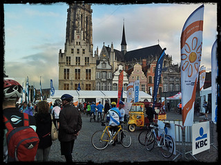
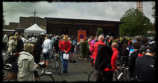
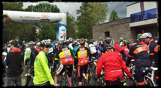
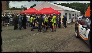
Up bright and early at 5.30am , riding the car to Mechelen where the start was to be given at 7.45 for my group. I decided to ride in the 27kph average group, the 24 being too slow and the 30 too fast for my liking.
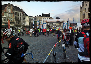 
The weather was cloudy but even though it was fresh - around 8 degrees - and there was a lot of wind, I settled for a 3 layer solution, the Assos BlitzFeder being the final insulation layer. I also put a thin rainjacket in my backpack because some showers were forecast. The bike was in tiptop shape and from the start the big peloton settled in a nice average. The big group makes for easy riding, but also calls for concentration . We reached the first rest stop in Zelem - around 60K into the ride - and I was still feeling fresh and full of energy. Eating and drinking being very important . When we left the stop we had our first rain shower. The peloton took a pause to allow everyone to don their raincoats or other protection. The raincoat would be worn for the rest of the ride.
The wind was blowing in our backs and some 4.5 hours into the ride we reached the halfway point, 125km into the ride, Bilzen. When we arrived in the city hundreds of people were lining the streets, making a lot of noise, cheering us on. Amazing, we felt special. In Bilzen we would stop for a warm meal . I checked for the members of the other KBC b.strong teams and found some company for the meal. Pasta and hot soup, delicious.
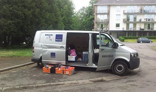
Around an hour later, we started again for the second leg, the ride back to Mechelen. I had some fears for the wind but once again, being in a big group helps , and we made good speed on our way in . Two more rest stops were planned, one after around 40K in Beringen, in the neighborhood of the old mining site. Again , I stocked up on plenty to eat and drink. The organisation was almost perfect. A big fleet of Police and Way Captains on motorcycles stopped all traffic and blocked all crossroads so that our peloton could pass. The only time we had to stop was when we came to a railroad crossing and we had to wait for a train to pass. Also, the rest stops were well stocked and manned by the most friendly people. All for the good cause. A big applause for them.
40K later we were already at the last rest stop, situated in Westerlo. Again eating and drinking for the last stretch. We already passed the 200K mark and I was beginning to feel confident I would make it. When passing in Duffel and riding on a big road towards Mechelen distaster struck. The group had to brake for some potholes in the road, I had to turn into the sideberm briefly and when we started rolling faster again I could feel my rear tyre losing pressure. Up goes my hand. The truck with the technical assistance team stopped besides me, my wheel was taken out and I was given a replacement wheel. It was a Shimano cassette but the shifting went fine and before long I was back at the peloton, which had dropped its speed. Riding behind the truck coming back was easy. After the ride I would pick up my wheel, with a new inner tyre and inflated. Great job guys !
Arriving in Mechelen was another great experience, the Grote Markt and the streets leading towards it were packed to the brim with enthusiastic supporter, making a lot of noise and cheering us on. What an expirience. I was very glad to be able to participate and the ride was completed without any physical trouble. Ok, my neck , triceps and hands started to hurt near the end of the ride and I could also feel some pain in my hips, but my back didn't budge. Good job of the osteopath!
Endomondo track
Ride Stats : 257K and 685 heightmeters (Garmin) in 09h34mins
5236/18415
12-05-2013, 00:00 geschreven door Big Bad Wolf
|
|
|
|
|
| 05-05-2013 |
| Ravel 2 and L147 |

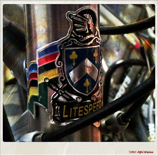
Great sunny weather today so I took the Litespeed Vortex out for a longer ride. Starting over Bierbeek, Willebringen and Hoksem to reach Hoegaarden, where I followed the Ravel 2 . Past Jodoigne I followed the Ravel 2 to where it intersects with the L147 ,which connects Landen with Perwez, and goes further to Gembloux. I took a left turn and followed this small tarmac road through Jauche and Orp to where it ends, just before Landen. A great stretch of road that is calm and deserted. With the wind in my back I could maintain a good speed here, concentrating on recuperation from yesterdays' ride. Turning left once more and now riding back towards Hoegaarden through Overwinden, Ezemaal , Goetsenhoven and Outgaarden. Flirting with the language border. Back in Hoegaarden I had to tackle the climb out of it with the cobbles near the end giving me a good shaked. Meldert and another climb followed. The wind was bothering me a bit , and of course I was also starting to feel the kilometers - yesterdays' and todays' - accumulating in my legs. In Opvelp I turned towards Beauvechain for a loop that would bring me through Tourinnes and Hamme Mille on to the N25 . Back into Blanden I had enjoyed a solid ride .
Endomondo
track
Ride Stats : 91K and 560 heightmeters (Garmin) in 03h19mins
4980/17730
05-05-2013, 15:06 geschreven door Big Bad Wolf
|
|
|
|
|
| 04-05-2013 |
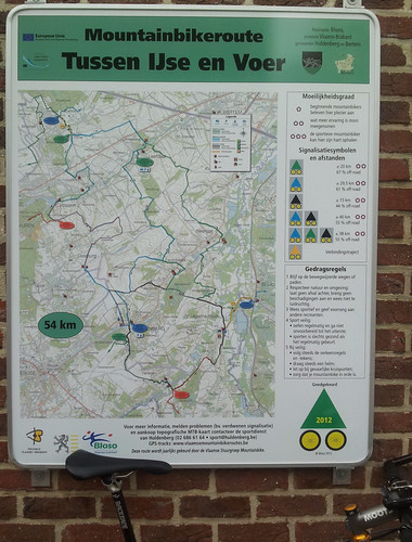
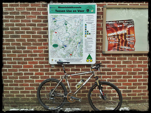
| Yse and Voer Bloso trails |
This morning saw clear and sunny weather. The temperature was just above 10 degrees C but that did not bother me much. On the contrary, I prefer temperatures between 10 and 20 degrees, they are perfect for cycling and certainly for mountainbiking. I set out through Meerdael Forest and Sint Joris Weert towards Sint Agatha Rode where I joined the Black Yse and Voer Bloso trail. My plan was to combine all three routes today. There was some kind of happening because around these new trails because I passed a lot of bikers on the black trail looping towards Terlanen and Huldenberg. Here I switched on the Blue which took me way up north to Duisburg and even Vossem and Moorsel, before turning towards the east and later to the southeast to join Leefdaal. Here I hopped on the Green to complete the last of the trails before joining the Black Bloso again riding down to the Wolfshagen and into Sint Agatha Rode. The trails are well marked, but at some points there are road works and of course no arrow was to be seen. So I took the precaution of downloading them into my Garmin. Better be safe than sorry.
What can be said about these trails? Well, they are varied, a lot of field tracks, a couple of passages through little forests - Sint Agatha Rode Bos and Moorselbos among them - some of the trails run parallel with the Overijse Bloso routes and the Tervuren Bloso routes. They skid along the edge of the Sonian Forest, so if you feel up to it, you can combine them, just make sure you take enough to eat and drink ! A couple of passages through villages demand your attention, be advised that you do NOT have any right of way just because you are a biker following arrows. I was fortunate to do these trails after a long dry period. Some passages can be quite muddy . I was surprised at the amount of climbing, but there are quite a few long and even steep climbs. The climb out of Huldenberg along the Dreefstraat, the dreaded Moskesstraat in Terlanen, the Kleine Hollestraat out of Leefdaal, and the climb into the Kleine Keistraat towards the Grote Keistraat are some that I remember quite well. There are also a couple of zooming downhills , all easy now that its dry but some might prove quite a handful when the floor is wet.
When I arrived in Sint Agatha Rode I decided to add a couple of extra kilometers to my ride. I first rode through the river Dyle estuary to reach Pecrot. Here I worked my way up the Malaise crest and then dropped down into Nethen. Along the Savenel wall I joined the Blue Meerdael Bloso and followed that, and later the Red, accumulating trail after trail, kilometer after kilometer, and sight after sight. Nature is becoming alive at last, trees are turning green with foliage and there are flowers - white, yellow, blue, red - everywhere. When I arrived at the Margrietendreef I decided to call it a day and ride into Blanden for a last loop.
Endomondo
track
Ride Stats : 73K and 915 heightmeters (Garmin) in 03h32mins
4889/17170
04-05-2013, 15:03 geschreven door Big Bad Wolf
|
|
|
|
|
| 30-04-2013 |
| Tussen Yse en Voer |
When I came home from work and the temperature was still around 15 degrees C I rode out with the Moots YBB. I started out with no particular plan but followed the Langendaal along the edge of Meerdael forest towards Sint Joris Weert. Rode through the Doode Beemde, passing on the bridge where I fell last october. Everything is bone dry now so there was no risk of slippage. Towards the Wolfshagen and up the Smeysberg where I stumbled upon Green Bloso arrows. Since I had no other plans I decided to follow them. Into the Yse valley and then out of it towards Leefdaal where I came upon the starting point of this route. Turned out to be part of some new BLOSO trails which passed through Bertem and Huldenberg. I continued along the Green and gradually came back up the ridge where a nasty wind from the north greeted me. Luckily the trail turned towards the southeast and down into Neerijse.
From Neerijse it went back over the Smeysberg to drop onto the Wolfshagen again. I left the route and rode back through Sint Joris Weert into Meerdael Forest. Here I followed my front wheel along some nifty climbs and descents, following the Meerdael Bloso for a while. Doing a perimeter ride which brought me to Mollendaalbos and then back into Blanden along the Godensalon and the Margrietendreef. A solid 50K of riding which had me dig deep from time to time but I was able to maintain a good speed throughout the ride.
Endomondo
track
Ride Stats : 52K and 620 heightmeters (Garmin) in 2h29mins
4725/15565
30-04-2013, 21:15 geschreven door Big Bad Wolf
|
|
|
|
|
| 28-04-2013 |
| Mollendaal Trails |
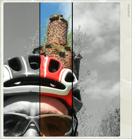
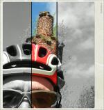
Today saw me out with the Moots YBB. Fridays' rain was long forgotten and when I entered the forest I could not see anything but bonehard dry trails. I decided to start with my twisty mollendaal trails loop and whilst weaving through the forest from north to south and back again I enjoyed the crisp but clean air. Temperature was around 10 degrees C. No more, no less. When I finished the trail section I rode back to the Weertsedreef for another succession of trails, leading me towards the Warande Pond. From here I followed some more trails bringing me to one of the nicer looking valleys in Meerdael. I took 3 pics and kinda stitched them together with Paint. This is the result. Try not to see the obvious color differences, like I said , no posh stitching program, just cut and paste.

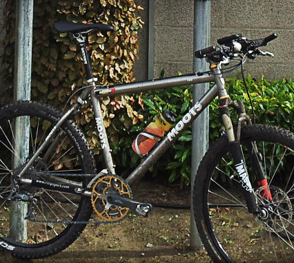
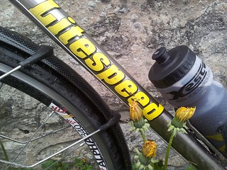
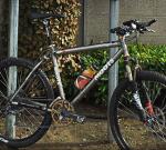
Venturing further along smaller trails , checking out some tracks I did not do for a long while, I wound up at the Hertebron near La Hetraie and decided to take a picture of the bike.

Riding onwards I took the new biketrail parallel to the Weertse Dreef and then took a right turn on the Herculesdreef and another right turn to get back into the military compound and from there I followed the Green Bloso into Vaalbeek. A little venture into Heverlee bos closed my ride for today. Entering Blanden I followed some footpaths and then took a last loop to arrive into Blanden again following the Margrietendreef. Had a long and solid ride.
Endomondo
track
Ride Stats : 53.5K and 700 heightmeters (Garmin) in 02h42mins
4673/14945
28-04-2013, 15:18 geschreven door Big Bad Wolf
|
|
|
|
|
|
|
| Gastenboek./.Guestbook |
Druk op onderstaande knop om een berichtje achter te laten in mijn Gastenboek. /
Press the button below to write in my Guestbook.
|
| Email Me |
Press the button to send me a mail
|
|
|
|