|
|
|
| Tales from the Woods |
|
|
| 18-10-2009 |
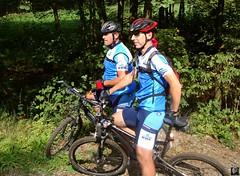
 Field Trip Field Trip |

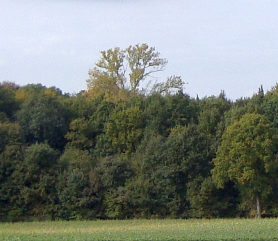
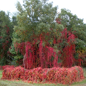
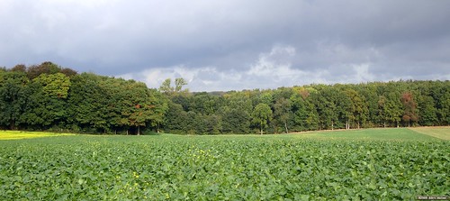
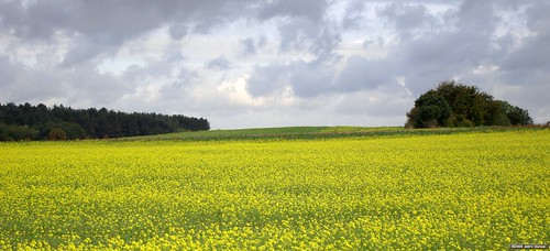
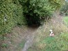
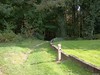
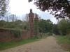
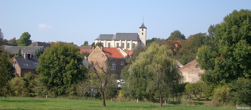
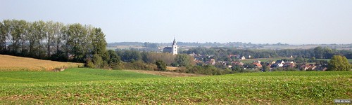
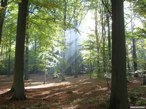
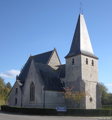
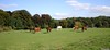
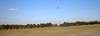
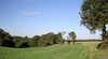
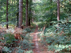
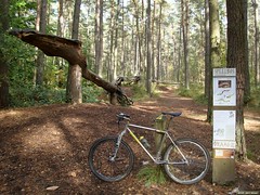
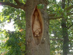
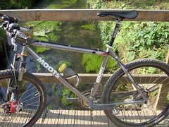
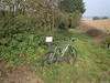
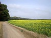
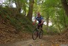
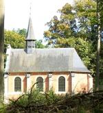
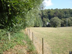
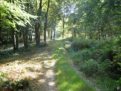
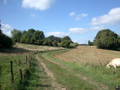
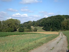
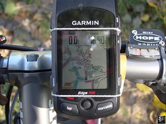
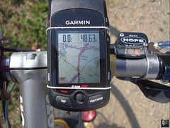
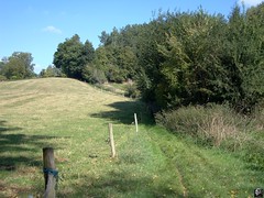
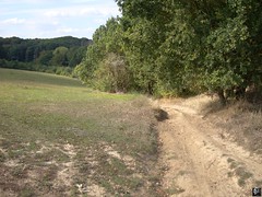
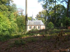
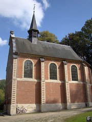
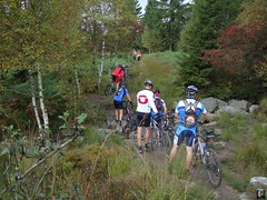
Another night close to freezing left the forest cold in the morning. Even when I rode out around 11am it was still only 5 degrees C. I was able to make a nice picture of the sunlight filtering though the autumn leaves. Soon I was out of the forest. The plan was to ride through the fields to the south-east and conenct with l'Ecluse and if possible Sart-Melin. Only obstacle was the Beauvechain airfield I had to leave on my right. The fields felt a lot warmer than the forest, because here the sun shone freely and there was no wind to speak of. Using the sun for direction and the Edge 705 to find the trails I could conenct the dots and arrived at l'Ecluse. Here and there I was able to include some singletrack and before long I was on my way towards Melin. I wanted to get home before 2pm because I wanted to watch the cyclocross World Cup race in Plzen. In Mélin I turned my bike towards the northwest and conencted back through the fields towards La Bruyere, Beauvechain and Tourinnes . I spotted the Saint Corneille chapel from afar, its white wall shining in the sun. Then I entered the Meerdael Forest again and made my way home in time for the World Cup.
Tomorrow I have to go back to work after 4 weeks of holiday. I had a good holiday, the weather was great in the first couple of weeks and then a bit of rain in the last 2 weeks but nothing really bad enough to keep me inside. I was able to ride my bike for more than a 1000K and 11000 heightmeters during that time.
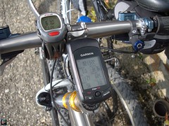
Ride Stats : 40.5K and 365/400 heightmeters (Polar/Garmin) in 2h9mins
8238/84335
18-10-2009, 16:41 geschreven door Big Bad Wolf
|
|
|
|
|
| 17-10-2009 |
| Meerdael Bloso ride |
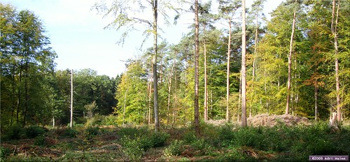
A little bit of rain yesterday but nothing that could worry me when I rode out this morning for an easy ride following the Meerdael BLOSO routes. I rode them in the reverse sense, starting with the Red at the bridge over the Naamsesteenweg and then switching to the Blue some 20K later and finish off with the Green. When I exited the Heverleebos I switched on the Blue again which brought me back to the Red and my point of departure. May sound complicated but its not. The trails were perfect , just a little moisture here and there and the big puddles along the E40 have filled up again. But there was always a trail going around the puddles for those who fear mud on their bikes. The weather was OK with some 11 degrees C average and the sun showing from time to time which felt good especially in the freshness of the forest.
Ride Stats : 53,5K and 500/560 heightmeters (Polar/Garmin) in 2h51mins
8197/83935
17-10-2009, 15:09 geschreven door Big Bad Wolf
|
|
|
|
|
| 15-10-2009 |
| Haasrode Toer |
|
Freezing last night and still that cold northern wind blowing. I waited until 1pm to ride out for an easy recovery ride. I decided to do part of the Haasrode toer, which brings me to Haasrode, Bierbeek, Neervelp, Willebringen, Oirbeek, Hoksem and then back over L'Ecluse and La Bruyere. Here I decided to ride in over Beauvechain and Hamme Mille. A good ride with the Litespeed on road tyres. I have decided to treat the Hilset to a new crank. This will consist of a Shimano M960 XTR crank, Hope ceramic or Chris King bearings and Specialités TA C116 chainrings. So its bye bye to the Tune Fastfoot which has served me well but also presented a fait bit of annoying side-effects like loosening crank bolts and a shifting axle.
Ride Stats : 51K and 390/455 heightmeters (Polar/Garmin) in 2h21mins
8144/83375
15-10-2009, 17:02 geschreven door Big Bad Wolf
|
|
|
|
|
| 14-10-2009 |
| Pietrebais 54K TT 2009 |
A bit frisky this morning so I waited until noon to ride out. The weather was sunny but rather cold. Riding up to Pietrebais I had the northeasterly wind more or less in my back. Which was fine because I needed the time to warm up a bit. The Pietrebais TT was held a couple of weeks ago but I couldn't attend so I was glad to be able to ride it following the gps track someone mailed me. Thanks for that !
I have ridden the Pietrebais TT before , but then it only was a 45K affair. Even then, the trail builder surprised me with a lot of nice trail combinations and a thorough knowledge of the area. So I was eager to ride this one, a full 54K and announced to be around 900 heightmeters.
As it turned out, it was even a bit more, and thats exactly how it felt in my legs as well. The start is relatively easy on the legs with a long steady uphill. Care has to be taken. Even though it hasn't rained for a couple of days the trails underneath the trees' green clover are wet and slippery. Once in the fields things dry out and before long I'm back riding downhill towards Pietrebais. Crossing the "rue du Fond de Village" and I'm on another uphill leading all the way to the outskirts of Roux-Miroir. The trail then turns back towards Pietrebais for a nice loop including some singletrails along the forests' edge and between two green fields in a valley. After that it points me towards Longueville. A first passage next to the Chapelle du Cheneau. Now follows a very nice and difficult loop taking me towards Chaumont-Gistoux. I know the area here very well from all my Accro Bike adventures and other trailbuilding duties. Good thing because that way I can easily predict where the GPS wants me to go. The Bois de Chaumont is a real maze to the unwary. The trail builder succeeded in making a very good and consistent loop here. With some steep descents and a hell of an uphill. The fact that a recent thunderstorm has washed out the trails didn't help either. But I'm glad to report I could ride it all. The heightmeters are added liberally in this area and the track slowly loops back to the west and towards Bonlez. A nice long climb and then a difficult descent into the Bois de Bonlez. The trail becomes a rivulet and remains so for 500 metres. Down past the rose fishery and then upwards into the Bois de l'Etoile. Again I zoom down deep into the valley and then turn right for a long climb that brings me from 60 metres all the way up to 145 metres and back to the Chapelle du Cheneau. From there its inevitable that the trail veers down again, this time towards Lower Heze and Grez-Doiceau.
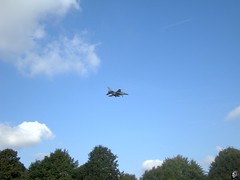
Next comes the climb to the church of Biez, a tough cookie along a singletrail that becomes steeper and steeper. Then the track drops down again on some cobbles and another narrow singletrack brings me back up ; in Heze this time. From here the trail goes towards Cocrou in a long sandy downhill through a forest. In Cocrou I cross the busy N91 and another cobbly climb brings me upwards into the Bois de Linsmeau. A track alongside the forest edge, sometimes a bit muddy delivers me into the fields where the wind welcomes me straight in my face. I pass the landing lights of the Beauvechain military base and a couple of Marchetti SF260s and an Alpha Jet amuse me by passing over my head and landing on the strip. No F16s today.
The trail now descents back towards Pietrebais, through a nice but slippery hollow road in a forest. But we are not there yet. Another climb awaits, out of Cocrou and ultimately into the fields south of Pietrebais. A great singletrack then drops me into Pietrebais where a last and steep climb - on tarmac this time - takes me north of Pietrebais again. Turning to the right and easing down on tarmac I am back before the Girls' School where my ride started a couple of hours ago. The numbers are 54,2K and 935 heightmeters. I uploaded the GPX track to EveryTrail. You can check it below.
From Pietrebais I ride back home, through Grez-Doiceau and I can't resist taking the difficult climb up to Gottechain. The trail next to the Gottechain church is completely washed away and I have to walk a couple of metres. Next down into Hamme Mille and into Meerdael Forest to complete this 5-hour ride.
Ride Stats : 84K and 1080/1155 heightmeters (Polar/Garmin) in 4h56mins
Pietrebais TT 54K 2009 at EveryTrail
Map created by EveryTrail: GPS Community
8093/82920
14-10-2009, 20:49 geschreven door Big Bad Wolf
|
|
|
|
|
| 12-10-2009 |
| Nightride reridden |
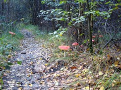
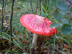
Today I wanted to re-ride last saturdays' Nightride. That ride was a great sampling of what Meerdael Forest has to offer and obviously, I had the GPS track now. So I set out from the CC The Borre in Bierbeek and did just that. The trails were still moist but one advantage you have during the day is that you can oversee the complete trail and point your wheel in the dryest direction. My GPS surely had some troubles last saturday. I noticed this because the heightmeters were way off, but also at some points it placed me on another trail as the one I actually was riding on. I'm thinking perhaps in the evening there are less satellites on the horizon, making the error in position bigger than during the day. I cannot explain the missing heightmeters, on the rides' profile there it seems that during the last hour the height only varied by 10 to 15 metres. Today the recording went fine and I had the correct amount of heightmeters. I am bound by secrecy where it concerns the track but I can make your mouth water by showing the profile. I stopped along the way to take some pictures. The sun was out and even though there was a cold northern wind blowing I was protected by the forest. The average temperature was around 14 degrees C, just enough for an enjoyable ride.
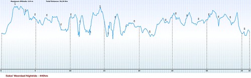
This week is the Week of the Forest, and the trails around the Kluis were crowded but everyone was very friendly to the other , each enjoying the forest in his or her own way. I already mentioned it last time, but I am very impressed by Solo's ride. I recognize a lot of tracks out of my own Meerdael adventures but there are also some new connections he made that make his ride stand on its own. I'm told he also has an XXL version , close to 80K and 1200 heightmeters, which is quite impressive. Can't wait to ride that one and compare it with my own Secret Meerdael ride, which stands at 62K and 1100 heightmeters in its last form.
Ride Stats : 51K and 540/580 heightmeters (Polar/Garmin) in 3h00
8010/81765
12-10-2009, 18:49 geschreven door Big Bad Wolf
|
|
|
|
|
| 10-10-2009 |
| Meerdael Nightride |

A lot of rain last evening and also during the day, so I was a bit hesitant about going to the nightride that was organised by Stef 'Solo' Reynaerts. Planned and on the 4Bikers.be website, a lot of people who initially agreed to come didn't fancy riding in the mud and cancelled. But when around 3pm the rain stopped and the sun came through I thought by myself 'why not' and decided to go. Had to return when I was halfway to the starting point because the mudfender I mounted on my front fork clashed with the Fox RLT 80 . It touched the forks bridge on compression. So I turned around and took off the front fender, and then rode towards Bierbeek and The Borre were the start of the ride was.
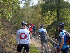
Stef was there, as well as Magura and Magura senior, Fully Fetzl and I believe the sixth was Supernaut. The ride was very good. A lot of twisting and turning, with only the occasional screech of an owl and the rustling of an escaping roedeer to break the silence of the forest. The heavy rains had left a lot of deep, washed out ruts so care had to be taken in the descents. Fortunately you don't see most of the dangers in your cone of light, so you don't have to worry about them either. I used the Lupine tesla 4 which behaved flawlessly. I had it on the middle stand which should last for 6 or 7 hours. Even then I heard remarks that it was very bright. I had to react with catlike quickness a couple of times when my front wheel hit a log, or skipped into a rut I didn't see. Also puddles are sometimes a lot deeper than you think and this takes the speed out of your bike very quickly. Some 38K and 400 heightmeters later we were back at the starting point. No mechanicals, no falls, 6 experienced mountainbikers who enjoyed a great ride in the dark, wet and silent forest. The smell of the wet pines was overwhelming and my bike now looks like it has been dragged through a mudhole - which, come to think of it , is more or less correct.
Still the overall impression was that it was not as wet as I had expected. A couple of puddles yes, some a bit deeper than others but for the rest just an overall dampness of the tracks , nothing more, nothing less. My GPS had less heightmeters than my Polar, which is quite strange. But the Polar only had 25.5K recorded since the speed sensor looks like it needs a new battery. The sensor died 1h30 into the ride. It did record the time, heartrate and heightmeters though so if you couple both instruments, and my Classic Cateye Enduro 2, you get a good idea of the rides' length and difficulty.
Ride Stats : 54K and 565/375 heightmeters (Polar/Garmin) in 3h12mins
7959/81185
10-10-2009, 00:00 geschreven door Big Bad Wolf
|
|
|
|
|
| 09-10-2009 |
| Mustang |
Due to the ongoing troubles with the Tune crank on my Hilset, I decided to set up my Litespeed with the road wheels and ride over to Filip Sport. The Hilset will have to wait until I have a solution for the shifting axle. I noticed an interesting Shimano M960 crank lying around at Filips' and decided to ask its pricing. If Tune does not deliver by this weekend I think about cancelling the order and put another crank on my Hilset. Shimano XTR has never failed me - I have a 2000 M952 XTR version on my Moots and a 2007 M-970 XTR crank on my Merlin.
I will not moan about Tune anymore, people who read this blog frequently will know about the ordeals I had to go through. There's a price to be paid if you want light and flashy stuff.
Riding along in Maleizen and just entering La Hulpe I noticed a nice Ford Mustang. I have no idea what country the number plate is from but the car sure was nice, a real muscle-car by the looks of it. Nice color too.
Riding back the clouds were becoming more and more covered, and sadly more rain is forecast for this night. I would like to do an offroad ride tomorrow evening so lets hope it doesn't rain too much.
Ride Stats : 52K and 330/390 heightmeters (Polar/Garmin) in 2h17mins
7905/80620
09-10-2009, 17:10 geschreven door Big Bad Wolf
|
|
|
|
|
| 07-10-2009 |
| Between two fronts |
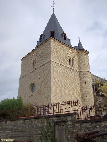
Yesterday saw a whole day of rain, but this morning was dry and before it started raining again I decided to ride out for a quick ride on the Hilset. Just my shortest lap riding over Bierbeek, Opvelp, Beauvechain, Tourinnes and Hamme Mille and then back home. In Tourinnes I took a picture of the church that gave the town its name. Its still being restored but the main tower is already out of the scaffolding.
Ride Stats : 25,5K and 160/190 heightmeters (Polar/Garmin) in 1h10mins
7817/79955
07-10-2009, 12:59 geschreven door Big Bad Wolf
|
|
|
|
|
| 05-10-2009 |
| Meerdael Perimeter in light to moderate rain |
This morning saw some light rain that died out towards noon. When I left it rained ever so slightly, but I still wanted to get a ride in because more rain was forecast for the afternoon. Sabine, the VRT weather person, spoke of light to moderate rain, between 5 to 10 litres per square meter in some regions. That is no doubt great news for farmers and all those pining for rain since last july. In fact, I can't remember more than an hours' worth of rain in the last 2 months.
I decided on the Meerdael perimeter ride, staying as close as possible to the forest edge whilst following double- or singletrack roads. All this in an easy tempo, to recuperate from last weeks rides. Before long, things got darker in the forest and indeed the rain started to fall. A light drizzle at first and with the thick foliage still in place it didn't bother me much. The raindrops were scarcely reaching the forest floor.
Whilst I was reaching Valduc I could hear the sound of the rain on the leaves, it was starting to rain now. Sometimes a gust of wind made the trees shudder off the raindrops but still the roads were pretty dry. When I reached Sint Joris Weert and was about to enter the Kouterbos I decided to ride home though. The rain was not lessening like I had hoped and the roads were becoming wetter and wetter. Nevertheless I got in a good easy ride, but I do need to wash the Moots clean, because the specks of mud had covered it from the wheels up.
Ride Stats : 22K and 215/300 heightmeters (Polar/Garmin) in 1h22mins
7791/79765
05-10-2009, 15:17 geschreven door Big Bad Wolf
|
|
|
|
|
| 29-09-2009 |
| Exploration |
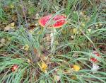
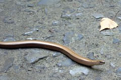
Around noon the sun was peeping through the cloud cover and I gathered myself on my Moots for an easy ride. I put a little more pressure in my tyres because I was going out for a mixed ride, some tarmac, some offroad. Starting out into Heverlee forest I came accross a slow-worm (Anguis Fragilis or Hazelworm in Dutch) lying in the middle of the track. Probably warming up a bit in the sparse sunlight. After having taken its picture I moved on for a big loop, taking small tracks and bigger ones. During these kind of rides I never have an exact plan, I just follow my front wheel. After a passing through Heverlee and the Arenberg campus I came in the area around the Bertem petrol station alongside the E40. Making a few loops over singletrails, then crossing the E40 and following the Green Bloso route towards Korbeek Dijle.
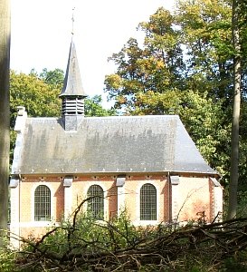
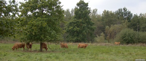
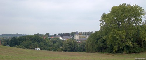
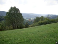
Here I disappeared into the Doode Beemde. We have seen a considerable amount of days without rain so I wasn't bothered about getting my feet wet. On the contrary, every trail here was dry and hard. Passing over wooden boardwalks that normally stand over moory ground, there was no water to be seen underneath . There were big groups of young juveniles with guides, they were probably busy cleaning up the area or attending an explanation about the Doode Beemde. Crossing the pastures I saw some beautiful brown cows grazing, some with calves. The tracks pass straight through their pastures, so I musn't forget to close the fences. Nearing Sint Joris Weert I decide to ride towards Pecrot and La Malaise. Further on towards Bossut and then down towards Hamme Mille. I see a big white church standing out against the horizon and realize the old church of Tourinnes La Grosse is out of its scaffolding. It has been getting a thorough cleaning since last winter and now the big tower is back in all its splendor. I decide to ride up to it and take a couple of pictures. Looping around it I managed to get a picture from high up on one of the surrounding hills.
My last couple of kilometers then bring me back along the Chapelle Sainte Corneille in Mille and into the Meerdael Forest. After more than 3 hours but with an average heartrate of only 105bpm I am back home with a nice distance under my belt. Now its time for a days' rest and perhaps later this week I might go to Nandrin or the like. The only factor seems to be the weather. It has been dry for a long time but it looks like it 'might' rain nearing the weekend. Just have to wait and see I guess.
Ride Stats : 84K and 425/540 heightmeters (Polar/Garmin) in 3h15mins
7650/78050
29-09-2009, 18:52 geschreven door Big Bad Wolf
|
|
|
|
|
| 28-09-2009 |
| Accro Bike 55k Special |
This morning saw a lot of mist so I had to wait until noon for the sun to come out. But then the conditions were ideal for a long ride. Not too warm and almost no wind. I decided to ride the 50K version of the Accro Bike, once an organised ride that was held in October and offered a 42K version, also as a chrono, and a longer 50K version. The version I ride dates from 2001 or 2002, after that the ride did not enter the Chaumont Gistoux area. In 2008 it was decided not to organise the ride any more. With the recent O2 bikers roadbook focussing on Grez Doiceau, I had not ridden the Accro Bike for a while. The O2 Bikers roadbook uses a lot of the same trails, but mostly in the reverse direction. It also offers some new trails, trails that I could use to make a special version of the 50K Accro Bike.
I started out as usual riding through Bossut and Archennes towards Grez Doiceau. The Accro Bike starts on the village square and then rides in a clockwise fashion through Biez, Cocrou, Pietrebais , Longueville, Chaumont Gistoux, Inchebroux, Bonlez and Dion Le Val. I added an extra descent over a singletrack in Pietrebais followed by a long ascent from downtown Pietrebais all the way up to the chapel in Longueville. From there I continued along the Accro Bike trail, descending into Heze and then clicking on the 42k version. I added and extra descent/ascent into the Gorge aux Loups , and then found a new trail in the Bois de Glabais, so that I didn't have to do the difficult - read, unride-able - sandy ascent. The new trail runs parallel to the sandy groove and is steep as well, but still manageable. A bit further, in Les Bruyeres I avoid the very steep ascent, taking a more moderate climb to reach the same connection in the Bois de Chaumont. When I climbed out of Bonlez, on a small tarmac road, a dog attacked me. Somehow it had escaped from behind its fence. It bit me but only superficially. I screamed my lungs out, partly to scare the dog, and partly to let go of my frustration towards the owners of the canine attacker. It didn't pursue me and after checking my upper leg I found nothing but some squeeze marks. No blood. So I decided to move on.
In Dion Le Val I also added a small extra loop , dropping down into the fields from the N25 and then turning left to ride back upwards towards the N25 again. Just before the tunnel I turn right and follow a singletrack that eventually reaches a long downhill into Dion Le Val. Another long climb into the Bois de Bercuit, followed by a downhill towards Gastuche. Back upwards on the same slope and after another downhill I'm back in Grez-Doiceau. The ride is 55K on my GPS and offers 900 heightmeters. Thats 5K and 100 heightmeters more than the original Accro Bike Trail. The dry conditions made it a breeze to ride it, taking into account that the relentless following of climbs and descents, some up to 27% makes this ride a challenge, both physical as technical. When it has rained you can add an extra hour to your total time, the trails become very heavy and very difficult when wet. Not to be underestimated. I offer the trail map and a link to the GPS track. Beware loose dogs and keep the noise level down on the small trails.
I returned towards Meerdael with a good feeling throughout the ride. I felt strong today and wanted to do some extra mileage in Meerdael Forest before arriving home after almost 5 hours on the bike.
Ride Stats : 84K and 1130/1250 heightmeters (Polar/Garmin) in 4h59mins
Accro Bike 55k Special BBW at EveryTrail
Map created by EveryTrail: GPS Community
7592/77510
28-09-2009, 00:00 geschreven door Big Bad Wolf
|
|
|
|
|
| 25-09-2009 |
| Meerdaal 2000 recon |
A beautiful sunny morning and I couldn't wait to get on the Moots and hit the road. Short road section to Bierbeek and the start of the "Meerdaal 2000" ride I was going to recon today. This organised ride is taking place on Sunday the 25th of October,starting next to the Borre and the football fields. Please mark this ride on your calenders, it will be worth it.
The organisers gave me the GPX track to the longest distance, supposedly 65K. The track was made by someone connecting the dots on a map, and what that meant I was about to find out later. Starting at the Borre the track veers to the left towards the southeasterly section of Meerdaal Forest. The forest was still fairly cold but the sun was heating up the fields I arrived in after a first section of trees. I noticed the trail on my GPS was not exactly following the road lines on the map, and at one time I was sent into a track that dead-ended. Mm, first drawback of drawing tracks on a map, you are never sure if the road you select is still there. But no worries , I turned around and chose another road to arrive where I should arrive. After all, this is my backyard and I know every nook and cranny here. A passage through the fields into and out of Tourinnes la Grosse. The sun is out in full september force and warms up my skin. Life is great.
Crossing the N91 and making my way towards the south I notice a hunting party to my left. But the guns are pointed in the other direction, no worries. A very nice section leading up through a difficult stony and rubbly track into the Bois de Linsmeau and then back down into Cocrou. Crossing another busy road and I'm making my way towards yet another forest patch. A 20% uphill makes me sweat and at the top I turn left for a quick downhill on tarmac. My GPS dictates me into a very narrow singletrail I know from the 2008 Belgian Championships Marathon track . Going down it is easier to negotiate the narrow track with a rivulet running parallel to it. Its dry now and everything is fine but I can imagine a lot of slipping and sliding when this trail is wet. At the bottom I cross a concrete bridge and then follow the track towards a tarmac road. Taking left here and then after 500m turning right for a very beautiful climb in a hollow road in the Bois de Beausart. At the top of the climb I stop for a little snack. While I'm eating I'm noticing 2 F-16 jetfighters passing. They are making fly-by's on the Beauvechain airstrip and I advance into the fields to make a couple of pictures. The powerful jet engines make the air tremble - chicken skin on my arms and legs.
When I look at my GPS I notice something is wrong. It is pointing me back to the north, back to the start. What has happened ? I stop, manually stop the navigation, select my track again and let it re-navigate and check my position. To my surprise I'm way off the trail! I turn to the south down into Pietrebais to reconnect with the proper trail I should be following. A bit further I see that the track veers off again. The Edge beeps and re-calculates its position when it loses the track, and when it does that it doesn't navigate you back to where the track lies, but it navigates you back to the start !
So that is what happened before as well. At one point it must have lost the track, and it can recalculate very quickly. So quickly you don't even notice it. In fact, there is only one way you CAN notice it has recalculated you towards the start. There is NO trail behind you ! Normally when navigating a gpx track you see a purple trail before you, but there is also a purple trail behind you. When it has re-calculated, you only see one part of the track. Check the pictures to understand what I mean.
Surely enough, now that I begin to pay more attention to the track I notice there are often moments when it runs next to the lines on the map. This is because it has been drawn on a PC, and is not an actual track made by riding on the trail. And when cutting a corner, or by plainly sending you into the field or the forest, the GPS gets confused, "loses" the track and promptly recalculates. OK. Lesson learned. I would have to stop at least 15 times, more frequently towards the end of the trail. Perhaps the trail drawer got sloppy I don't know, but it surely breaks the rhythm.
Ok, back to the trails. In Pietrebais there is a very nice singletrack climb bringing me towards the "Ferme de la Sarte" . This is Biez and there now follows a nice loop bringing me up towards Longueville. At the Chapel they choose a track that leads down into a deep gully, passing this and a very steep and difficult climb awaits. Great, I'm really enjoying this part of the ride. Long downhill down into Bonlez and directly turning to the right for a long climb up the ridge again. Dropping into downtown Biez and then taking the trail towards la Royenne. I notice my rear tyre seems to be slowly losing air and I stop to put some more pressure in it. I take the difficult and steep singletrack up towards Biez and after the church another singletrack leads me down towards Grez-Doiceau. This is "Accro Bike" country and the trails are very familiar to me. The heightmeters quickly accumulate and the pace needs to be watched, lest you overstrain yourself. The track now turns to the north and of course the singletrack climb towards Gottechain could not be left out. Great and difficult track. Will be slippery when wet though.
After Gottechain the trail then heads for Archennes, using another rarely used trail. Care has to be taken. The grass has been mown but still there are some ruts hiding and waiting to catch the wheels of the unwary. The climb out of Archennes and onto the La Malaise plains will surely start a lot of bikers wondering why they did not choose one of the shorter distances. Full attention is needed for the downhill that almost brings you into Florival. But the next hill is already waiting around the corner and after that a sweeping trail through the fields brings you high above Pecrot. Down along a sandy forest track with roots, ruts, drops and back up again in a long hollow road. Arriving in the Bois de la Hocaille, passing the beautiful white chapel, crossing the Rue de la Malhaise and veering left into a singletrack taking me eventually down towards the railroad. But not quite since the track turns right and then left to follow the railway for a while towards the Bois de Beaumont. Arriving in Nethen and passing the La Hetraie camping I am back in the Meerdael forest. And a 22% climb makes sure immediately that the ride is not over yet. Past the Weertse Dreef into the Kouterbos the terrain finally becomes less hilly and in the neighborhood of the Zoete Waters I have another bite to eat and put some more pressure into my rear tyre again. The last couple of K's into the Mollendaalbos and past the Blanden cemetery make for a nice cooldown .
I arrive back at the start with close to 70K on my counter and indeed almost a 1000 heightmeters. Not to be under-estimated, and I hope the trails will be dry on October 25th. The region is beautiful and demanding but the reward is a very nice ride and some challenges along the way, both technical and physical.
Ride Stats : 84.5K and 1015/1145 heightmeters (Polar/Garmin) in 4h50mins
7447/75795
25-09-2009, 21:27 geschreven door Big Bad Wolf
|
|
|
|
|
| 24-09-2009 |
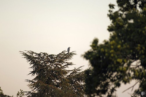
| Spotted Heron |

I had plans to do a big offroad ride today but when I woke up it was raining and it kept on raining lightly throughout the entire morning. So I had to change my plans. Looking at the Time Trial World Championships in Mendrisio where an astonishing Fabian Cancellara degraded the rest of the field to also-rans I decided to do an easy recovery ride in the late afternoon. So I took out the Hilset for an easy spin along the 30K Road Bloso route starting in Heverlee. Nothing much happened , it was around 19 degrees C and very quiet and the roads had dried up nicely.
When I got home my attention was pointed to a big bird sitting in a tree around 200-300 metres from our home. It looked like a blue heron but to make sure I got the big 300 F2.8 lens out and was able to get a couple of shots in, despite the long distance, the waning light and the difficulty to keep the heavy camera and lens steady. It was a big heron indeed, no doubt resting and checking out the swimming pool of the neighbors.
Ride Stats : 35K and 215/260 heightmeters in 1h34mins
7363/74650
24-09-2009, 19:49 geschreven door Big Bad Wolf
|
|
|
|
|
| 22-09-2009 |
| Recovery |

Another beautiful day and even though I felt tired form yesterdays' ride I decided to go out. On the Hilset this time. I am still waiting for the new crank bearings and am bearing up with the shifting axle for the moment. It seems to get worse because I had to stop along the way to hit it back in place with a piece of stone.
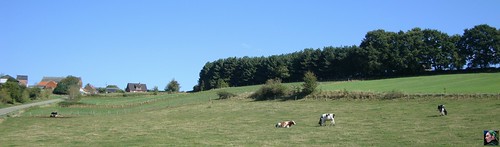
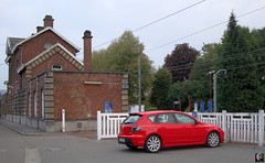
I set out over Hamme Mille and Bossut and rode all the way to Dion Valmont before looping back over Bonlez - where I took a picture of a nice F430 with a personalized numberplate . I discovered a tiny little backroad and this brought me towards La Royenne and further on to Grez Doiceau. Back along the busy N25 towards Hamme Mille and I noticed the axle had moved again. But I let it be until I got home were I treated it to a couple of firm blows with a big hammer. Tune may make light and exclusive stuff, but ever since I got this fastfoot crankarms I have had some kind of trouble with it. First the bolts would loosen all the time, the bearings are crap and now the axle is moving perpendicularly. The bearings are won and stiff and I'm guessing (hoping ?) this is what causes the titanium axle to shift. Anyways, if it keeps on shifting after it has received new bearings I might be on the lookout for a new crank.
For now I had an easy ride - really easy because my average heartrate was 99bpm - in fine sunny weather, even if there was a strong wind blowing. I leave you with a picture taken near Bossut.
Ride Stats : 37K and 330/445 heightmeters (Polar/Garmin) in 1h50mins
7328/74390
22-09-2009, 16:45 geschreven door Big Bad Wolf
|
|
|
|
|
| 21-09-2009 |
| Fire brigade 73K ride |

This "old wives' summer" doesn't seem to end. Great ! After the 2 straining Ardennes rides from last week I needed to do something less difficult so I opted to ride the 73K distance of the organised ride the Leuvense Brandweer organised a few week back.
Great invention, GPS, because someone was kind enough to upload the track and hey presto, you can ride it yourself.
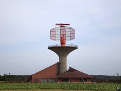
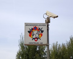
I connected with the track in Korbeek Dyle. Got the GPS aligned and off I went. The track first goes to the area between Neerijse and Leefdaal. Some very beautiful hollow roads here and of course the track builders take advantage of the rolling hills to score a lot of heightmeters. After a while the track turns to the north towards Bertem where it crosses the E40 a first time. A lot of field trails here, dusty and hard. But after crossing the N3, Bertem forest looms on the horizon. A very nice and difficult first loop here, with a 21% ascent that makes me strain my muscles to make it. Out of the forest for a loop towards the south to gather some momentum for another climb over the ridge. A fast descent along the forest edge and the track then turns towards the east. Another stretch of forest brings me up towards the radar buildings overlooking Bertem. I have a feeling the trails become a little easier now, as we turn towards the east again towards Everberg. But since 'berg' means 'hill' obviously before long another climb announces itself, this time on tarmac. But before long I am back offroad enjoying a nice descent and the trails aims towards the northwest now in the direction of Veltem Beisem and Winksele. My legs begin to tyre from the constant succession of climbs and descents. The trails are still hard and dusty. As I arrive in Winksele and undercross the N2 my GPS is having trouble finding the right direction and I have to take a moment to stop and stop the navigation. Letting it re-navigating the route again brings it back to life and on the right track. The trail now turns to the west for a last but very nice singletrack loop in a forest. It then runs parallel and eventually returns for another playful loop into this little wooded park, called Mollekensveld, if I'm not mistaken. There are some nice dropoffs here. I ride them without much trouble and am grinning when I remember that some people were complaining about them not being marked as 'dangerous' spots. Hey, it's mountainbiking, you can't expect it to be a road-ride. I pass the starting point, the Firemen caserne at exit 16 on the E314 and am now doing the first couple of K's of the ride bringing me back to Korbeek Dyle, where I started. Some nice tracks along the E314 , luckily they are dry , I've done them in other conditions as well and I can tell you, when wet or muddy they are a lot more difficult. When I arrive at Korbeek Dyle, I already have 78K on my GPS and riding back towards Meerdael along the Green Bloso route I stop at the Zoete Waters for a refreshing drink at the well near the chapel. I had a good long ride, not too difficult - especially when coming from the Ardennes - but certainly not easy. The amount of heightmeters will testify to that. I cannot but congratulate the track builders, I'm sure "Carlito" is one of them, on a very well laid-out ride. Here are a couple of pictures I took during the ride.
Ride Stats : 90K and 1060/1220 heightmeters (Polar/Garmin) in 4h58mins
7291/73945
21-09-2009, 20:48 geschreven door Big Bad Wolf
|
|
|
|
|
| 19-09-2009 |
| Theux Signal de Botrange Theux KBC MTB ride |

Warm weather was forecast with only a slight chance of precipitation. A perfect day for a solid Ardennes ride. Meeting up with the KBC MTB club at the Theux railway station around 8.45am and just before 9am we set off on the Longest Downhill. As regular readers know, this is a ride that consists of 2 parts. One part is the uphill from Theux to Signal de Botrange. I have been perfecting this part for a couple of years now to include as much offroad as possible. In the days when the Downhill was published in O2 Bikers - issue #59 to be more precise - the uphill part was as good as ignored. I did publish a first part of what was a long tarmac uphill followed by a roadbook from Le Petit Normand up to the Signal de Botrange in 2001. But I was not satisfied with all the tarmac between Theux and Le Petit Normand, so I set out with 1:15000 scale maps to find a more suitable and mountainbike-worthy uphill. As it stands now I am pretty pleased with the result. Arriving at the Signal de Botrange you have around 750 heightmeters under your belt and have passed some nice singletrail sections on the 32k stretch.
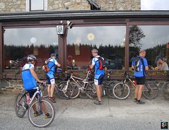
Taking a rest with the group at the restauration/cafe up on the Signal, the figures on my GPS speak for themselves. During the uphill we had split up in 2 groups, each with a rider having my GPS track from 2 days ago on a Garmin Edge. I was leading one of the groups, taking a more leisurely pace upwards. As usual I stopped at the Passerelle Michel Thorez for a snack. Even so we only arrived 10 minutes after the faster group. Hearing the remarks at the table it looked like they liked the uphill bit very much. And the best part was yet to come - the famous "Longest Downhill in Belgium" .
The Longest Downhill is a mixture of everything that make riding a bike offroad in the Ardennes so special. Starting in the Fagnes, we take in quite a bit of doubletrack before arriving at a small track with a river crossing. Then, arriving at the Vecquee, things turn wet and soggy forcing us between the trees to negotiate hundreds of roots. A very stony downhill follows, taking us close to the river Hoegne. Another very difficult downhill, with lots of stones, small rivulets of water and gullies, takes a victim. One flat tyre, from the looks of it a snakebite. Then we zoom down again towards the river Hoegne. A section with a couple of river crossings by wooden bridges, forest tracks interspersed with roots, rocks and small puddles, a little uphill section through a river, a fast singletrail downhill, its all there. During the downhill at one moment the group split up in 2 parts, unfortunately exactly at the spot where I had foreseen a very interesting singletrack. A singletrack out of the 2007 World Championship Marathon circuit in Verviers no less. The second group had taken a right turn where they should have gone left. My fault, I was assuming the group was more closely together. As it stood, I had no option but to leave the singletrack be and take my part of the group after the runaway members. We found them 1.5K further, waiting at the end of an offroad section not far from Neufmarteau.
Near the end, reaching Polleur, there was an option to return by tarmac, as the original O2 bikers version did. But being mountainbikers and - it must be said, the level of fitness and technicality was very good in this group - we all choose for the offroad version, even if this means climbing two more hills - one with an 15% climbing grade. Near the end, the forward running GPS rider misses a turn and we are sent to Theux via a very, very steep downhill ending at the famous steps near the Lycee. Checking my GPS data after the ride, I found it to be a 24% grade at its steepest. Ouch.
I had been looking for this particular downhill for a while now and I'm glad we found it, a lucky accident one might say. It also features in the Ardennes Trophy, a marathon race held every year and starting in nearby La Reid. Here it is an absolute crowd-stopper because of its inherent level of danger.
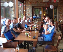
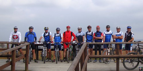
Arriving in Theux we are offered a bite to eat and drinks to go with that, courtesy of the KBC MTB Club. I hope they all enjoyed our day out - I certainly did. The weather was perfect with 17 degrees up on the Fagnes, nearing 24 degrees when we where back in Theux, some 550 metres lower.
Ride Stats : 66K and 1045/1090 heightmeters in 4h10mins
Theux-Signal de Botrange-Theux (scenic route) at EveryTrail
Map created by EveryTrail: GPS Trip Sharing with Google Maps
7201/72725
19-09-2009, 00:00 geschreven door Big Bad Wolf
|
|
|
|
|
|
|
| Gastenboek./.Guestbook |
Druk op onderstaande knop om een berichtje achter te laten in mijn Gastenboek. /
Press the button below to write in my Guestbook.
|
| Email Me |
Press the button to send me a mail
|
|
|
|