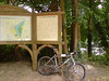
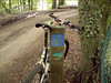
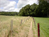
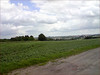
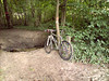
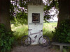
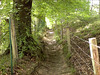
Light drizzle this morning so I decided to wait a while before heading out. When I finally rode out around noon it was still raining very lightly but the forecast called for sun so I decided to risk it. First I had to ride towards Halle and the 7 Fontaines area - where the Green Route passes. It took me around 1h45 to cover the 39K, riding over Duisburg, Jezus-Eik and then up to the Middenhut and Sint Genesius Rode . Around 30 minutes into the ride the drizzle stopped and it would remain dry for the rest of the day. Great! Just before the Kapucijnendreef in the Sonian Forest I was stopped by a Chinese (?) girl in the forest who asked for directions to the Tervuren museum.. Took quite a bit of explaining - I hope she eventually found it. At the 7 Fontaines I had to find the point where the Green Route passes but that didn't prove too hard to find. I had been here before, first with Minna and later on my own, so I remembered most of the route, or at least that was what I thought. I had a map with me that I got from Minna and that would prove of great value along the ride. After the first climb on some of the worse cobbles I ever saw - and yes, I rode Paris-Roubaix twice - the route remains on the plateau for a while on tarmac. Then it turns left and the fun begins. A nice little downhill into the Bois de Hamme followed by a climb up to the Chapelle Bon-Dieu de Gembloux. This little chapel is a point where the route passes 2 times. The track then bends to the right for a downhill into Sart Moulin. A great little section in the forest follows - I don't think Minna did this, the arrow is hardly visible - down and again up along a singletrail. Then a section where you have to go through a hollow road uphill to emerge on tarmac. Down it goes to the big road which is crossed. A section into an industrial area - mind the arrows - and then it goes into the Bois de Foriest and the Bois d'Ophain. Some of the arrows are very well hidden and at places they have put new arrows up . The Green, Blue and Yellow route have a common section here and its a really nice one. One known mudhole has been completely gone - they have simply filled the holes so there is no more puddles nor mud. A nice track leads you down to the Ry du Vervois. Just before that there is a sharp turn left with a passage through a little river and a nice uphill section in what appears to be a private forest. You emerge in a rural area where great care has to be taken not to loose the track. Its to the right and some 20 metres on the street you have to turn left into what appears to be a footpath. The arrows are all there but sometimes you have to REALLY REALLY look for them. Some are partially covered, others are hidden behind parked cars etc.. The trail then descends into Braine l'Alleud itself, with some twisty passages through the city. Take care, there are cars here and the track really twists and turns. You pass the church where the routes start- leave the church to your right and turn left or you will lose the trail. Then you descend towards the river Hain, cross it and commence a nice little climb out of the city on a small trail. You then more or less make your way back to the big road, which you have to cross again. Some climbing to be done now, some on tarmac, later on hardpack . You slowly make your way back to the aforementioned chapel. I stopped for a little snack. After the chapel, there is another really narrow trail turning right from the gravel road. Its overgrown with grass and there is a gully so be careful. You then make your way into the Bois de Clauseweide, provided you don't miss the arrow that is covered behind the foliage. Forest road with a golf track on your right and you are heading for a really nice downhill-uphill passage along a narrow trail. Great fun, remember to shift on time or you will be walking here. Before long you arrive back at the 7 Fontaines area. This is a very nice trail, with some interesting challenges, great tracks and you notice some effort has gone into finding good trails instead of taking the easy way out and incorporate another piece of tarmac. Not here. They have done a good job. The arrows are there but at some points you can use the map, so bring it . It's 100% ride-able, no mudtraps although at some points there are cobbles I would be very careful on when it has rained. The trail is some 26K long and incorporates 440 heightmeters. So you need a certain level of fitness , its not a beginners trail.
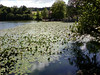
When I was back at the ponds of 7 Fontaines I wondered if I should ride the trail again. The first time I had to look a bit for the arrows, so I couldn't ride it at a good speed. But seeing that I stil had to do 40K to get home I dismissed the idea. Perhaps I will do it again soon with Guna - who I had to disappoint today because she couldn't start as late as I wanted to - at least then I would not have to look for the arrows anymore. The ride back was nice because the sun was out in full force now AND the wind was blowing in my back. The joys of biking. I had to suppress the urge to close my eyes and dream away.
Ride Stats : 106K and 935 heightmeters in 5h01mins
4976/46740
Reacties op bericht (0)
Gastenboek./.Guestbook
Druk op onderstaande knop om een berichtje achter te laten in mijn Gastenboek. /
Press the button below to write in my Guestbook.