|
|
|
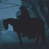
| Tales from the Woods |
|
|
| 15-03-2012 |
 Eric Robert TT 50K Eric Robert TT 50K |

The weather forecast for today looked good. Warm wind , sunny skies and temperatures around 18 degrees. Early spring. SO I took off half a day at work and rode the Obed along the track of last sundays' TT which started in Grez-Doiceau and was organised by Eric Robert, Gottechain citizen. The arrows were long gone but I had the complete track from a collegue at work. I picked up on the trail in Nethen and so I was having the toughest part of the ride first. The loop in Pecrot, the uphill towards La Malaise and the the long climb out of Gastuche onto the Bercuit Golf. Back down towards Doiceau and through Archennes to the start at the Omnisports Hall in Grez-Doiceau.
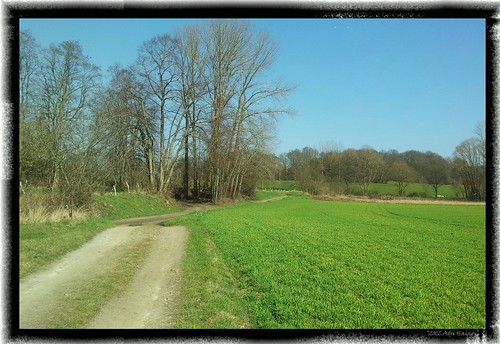
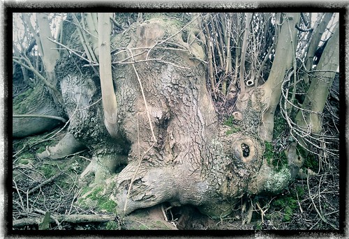
Here I came onto known territory. The trails were almost dry and I could ride everything. Even the steep gully climb up to La Malaise and the bad stone horror climb out of Nethen . I paused when I saw some great landscapes and the sun made the early greens splash.
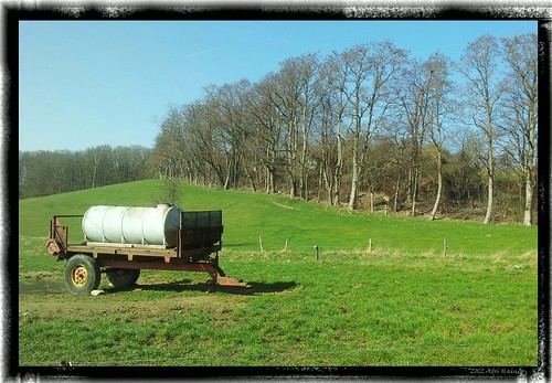
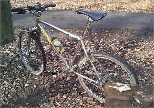
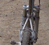
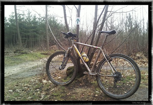
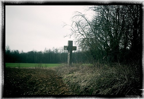
The Obed badly needs new bearings in the bottom bracket, I can almost feel the crankarms move when I pedal. I hope I can drop it off chez Filip Sport this week. I also need to have the front wheel of the Moots YBB re-Stan-isized. The No Tubes fluid has dried out and it is not longer holding air. When I came at the end of the last climb - the stony one - and faced towards Nethen I took a picture of the valley whence I just came.
Into Nethen and back home through the Meerdael Forest I could feel the fatigue from this ride coming over me. 60K and nearly 800 heightmeters is not to be scoffed at. And due to the technicality and steepness of some of those climbs the intensity is even higher.
At home I tried my new Skins RY400 recovery tights. One needs every bit of help one can get to avoid Delayed Onset Muscle Soreness. The tights feel very comfortable.
Endomondo track
Ride Stats : 60.5K and 775 heightmeters (Garmin) in 3h24mins30secs
1770/17535
15-03-2012, 16:55 geschreven door Big Bad Wolf
|
|
|
|
|
| 11-03-2012 |
| Dongelberg |

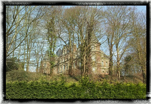
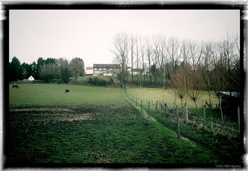
Sunny sunday. It looked like a perfect early spring day so I decided to take the Hilset out for an easy recovery ride. My goal was to ride over Bierbeek, Meldert and Hoegaarden towards Jodoigne. There I took the busy N29 in the direction of Gembloux. A couple of kilometers further I took a right turn towards Dongelberg. I had hoped that the castle grounds would be open to the public but again the gates were closed. So again I had to settle for a makeshift picture taken from the street.
Moving further onwards towards Incourt and then over the plains to Longueville. There were a lot of cyclist by now and I was getting passed by flocks of multicolored shouting people striding carbon steeds. Into Grez and then through Archennes, Florival and Sint Agatha Rode. The weather now was clement and the sun was really doing wonders. I felt elated and even though I began to feel the kilometers in my legs I enjoyed the ride to the end. Past the Zoete Waters and then a last loop into Blanden before arriving home.
Endomondo track
Ride Stats : 65.5K and 515 heightmeters (Garmin) in 2h51mins
1710/16760
11-03-2012, 00:00 geschreven door Big Bad Wolf
|
|
|
|
|
| 10-03-2012 |
| Gnarly in Gottechain |

I decided I would try for the 50K track that is the main distance in tomorrows' organised ride in Grez-Doiceau. The track and organisation are from the hand of Eric Robert, a well-know local cyclist and organiser of cyclocross and other sporting events. I noticed last thursday that the track was already fully arrowed so why nog give it a try today.
The weather was warm - 9 degrees on average - but with a low cloudcover and some occasional light rain it was a bit gloomy. Nothing a Gore tex jacket couldn't handle so I took the Obed for a spin.
Arriving in Gottechain I got underway for a series of loops that took in most of the tricky trails in the neighborhood. The trails were moist but there was no real mud to speak off. Except for one impossible climb just out of Florival all was very well manage-able. The trail was heavy though, a lot of ups and downs and sometimes the going was tough in the sticky trails.
When I arrived in Florival I saw a multitude of arrows going in 3 directions. I am sure Eric has devised some kind of loop there but I missed out on the logic and rode on towards La Malaise . I later noticed I must have missed almost 10K. I hope that tomorrow the arrowing will make more sense at this place or I predict a lot of bikers going in every possible direction.
I rode on and got a series of good trails around Bossut before dropping down into Archennes.
A last loop that took me towards the outskirts of Gastuche and before long I was at the Event hall in Grez-Doiceau where the ride starts. With 40K into the ride I decided to call it a day and make my way back whence I came. Into Meerdael Forest and it started to rain a little more heavily, making the trails wet and dangerous. I had a good solid ride today with a lot of heightmeters .
Endomondo track
Ride Stats : 61K and 755 heightmeters (Garmin) in 3h38mins
1644/16245
10-03-2012, 15:11 geschreven door Big Bad Wolf
|
|
|
|
|
| 08-03-2012 |
| Gottechain |

After a couple of days of windy and showery weather today announced itself dry with big sunny breaks. In the late afternoon I rode out for an exploratory ride into Meerdaelwoud. I quickly decided to ride towards Nethen and then ride the loop to Bossut and Gottechain. I could see the arrowing for next weekends' organised ride - organised by Eric Robert - was already there. The ride starts in the Sports hall of Grez-Doiceau and might be worth considering. I followed it for a while because it happened to go where I was going.
Up into Gottechain and then down along the narrow path in the fields. Back up again and onwards towards Nodebais. Here Eric went for other venues so I rode on without any arrows. Down along Valduc and then back upwards for a long series of trails into Meerdael Forest. The trails were moist from time to time and were also suffering from the many machines used in the exploitation that is still going on with a lot of trees being felled and torn through the forest and along the singletrails. Those singletrails are now doubletrails and it will take a while for them to recover from the heavy traffic.
Endomondo track
Ride Stats : 41K and 515 heightmeters (Garmin) in 2h16mins
1583/15490
08-03-2012, 19:21 geschreven door Big Bad Wolf
|
|
|
|
|
| 04-03-2012 |
| Dongelberg |

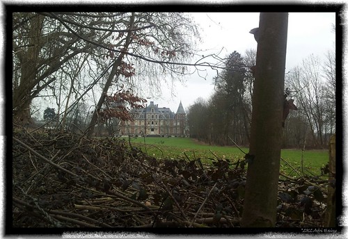
I had been thinking about riding towards Dongelberg and have a closer look at the castle. Today I deciced I should give it a try. I rode out with the intention of riding towards Dongelberg using as much as possible the offroad trails. Obviously Beauvechain airport is in the way of a straight line towards Dongelberg so I had to use a little bit of tarmac getting around it. When I reached Happeau I had to turn back because of an extremely muddy track through a hollow road in the fields. Getting my tyres wet so I looked for another option to move further to the south. My aim was the big water tower and I knew that Dongelberg was situated in the valley just beyond it. I arrived in Dongelberg but was disappointed to find the castle grounds were closed for one reason or another. Riding around it I discovered a spot where I could take a picture of it through some shrubberies.
Moving onward my next goal was to arrive home without getting wet. There was rain forecast and I rode towards the water tower and the past the ferme d'Happeau to reach Pietrebais.
From Pietrebais I was again forced to use a bit of tarmac making my way towards Nodebais and Tourinnes-la-grosse. From here I quickly found access to Meerdael Forest when the first drops started to fall. It was a good ride and my legs felt OK after yesterdays ride. Of course there was some fatigue but the only real trouble I had today was with the muddy sections in the Brabant Walloon fields and the wind that blew noticeably stronger than yesterday during the first part of my ride.
Endomondo track
Ride Stats : 42K and 420 heightmeters (Garmin) in 2h13mins
1542/14975
04-03-2012, 14:18 geschreven door Big Bad Wolf
|
|
|
|
|
| 01-03-2012 |
| Haasrode base loop |

Calm weather today. With an average temperature of 8 degrees C, no wind to speak of and dry conditions I was set for a longer offroad ride. I decided on the track of last years Haasrode organised ride. Riding the base loop is around 36K and about 2 hours. This suited me fine. The forest trails were almost dry and the only obstacles were deep ruts made by the big tractors pulling out the trees in the ongoing exploitation of the forest. I made good speed and soon was out of Meerdael Forest for a loop through the open area towards Gottechain. The little loop taking me down and upwards again was too wet to ride . I had to walk a couple of meters. Unfortunately, clasping my rear brake made me lose one of the brakepads, thus leaving me with no rear brake. I only noticed that on the following downhill. Losing you rear brake is not THAT big a deal, but nevertheless my stopping power was comprimized.
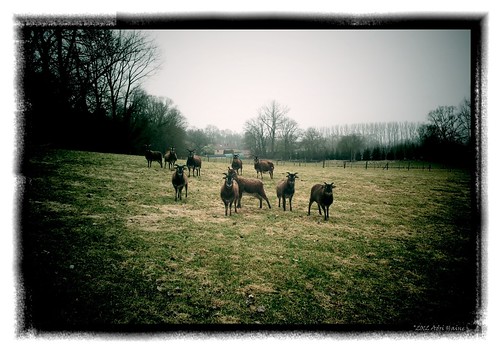
I said hello to some local sheep and made my way towards Bossut and Nethen. From Nethen I entered Meerdael forest again for a last couple of K that had me zooming along happily with todays ride.
Endomondo track
Ride Stats : 40.5K and 490 heightmeters (Garmin) in 2h07mins
1423/13695
01-03-2012, 19:34 geschreven door Big Bad Wolf
|
|
|
|
|
| 27-02-2012 |
| Forest ride |

Windy this afternoon so I decided to ride into the relative shelter of the forest. The trails were great, just a little bit moist but no puddles or other wet spots. I tried out some of the smaller singletracks but there are still a lot of exploitation works going on and there is a lot of small and bigger timber blocking the trails. I tried to follow the GR track crossing through from east to west but from time to time I added an extra loop to check out the condition of a trail. I stopped at the Dikke Eik for a picture.

From Mollendaal forest I crossed into Meerdael Forest for a hilly section. It took some getting used to the steep sections but I quickly found a good rhythm in the climbing. The downhills were enjoyed to the max with good grip and a squealing front brake. near the end I was zooming along quite well on the big ring. The race face bottom bracket needs new bearings, I have around 2-4mm play and I begin to notice it when I pedal. The trouble is that it is not easy to find replacement bearings for these old square tapered axles. Filip Sport is looking for them.
Endomondo track
Ride Stats : 27K and 360 heightmeters (Garmin) in 1h29mins
1348/12850
27-02-2012, 19:24 geschreven door Big Bad Wolf
|
|
|
|
|
| 26-02-2012 |
| Dongelberg |

This morning saw a drop in temperatures and it was gloomy and there was a slight drizzle falling when I rode off along the Naamsesteenweg. The plan was to follow this to Hamme Mille and there switch on the N91. I followed that past the Beauvechain airport and Pietrebais until I reached Incourt. Here I took a left towards Dongelberg. Passing the beautiful Chateau I made a mental note to stop here one of these days to try and take some pictures of this majestic building. The absense of leaves makes it viewable from the street and I also noticed a small portal which seems to be open to the public , offering entrance to the castle gardens.
But for now I rode on towards Jodoigne where I joined the Ravel, taking that towards Hoegaarden.With the Ernest Oury straat still broken up, I had to ride past the Villa Hugardis to try and join the N221 towards Tienen. Taking a left turn up the ridge and then a right towards the St-Katelijne Chapel in Sint-Katelijne-Hauxem.

Stopping to capture this building with my Samsung Galaxy S2 and then I rode onwards to the Marollen Chapel. Here I took a left and crossing the Waversesteenweg I reached Hoksem where I stopped again to take a picture of its two-pronged church.

The pictures where taken through the Vignette for Android application and some post-preocessing filtering was done making them a little more gloomy and vignetted.
From now the wind was blowing against me but at least the drizzle had stopped so I could concentrate on riding back to Meldert along some smaller trails. From Meldert I rode to Willebringen and then into Neervelp and onwards to Bremt, Bierbeek and Haasrode. In all a very nice distance and my legs felt better than yesterday. My average heartrate was also 12 bpm lower than yesterday which could be due to the lesser wind.
Endomondo track
Ride Stats : 61K and 515 heightmeters (Garmin) in 2h50mins
1321/12490
26-02-2012, 14:27 geschreven door Big Bad Wolf
|
|
|
|
|
| 21-02-2012 |
| Mollendaalbos |
Yesterday I did not feel like riding a bike. My legs were still recovering from the weekend rides . Instead I had a good walk passing next to the "Dikke Beuk", a 200-year old tree that gas a span of almost 5 metres and is 38m high. It looked very majestic.
I walked a leisurely 6.5K and my legs felt fine with the workout.

Today saw me on the Litespeed Obed for a quick ride into Mollendaal Forest. I came upon the forester at the start of my ride and we exchanged a few words about where to ride; where not to ride; forest exploitation and the effect it has on the forest trails. He says it is OK to ride on all the roads that are on the map and are not forbidden by signage . I am sure I have a different map of the forest than he has. He is not counting singletrails I'm sure. I told him there were a lot of blocked smaller roads and he said they would look into it once the regular forest exploitation comes to an end.
I did my longer Mollendaal loop and the dusk was falling upon me near the end of the last stretch. I decided to ride past Bremberg and return on the roads where there was at least light enough to see where I was going. I hadn't counted on needing a light but darkness was upon me rather quickly today, and with the moon being new there was no light to guide me.
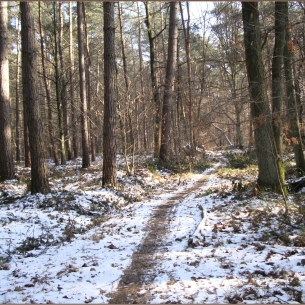
The trails were moist , and wet at the sunny side of the forest where the ground looked like it was more saturated. At one time I had to really push hard on the pedals to get through some kind of bog that had formed on a trail. It might need a couple of days more to dry out before the wetter tracks would be at their best. But most tracks were quite fine even today. I suffered a bit near the end of my ride but that had mostly to do with the fact that I simply did not see where the dry spots were.
Endomondo track
Ride Stats : 26K and 345 heightmeters (Garmin) in 1h30mins
1174/11205
21-02-2012, 19:37 geschreven door Big Bad Wolf
|
|
|
|
|
| 19-02-2012 |
| Sint Agatha Rode |
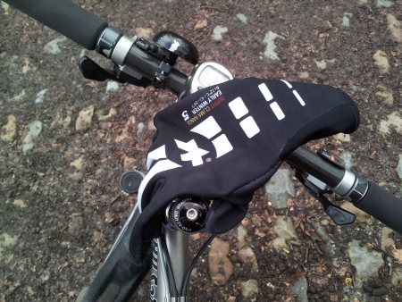
Last night saw a considerable drop in temperature. This morning it was just above 0 degrees. I rode out with a layer of clothing more as compared to yesterday. I used some very thin undergloves which Elias - who is currently racing in Finland - hinted me to. They look and feel like something very flimsy but they actually seem to work. The Assos gloves I used today are rated to 6 degrees C and with the undergloves I could descend 4 or 5 degrees lower without any trouble.
My ride was a simple one. Riding along the Expressweg and then the Geldenaaksebaan into Heverlee. Crossing through to the Arenberg area and Egenhoven and then follow the Sint Jansbergse Steenweg all the way to Huldenberg. Here I rode up the Smeysberg and then down again into Sint Agatha Rode. Could not resist taking a picture of its church and the tree in front of it. Some postprocessing with Vignette for Android produced a nice vintage result.

Riding on towards Sint Joris Weert and then through Meerdael Forest along the Weertse Dreef. I had only felt a couple of raindrops but not long after I arrived home it started to snow. My legs felt already stronger than yesterday.
Endomondo track
Ride Stats : 38K and 335 heightmeters (Garmin) in 1h43mins
1149/10860
19-02-2012, 13:38 geschreven door Big Bad Wolf
|
|
|
|
|
|
|
| Gastenboek./.Guestbook |
Druk op onderstaande knop om een berichtje achter te laten in mijn Gastenboek. /
Press the button below to write in my Guestbook.
|
| Email Me |
Press the button to send me a mail
|
|
|
|