|
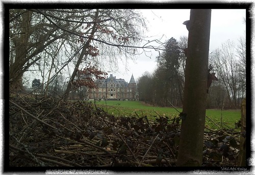
I had been thinking about riding towards Dongelberg and have a closer look at the castle. Today I deciced I should give it a try. I rode out with the intention of riding towards Dongelberg using as much as possible the offroad trails. Obviously Beauvechain airport is in the way of a straight line towards Dongelberg so I had to use a little bit of tarmac getting around it. When I reached Happeau I had to turn back because of an extremely muddy track through a hollow road in the fields. Getting my tyres wet so I looked for another option to move further to the south. My aim was the big water tower and I knew that Dongelberg was situated in the valley just beyond it. I arrived in Dongelberg but was disappointed to find the castle grounds were closed for one reason or another. Riding around it I discovered a spot where I could take a picture of it through some shrubberies.
Moving onward my next goal was to arrive home without getting wet. There was rain forecast and I rode towards the water tower and the past the ferme d'Happeau to reach Pietrebais.
From Pietrebais I was again forced to use a bit of tarmac making my way towards Nodebais and Tourinnes-la-grosse. From here I quickly found access to Meerdael Forest when the first drops started to fall. It was a good ride and my legs felt OK after yesterdays ride. Of course there was some fatigue but the only real trouble I had today was with the muddy sections in the Brabant Walloon fields and the wind that blew noticeably stronger than yesterday during the first part of my ride.
Endomondo track
Ride Stats : 42K and 420 heightmeters (Garmin) in 2h13mins
1542/14975
|


