|
|
|
Tales from the Woods |
|
|
04-10-2006 |
Going nowhere but at least I was fast |
Damn
weather keeps me inside. I wanted to go out for a quick 1h offroad ride
or even a 2h road spin, but the rain decided otherwise.
So I
stayed in and spend an hour on the rollers.. a bit boring but I got a
good workout, warming up reading the latest Mountainbike Plus magazine
for about half an hour and then riding just under my aerobic treshold
for another 30 minutes. My legs felt good. I hope the weather stays dry
tomorrow so I can get a road ride in.
04-10-2006, 20:02 geschreven door Big Bad Wolf
|
|
|
|
01-10-2006 |
Mazy |
The Ride
So
I decided to go to Mazy and ride the 5th 'Vallee de l'Orneau' organised ride. After last nights' thunderstorm I wasn't sure
if Braine would've been spared (it wasn't ) , and since I hadn't been
in Mazy for a while and I knew that organized ride was bound to be less
crowded , I made a last minute decision to ride there.
Had
a bit of trouble finding Mazy ( I really need to get out my map sooner
instead of just riding along in the wrong direction ) but I
arrived around 11am and found some parking space very close to the
start. The first riders were already back at the start and I heard some
complaints about the last 10K being a lot of tarmac.. Oh great.. :(
But
then I had been here before, for the "Randonnée des 5 Chateaux" ,
a classic ride passing - you would never have guessed - along 5 of the
areas' very beautiful castles. I also did the "Sauvenieroise" , another
race starting in not-so-far-away Sauveniere and I knew I would be hard
pressed to get a Hill Factor of more than 10 out of this ride.
Payed
5 at the start and soon enough I was on my bike and ready to go.. All
of a sudden someone comes riding up next to me and I am pleasantly
surprised to see an old friend. Someone I was in the LCMT with a couple
of years ago.
Also a titanium freak we take some time checking out each others'
Litespeeds while he also informs me the last 15K are rather flat and
dull.. Great x 2 .. :(
On
my way then and there are some nice tracks straight away. No rain here
so most of the trail is dry and bone-hard. The Orneau is a small river
we will see quite a few times. The offroad sections near that river -
and the trails descending towards it or climbing away from it - are
really nice. Pity that there is also a lot of tarmac, or dull
fieldtracks, to get from one nice trail to the other. I more or
less ride together with a guy with a Cannondale Rush and I am amazed at
his ability to really make speed on the heavy pothole-ridden field
tracks. He can remain seated and really put down the hammer while I
have to get up from time to time to avoid being hammered in my back.
This is the kind of ride that makes even the most ardent hardtail freak
long for a full suspension bike. I really have to look at that Titus Racer-X I have been thinking about for a while now.
On
the uphills I have the advantage though, due to my lighter bike I can
power away from him. So we kept on passing each other during the entire
ride. As was being mentioned, the last 10K or so was on the plateau,
and the wind was blowing fiercely in our faces to even make it more
tough. Only one last quick descent towards Mazy and we are back at the
start, only 2h35 after I left.
As was to be expected, after 54K there are only 590 heightmeters on my Polar (Hill Factor of 10.9 ) . Still there were some really nice sections and I am not alltogether unhappy I chose this ride.
The Lowdown
What I liked:
- 2 well stocked rest stops, spread evenly along the ride, friendly people.
- arrowing was sufficient, white background plaques with red tip indicating direction, some chalk and arrows on tarmac.
- some nice sections along the river and at least one great downhill just before the 2nd rest stop
- police at busy roads stopping traffic , making crossing these roads very easy and safe
What I didn't like:
- long tarmac sections or dull field tracks between the more interesting sections
- no discount for licencies.
- could have used some more offroad sections near the end. Looks like they concentrated on distance, not on content.
Synopsis
The area has potential, but between the interesting sections, and there really
were some very nice tracks around, there is too much tarmac or field
roads to really make this ride (or this region) stand out. The
Randonnee des 5 Chateaux is better but they get permission to pass on
privately owned trails, something the organisers of this ride did NOT
get. Also note that this region is to be avoided after heavy rainfall ,
the dull field tracks then becoming sticky with mud.
The bare facts
I have uploaded the ride's profile HERE
and you can find a map of the 52K distance HERE
01-10-2006, 16:28 geschreven door Big Bad Wolf
|
|
|
|
27-09-2006 |
Moots Dash |
Quick
dash with the Moots in Meerdael Forest , more or less following the Red
Bloso. Here and there I followed a little deviation, mostly hilly and
singletracky to add some spice to the route.
I had to hurry to get out of the forest before dusk and mist rolled in.
Just 24K and 230 heightmeters gave me enough opportunity to work off the stress of a bad hair day at work.
Meanwhile, the weather forecast for this weekend isn't making me very happy either, possibly rain on Saturday..
Still, another 2 days to go so things can change
27-09-2006, 19:29 geschreven door Big Bad Wolf
|
|
|
|
25-09-2006 |
Thorny Hedges |
Plans for next weekend: On Sunday October 1st , there is an interesting ride in Aubel , as part of the Gileppe Hautes Fagnes challenge.
WHERE |
DISTANCES |
START |
CONTACT |
PRICE |
Aubel (Lui) |
8.5-15-25-35-45K |
8.00-12.00am |
GHF 087/686989 |
3-5 |
The Aubel area is characterized by its thorny hedges, so I will take enough spare tyres and a good pump with me.
The area is not as hilly as Theux but I should envision a hill factor close to 20 nevertheless.
Climbs will be shorter and less steep .
Also, not as much rocks and stuff..more meadows and some forest areas
but mostly open areas.
Talking of Theux: since I suffer from a severe case of Theux addiction I am planning to go to the region again next saturday (september 30) to do a combination of the Green and Blue Route.. I did this combo last week but this time I won't go into the Ninglinspo area this time
Tentative shedule:
leave at the Chateau de Franchimont at 10am
45-50K ride (with 1100 heightmeters at least) should take about 3-4 hours
Lots will depend on how the weather holds.
25-09-2006, 20:25 geschreven door Big Bad Wolf
|
|
|
|
24-09-2006 |
Aywaille |
The Ride
Today
saw another ride in the Ardennes region, not far from Theux or the
Ninglinspo for that matter. So I was pretty eager to get over there.
The weather looked good, 21 degrees on average during the ride,
as I saw later, scattered showers were possible but not a drop
actually fell during the ride. Dropping down from the N25 into the
Ambleve valley one cannot but be in awe for the sheer height of the
wooded cliffs surrounding this river. I was expecting a lot of
climbing, at least getting out of this valley should prove quite a task
and one hell of a warmup.
I was not disappointed. After inscribing
(2 I think it was ) I got a little sticker for the rest stops,
with on it a phone number in case of emergency. A good point this one.
Especially in these areas an accident is practically waiting around
every corner and it only costs little to provide each and every
participant with a working emergency number. But not all is good, read
on.
This ride was organised by the "Velo Club de la Redoute" (a
well-known hill from road racing ) and fell under the Adam Smol
Challenge. It was obvious when I entered Aywaille that there was a lot
of attendance.. not a parking space in sight in a 500-meter radius from
the Inscriptions, which where at the Espace Sports at the rue de la
Heid. Luckily one of the regionals gave me the golden tip to head back
into Aywaille and park in the neighborhood of the train station. It
added an extra K to my mileage but who cares.
So, lets ride. The
arrowing consisted of yellow fields with black arrows, no arrows on the
ground. The arrows are very visible and I can safely say the arrowing
was first class. What I did not like was the fact that there where no
'danger' signs before the really 'bad' downhills, nor were there any
signs indicating a road crossing, and we did cross a few very busy
governmental roads.. Very dangerous
As I expected (hoped for
actually) the first climb was a masterpiece. After about one K of
gently following the river, all of a sudden things got serious pretty
quickly. Up it went and very steep, coupled to some wet rocks and other various
slippery stones. I saw a lot of people already pushing their bike. Oh
dear, this was gonna be a long ride for them
I should at this point
mention that there were 4 distances offered. An 8K "kids" ride, and the
bigger distances, being 15K, 30K and 45K. Or as it would turn out, 1 , 2
or 3-hour rides if you were fit enough.
After a climb which took us
in 6 kilometers and in 3 stages all the way up to 320 metres (from 150
metres at the starting point) things just kinda flowed one into the
other. A climb along a meadow in slippery grass was followed by a wet
downhill and not far into the ride, the 15K already took its own way
back to Aywaille. The pushers from the first climb will be happy with that I'm sure.
A 30K-45K split took the 45K into what I consider
to be the most hazardous of descents I've done this year. Dropping down
some 80 heightmeters in about 800 running meters and on wet rocky underground ! I remember thinking to
myself a few minutes before, "where are the rocks?" , so I was being
served, and well served.
The rocky-wet-hollow-road drop into
Flagothier was awesome, and I admit at one point I walked a little bit,
not being helped by seeing a guy losing it and smack down against the
rocks. He was OK (at least, he said so ) but he made me loose a
bit of my mental drive. I had to pull out all registers, and NOT
pull too much on the brakes to make it down.. wow, this is the
real stuff.
After that drop, I had to climb back up a parallel
hollow road (which accounts for the wetness of the rocks) and again I
had to put a foot down when the sheer steepness of the
climb, combined with the slippery underground stopped me in my
tracks. Walk a few meters to a dryer spot, saddle up and 'hop-hop-hop'
there we go again. Marvelous.
Not far after this one we came back on
the 30K loop and the first rest stop arrived just in time for most of
us, with 17K on the counter.
It was well stocked and very friendly
people gave me something to drink while I helped myself to some cake.
No power bars like last week in Theux, but I brought my own so I gobbled
one down while drinking some powerdrink.
I was getting into the
rhythm now and I had the impression the height differences were
mellowing down a bit . Mellow down, yes, but they were steep
still, and care had to be taken in the downhills, each and every
time.
The track made a big loop around Aywaille , clockwise , going towards the
North now as far as Dolembreux and Gomzé Andoumont (home of the
"Bataille des Ardennes" ) . Rocky stuff, and some nice views, but watch
it, keep your eyes on the trail !
Some nice passages in the forest
followed here. Great downhill followed by a real teethgrinder
uphill. Mellowing out again as we arrived at the second
reststop, some 30K into the ride.
Here, again, I was handed a
drink and helped myself to some cake. I tried all the flavors, some
green, red and yellow beverage - the yellow tasted best - and got going
again.
Another 45K-only loop brought us all the way east to
Adzeux and here we got our second great rocky downhill of the day.
Being dry, I had no trouble whatsoever and kept the speed high, internally screaming with joy.
They reserved a really great finale for us, after rejoining and
leaving the 30K loop again, we went into the Bois de Wernoumont for
a long uphill, not very steep, but in the forest we could meander
through the trees to avoid the only water puddles I saw during the
entire ride. We were not far from the top of the famous "La Redoute" but
we followed the forest rim on a really nice track with (dry) roots and
lots of them. It amuzed me I had no trouble whatsoever following a full
suspension rider (I was on my Litespeed hardtail) who speeded along
trying to get rid of me, which he couldn't , roots or not.
Then
came an a-w-e-s-o-m-e rocky downhill, dry and with big lacets dropping
steeply down all the way back into the valley. This was really the
best downhill of the ride, and I wouldn't mind riding it in the other
direction (ie uphill) , just not today thank you.
I passed a few more bikers on
full suspension bikes, which only made me grinning more. All the way
down I noticed I used up to 75mm of travel from my 80mm fork, which kinda
indicates how fast it went, and with the rocky drops this really was a
great downhill. I would NOT want to ride this one in the rain though,
as most rocks go, they become very slippery with only limited room
for deceleration.
After we were back at the river Ambleve, a
2K ride along some footpaths and over some meadows saw me safely
back at the start.
The lowdown
What I liked:
-great tracks, one really long uphill, some great rocky downhills, especially that last one - wow
-arrowing was without fault thoughout the entire ride
-distance splits were very well announced, as well before as after the split, confirming the distance you were on.
-everyone got a sticker with emergency number on it
-rest stops where reasonably stocked
-friendly people at rest stops and at inscription
-enough choice of beverages at rest stops ; water and various powerdrinks, Red Bull ( + girls) at first stop
What I did not like:
-no danger signs before downhills
-no danger signs before road crossings
-no powerbars or bananas at rest stops
-not enough really long climbs
-why not go towards Nonceveux and get an extra 300 heighmeters there , on a 55K ride ?
Synopsis
In
all, this is a great ride , as you will see from looking at the
profile, the climbs are of moderate lenght (except the first one) but
mostly pretty steep and sometimes very slippery, on grass, on rocks or
on roots. Hill factor of 20.6 really tells the tale.
We are in the
Ardennes here, so the underground is of the rocky kind. This means some
suspension and fat tyres (I was on 2.25 Big Jims) are handy. Downhills
are always to be treated with respect on these rides, as they can
change from a gently dropping meadow road into a rocky nightmare
behind every corner.
The bare facts :
47.3K and 975 Heightmeters (Hill Factor 20.6)
More Info:
Organisers Website
GPS track on Google Earth
24-09-2006, 00:00 geschreven door Big Bad Wolf
|
|
|
|
21-09-2006 |
Dreamland |
So,
today was the big day. Weather forecast called for unclouded skies and
around 26 degrees for this first day of the Fall. Hop into my car and
around 10.30 I'm at the Chateau Franchimont overlooking Theux. 3 more
bikers are preparing to leave, I question them about their plans and
mention that they shouldn't leave without a map. Seems they have an NGI
map but when they went to the Tourist Office this was closed because of
illness of the proprietor. No problem, I give them my map and they copy the outline of the Red Route (their plan for today) on theirs. I bid them a good ride and leave , taking the Green
loop which follows the Red for a while but then descents rather quickly
into Polleur. Nice downhill, the rocks are a bit wetter than last
weekend so I take care not to brake too much up front. Crossing Polleur
things get serious with a long rock-strewn ascent into the majestic
Bois de Staneu. A long one but it is soon followed by a tricky descent
towards the Ri de Chawion, a little river I briefly follow then cross
to get on the Blue Loop. Care must be
taken here, because there are also blue signs from the Spa routes. But
the Theux signs are marked 'Theux'.. Nice touch. Another steep and
long climb makes me feel my legs, which aren't feeling too good, oh
dear and I still have about 45K to go. Worries for later, I try to find
a good rhythm which isn't easy with all the little rocks, pebbles and
roots trying to topple my bike over while I advance at an awesome
7kph.. this climb is long.. but as always, the reward is a great
downhill meandering towards 'Le Marteau'. The signage on the Green and
so far on the Blue is flawless. Let's hope it stays that way. Down
at Le Marteau I cross the busy N62 and quickly disappear into another
trail going upwards again towards Le Haftai. Loose rocks again, but
this is Theux, so better get used to them really quick. I come upon the
Red Loop now which I will follow up to La Porallée. The wind is quite
strong on this high point, but it bears a sweet scent of pine forest
with it and actually is quite warm. At La Porallée I begin the
downhill towards La Sedoz. I have to get out the map and check a couple
of times but once I've crossed the Ruissau des Blanches Pierres (after
a very steep rocky but mostly dry descent) I just have to follow
footpath Number 21 all the way down. First I stop at the Point
de Vue Drouet, at little cabin with a marvellous view over the
Ninglinspo valley. Some 250 metres below I spot an open patch of field
amongst the pine trees.. I will pass that patch on my way up later. Take
some piccies and move on, the road is meandering steeply downhill, but
the rocks are mostly dry and I have no trouble at all to keep on
riding. Just take it easy in the corners and catch some speed on the
straights.. When I reach the Rue Sedoz I have dropped nearly
255 meters and now awaits the part I fear most, the uphill
along the Ninglinspo river. But although it is steep (averaging
8% or otherwise put you gain 250 meters in 3K) and rocky, it is
manageable on the middle ring and the river crossings (4 or 5)
are easily taken on the bike. Sometimes a little trickle of water
makes the rocks a bit slippery but I was never in any trouble. Taking
some pictures along the way, but although I would have loved to stay a
bit longer, relaxing while listening to the gentle sounds of the water
on the little cascades, I had to keep moving, still a few hours to go.
I also make the very steep last 500 metres and am back where I
started some 40 minutes earlier , on the Theux Red Loop . This
part of the route I still know by heart from last week, and I even spot
some signage I didn't see back then. I take a few pics of the Charmille
du Haut-Maret, the longest of its kind in Europe I'm told.. and speed
along the plateau to drop back down again and rejoin the Blue Loop, this time I will follow this loop until the end. Some
nice uphills follow, a very nice little loop around the Chateau de
l'Ourlaine, with a very difficult rocky descent followed by another
rocky climb, there is no time to relax on these routes, at least not
when you are on your bike. I take a little break to gobble down some
food and then head towards Hobdomont for the last 10K of the loop. Lots
of tarmac now, which suits me fine, I'm getting a little bit tired. The
views remain great though.. while speeding down at some 50kph I spot
the Chateau de Franchimont on my right, some 3 to 4K away, as the crow
flies.. Crossing the N62 again and finally dropping down towards the
river Hoegne. Now there is but one climb left, up towards the Chateau
de Franchimont. You can either take the 300 meters version (fiendishly
steep) or opt for the 1500 meters version which I did. Nice singletrack
with some scary drops next to it, look at the track, look at the track
now.. At last I'm back at the Start, with 58K and just shy of 1300 heightmeters this is another beautiful trip. A Hill Factor of 22.4 is indicating that these trails are not for the meek. But I've been to Dreamland, and made it back in one piece. I'm
very satisfied of this ride. I started out feeling a bit tired, but
once I was back out of the Ninglinspo valley I felt like I
could let myself go a bit faster. Stopped twice to eat something and my
drink bottle was empty some 5k before the end.
You can check out the pics I've made by CLICKING HERE
21-09-2006, 20:23 geschreven door Big Bad Wolf
|
|
|
|
20-09-2006 |
My Kingdom for a BLOSO arrow .. |
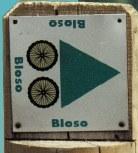
Today saw me riding the Moots around the Blue and Red BLOSO routes of Meerdael. I wanted to do an easy ride in view of tomorrows' tough one and the BLOSO routes provide just that. The ride went well, I had 39.8K and 405 heightmeters with an average heartrate of 118bpm. Piece of cake .
It's the second time this week I take out the Moots because I have not ridden it as much as other years . I usually get around a 1000K out of it each year but this year has seen me a lot on the Litespeed and the Hilset, and less on the Moots. It's probably due to the bad weather last August (I only ride the Moots when it's dry - I haven't had to wash it in the 3 years I have it) but September is turning out to be a real dry and warm month so we'll get there.
Was a bit pissed to see that after more than 2 months, there are still at least two arrows missing on the Red Loop. I'm gonna email the Sports Representative (SR) of Oud-Heverlee later on and tell him exactly what is on my mind. The BLOSO routes are meant to be checked at least once a month by a so-called "Parent" . The Meerdael BLOSO has 2 of those Parents but since the beginning it was obvious that they were not doing there job. That coupled with the fact that they don't answer (or even read ?) their emails doesn't make it very easy for the users of the routes to report missing arrows , other fallen trees and such..
Normally, the Parents gather the complaints , bring these to the SR, who in turn alerts the BLOSO community. The BLOSO then takes the necessary steps to return the route to its original condition. I don't know where the trouble lies in this "chain of events" , but in Overijse for example (where I know the "Parent" personally ) I usually see that when an arrow is reported missing, it is replaced within a fortnight, sometimes even within the week !
Well as I said, I wil email the SR , with the elections coming up in less than a month, they tend to listen a bit more to their citizens.
And now it's time to relax a bit and watch the time trial events of the World Championships in Salzburg
20-09-2006, 15:07 geschreven door Big Bad Wolf
|
|
|
|
19-09-2006 |
Brooding on my next ride |
So, I decided to create a Blog.. Why ? It's easier to be able to communicate some stuff without having to email around.
For the moment , I'm pretty excited to go back to Theux again. For those not familiar with what I do and what Theux means in that respect, check out these links :
http://redridinghood.fotopic.net/c1082029.html
and
http://redridinghood.fotopic.net/c1077328.html
I want to go back, and plan to do so on thursday, to check out the combination of the 18K and 37K routes. Starting out from the Chateau Franchimont again I would first choose the 18K route (route Nr 7) climbing into the Bois de Staneu and descending towards the little Ry de Chawion. There I would hop over on the 37K route (route Nr 8) and follow this one further on At the furthest western point I would like to briefly hop on the 57K route (route Nr 9) to reach the Porallée area. Why? Well, I would like to descent from the Porallée area towards Noncevaux (260m drop ) and climb back up again following the Ninglinspo river. This area is one of the most beautiful in Belgium. Google it to find out more . This would yield a 50K ride with well over 1100 heightmeters. More than enough to keep me busy for 4 hours or thereabouts. I hope to be able to get some nice shots too of the area. A little plan of the Ningslinspo area and the route I want to follow can be seen by clicking HERE
19-09-2006, 00:00 geschreven door Big Bad Wolf
|
|
|
|
|
|
Gastenboek./.Guestbook |
Druk op onderstaande knop om een berichtje achter te laten in mijn Gastenboek. /
Press the button below to write in my Guestbook.
|
Email Me |
Press the button to send me a mail
|
|
|
|