|
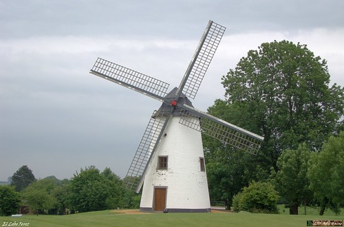
Thanks to Roger I got the GPS track from the "Route des Loups" (RDL) or 1st Wing ride, starting at the 1st Wing Airforce Base in La Bruyere. So why not try the 90K distance as a solid long distance ride. I started out and made the connection to the point where the RDL crosses the N240. The ride leads me first towards Roux-Miroir and Sart Risbart along the same roads as the Ludo Dierckxsens, a trail I ride very often. Then the RDL veers off to the left towards Opprebais where I stop to take a picture of a beautiful white windmill. The clouds are covered and at one point I feared it might start to rain but fortunately all I saw were some roads that were drying up after a little shower. I was spared from rain.
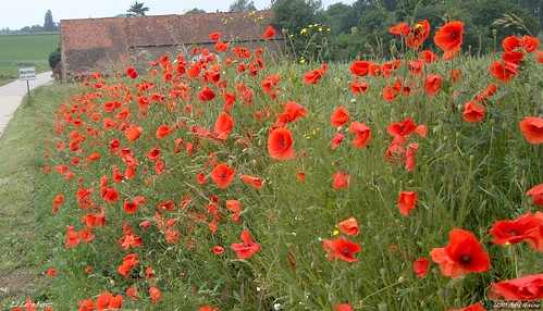
From Opprebais the RDL takes me now towards Maleves Sainte Marie Wastinnes and then into the town of Perwez. A little busy town where I have to look out for cars coming from all directions. After a couple of turns and carefully following the little ' 1 W ' signage I'm quickly out in the open again as I ride further south to Aishe-en-Refail and Mehaigne. The wind is still blowing in my back and the ride is a pleasant one so far. Some small hills and always ondulating up and down. The RDL now veers towards the East and more or less follows the river Mehaigne towards Wasseiges and Ambresin. Here some markers indicate a rest stop but obviously - since this ride took place last wednesday - I have to do without that. But I have my own food and drink and when the trail turns towards the north I begin to feel the wind. The clouds look like the sun will burst through any minute now and for a while I am riding on a plateau when I connect Merdorp to Thisnes. Then I am descending into the valley of the Petite Gette river and when I arrive in Orp-Le-Grand a long climb awaits me. The legs are beginning to feel the distance and furthermore the wind does its best to make it just that little bit more difficult. Near Marilles I stop to take a picture of some beautiful poppies next to the road. The sun does come out now and makes the wind a little less cold.
I am now back in places I have often been before and when I cross the Ravel 2 in Huppaye I stop for another bite to eat. Musn't let the energy levels fall down too much. From Jauchellete another descend in a beautiful verdoyant valley takes me towards downtown Dongelberg where I have to suffer another steep climb. Over Lathuy and Melin I then bike back towards the N240. Very beautiful region here, and the sun is now really burning a hole in my shirt. When I arrive in La Bruyere I stop the navigation on my GPS and head towards Beauvechain and Tourinnes to make my way back home. I had the track but with the GPS in my backpocket I only took it out when I wasn't sure of the signage. Still, its good to have this kind of backup, indeed in Opprebais at one point the signage was very confusing. For the rest I had no trouble at all following the little markings on the road. When I arrived home I was tired but also pleased with this ride. It was my longest so far this year.
Ride Stats : 112.5K and 720/845 heightmeters (Polar/Garmin) in 5h01min
4284/45520
|


