|
After yesterdays rainy and cold intermezzo I was weary that I would find a lot of mud on my trails. I decided to ride the newest O2 Bikers roadbook. It is called Taalgrens and this makes allusion to the fact that it flirts with the language border between Vlaams and Waals Brabant. The dutch-speaking and french speaking side of the province of Brabant.
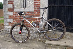
The trail starts at the Zoete Waters in Oud Heverlee and the first 10K or so lead through the Kouterbos and the Meerdael Forest. Some pleasant trails and with the forest floor being moist some care needed to be taken on some of the downhills. The Moots is equipped with Continental Mountain King tyres so grip wasn't an issue. What was an issue is the fact that my front brake - a 180mm Hope Mini - seems to be dragging itself against the brake pads, or at least one of them. I had them replaced when the bike went in for service and it seems the brake pads need some braking in. This constant dragging makes the ride a little tougher than it should be. Its not much, but it does slow down the wheel after 3 or 4 turns when you let it run free. I must have a look at that brake and see if anything can be done to fix this.
Anyways, upon leaving Meerdael Forest the trail then loses itself into the Nethen fields before making way towards Pietrebais. More field trails here, with the landscape ondulating up and down so adding to the heightmeter count all the time. The trail then makes its way towards Lathuy before turning slowly back towards Happeau . The field roads sometimes give way to descents in semi-hollow roads where care needs to be taken not to choose the wrong trail. There are some deep ruts here and taking the wrong one will lead you into a muddy puddle. I keep my eyes open and manage to circumvene all trouble.
The trail then moves towards St Jean Geest and I recognize some trails I did in the winter. Unfortunately the trail also goes though a deep hollow road that is a real mud trap. I take no risks on the slippery downhill and walk a couple of meters when the going gets too muddy. On the other side of the hollow road I cross a tarmac road and can recuperate a bit while following a small tarmac road. After a while a nice and tricky downhill with lots of ruts follows and I really enjoy finding a trail that keeps me going forward. After the downhill follows an uphill - of course - and this is a difficult one because they paved the track with little stones and debris. More field tracks follow and it isn't until I reach the Ferme de Wahenge that I find another forest passage. Very short though and now I am on the trails I already did a couple of days ago. A lot of boring fields trails bringing me towards Beauvechain and then into the Meerdael Forest again. Here I have to follow some broad forest roads that lead me back towards Vaalbeek. A nice little uphill that hurts my legs and then a last 1.5K on a braod forest trail and I 'm back at the start. A little more than 80K and according to my GPS some 880 heightmeters.
This roadbook obviously focusses on distance, compromising on the beauty of the trails. Of course it can be made a lot more interesting but then these 80K might be a tad too difficult for most. Riding 5 hours on a mountainbike is not something that most are trained for. And if you should couple that to more heightmeters or more technical trails - they are there, I can assure you, just try the Grez Doiceau roadbook for example - most bikers would arrive more dead than alive at the end of an 80K ride.
As it stands , this is a nice ride as an in-between, to get some distance in the legs without straining them too much.
Ride Stats : 92K and 745/930 heightmeters (Polar/Garmin) in 5h25mins
3413/34860
|


