|
|
|
| Tales from the Woods |
|
|
| 04-09-2008 |
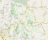
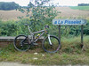
 Dreamland revisited in Nonceveux Dreamland revisited in Nonceveux |
It
was about time I visited the Ardennes again and today I felt like I won
the lottery. I rode to Nonceveux , not far from Remouchamps in the
Ambleve valley to ride the O2 Bikers roadbook . From the figures it
looked like one of their toughest roadbooks ever, both physical (5/5 stars) and
technical (4/5 stars) as well as offering almost 1100 heightmeters on a 36K
distance. What more does a real biker need?
It starts easy from the
little church of Nonceveux, over the river Ambleve and then taking the busy N633 for a couple of 100
metres and then the first offroad climb takes me through a few hairpins up towards the Tilleul des
Pendus. The climb is steep and the legs have to get in gear. But I feel
fine and the Merlin is in top shape too. I am following the track on my
Garmin Edge 705 and I would experience no major problems with that throughout
the whole ride. I saved the track in Course format (.crs file) which
proves to be THE format the Edge 705 really likes. Only in some of the
deep valleys did it hesitate a few moments because satellite reception was not
optimal.
That being said, lets continue the ride. A
rocky path takes me down towards the N697 which I follow briefly before
climbing on a tarmac road towards Pierzay. At the top I turn left into
a freshly mown path - brambles and other thorny branches lie scattered
over the trail. I am on NoTubes but still I felt like having a flat
every moment. But nothing happens, and the trail gets gnarly as it
changes into a rocky underground and the downhill gets steeper - better keep concentrated. A few switchbacks
and I am at what looks to be an old quarry. The soil is red and there
are some puddles here. I follow the little Gergova river upstream
before crossing the N697 again. I follow this busy road for a short while before
an impossible climb takes me right up a plateau and on to what looks like a Fagnes track. Before long I turn right and head back towards the Tilleul des
Pendus. Wow, 10K far and already almost an hour of biking.
A
broader track drops me down towards Sedoz where a very steep climb
takes me up to meet with one of the many small rivers that drop down
from the plateau towards the Ambleve valley. My pace is little more
than crawling and it is very dark and damp under the dense tree cover.
My GPS loses signal for a few seconds from time to time but I have no
trouble following the set track. I cross the little river and cross
over towards the Chaudiere valley. This little ruisseau I follow - the little
rivulet in a deep valley left of me - down to where it crashes into the
Ninglinspo. I have a little bite to eat at this point, enjoying the
elfin quality of the little babbling brooks. The climb that follows now
- following the Ninglinspo river upstream - is very well known to me. I
relax in a comfortable pace and start the 200m vertical ascent. Along
the way I cross the little Ninglinspo river several times before making my way
away from it towards Blanches Pierres. A fast downhill brings me close
to the Tour Drouet and I decide to have a look at this magnificent
viewpoint. This means I have to climb back up again around 50
heightmeters to take the rocky road into the Hé des Graviers. Steep
sections strewn with rocks take me towards the 370m mark. I have to
follow another fagnes road, with wet patches and a lot of roots. The
Merlin laughs at these conditions, its suspension working like a charm
. In the Bois Bablette a fast downhill takes me to the bords of the
Chefna river.
This
might easily be one of the most beautiful spots on this ride. The climb
with the little river babbling on my right is tough, steep and rocky.
Luckily it is reasonably dry. I have been here before but the beauty of
the terrain still gets me. At the top I take almost an 180 degree turn
to follow the river on its other side down again. This descent is a
difficult one. Wet patches, rocks, roots and gullies force me to be very attentive
and I enjoy the Merlin again whilst I lead it over the rubble
downwards. Two big deer cross my path and scatter themselves with unseen grace down the steep slope towards the Chefna. I stop and watch them in amazement. After a while the track gets broader and I storm down
into the Ambleve valley.
Crossing the Ambleve only one more climb
awaits me. The first bit is amazing. Pure bedrock and steep steep steep , there are
no words for it. I admit I had to walk a few bits. When the dense forest
opens up I have an amazing view over the valley and I see the lush green forests
on the other side of the Ambleve, where I was less than half an hour
ago. At Rondai Fontaine I am sent into what seems to be an off-limits
road, there is a sign stating that no entry is permitted. But what can
I do but follow my GPS track, right? The track drops down slowly at
first, approaching the E25. But then it gets serious - and wet with the
first real mud I saw today - and I have to hit the brakes hard from
time to time to keep the speed on the safe side of sorry. Just before
dropping into Nonceveux it gets downright dangerous when the track
turns into some kind of rocky garden.
Wow,
what a great ride this was. 36K and indeed a whopping 1100 positive
heightmeters - my GPS and Polar agreed on the number for once - and at
times the track was indeed very challenging and technical. The climbs
were of the steep kind and you need a bike that provides traction over
rocks, loose stones, roots and bedrock. A great trail but not for the
meek.
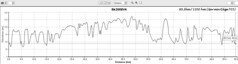
Ride Stats : 36K and 1100 heightmeters in 3h3minsHill Factor : 30.5Ride Profile : CLICKMaps (GPS and NGI) :
 
7584/75540
04-09-2008, 00:00 geschreven door Big Bad Wolf
|
|
|
|
|
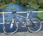
| 03-09-2008 |
| Mastering the 705 |

Today my original plan was to go to Nonceveux and ride the O2 route there, but when I noticed on meteox.be that it was raining I decided to stay home and try out some stuff with my Garmin Edge 705 GPS. I had made a Course file of the 2008 Belgian MTB Marathon Championship trail and decided to ride a chunk of that. First I put the .crs file on my GPS's SD card but that proved to be the wrong option. Turns out the GPS only selects Courses that are saved in its internal memory. So from the start in Pecrot, I biked back home, moved the .crs file from the SD card to the Garmins' memory and headed back to the start.
Obviously I was getting a good workout in the meantime because the area between Meerdael and Pecrot is not exactly flat. In Pécrot I selected the 'Do Course' option on the Edge, and hey presto, I got the trail on my screen and I could start. One thing I noted was that as soon as you press the 'Do Course' option, the Edge resets all counters to zero. That is not a problem because the history files can be downloaded afterwards on your PC (or is that uploaded ?) and all is there. But its nice to know and it isn't in the manual.. just one of those things.If you remember my entry a few days ago I was complaining about the 705 powering off during the navigation along a .gpx file. Obviously it is made to follow Courses, because today it didn't power off, and I had all the history without losing as much as a metre along the way.
My theory is that navigating along a gpx track demands too much of the units' processor, causing it to bunk and bail out by powering off... When you follow a course it doesn't have to do any navigating, just indicating where you are on the map and keep tabs of your speed, heightmeters and other parameters. You don't get any warning before an upcoming turn, but you do get an audio and visual warning when you venture off of the Course. And when you get back on it you get a beep and a message as well. Great, looks like Courses are the way to go. Now lets ride !
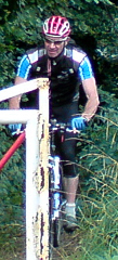
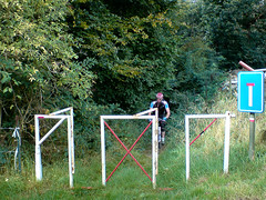
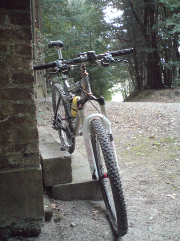
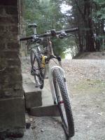
So I did the first 20K of the Championship trail today. The first kilometers after that start next to the railway station in Pecrot, are on tarmac , with a long and steady climb ending in a turn to the left into what could be called a double singletrack. From there on , the track twists and turns and eventually has a very dangerous downhill dropping you into Nethen. This downhill consists of a series of washed-out gullies, with big stones and other debris making it very hard to keep the rubber side down. In Nethen, you then take some cobble and tarmac before arriving at a very steep climb , very narrow and I don't think anyone will be able to ride this. Check the picture. After that, a little singletrack takes you around the plateau before dropping you back down along a narrow track. Then there is the famous 'jungle' hollow road, which I didn't do because it is unrideable. Instead I took a little detour which I believe the organisers should take too. It consists of another hollow road going up parallel to the jungle track but with better traction and above all, no deep gullies. Then the trail moves towards Bossut before turning to the left towards the Varadero manege. Here I hit the 'End Course' button. With 20K on my lap counter I decided to call it a day. I will do the rest of the trail in the coming days. I took a turn towards the Meerdael Forest where I had a bit of fun on my secret Meerdael trails before arriving home. GPS track (in gpx format) of the first 20K : CLICKTrail map of the first 20K:
 Ride Stats : 61.5K and 725 heightmeters in 3h11mins7547/74440 Ride Stats : 61.5K and 725 heightmeters in 3h11mins7547/74440
03-09-2008, 19:23 geschreven door Big Bad Wolf
|
|
|
|
|
| 01-09-2008 |
| Connecting the dots |
Or trying to. Thats what I wanted to do today. I head out for the region south of the Bois de Bercuit to do some recon of the possibilities to pass there with the track for the Belgian (and Dutch) Championships Mountainbike Marathon . Saturday I had less time to explore all possibilities but today I checked every little trail. And the result was disappointing. I made little map of the area where you can see which areas are private and which tracks are passable, but with a price to pay.
One track is only for walkers, and includes a heavy iron gate.. So having a race pass there.. I don't think so. The other one is the track going down from east to west next to and then in to the forest. I take this one when I do the Accro Bike. It only has one disadvantage ; there is a bit of mud at its lowest part. Today it was almost ride-able but I still had to walk a few metres. Well, thats the input I also gave to the track responsables in our club, lets see what they come up with
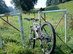
The Merlin proved once again to be a great bike, even for terrain like this it brings extra comfort and also some extra speed in the climbs and downhills. Although I took it easy today, legs still a bit grilled from last weekends' rides.
Ride Stats : 50K and 550/568 heightmeters (Polar/Garmin) in 2h33mins
7486/73715
01-09-2008, 19:59 geschreven door Big Bad Wolf
|
|
|
|
|
|
|
| Gastenboek./.Guestbook |
Druk op onderstaande knop om een berichtje achter te laten in mijn Gastenboek. /
Press the button below to write in my Guestbook.
|
| Email Me |
Press the button to send me a mail
|
|
|
|