Why has May been so wet?
- Published

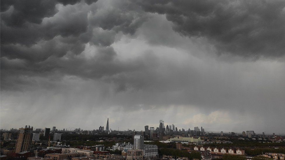
Heavy showers across London, captured by Weather Watcher simontenor1
April showers didn't put in much of an appearance this year - but May has more than made up for it.
The weather has become stuck in an unsettled, turbulent pattern with drenching downpours sweeping across the country.
Figures from the Met Office showed that by the middle of the month, Wales and some parts of England had already seen more rain than they would normally expect in the whole of a typical May.
And more showers and thunderstorms this week mean the rain gauges are still filling up.
In fact, by the morning of 18th May, Topcliffe in North Yorkshire, Bala in Gwynedd and Cardiff had already seen more than double their normal rainfall for the whole of the month.
Some parts of England and Wales have already seen more rain than they would expect in the whole of a typical May.
It's possible some places will end up breaking records as these totals could continue to grow.
This is in stark contrast to an April that - while cold and frosty - was the UK's sunniest on record, and much drier than normal.
So what's changed in the atmosphere to flip our fortunes so spectacularly?
High pressure changing position
In April, the jet stream was weak, and remained well to the south of us. High pressure developed close to the UK and became persistent, blocking the progress of rain-bearing weather systems.
But as April turned to May, that blocking area of high pressure drifted away and settled over eastern Europe.
High pressure drifting eastwards through May has allowed more unsettled weather to move across the UK.
In turn, the jet stream strengthened a little and shifted northwards, directing Atlantic low pressure systems right across our shores.
At the same time, a dose of strong May sunshine has injected energy into the atmosphere - and combined with low pressure overhead that has led to very unstable conditions with air able to rise rapidly.
This has provided the perfect recipe for towering cumulonimbus storm clouds to bubble up, meaning the rainfall has often been intense and heavy, with hail and thunder mixed in.
Is there any chance of anything drier on the horizon?
Higher pressure could return by the end of the month, bringing a change to something a little drier.
You can be sure we'll be keeping a close eye on that at BBC Weather, and will keep you up to date!
Learn more about the weather